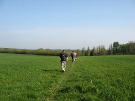
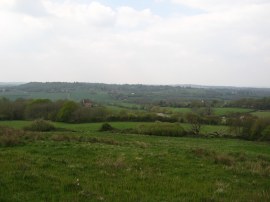
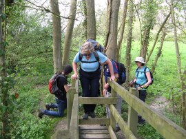
(1) Heading towards Romford Road
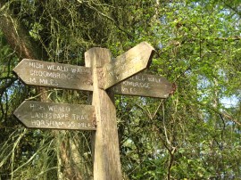
(2) Trail Way Marker
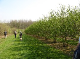
(3) Kentish Cobnut Trees
Other Links >>> |
|
HIGH WEALD LANDSCAPE TRAIL - Part 5
Pembury to Cranbrook
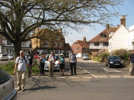
There was almost a full set of walkers for this stage of the High Weald Landscape Trail with just Maria unable to make it. We met up in Cranbrook where we were able to park on the A229 Angley Road at the point where the High Weald Landscape Trail crosses the road. From there we had an easy, and reasonably direct, transfer over to Pembury back to where we had finished the last stage of the walk at the outskirts of Pembury.
|
|
|
|
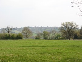
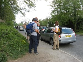
(1) Heading towards Romford Road |
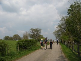
(2) Trail Way Marker |
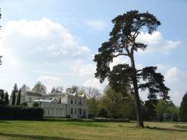
(3) Kentish Cobnut Trees |
Having met up with Sally we then set off along the Hastings Road which the route follows down to its junction with the A21 before heading to the left along a footpath that heads away from the road. The path heads across a couple of fields, photo 1, to join a track that heads down to Romford Road. Here we headed to the left along the road before joining another track on the right that heads down past houses to Snipe Wood. For a while the route follows a fence lined footpath through the trees before entering a more open path through the woodland. A short distance further we reached the point where the route of the Tunbridge Wells Circular Walk, which we had been following since Groombridge, finally splits from the High Weald Landscape Trail. This spot had been marked by a tall wooden fingerpost with the route mileages however for sometime this had been knocked over and lying on the ground. Chris managed to manfully lift the heavy wooden post into an upright position, briefly allowing a photo to be taken, photo 2, before the weight got too much and the post went back down to the ground. For the record the post showed we had walked 55 miles from Horsham and have 37 left to Rye, a further 12 of which we would be walking today. Hopefully it won't be too long before the post is properly re-instated besides the path. At the fingerpost the path joined a broader track that headed past a small pumping station and began heading uphill through the trees to briefly rejoin the Romford Road. Here we headed to the left to reach a driveway on the right. Almost immediately the route joins a footpath on the left that heads past some fruit trees and alongside an orchard which was planted with Cobnut trees, photo 3.
 |
 |
 |
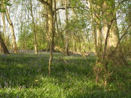
(4) Bluebells, not quite in bloom |
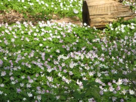
(5) Wood Anemones |
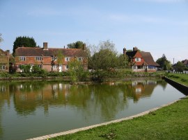
(6) Matfield village pond |
Having followed the field edge round the trees the path then heads downhill through a small area of woodland. We were just too early for the bluebells, photo 4, although there was a definite blue tinge to the flowers however a short distance further on there were a large number of anemones out in flower under the trees, photo 5. Leaving the trees the route crosses over Bramble Reed Lane and heads downhill across a grassy meadow to reach another area of woodland. After crossing over a small stream the footpath heads across a slightly boggy area along a section of boardwalk before heading uphill over two more fields to join a track which is followed into the village of Matfield. The actual route of the path follows the road round the edge of the large village green although we headed diagonally across the grass towards the village pond, photo 6, and the B2160 Maidstone Road. Besides the village shop was a board advertising the events associated with the forthcoming royal wedding, (photo 30 below).
 |
 |
 |
(7) Orchards nr Matfield |
(8) Approaching Brenchley |
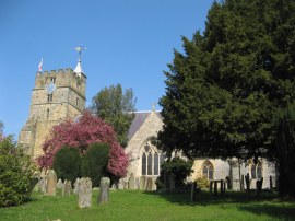
(9) All Saint's Church, Brenchley |
Crossing the road we followed a slightly obscured footpath which heads between houses back out into fields, at first heading alongside the edge of a large field planted with blackcurrants. The path then heads by a small orchard up to Brenchley Road where the route heads to the right for a few yards before joining a fence lined footpath on the right of the road which is followed to Petteridge Lane. Reaching this road the route heads to the right before joining a footpath on the left that heads through trees to reach Tibbs Court Lane. Here we headed to the left down the road before joining another footpath on the left. This heads up a short driveway before joining a path that runs past an area of older and larger apple tress, their branches heavily covered in lichen. Despite having eaten very well the day before I was already feeling hungry at this point and ate the first of my sandwiches as we headed along the path which leads down between orchards to pass a large pond to the left of the path before heading gently uphill towards the village of Brenchley. The day had started bright and sunny with almost no breeze although over to the left we spotted a few large clouds bubbling up on the horizon. Nearing Brenchley the path passed a field of sheep, photo 8, before heading through a small and very palatial housing development to join Fairmans Lane. Heading to the left the route soon joins a path on the left running parallel to the road that leads up to Brenchley Church, photo 9.
 |
 |
 |
(10) Leaving Brenchley |
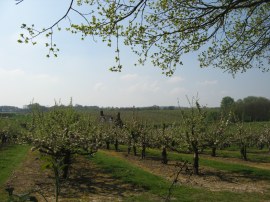
(11) Apple Blossom |
(12) Furnace Pond, Horsmonden |
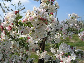
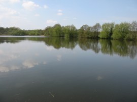
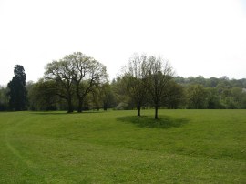
By now everyone else was also feeling hungry and we had hoped to find a bench in the church for a quick rest however we could not see any and the church was also quite busy with it being Palm Sunday and thus we headed across the road and sat on a small stone wall surrounding a tree in the centre of the village. It was a pleasant shady spot, ideal for stopping and watching the world go by. Having rested we then resumed our trek along the High Weald Landscape Trail, photo 10. The route leaves the village along an enclosed footpath that leads out to a grassy field. This heads downhill, over a stream and through a small patch of woodland before heading uphill into an area dominated by orchards. Reaching Palmers Green Lane the route heads to the right past the attractive Hononton Cottage before joining a footpath on the left that heads through the middle of a large orchard. All the trees were in bloom and the warm still air was filled with the scent of apple blossom, photo 11. Heading through the orchards the route turns half right to run alongside the edge of a tall windbreak hedge before crossing a farm track and heading down hill to pass along the end of the large 16 acre Furnace Pond, photo 12. This pond used to power the furnaces of John Browns foundry and Horsmonden itself was once the centre of the Wealden iron working. The pond is also the site of one of the largest perch that have ever been caught in the UK and as we approached the pond we passed a couple of fishermen with enough equipment to invade a small country. To some merriment Sara asked if she could take a picture of their "equipment".
 |
 |
 |
(13) Shirrenden |
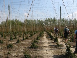
(14) Hops |
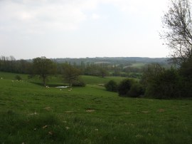
(15) Our lunchtime view |
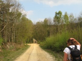
From the pond the path heads towards Furnace Road before turning to the right along a track. This runs close to the pond for a short while before the route joins a path on the left that heads gently uphill through the parkland grounds of Shirrenden House, photo 13. Crossing Horsmonden Road the path then heads down the tree lined driveway of another fine old house, Sprivers, continuing ahead past a small pond and on round to reach the B2162 Lamberhurst Road. Crossing the road the path then headed through a couple of small fields that had been planted with hops, photo 14, something that is becoming an increasingly rare sight. At Lewes Heath the path heads to the right along the edge of a large grass covered field before heading through a small band of trees and across another similar field, photo 15, where we stopped for our lunch break, the gently sloping grass covered slope making an ideal spot to site and soak up some of the sun. It was a lovely peaceful location and I could have easily fallen asleep in the warm sunshine.
 |
 |
 |
(16) Violets |
(17) View towards Goudhurst |
(18) Brick Kiln Lane |
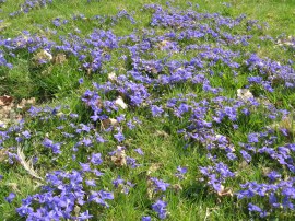
In a couple of spots in the field where large areas of violets, photo 16, growing through the grass. The path heads down to cross another small stream with a pond hidden away in the trees to the left before heading up through more parkland to reach Rectory Park Road. Away to our left we could see the village of Goudhurst sitting on top of the hill which we would soon be climbing, photo 17. First however the High Weald Landscape Trail heads does a dog leg, heading along Rectory Park Road towards some oast houses and the rather isolated Horsmonden Church before heading to the left along Brick Kiln Lane, photo 18.
 |
 |
 |
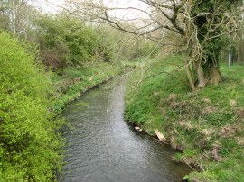
(19) River Teise |
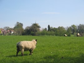
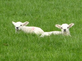
(20) Lambs |
(21) View back towards Brenchley |
Reaching a road junction, the route then heads to the left down Small Bridge Road, heading steadily downhill to cross over the River Teise, photo 19. Once over the river the route starts its ascent up to Goudhurst which sits on top of a hill. After following Small Bridge Road a little further the route joins a footpath on the left which heads across a field which was being grazed by a number of sheep and their lambs, photo 20. Leaving this field the route crosses another minor road and heads into another field, the path gradually becoming steeper as it then heads across an area of rough ground to reach edge of Goudhurst where the route joins a footpath running between houses that leads up North Road. Photo 21 was taken looking back across the countryside we had just walked; the start of Rectory Park Road is to the far left of the photo, close to the horizon. After a short wait for Tommy, who had been out in front as we headed up the hill and missed the path, we headed over North Road where the High Weald Landscape trail then joins another short stretch of tarmac path running between buildings which leads to Church Road. Here the route heads to the left but we detoured to the right down the main road to a village shop where most of us brought an ice cream.
 |
 |
 |
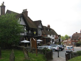
(22) Goudhurst |
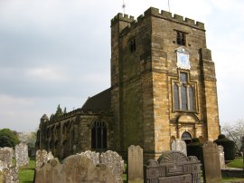
(23) St Mary's Church, Goudhurst |
(24) View from Tidymotts Lane |
We then headed back up the busy road where there are a number of interesting buildings, photo 22, although as ever these were all partially obscured by parked cars. Reaching the churchyard of St Mary's Church, photo 23, we sat on a couple of handily placed benches to have a little rest and eat the ice creams. Apparently on a fine day it is possible to see Canary Wharf in London from the church tower. Due to the warm weather for the first time this year I had drunk all of my one and half litre bottle of water and my rucksack felt unusually light when we set off, although I did have another litre in my rucksack. From the church the path heads through the churchyard to cross Back Lane and over another small paddock to Tidymotts Lane from where there were good views ahead across the surrounding countryside in the direction we were heading, photo 24.
 |
 |
 |
(25) Another cache found |
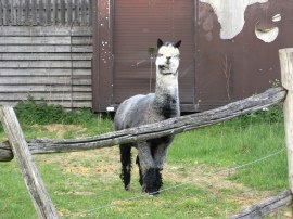
(26) Alpaca |
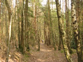
(27) Angley Wood |
Heading past Maypole Farm the route joins a field edge path that is followed down past some houses to eventually reach a small wooden bridge over a stream where Tommy added his name to a geocache hidden in a nearby tree, photo 25. Apparently he had already found this cache a year earlier with Dave although at that time he did not have cache user name. The route then continues alongside a field edge path before heading to the left along an unsurfaced farm track running between fields and through the occasional patch of trees. This stretch of path is followed for some distance as the route winds its way towards Little Glassenbury where the route heads uphill along the edge of a field. Reaching the end of this field we crossed over the B2085 road and headed over a small wooden bridge over a ditch to a gate into a field. Here the path follows the field edge round to the left to reach the some farm buildings where there was a small enclosure with a couple of rather haughty looking Alpacas, photo 26. The route heads then to the right besides the farmyard where there was also a rather rusty and neglected looking armoured personnel carrier parked up. This path is followed down into an area of woodland where the route bears to the left through the trees. For the remainder of the days walk the High Weald Landscape Trail makes its way through the trees of Angley Wood, photo 27.
 |
 |
(28) Angley Wood |
(29) Angley Road, Cranbrook |
Angley Wood contains a mixture of deciduous trees and conifers and the sandy, almost heath like, soil was very different from the ground we had been walking over for most of the day. Close to Wenmans Cottage a metal footpath sign directs the route along a footpath through the trees that leads to a broader track where the route heads to the left, photo 28. A few more twists and turns takes the path uphill to reach Angley Road on the outskirts of Cranbrook where we reached then end of this stage of our walk along the High Weald Landscape Trail.
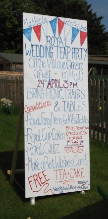 |
(30) Royal Wedding Poster |
Yet again we had been so lucky with the April weather on this walk, which was far warmer than the average, sunny with just an occasional gentle breeze; perfect for walking through the bright Spring countryside. The apple blossom was probably at its peak making it the ideal time to walk this particular stage. Back at the cars we had walked 14.0 miles, all of which had been along the High Weald Landscape Trail.
I have uploaded the route of the walk which can be accessed here: HWLT stage 5 Route.
If you would like to comment on this walk you can do so here:
![]() Back to:Walk index page
Back to:Walk index page
| ©2012 Bertuchi.co.uk. Please contact me using the email button on the right if you have any questions or comments regarding the site. Any feedback and additional information about places of interest on the walks is always welcomed. All rights reserved. Please contact me if you want to use any of the images or information from the site. ENJOY YOUR WALKING |
|