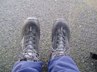
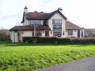
(1) My new Scarpa ZG65 XCR boots
(2) Tolmers Road
(3) Home Wood, Cuffley
Other Links >>> |
|
THE HERTFORDSHIRE WAY - DAY 1
Cuffley to Hertford
So a New Year, a new walk and also new boots , a pair of Scarpa ZG65 XCR, photo 1. After the problems I had been having with my feet when wearing my Zamberlain boots I thought I would try a lighter fabric pair of walking boots, the label said "light and flexible" and they fitted well. As I had only brought the boots the day before and thus had not worn them before I packed my old Merrel walking shoes in my rucksack in case of soreness but the only way to break the new boots in is to wear them. And what a revelation. I walked 12.9 miles in them straight from the box and my feet felt as fresh at the end of the walk as they did at the start which was very pleasing.
|
|
|
|
(1) My new Scarpa ZG65 XCR boots |
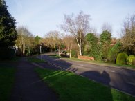
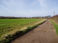
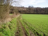
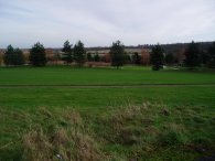
(2) Tolmers Road |
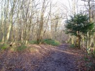
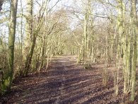
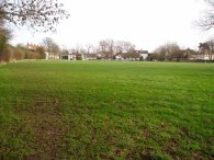
(3) Home Wood, Cuffley |
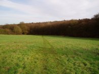
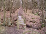
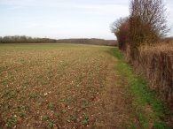
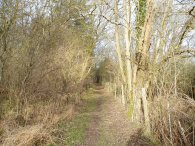
I did this walk on Sunday 14th January. I drove to Cuffley station where it cost £1 to park for the day. Leaving Cuffley station which is on the route of the Hertfordshire Way I turned right and then right again along Tolmers Road, photo 2. The way winds itself along the residential road for about a mile or so towards Home Wood where the route links up with the route of the Hertfordshire Chain Walk which I had walked this time last year. Passing through Home Wood, photo 3, the route turns right into the road, Carbone Hill, which is then followed uphill towards the village of Newgate Street.
 |
 |
 |
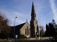
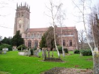
(4) Church, Newgate Street |
(5) Farm track Nr Newgate Street |
(6) Nine Acre Wood |
The day before had been grey and cloudy and very windy with the occasional light shower however overnight the weather had changed completely and I woke up to hazy blue skies and almost no breeze whatsoever and still very mild for the time of the year. As mentioned in the Hertfordshire Way guidebook care has to be taken walking up Carbone Hill as even on a Sunday morning the road was quite busy and there is no pavement. At one point I had a coach coming towards me whilst cars were going past on the other side of the road. Turning left into Newgate Street the route leaves the Hertfordshire Chain Walk and passes the church, photo 4 before then left again along New Park Road. This eventually becomes a track as views open out on either side, photo 5. The Hertfordshire Way continues along the track and at the end turns left into Tolmers Causeway and the almost immediately right into the amusingly named Cucumber Lane by Birchwood Cottages. A short way down Cucumber Lane the route heads left down a bridleway besides the Nine Acre Wood, photo 6.
 |
 |
 |
(7) Windmill Brook |
(8) Track Nr West End |
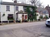
(9) The Candlestick Pub, West End |
This bridleway is followed in to Hornbeam Lane which heads along to cross the B158 Kentish Lane. The route continues along a footpath on the other side for a short distance before turning right along another track by some farm buildings. This heads downhill, past Duncan's Wood, toward a stream where route turns left to follow the stream just before an impressive wooden bridge. This stream is followed down to Windmill Brook, photo 7. By the brook I saw a couple of long tailed tits and a coal tit. From Windmill Brook the path crosses the wooden bridge and heads up besides fields to a track. The route turns right on to the track, photo 8, heading downhill and then uphill before turning left to take another footpath running along the side a field which leads up to the road in West End by the Candlestick pub, photo 9.
 |
 |
 |
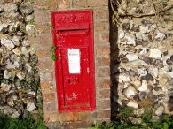
(10) An old letterbox |
(11) Field Nr West End |
(12) Backhouse Wood |
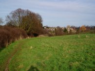
From the Candlestick Pub the route turns right down the road, passing an old Victorian letterbox in an old garden wall, photo 10, before after about quarter of a mile turning right once again off the road by West End Farm to join the same track as in photo 8. This is followed all the way back to where the route turned off left to reach the pub although now the route takes a footpath off to the other side that heads back done besides a field, photo 11, to re-cross Windmill Brook. The path then heads uphill besides Backhouse Wood to the cricket ground in the village of Essendon where the benches besides Essendon cricket club made an ideal place to stop for a few minutes. Photo 12 was taken looking back downhill from the entrance to the cricket ground.
 |
 |
 |
(13) Hatfield London Country Club golf course |
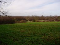
(14) Playing fields, Little Berkhamstead |
(15) Five Horseshoes, Little Berkhamstead |
Leaving the cricket ground the path turns left along the road for a short distance before turning right along School Lane. The path soon turns right off the lane through trees heading downhill to reach the grounds of the Hatfield London Country Club golf course, photo 13. The route heads downhill past the clubhouse and on past another house at the bottom of the valley before turning right and heading uphill on a path running between trees. The path leaves the trees and levels out and then joins a driveway besides the buildings of Danes Farm. One thing that has struck me about the walk today is the number of people I have seen out walking which is far higher than usual. I wonder if this is more people being out because the weather is good or January new years resolutions to keep fit or whether that the Hertfordshire Way is a more popular path than some of the other walks I've done recently. At the end of the driveway the route turns left onto a road by a white house and then almost immediately right down a broad bridleway and then once again almost immediately left again to enter the playing fields of Little Berkhamstead, photo 14. At the end of the green is the Five Horseshoes pub, photo 15. I remembered parking opposite here when I had walked the Hertfordshire Chain Walk.
 |
 |
 |
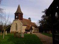
(16) St Andrews Church, Little Berkhamstead |
(17) Strattons Folly |
(18) Approaching Bayford Woods |
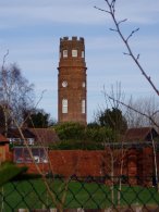
Close to the playing fields Little Berkhamstead has a useful village store for stopping off for snacks and drinks. Besides St Andrews Church, photo 16, I once again joined the route of the Hertfordshire Chain Walk and turning right by the church the path heads gently downhill with the tower of Strattons folly coming into view on the left, photo 17. Crossing a minor road, Bucks Alley, the path continues to head downhill over fields towards Bayford Woods, photo 18.
 |
 |
 |
(19) Bayford Woods |
(20) Road into Bayford |
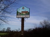
(21) Bayford village sign |
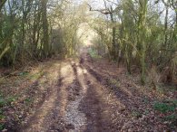
The path climbs up hill through the wood, photo 19, crossing a track before taking a stile into a field close to the top of the hill. Leaving the field the route enters a lane that runs down between hedges towards a road where the route turns left to follow the road into Bayford, photo 20. Just past the Bakers Arms pub, by the village sign, photo 21, the path leaves the route of the Hertfordshire Chain Walk and continues down Bayford Green past some very nice houses. Not long after the road becomes a track the Hertfordshire Way takes a path off to the right, a signpost says it is two miles to Hertford.
 |
 |
 |
(22) Field nr Bayford Green |
(23) Woodland Path, nr Hertford |
(24) Approaching Hertford |
The path enters a field and runs round the edge of a house. It then heads slightly downhill towards some small trees where the route turns left over a stile into another large field, photo 22. In a cutting to the right of the field is the railway lines that run between Hertford and Cuffley. The path heads gently downhill beside the field next to the railway lines for some distance before eventually the path leaving the field over a small wooden bridge to the right. The path continues to run alongside the railway lines which are now above the level of the path on an embankment. Continuing on along besides the railway lines in a narrow patch of woodland, photo 23, the route crosses another small wooden bridge. As I was walking I was starting to get worried that the train service was not running as not a single train had gone past me however eventually a train went by and my mind was put at rest. On the way this part of the route passes a number of extremely tall and impressive pine trees. Eventually the path crosses a footbridge over the railway lines and takes a footpath that runs along the edge of a field towards the outskirts of Hertford, photo 24.
 |
 |
 |
(25) Mandeville Road, Hertford |
(26) All Saints Church, Hertford |
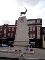
(27) Hertford War Memorial |
Having past round the edge of a couple of fields the route goes down steps down to Brickendon Lane and turns right down Mandeville Road, photo 25. the route turns right into Wilton Crescent and then right again along a hedge lined footpath past a school. At the end of the footpath the path heads into Queens Road. Just past the junction with Highfield Road the Hertfordshire Way takes a footpath known as Hagsdell Lane that runs between houses diagonally of down to the right. This heads steeply downhill to cross a small stream before heading more gently uphill on the other side. It was here for the first time during the day I took the wrong route. At the stream at the foot of the steep hill the route of the Hertfordshire Way actually turns left on to a path besides the stream that leads into Valley Close where as I continued uphill along the footpath to the Simon Balle school and thus had turn round and retrace my route back down hill to rejoin the correct path. From Valley Close, the route crosses Hagsdell Road and enters the churchyard of All Saints Church, photo 28. Leaving the churchyard the path then takes a subway under main A414 road into centre of Herford. The route runs along Church Street before turning left into Fore Street. Photo 27 shows the War Memorial at the junction with Parliament Square which marks the official end of this stage of the Hertfordshire Way in the guidebook.
 |
 |
 |
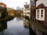
(28) River Lea, Hertford |
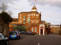
(29) The McMullen Brewery |
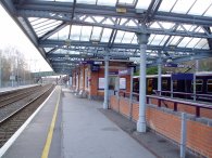
(30) Hertford North station |
I however continued on a bit further along the walk as I had to get to Hertford North station for the train back to Cuffley. The route passes into the Wash and over Mill Bridge which crosses the River Lea, photo 28. From Mill Bridge the route turns right into Old Cross, passing the buildings of the McMullen Brewery, photo 29, before continuing on into Cowbridge and finally Port Vale. At the junction with Beane Road I left the route of the Hertfordshire Chain walk and headed over the River Beane to Hertford North station, photo 30. A ticket back to Cuffley cost £3.40.
The total distance I walked was 12.9 miles and this stage proved a very enjoyable introduction, and surprisingly undulating start to the Hertfordshire Way.
![]() Back to:Walk index page
Back to:Walk index page
| ©2012 Bertuchi.co.uk. Please contact me using the email button on the right if you have any questions or comments regarding the site. Any feedback and additional information about places of interest on the walks is always welcomed. All rights reserved. Please contact me if you want to use any of the images or information from the site. ENJOY YOUR WALKING |
|