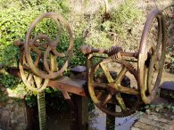
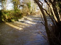
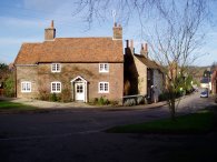
(1) Sluice gate, Goldings Canal
(2) Goldings Canal
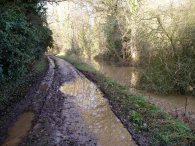
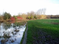
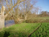
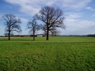
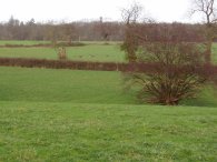
(3) Waterford Marsh
Other Links >>> |
|
THE HERTFORDSHIRE WAY - DAY 2
Hertford to Thundridge
This was a rather unexpected days walk enabled due to my office being closed. The gales of the previous days had caused a power cut in the Kings Cross area where I work which in turn had caused a number of problems in the office which needed to be sorted out before we could return to the building.
After the bad weather of the previous few days once again I was very lucky with the weather as the day started bright and almost cloudless and although there was a bit of a breeze blowing it was nowhere near as windy as the previous days.
|
|
|
|
(1) Sluice gate, Goldings Canal |
(2) Goldings Canal |
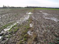
(3) Waterford Marsh |
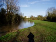
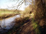
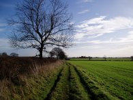
I parked in Nelson Street, Hertford, from where it was a very short walk down to rejoin the route of the Hertfordshire Way as it entered Molewood Road. This road becomes a private road and, a little further along, a track that runs alongside the small Goldings Canal, photo 2, which was in effect just a mill stream. The path passes under railway lines and heads up to North Road which the route follows off to the right. Reaching a bridge over the River Beane the path heads down to join the river as it flows through Waterford Marsh, photo 3.
 |
 |
 |
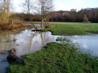
(4) Waterford Marsh |
(5) Waterford Marsh |
(6) River Beane |
The water in river was muddy and brown and at one point was just overflowing the river bank, photo 4. Opposite the church at Waterford I saw a Kingfisher flying along the river, its blue back shining iridescently in the sunshine, I also spotted a group of Little Grebes while I was walking along although they soon went and hid in the undergrowth. Crossing over Waterford Marsh which was very boggy and muddy ground after all the recent rain the route reaches a road where it turns right and then soon left into a road known as Barleycroft. At the end of Barleycroft the route then enters field through a metal kissing gate and head across to rejoin the Rive Beane close to a tunnel under a bridge that takes the footpath and river back under the railway lines once again. A short distance further on the route leaves the river for a while and joins a road. Heading to the left the route takes a turning to the right and then when the road turns to the right continues ahead along a farm track. At the end of a large barn the route takes footpath off to the left which once again takes the Hertfordshire Way back down besides the River Beane, photo 6. The path runs alongside a thin strip of woodland and the ground was scattered with twigs and branches that had been blown off the trees in yesterdays gales. A couple of larger trees had also been blown down across the path but I met an elderly gentleman was already out on his bicycle with a saw in his hand busily clearing the way.
 |
 |
 |
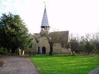
(7) Stapleford Church |
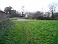
(8) Approaching Woodhall Park |
(9) Weir, River Beane |
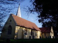
Eventually the path makes its way to Stapleford where it joins a road besides the church, photo 7. The path heads up the road to the right and then turns left along a road named Clusterbolts. On my edition of Explorer Map the route of the Hertfordshire Way is shown as continuing straight ahead up the road rather than turning left into Clusterbolts but as described in the Hertfordshire Way guidebook 2nd edition the route has been revised to take in the Woodhall Park. Having walked the original route on my return I can confirm that the new route is a far better alternative. At the end of Clusterbolts the route takes a footpath, photo 8, which runs alongside the River Beane to the Woodhall Estate. The path climbs a ladder stile over the estate wall besides a noisy weir, photo 9, and makes its way through the Park.
 |
 |
 |
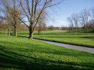
(10) Woodhall Park |
(11) Woodhall Park |
(12) Road into Sacombe Park |
Just inside the park a large tree had been blown across the path next to the river, photo 10. The route makes its way over grassland down to a track which is followed to the left over a bridge. On the other side the route heads down a track that runs to the right, running parallel to a river known as The Cuts, photo 11. A little further on the Hertfordshire Way takes a footpath that runs off to the left of the track heading gently uphill which gives good views across the estate to take another stile over the estate wall. The path then runs right along the outside of the wall before crossing through a small patch of woodland, past the Ware Lodge and uphill besides a field to join a road which is followed to the left down to the A602. Crossing the A602 the route heads down a private road that runs down into Sacombe Park, photo 12. As I crossed the cattle grid into the grounds a group of hunters were heading stretched out in a line across the grassland towards a wood.
 |
 |
 |
(13) Footpath nr Bengeo Temple Farm |
(14) Approaching Chelsing Farm |
(15) View towards Wadesmill |
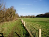
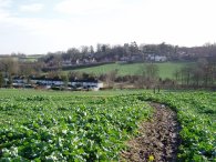
The path leaves the road to the right besides a grass covered reservoir and heads along a footpath, photo 13, that runs between fields towards Bengeo Temple Farm. At Bengeo Temple Farm the revised route of the Hertfordshire Way links back up with the original course. The route turns left then right to skirt round the side of the farm buildings and heads down the side of a field to a track. It felt really warm in the sunshine and I even saw a butterfly flying about. The track heads downhill to cross a stream where the route leaves the track and heads up a flight of steps into more fields. Curving round Lord's Wood the path heads across open ground past Chelsing Farm, photo 14. The route continues on over fields where the path was particularly muddy to head downhill towards the village of Wadesmill, photo 15.
 |
 |
 |
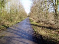
(16) Footpath in Thundridge |
(17) Ermine Street, Thundridge |
(18) Fields nr Bengeo Temple Farm |
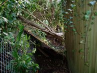
Turning left onto Anchor Lane the route heads down to the old A10 Cambridge Road (now the A1170) besides the Anchor Pub. Crossing over the road the path heads to the right and over a bridge across the River Rib before turning left into Ermine Street in the village of Thundridge besides the Wadesmill Post Office and Stores. Following Ermine Street round to the right the road heads uphill past a school. Where the road bends to the right again the Hertfordshire Way heads across the pavement towards Windmill House and then takes a narrow footpath running between houses off to the left. A short way down this path a tree had fallen taking a fence panel with it that more or less blocked the route, photo 16. Rather than waste time scrambling over this I decided to end today's walk here. I had done 7.4 miles and thus had a similar distance to walk back to the car in Hertford and Ermine Street, photo 17, looked at if it would provided a suitable parking spot for the next stage. On the way back close to the buildings of Bengeo Temple Farm I came round a corner and spotted a small Muntjac deer very close by. It soon ran off but in the next field over I noticed there was a larger herd of deer sitting down, photo 18. One of the advantages of doing a walk there and back rather than just in a linear fashion is you get to see things that you may have missed first time around and to view the route from a different perspective.
 |
 |
 |
(19) Hertfordshire Way by Bengeo Temple Farm |
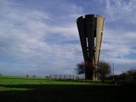
(20) Water Tower, Tonwell |
(21) Footpath nr Tonwell |
As mentioned earlier at Bengeo Temple Farm the old and new routes of the Hertfordshire Way link up and on the way back I followed the original route. In photo 19 which was taken looking back along the Hertfordshire Way, the old route continues straight ahead while the new route via Woodhall Park comes in from the right. After a long stretch of walking along the farm track from Bengeo Temple Farm the route heads past a water tower, photo 20, to join a road in the village of Tonwell on Temple Lane. At the end of Temple Lane the route turns right onto a road that runs down to cross the A602. Crossing the road the route heads up a footpath running between fields. While I was walking this stretch of path I got a call from my daughters school saying that she had hurt her ankle quite badly and insisting someone come and pick her up which was a bit difficult as I still had about five miles or so of walking to get back to the car, let alone drive back to Walthamstow. Fortunately after ringing around I managed to find a friend who was willing to go and collect her, as had my wife who was on her way to Liverpool. I just hoped her ankle injury was not too serious, which turned out to be the case. This was the second time I had been out walking when I've had the school ring me to say Dani has hurt herself and needs collecting yet I hardly ever have the opportunity to go out on a midweek walk when she is at school. The last occasion it happened I was just pulling into Hartington Youth Hostel in the Peak District!
This section of path over the fields was incredibly muddy and boggy in places, photo 21, the worst stretch on the days walk. The path runs down onto a road where it turns right down to a T junction. A pub is marked on the map but this has now been turned into a house.
 |
 |
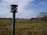
(22) Old tip nr Stapleford |
(23) Stapleford Church |
The route continues ahead over another field and then turns right onto a track that leads back towards Woodhall Park. Not long after passing a house the route turns left and takes a path across a grassed area of an old tip, currently being grazed by sheep. Around the edge of the area were a number of ventilation poles, photo 22, presumably to help extract the fumes from the decomposing rubbish underneath. The route of the path has been slightly rerouted from that which is marked on my map, turning off to the left from the track slightly earlier than marked. I could see the remains of the old stile into the area away to the right. Crossing the tip the path joins a road, Church Lane, and heads downhill to the right back into the village of Stapleford to complete my walk along the old section of path from where it was back along my original route for the rest of the walk back to Hertford.
I walked 7.4 miles along the Hertfordshire Way to Thundridge and a total of 13.6 miles for the day. Once again I wore my new Scarpa ZG65 XCR boots and once again they were completely comfortable. The Goretex lining had kept my feet dry all day despite the wet conditions underfoot, the only problem being they are now completely caked in mud and I doubt will ever look as clean again as they did last weekend.
![]() Back to:Walk index page
Back to:Walk index page
| ©2012 Bertuchi.co.uk. Please contact me using the email button on the right if you have any questions or comments regarding the site. Any feedback and additional information about places of interest on the walks is always welcomed. All rights reserved. Please contact me if you want to use any of the images or information from the site. ENJOY YOUR WALKING |
|