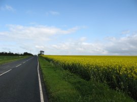
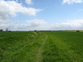
(1) The start of Stage 7
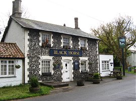
(2) The Black Horse, Melbourn
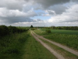
(3) Approaching the A10
Other Links >>> |
|
THE HARCAMLOW WAY - PART 7
Melbourn to Old Wimpole
I did this walk on Monday 3rd May 2010, parking in a side street in the centre of Melbourn. From here it was just over three quarters of a mile walk down New Road to reach the point I had finished my last walk along the Harcamlow Way a few weeks earlier, just outside the village. It was a generally bright day, although once again quite windy, and there a succession of rain clouds that passed over and as I was locking up the car there was a brief shower of hail.
|
|
|
|
(1) The start of Stage 7 |
(2) The Black Horse, Melbourn |
(3) Approaching the A10 |
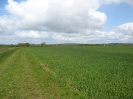
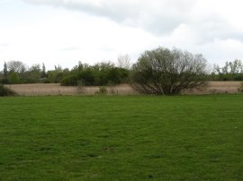
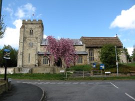
Reaching my start point, photo 1, I then turned around and retraced my steps back into the village, although not quite as far as my parking space. The route leaves New Road and heads to the left along Orchard Road, passing the Black Horse Pub, photo 2 and at the end of Orchard Road turns left again into Water Lane. As I reached the lane there was a heavy downpour, I had been watching the clouds approach for some time, and I hurriedly had to put on my waterproof jacket though fortunately the rain did not last for the long, the cloud soon blown away on the wind. From Water Lane the route turns to the right along Back Lane, passing a small industrial estate as it makes its way down to the Royston Road. Here the route joins a well surface byway on the left which heads through trees and then between fields, photo 3, to reach the A10.
 |
 |
 |
(4) Field nr the A10 |
(5) Heading towards Whaddon |
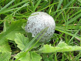
(6) Speckled blue birds egg |
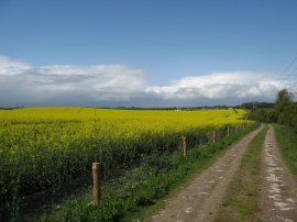
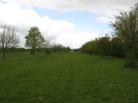
At the A10 the route turns to the right along the road where after a short distance I joined a footpath on the right that headed slightly away from the main road to join the course of the old road. This was a minor deviation from the route as marked on the map but made for a more pleasant walk. Reaching Royston Road I turned to the left to cross over the A10 to join a track that continues ahead to pass under some railway lines. This track then continues ahead, running alongside the edge of a large field that was planted with oilseed rape which was now just coming into flower, photo 4. Ahead of me I could see another set of heavy showers although these ones were being blown away from me. After about a mile the route reaches some nurseries and joins a footpath on the right that headed past a field of free range chickens and on past a small patch of woodlands towards the grounds of Kneesworth House Hospital. The path skirts round the edge of the hospital grounds before continuing on to Chestnut Lane. Here I turned to the left heading into the edge of the village before joining another footpath on the right which runs over fields towards Fountains farm. Here the route turns to the right again, running between open fields, photo 5, as the Harcamlow way makes its way steadily towards the village of Whaddon. As I was walking along this stretch of path I came across a large number of hatched eggshells of various shapes and sizes lying in the grass, all of which I have yet to identify. The one in photo 6 was pale blue with grey and black speckles and the blades of grass give some indication of its size which was considerably bigger than say a sparrows egg. The eggs were also very difficult to photograph, every time I lined them up for a shot, the wind blew them away.
 |
 |
 |
(7) Fields nr Whaddon |
(8) Wimpole Avenue |
(9) Wimpole Avenue |
Reaching a road the route turns to the left to cross a small field before rejoining the road Bridge Street. Here the route continues ahead for a short distance before turning to the right down Church Street. Where Church Street bends to the right the Harcamlow Way joins a footpath that continues ahead across more open fields, photo 7, which were particularly exposed to the brisk wind. This stretch of path eventually leads to Wimpole Avenue, a broad tree lined avenue that stretches for two and half miles down from the south front of Wimpole Hall. I stopped for my lunch break in the shelter of the hedge that lines the avenue before turning to the right and heading up the avenue in the direction of Wimpole Hall. On the map there is an octagonal pond marked although this proved to be overgrown with reeds, photo 9.
 |
 |
 |
(10) Bridge over the River Cam, Wimpole Avenue |
(11) Approaching Wimpole Hall |
(12) Entry gates to Wimpole Hall |
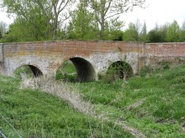
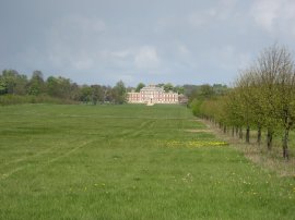
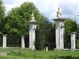
A short distance past the pond the route crosses an attractive brick bridge over the River Cam, photo 10. To reach this following the route as marked on the map I had to cross over a three rather old and decrepit stiles and I think a better alternative might be to head up the pond itself and take a more central route up Wimpole Avenue at this point. Once over the bridge the route continues up the right hand side of the avenue to reach the A603. Once over the road the route continues ahead with Wimpole Hall growing ever larger in the distance, photo 11. After about half a mile the route heads to the left across the middle of the avenue to join a footpath, which was not particularly easy to spot, that runs diagonally over fields towards the village of Arrington. The Harcamlow Way then follows the main A1198 through the village towards an impressive set of side gates, photo 12, that led the route back into the grounds of Wimpole Hall. Besides the gates there was a way marker for the Clopton Way which runs between Wimpole Hall and the village of Gamlingay.
 |
 |
 |
(13) Sheep, Wimpole Hall |
(14) Wimpole Hall |
(15) Home Farm |
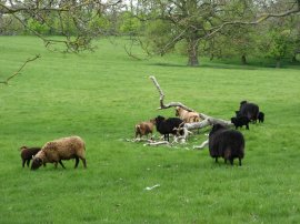
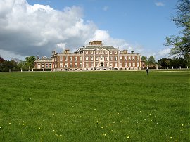
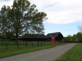
Just inside the grounds was a notice board which described how the area to the North East of the gates was used as a hospital between 1944 and 1960 however when it was closed the building were removed and the land returned to pasture, now happily being grazed by a multitude of sheep, photo 13. The route follows a surfaced track that runs through the grounds passing in front of the hall itself, photo 14. The route then heads on past the stable block which is now used as the visitors reception area and heads down the driveway to the property, which being a bank holiday Monday was being quite heavily used, to join a small road where the route turns to the right for a short distance, heading towards the building of home farm photo, 15.
 |
 |
 |
(16) The end point of stage 7, Old Wimpole |
(17) St Andrew Church, Orwell |
(18) Holy Trinity Church, Meldreth |
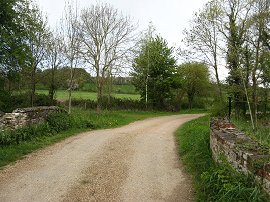
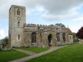
Just before the farm buildings are reached the route takes a driveway on the right where after about 500 yards by a bridge over a small stream I finished this stage of my walk along the Harcamlow Way, photo 16. In hindsight it would have been better to walk the short distance further to Mare Way which would have prevented me having to do a there and back stretch of walk along the track at the start of the next stage however I had already walked 12.4 miles by this point, 11.62 of which had been along the Harcamlow Way, it was just about to start raining heavily and there was a convenient footpath to start my walk back to the car, which was not quite as far away as I had estimated. Leaving the Harcamlow Way I joined a footpath that started heading South East, crossing the almost unnoticeable Thornberry Hill and then running alongside the edge of Cobbs Wood down to cross back over the A603. Here I joined Fishers Lane which I followed into the village of Orwell. The rain and hail had soon passed over and the weather was once again bright and sunny, in fact the ground at Orwell was more or less dry, obviously having missed the shower I had been caught in by Old Wimpole. Reaching the church, photo 17, I turned to the right down Town Green Road before taking a footpath that ran between houses to Lotfield Street. Here I turned to the right before turning left along Meadowcroft Way where I joined a footpath that is followed back out into open fields. The path then heads between fields before crossing the middle of another field to reach Malton Road where I then followed the road to the right. Just past Malton Farm the route crosses the River Rhee and I stopped for a short snack break before continuing on towards the village of Meldreth. Leaving the Malton Road I joined a footpath on the right that heads towards teh edge of the village before joining another footpath on the right which leads to the Holy Trinity Church in Meldreth, photo 18
 |
 |
(19) All Saints Church, Melbourn |
(20) Melbourn |
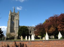
From the church the route heads across North End and along a driveway that leads to a large house. Just before the house is reached the path heads through a gap in the hedge to join a path that runs over a grassy field to join a tree lined track running alongside the River Mel. The footpath then follows the tree lined route of the river on a good path before crossing over some railway lines close to Meldreth Station. The route then heads alongside a field before passing through a brightly painted underpass under the A10 which soon leads to a large area of playing fields on the outskirts of Melbourn. Leaving the course of the river I headed over to Station Road which I then followed up past All Saints Church, photo 19, to its junction with the High Street, photo 20. From here I had just a short walk down New Road back to my parking place.
Reaching the car I had walked a total distance of 18.8 miles. I had really enjoyed this walk, despite getting caught in a couple of heavy showers a far greater number passed close by without getting me wet. The route was fairly pleasant, in fact my return route was actually more scenic than much of the Harcamlow Way part of the path and I was really pleased to be able to walk over 11 miles on the Harcamlow Way itself. For the next stage I hope to be able to walk to Coton, although there seems little alternative to a fair bit of road walking on th return leg.
I have uploaded the route of the walk which can be accessed here Harcamlow Way 7 Route.
If you would like to comment on this walk you can do so here:
![]() Back to:Walk index page
Back to:Walk index page
| ©2012 Bertuchi.co.uk. Please contact me using the email button on the right if you have any questions or comments regarding the site. Any feedback and additional information about places of interest on the walks is always welcomed. All rights reserved. Please contact me if you want to use any of the images or information from the site. ENJOY YOUR WALKING |
|