(1) Site of the new Tescos in Yiewsley
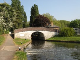
(2) Cowley Peachey Junction
(3) Grand Union Canal, Slough Arm
Other Links >>> |
|
GRAND UNION CANAL - Part 4
Cowley Peachey Junction to Watford
I did this walk on the 25th April 2011 which was the Easter Bank Holiday Monday. I took the tube to Paddington and then the train to West Drayton and 1hr 22 minutes after leaving home I was back at the Grand Union Canal.
|
|
|
|
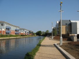
(1) Site of the new Tescos in Yiewsley |
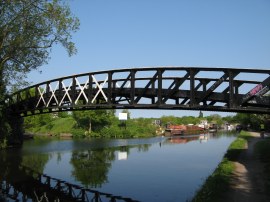
(2) Cowley Peachey Junction |
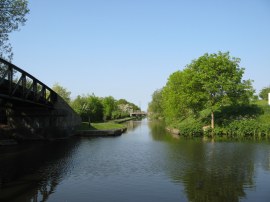
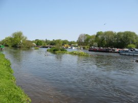
(3) Grand Union Canal, Slough Arm |
After walking just 0.4 of a mile I reached the point where the tow path had been closed when I last walked the canal a few weeks ago. Now, the building works had finished sufficiently to allow the path to re-open and I was able to walk past the new buildings, photo 1, for the further 0.3 of a mile up to Cowley Peachey Junction, photo 2, where I had finished my last walk along the main route of the Grand Union Canal before heading off down the Slough Arm, photo 3.
 |
 |
 |
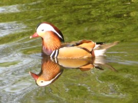
(4) Mandarin Duck |
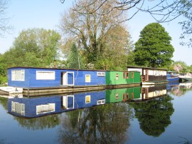
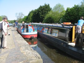
(5) House boats and Cowley Peachey |
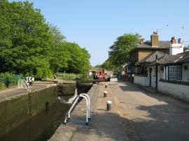
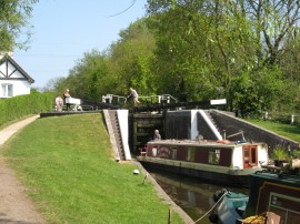
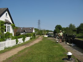
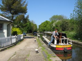
(6) Cowley Lock |
Today however I continued on ahead, passing a large area of moorings alongside the Packet Boat Marina where there was an attractive Mandarin Duck on the canal, photo 4. As well as the canal boats there were also some larger house boats moored up alongside the canal, photo 5. The path heads up to Cowley Lock, which is lock number 89, photo 6, where the fried breakfasts on offer at the Toll House tea rooms looked and smelt very tempting however it was rather early to stop for a food break so I continued on. past the lock the tow path climbs up to the Iver Road by the Malt Shovel pub to cross over the canal and continue on down the opposite bank.
 |
 |
 |
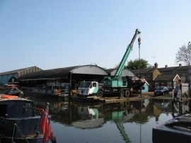
(7) Uxbridge Boat centre |
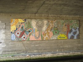
(8) Mural under the A4020, Uxbridge |
(9) Approaching Uxbridge Lock |
The path then heads down besides the North Cowley Moorings, along a broad section of canal as it makes its way towards Uxbridge. The path heads under the Cowley Mill Road and a short distance further on the route of the London Loop once again rejoins the Grand Union Canal towpath from Culvert Lane on the left. On the right hand bank, just before the A4007 Slough Road, the route passes the Uxbridge Boat centre, photo 7, which looks a very active yard, dominated by a tall green crane. A little further the path heads under the A4020 Oxford Road close to the centre of Uxbridge where there was an attractive mural under the road bridge, photo 8. Once under the road the path heads by Denham Marina to Uxbridge Lock where the route crosses over a bridge, photo 9, to the opposite bank of the canal.
 |
 |
 |
(10) Denham Lock |
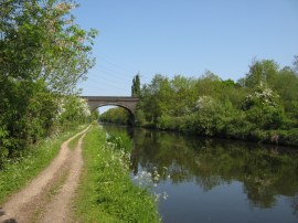
(11) Denham Railway Bridge |
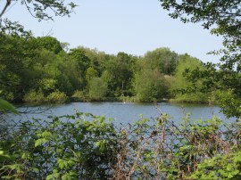
(12) One of the many lakes in the Colne Valley |
Heading away from Uxbridge the canal starts to leave the built up western fringe of London to pass through a much less developed area although the peaceful scene somewhat spoilt by the ever growing drone from the nearby A40. A low concrete span carries the road across the canal and shortly after the A40, the tow path crosses bridge 183 over the canal, where it very briefly links up with the route of the South Bucks Way which ends nearby. The canal now runs alongside Denham Country Park with a number of flooded gravel pits just visible through the trees on the other side of the canal up to Denham Lock, photo 10, which has the distinction of being the deepest lock on the Grand Union Canal at 11 feet and 1 inch. There is also another popular tea hut besides the lock. From the Denham Lock the canal takes a fairly straight course as it continues through the Denham County Park, the canal passing under the tall brick Denham Railway Bridge, photo 11. It was yet another bright sunny April day with hardly any breeze and a joy to be out walking in. There were also now more lakes visible through the trees on the left of the path, photo 12.
 |
 |
 |
(13) Entrance to the Harefield Marina |
(14) Widewater Lock |
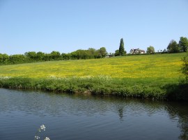
(15) Meadow nr Harefield |
On the right one of these lakes has been opened up to the canal to form the Harefield Marina which has 250 moorings, photo 13. The path then passes under the low bridge of Moorhall Road and almost immediately reaches lock 86, Widewater Lock, photo 14. Just under a mile further up the canal is running alongside the large Broadwater Lake on the left and on the opposite bank a grassy meadow sloped gently uphill towards Harefield, photo 15, one of the first noticeable hillsides that the canal has passed.
 |
 |
 |
(16) Black Jack's Lock |
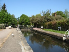
(17) Copper Mill Lock |
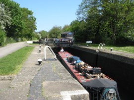
(18) Springwell Lock |
Next up comes Black Jack's Lock, photo 16, and then Copper Mill Lock, photo 17, where the towpath crosses Copper Mill Lane and the London Loop leaves the Grand Union Canal for the final time. Between the two locks the path heads by a couple of weirs on the left while on the right bank the canal passes an area of houses. Just below the Copper Mill lock the remains of an old mill stream, and I assume a weir channel, had been converted to a small canoe slalom course where a couple of canoeists were manoeuvring themselves between the poles while two lads in a much larger boat just crashed around amongst them. The tow path then heads along a broad track running past houses before heading back out into the countryside and approximately a mile further on reaches Springwell Lock, photo 18, close besides Springwell Lake. I stopped on a bench besides the lock for a 10 minute break enjoying the warm sunshine. I had been making very good progress along the path and decided I would walk on to Kings Langley rather than Watford which had been my original destination for the day.
 |
 |
 |
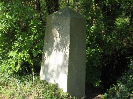
(19) Coal post besides the Grand Union Canal |
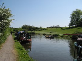
(20) Countryside nr Stockers Lock |
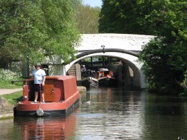
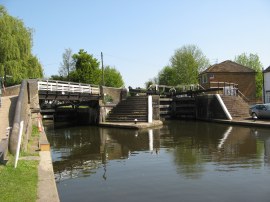
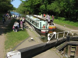
(21) Batchworth Locks |
Leaving the lock the canal passes a large abandoned factory building where a large stuffed gorilla had been hung from a beam high up at the top of the building. The towpath then runs alongside an area of semi permanent moorings, where a number of the boat owner had made small gardens besides the path, as well as erecting various rather weird bits of sculpture. I also spotted one of the large granite coal post besides the bank, photo 19.At this point the canal begins heading round to an almost easterly direction heading through another area of pleasant countryside, photo 20, passing by Stockers Lock, as it makes its way towards Batchworth. The canal heads under the A404 and reaches the Batchworth Locks, photo 21, which are lock 81. Here there are two locks side by side, the right hand lock on the main Grand Union Canal and the left hand lock which marks the junction of the canal with a tributary of the River Chess. Besides the locks is the Batchworth Canal Centre where there is a small visitors centre and cafe.
 |
 |
 |
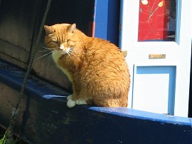
(22) Captain of the ship |
(23) Lot Mead Lock |
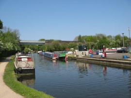
(24) Bridgewater Basin, Croxley Green |
From the lock the route is soon running along a pleasant tree lined section of towpath past an area of moorings. Between here and the next lock, there are still lakes to the left of the path although these remain largely hidden from view behind the trees. A considerable number of the canal boats seemed to have pet cats on board, perhaps to tackle the canal side rats, and on one I spotted a particularly nice ginger cat sitting on the side of boat, photo 22. Nearing Lot Mead Lock, photo 23, the canal passes under a disused railway line which now forms part of the Ebury Trail, a 3.5 mile route along the old Watford and Rickmansworth Railway. Shortly after the lock the canal encounters another rail bridge which carries the still very much in use Metropolitan Underground and Chiltern line services over the canal. The canal then runs through a low tree lined cutting as it makes its way towards Croxley. Soon after Common Moor Lock the canal begins running alongside an area of predominantly new housing before passing under another disused railway line and the bridges that carry the A412 over the canal by Croxley Green. The canal then heads past the moorings at Bridgewater Basin, photo 24, before once again heading under a rail bridge, this time the one carrying the Metropolitan Line spur into Watford which can be seen in the background of photo 24.
 |
 |
 |
(25) Cassio Bridge Lock |
(26) Iron Bridge Lock |
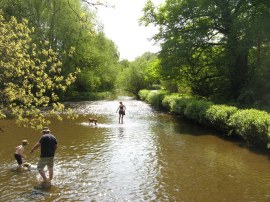
(27) Paddling in the River Gade |
It was as I was walking along this part of the towpath that I suddenly realised that I had not brought out my wallet with me which instantly scuppered my plans of walking onto Kings Langley as I would not have the money to buy a rail ticket back. This was rather annoying considering the progress I had been making along the path on what was an ideal walking day. Normally I carry a spare £10 note in my rucksack for just such emergencies but this had been "borrowed" by my daughter so my only option was to head to Watford where I could use my Oyster Card to travel back. By this point I wasn't very far from Watford and I headed on past Cassio Bridge Lock, photo 25, before stopping at a bench to eat my pack lunch, having walked about 12 miles. From there it was just a short walk further along a tree lined section of the canal up to Iron Bridge Lock, photo 26, where I finished this stage of my walk along the canal. Crossing over the canal I then crossed a bridge over the River Gade, photo 27, which at this point is running alongside the canal before heading into Cassiobury Park.
 |
 |
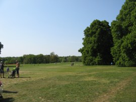
(28) Cassiobury Park |
(29) Watford LU Station |
The park was packed with people enjoying the warm bank holiday as I made way steadily uphill through the park, photo 28, before heading out into Cassiobury Park Avenue from where it was just a short walk down to Watford London Underground Station, photo 29, from where I was soon crossing back over a couple of the bridges I had just walked under as I headed back into London.
As usual I have uploaded the route of the walk which can be accessed here: Grand Canal Stage 4 Route.
Completing this stage I have now finally left the suburban part of the canal behind and am heading out into the countryside. I had been feeling really good on this walk, enjoying the warm weather, and it had been a real shame to cut it short however this did actually help with the mileages on future stages so probably was for the best. All in all I walked 14.3 miles of which about 13 had been along the canal towpath.
If you would like to comment on this walk you can do so here:
![]() Back to:Walk index page
Back to:Walk index page
| ©2012 Bertuchi.co.uk. Please contact me using the email button on the right if you have any questions or comments regarding the site. Any feedback and additional information about places of interest on the walks is always welcomed. All rights reserved. Please contact me if you want to use any of the images or information from the site. ENJOY YOUR WALKING |
|