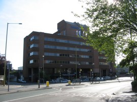
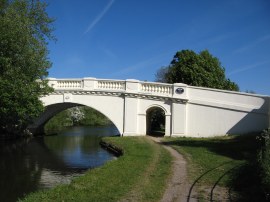
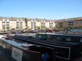
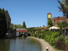
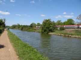
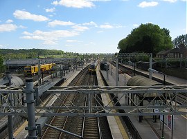
(1) Watford Junction Station
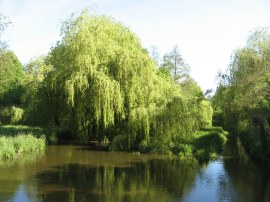
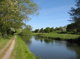
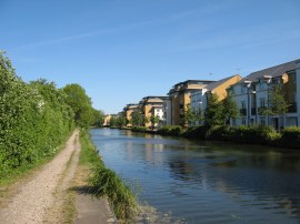
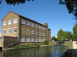
(2) River Gade, Cassiobury Park
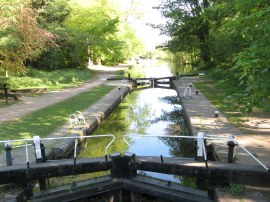
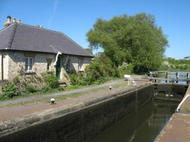
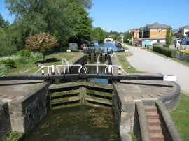
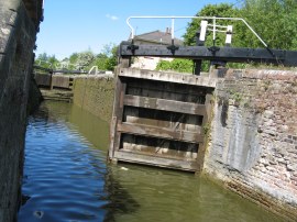
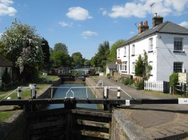
(3) Iron Bridge Lock
Other Links >>> |
|
GRAND UNION CANAL - Part 5
Watford to Tring
I did this walk on Monday 2nd May, 2011
|
|
|
|
(1) Watford Junction Station |
(2) River Gade, Cassiobury Park |
(3) Iron Bridge Lock |
I took the tube to Euston and then got the fast train to Watford Junction, photo 1, from where it was a 1.7 mile walk back to rejoin Grand Union Canal. It is possible to make this link a bit shorter however I went slightly off course as I headed through the Watford streets which were just off the edge of my map. Fortunately I was able to make good use of the map of my mobile phone and soon got back to where I needed to be. After heading through Cassiobury Park I crossed over the River Gade, photo 2, from where it was just a few yards up to the Iron Bridge Lock, photo 3, where I had finished the last stage of this walk. As with most of my walks just recently it was another bright sunny day with hardly a cloud in the sky although there was quite a strong wind, strong enough at times to blow the dust up off the canal towpath.
 |
 |
 |
(4) Cassiobury Park Lock |
(5) 71 miles to Braunston! |
(6) The Grove Bridge |
From the lock the route follows a broad path alongside the canal, lined on either side with trees. I soon spotted a heron standing fishing by the waters edge, the first of several I would see during the days walk. The route then heads past two locks in quick succession, the first of these was Cassiobury Park Lock, photo 4, which had new wooden lock gates. By the second lock was another of the distance markers to Braunston, photo 5, this one showing 71 miles left before I get there. Heading on up the canal the route crosses over the wooden bridge 166 to the other side of the canal before heading on up under a road bridge and on to the brightly painted Grove Bridge, 164, photo 6. Away to the left of the canal, on top of a hill was a large brick house and a small golf course which form part of The Grove hotel golf & spa resort and away to the right were fields.
 |
 |
 |
(7) Grand Union Canal, nr Hunton Bridge |
(8) North Grove Lock |
(9) The M25 Roadbridge nr Kings Langley |
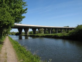
Not much further on the route crosses back over the canal at bridge 163 and heads up to Lady Capels Lock, which is lock 74. Having passed under the A41 the towpath leaves the canal side for just a few yards to skirt round the edge of a reed bed before rejoining the canal. After a few more twists and turns the Grand Union canal arrives at lock 73 and then a couple of hundred yards further on lock 72, which is the second of the Hunton Bridge Locks, the canal for a while running parallel to a road. Shortly after passing under bridge 162 the route heads along a straighter section of canal, photo 7, and ahead I spotted the wind turbine located by the M25 on the edge of Kings Langley. Away to my left across a field I could see the motorway and the earthworks associated with the current road widening project taking place and briefly wondered if the tow path was going to be obstructed although fortunately this was not the case. Shortly before reaching the M25 the route passed lock 71, North Grove, photo 8. Away to the right, across a field or so was some railway lines which were to remain in close proximity to the canal for much of today's walk. With the strong wind coming from more or less directly behind me I didn't hear much traffic noise from the motorway until I had almost reached the viaduct that carries it over the canal, photo 9, although I knew that once I was on the other side the noise would be accompanying me for some time as I made my way up to Kings Langley.
 |
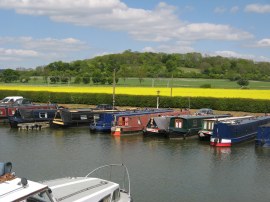
 |
 |
(10) Bridge 159a |
(11) New Housing at Kings Langley |
(12) Kings Langley Lock |
A short, straight stretch of path from the motorway follows the canal under bridge 159a, photo 10, which is situated just below Home Park Lock which is lock no 70 on the outskirts of Kings Langley. Just past the lock were two mallards with 13 ducklings in tow which seemed a very large number for one pair of birds and I wondered if it was a communal nursery rather than just the brood belonging to the pair. Reaching Home Park Lock I was back on the final section of path that I had walked before, having walked the next 5 or so miles as part of a circular walk I did when walking the Hertfordshire Way. Not far above the lock the canal passes a small water park besides the canal where there is the unusual site of the head of a giant dinosaur rising up besides the path. On the opposite bank is another of the many areas of new housing the now lines the route of the canal, photo 11. At the Water Lane bridge the route crosses over the canal and heads up by Kings Langley lock, no 69, photo 12 before continuing on through the edge of Kings Langley.
 |
 |
 |
(13) Site of the Nash Mills Housing Estate |
(14) Apsley Basin Moorings |
(15) Old Mill building, Apsley |
A slightly more rural stretch of path follows before the canal passes under the high concrete arch of the Kings Langley Railway Bridge. Continuing on, the tow path heads up to the road bridge by lock 69, Red Lion Lock. Crossing over to the opposite bank, the canal passes a site where there was a large pile of concrete rubble besides the path, the remains of old factory buildings on a site soon to be turned into the Nash Mills Housing Estate, photo 13. Reaching the end of the building site the canal passes Lock 68, Nash Mills lock. Reaching a white bridge, no 154, the route crosses over the canal again and leaves the tree lined stretch of path the canal had been following to enter a large area of new housing surrounding Apsley Basin Moorings, photo 14, where there was also a big new metal bridge sweeping over the canal; in sharp contrast to the old one I had just crossed over. Besides the basin is a vegetarian café and also a small supermarket and an Indian restaurant. The were a number of benches by the mooring which made an ideal place to stop and I had a short break on one of these while I ate one of the sandwiches that I had brought with me. Just above the mooring the route passes lock 67, where there was one remaining old building besides the canal, and continues ahead passing new housing to reach the nearby lock 66 in an area that had changed beyond all recognition from when I had last walked here just a few years ago.
 |
 |
 |
(16) Apsley Lock |
(17) Boxmoor Lock |
(18) Boxmoor Meadows |
From lock 66, Apsley Lock, photo 16, its on to lock 65 which is also known as Apsley Lock where the route crosses over the canal using one of the traditional white painted arched bridges, number 153. The route then heads alongside Hemel Hempstead, passing under the A414 Two Waters Road bridge with a big blue tower away to the right and some recreation fields on the right by lock 64, Boxmoor Lock. As I went past the lock water was overflowing the lock gates, photo 17, which was something I hadnt seen before but subsequently spotted at several other locks throughout the day. To the left of the canal was an attractive area of meadows running alongside the canal which are owned by the Boxmoor Trust, photo 18.
 |
 |
 |
(19) Boxmoor Top Lock |
(20) Winkwell Dock |
(21) Winkwell Swing Bridge |
The route then passes lock 63 which is situated close to Hemel Hempstead Station before continuing on with the area of meadows still to the left of the path and houses away on the right hand bank of the canal. Leaving Hemel Hempstead the tow path heads past lock 62, Boxmoor Top Lock, photo 19. The route then heads along a straight section of the canal along a broad path before bending slightly to the left to pass back under the railway lines where there was another heron fishing besides the canal. Not far past the railway lines the route passes Winkwell Dock, photo 20, and then heads by lock number 61 near the village of Winkwell. Shortly after the lock the towpath reaches the Winkwell swing bridge, photo 21, which was just swinging shut as I went by having opened to let a couple of canal boats to go past. Besides the bridge was the Three Horseshoes pub which looked inviting although I didnt stop. To the left of the canal bank the small river Bulbourne is also running besides the towpath, the canal sharing its route with the course of the river for a while in a couple of places.
 |
 |
 |
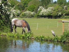
(22) Pony and Heron besides the canal |
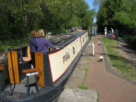
(23) Top Side Lock |
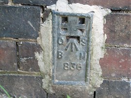
(24) Flush Bracket 836 |
The route then continues ahead running alongside Bourne End up to lock 59 where there was a little marker showing that it was now 63 miles to Braunston. Not much further on I reached bridge 145 which is where the Hertfordshire Way leaves the Grand Union Canal towpath and from this point on I had not walked any further sections of the towpath before. At this point the canal is now back out in the countryside with fields either side of the tree and hedge lined banks of the canal. At the edge of one of these fields I spotted a horse and heron standing together at the side of the canal, photo 22. Lock 58 is known as Sewer Lock and then there comes two more locks in quick succession, lock 57 and lock 56, which is Topside Lock, photo 23, which is where I stopped for my lunch break. Although it was a bright and sunny day the strong wind made it too cool for me to take off my fleece. Having eaten I then followed the canal as it made its way on to Berkhamsted with the main railway lines up to the north west once again running quite close to the right hand bank of the canal. Reaching bridge 143 the route crosses over the canal and I noticed there was a flush bracket on the wall of the bridge, photo 24.
 |
 |
 |
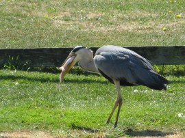
(25) A Heron with its catch |
(26) Port of Berkhamsted |
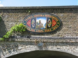
(27) Plaque on Bridge 141 |
Not long after passing over the bridge I spotted a heron in the canal catching a fairly decent sized fish. It then hopped up onto the canal bank, at its second attempt, and proceeded to swallow the fish down, photo 25. The route passes lock 55 and then lock 54, Ravens Lock, both with an attractive canal side pub besides them as the canal heads through an area known as the Port of Berkhamsted, photo 26, with houses lining both sides of the canal. Berkhamsted is a town that has really made the most of its canal waterfront and there were a number of interesting information boards places alongside the towpath detailing the history of the canal and the industries it served in the area. On bridge 141, where the route once again crosses over the canal, is a plaque, photo 27, which is inscribed "Francis Egerton of Berkhamsted The Canal Duke" and commemorates the 3rd Duke of Bridgewater who is also known as "the father of inland navigation" and who lived at the nearby Ashridge Estate.
 |
 |
 |
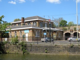
(28) Berkhamsted station |
(29) Canal heading towards Northchurch Lock |
(30) Canal besides the rail lines |
The canal heads very close besides Berkhamsted station, photo 28, which would make an ideal stopping off point for those using public transport, and a little further on reaches lock 53. Then unsurprisingly comes lock 52 which is almost immediately followed by lock 51 which is had the rather unusual name Gas 1, As I went by I wondered whether lock 52 had been called Gas 2 which indeed it is. As the canal heads out of Berkhamsted to the left of the path is a lot of new housing and to the right a few industrial units. The locks had really been coming thick and fast on this section of canal as the Grand Union Canal steadily heads up the Chiltern Hills towards its summit near Tring. With 51 locks past that means there are now just 50 left to go. The canal continues on through the suburban fringe of Berkhampstead to lock 50, Bushes and then lock 49 which was Northchurch Lock, photo 29. Away to my right I could see the hills of the Chilterns rising up above the canal and a little closer the railway lines which are also sharing the same valley through the hills that the canal does. Finally the house that have been lining the left had bank of the canal end and the canal is once again heading out through open countryside. Despite it being a Sunday there was a steady stream of Virgin Intercity trains, photo 30, heading up and down the lines as well as the occasional slower suburban services of the London Midland Trains, which I would be using later for my return journey to London.
 |
 |
 |
(31) Cowroast Lock |
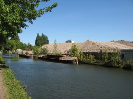
(32) Cowroast Marina |
(33) Tring Cutting |
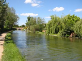
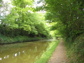
Reaching lock 48 the route crosses over to the other bank of the canal at the road bridge by Dudswell Lock. From there it is only a couple of hundred yards on to lock 47, which is also called Dudswell Lock. Next up is lock 46 lock, Cowroast Lock, photo 31, which marks the start of the Tring summit, where there is also a small marina besides the canal, photo 32. The Tring summit marks the high point of the Grand Union Canal as it crosses over the Chilterns. From its junction with the River Thames the canal has passed through 56 locks in over 36 miles and has ascended some 380 feet. The canal crosses the summit, which runs for two and a half miles, and then the descent northwards towards Braunston commences. For most of the way from Berkhamsted the towpath had been surfaced but this ended past Cow Roast Lock and the surface of the path became quite uneven for a while as it headed away from the lock. Leaving the moorings of Cow Roast behind the canal heads through the Tring Cutting, the banks on either side of the canal rising steadily higher as I made my way towards Tring, photo 33.
 |
(34) Tring Station |
Reaching bridge 135, which crosses over the Tring Summit Cutting I finished this stage of my walk along the Grand Union Canal. At this point the GPS said 16.9 miles which meant I had walked another 15.2 miles along the towpath for the day. I then headed up to the road from where it was just a short walk along Station Road to Tring station, photo 34, where I caught the train home.
As usual I have uploaded the route of the walk which can be accessed here: Grand Canal Stage 5 Route.
This had been a very enjoyable walk along the towpath and Watford seemed a long way away as I was heading through the countryside between Tring and Berkhamsted. For my next walk I will be heading up the canal for a short distance to Bulbourne, where the Aylesbury Arm, starts before retracing my steps slightly and walking the Wendover Arm.
If you would like to comment on this walk you can do so here:
![]() Back to:Walk index page
Back to:Walk index page
| ©2012 Bertuchi.co.uk. Please contact me using the email button on the right if you have any questions or comments regarding the site. Any feedback and additional information about places of interest on the walks is always welcomed. All rights reserved. Please contact me if you want to use any of the images or information from the site. ENJOY YOUR WALKING |
|