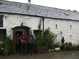
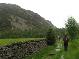
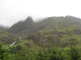
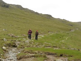
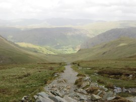
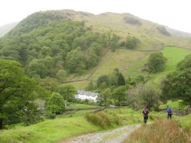
(1) Leaving Low Cock How
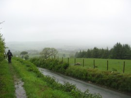
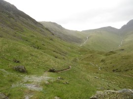
(2) Heading down to Ennerdale
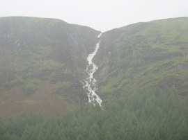
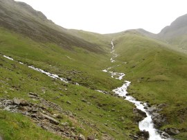
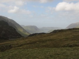
(3) Stream above Ennerdale
Other Links >>> |
|
COAST TO COAST PATH - Day 2
Ennerdale Bridge to Rosthwaite
A hardcore day. The weather forecast had been for torrential rain and gale force winds and that is precisely what we woke up to.
|
|
|
|
(1) Leaving Low Cock How |
(2) Heading down to Ennerdale |
(3) Stream above Ennerdale |
It was therefore with some trepidation that we all got kitted up and set off out into the elements from Low Cock How Farm, photo 1. Two of our fellow guests at the farm, who we would subsequently see just about every day of the walk, had already decided they were going to give the days walk a miss although one of them did briefly consider joining us but in the end decided not to. From the farm house we headed up to rejoin the coast to coast path and we were soon being buffeted by the wind and almost horizontal rain as we made our way down the path that runs alongside the road, photo 2, which took us the mile and half into a rain soaked Ennerdale Bridge. Around us we could the water running off the hills in white torrents, photo 3.
 |
 |
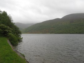 |
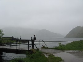
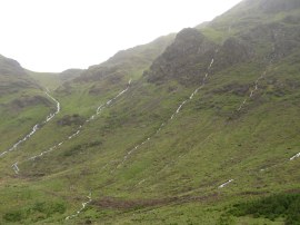
(4) Ennerdale Water |
(5) Path round Ennerdale Water |
(6) Ennerdale Lake |
There was little point in hanging around and thus we set off along the road that leads to the head of Ennerdale Water, photo 4. Here the classic Coast to Coast route follows a footpath running along the south side of the lake, which I have to admit was the way I wanted to go, however common sense prevailed and we opted to go along the jeep track that runs along the north shore of the lake. This was a longer route and at first seemed a poor choice. To get to the north track we had to follow a footpath, photo 5 that ran along the end of the lake which was exposed to the full force of the wind. Worse than this the path was also extremely flooded, well over the top of my boots in a number of places, with water running off the hills and with waves blowing up from the lake. Thus it was with completely sodden feet we reached the slightly more sheltered forestry track on the north shore of the lake. Here we passed the large group of walkers we had seen yesterday as we left the coast, who were making very slow progress along the path. At least at this point the rain had eased off and although the remainder of the day was very cloudy and dull we did not get caught in more heavy rain. The forestry track, although rather dull, did provide easy walking and a bit of shelter as we made our way along the lake, photo 6 and up to Ennerdale Youth Hostel which is close to where our intended route along the south side of the lake would have led.
 |
 |
 |
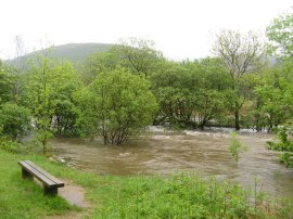
(7) River Liza |
(8) Track heading towards Black Sail |
(9) View towards Pillar |
However looking at the floodwaters from the River Liza in the valley floor, photo 7, I doubt we would have been able to get across to the path, even if we could have forded all the numerous streams running down into the lake from the hills that cross the south side path. From the youth hostel we continued ascending gently up along the track accompanied by an ever growing wind as we made our way out of the trees and up towards the Black Sail Youth Hostel, photo 8. Away to our right we could see Pillar rock rising above the valley, the very summits of the peaks remaining hidden in cloud, photo 9.
 |
 |
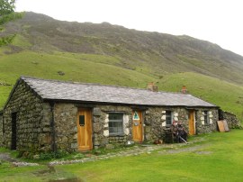 |
(10) View towards Kirk Fell |
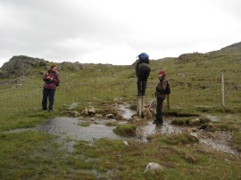
(11) Stream nr Black Sail YH |
(12) Black Sail Youth Hostel |
All around us water was flowing down off the mountains, photo 10 and we were all wondering how easy it was going to be to get across Loft Beck a little further on. My boots had been gradually drying out as we headed up the track but just yards from the hostel a small stream running down the hill was in spate, photo 11, and once again I had cold water flooding over the top of my boots as I made my way across.
 |
 |
 |
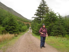
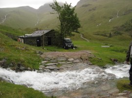
(13) Lunch stop at Black Sail YH |
(14) Path from Black Sail |
(15) View up Loft Beck |
We stopped to eat our lunch inside the shelter of Black Sail and also made a very welcome cup of tea, photo 13. While we were having lunch three women who had been following us arrived at the hostel; they were also due to be heading to Rosthwaite although we never saw them again that day once we left the hostel, hopefully they made it OK. From the hostel the Coast to Coast path takes an indistinct path, photo 14, which when we walked along it was often very waterlogged, up towards the end of the valley before bearing to the left and heading steeply uphill beside Loft Beck, photo 15.
 |
 |
 |
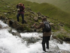
(16) Val crossing Loft Beck |
(17) View back down Ennerdale |
(18) Chris negotiating the stile |
However before we could begin our ascent we had to cross over the beck, photo 16, which was in full flood, at least half way up my calfs in places and considerably higher with the force of the water pushing round my legs, and a very tricky crossing for all concerned. I certainly would not have attempted if I had been on my own. Then it was up, up and up, out of the valley; a steep climb but in many places there were stone steps which made the climb a little easier. It was however becoming increasingly windy, 70mph winds had been forecast and keeping our feet and avoiding the worst of the water coming down the hill, which was also running down the path, was often difficult. At one point the wind blew the water up from the beck and I got a good soaking just from the spray. Luckily I had re-waterproofed my jacket and trousers the previous weekend and they were able to keep my relatively dry; definitely time well spent. Reaching the top of the hill we could see back down Ennerdale, photo 17, and with the cloud lifting visibility was good and we could clearly see the path down to the old tramway, it was just a case of trying to stay on our feet and avoid the worst of the flooding. At one point we had to cross a small stile over a sheep fence, photo 18, which proved very difficult, I got half way over and the wind was so strong I couldn't lift my other leg up over the stile which sounds ridiculous now but I needed to cling on to the top of the fence just to stay upright.
 |
 |
 |
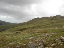
(19) Route of the path above Loft Beck |
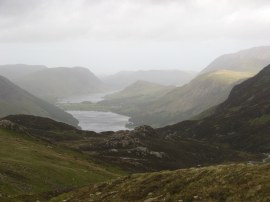
(20) View towards Buttermere |
(21) Val and Sara below Grey Knotts |
From the top of the hill the coast to coast route follows a path, photo 19, well marked with cairns, across the top of the hill before gradually heading round to the left below Grey Knotts towards the remains of the old Drum House and Honister Slate Mine Tramway. Away to out left were lovely views over Buttermere and Crummock Water, photo 20, quite often in sunshine although this never reached us, and to the right of the path, over towards Borrowdale. As was to be expected the wind was at its strongest on top of the hill and apart from Chris we all got blown over several times. One gust knocked three of us over at the same time which was actually quite funny to watch.
 |
 |
 |
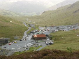
(22) The old Slate Mine Tramway |
(23) Honister Slate Mine |
(24) Path down to Seatoller |
From the tramway, photo 22, we headed downhill along the good path to Honister Slate Mine, photo 23, where we stopped for another very welcome cup of tea in the cafe there. Just before we reached the slate mine we met a man who was the support driver for the large party we had seen back near the start of Ennerdale although judging by their earlier progress and apparent walking ability I seriously doubted if they would have been able to make it past Black Sail; if they even got there. However we told the man where we had seen them and the route we had taken and he headed on up to find them. Leaving the slate mine we headed downhill along the road for a few minutes before we were able to join the route of the old road, photo 24, which runs to the left of the current road.
 |
 |
 |
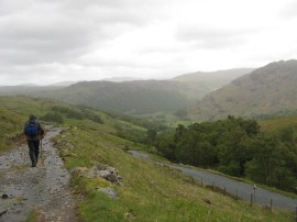
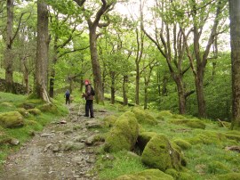
(25) Approaching Seatoller |
(26) Path nr Longthwaite |
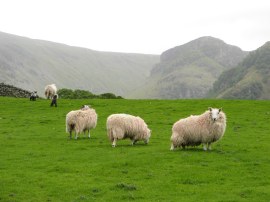
(27) Sheep nr Rosthwaite |
We followed this path all the way down into Seatoller, still accompanied by a very strong wind. For much of its length the path was acting as a stream, keeping my boots which were by now completely porous, nicely topped up with water. Reaching Seatoller, photo 25, we followed the road for a few yards before joining a path that runs from the car park down towards Rosthwaite. This was an attractive stretch of path, running alongside the River Derwent, passing between moss covered trees, photo 26, although once again the path was often more a stream than a proper path after the earlier rains. Eventually we reached Longthwaite Youth Hostel, where I had once stayed many years earlier on another very wet and windy walking trip. From the youth hostel we joined a road over the River Derwent before taking a footpath on the left that headed over a couple of sheep pastures, photo 27, into Rosthwaite.
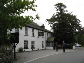 |
(28) Royal Oak Hotel, Rosthwaite |
From there it was just a short walk on to our nights accommodation at the Royal Oak Hotel. We took our wet boots and socks off outside and were soon shown up to our rooms before coming down to some welcoming scones and yet another cup of tea.
All in all we had walked 17.0 miles which in the conditions was an excellent achievement. Most of the other Coast to Coast walkers at the hotel had taken alternative transport to get there as had Ralph, the German walker we had met up with yesterday who was also staying in Rosthwaite for the night and had had to take a very circuitous route there due flooding on the roads in the morning. Apart from the three women who we saw at Black Sail we had not seen any walkers out on the path, aside from the large group near Ennerdale, and I did wonder how many other people had been able to complete the stage of the walk on the day. Sadly the weather had affected both Sara and Chris' cameras which had both stopped working although Chris' did resurrect itself a couple of days later. I would have loved to have taken some photos of the flooding at the bottom of Ennerdale although it was just too wet to take the camera out at that point.
As usual I have uploaded the route of the walk which can be accessed here: Coast to Coast Path Day 2.
If you would like to comment on this walk you can do so here:
![]() Back to:Walk index page
Back to:Walk index page
| ©2012 Bertuchi.co.uk. Please contact me using the email button on the right if you have any questions or comments regarding the site. Any feedback and additional information about places of interest on the walks is always welcomed. All rights reserved. Please contact me if you want to use any of the images or information from the site. ENJOY YOUR WALKING |
|