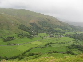
(1) Leaving Low Rosthwaite
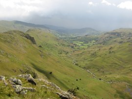
(2) Heading down to Ennerdale
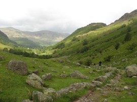
(3) Path alongside Stonethwaite Beck
Other Links >>> |
|
COAST TO COAST PATH - Day 3
Rosthwaite to Grasmere
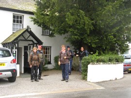
After an enjoyable nights stay at the Royal Oak Hotel in Rosthwaite, photo 1, we set off over to Grasmere on day 3 of our walk. Although this was a much shorter day distance wise it still felt quite strenuous after the long day the day before. The weather was still quite windy, but this was nowhere near as strong as the previous day and it was also much drier.
|
|
|
|
(1) Leaving Low Rosthwaite |
(2) Heading down to Ennerdale |
(3) Path alongside Stonethwaite Beck |
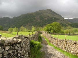
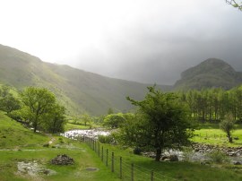
At first the route followed a lovely stone walled track running past sheep pastures, photo 2, which then starts heading up alongside Stonethwaite Beck, photo 3, as the route begins heading steadily uphill. For a while the path is shared with route of the Cumbria Way before this heads off over the beck and up Langstrath.
 |
 |
 |
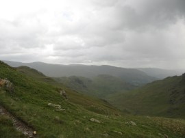
(4) Greenup Gill |
(5) View back down to Borrowdale |
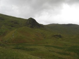
(6) Approaching Lining Crag |
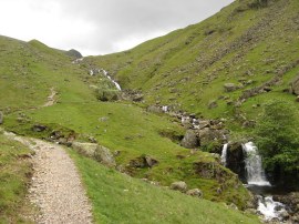
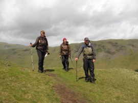
Continuing ahead, the ascent up the steep and sheltered path soon had me warmed up and I was able to take off both my waterproof jacked and fleece for a while as the path continued uphill alongside Greenup Gill, photo 4. Looking back behind us there were excellent views back down towards Borrowdale over the paths we had just walked, photo 5. As we ascended further though we left the shelter of the surrounding hills and the wind increased in strength again which soon led to the fleece going back on and just before the steepest section of the uphill climb besides Lining Crag, photo 6, a shower meant I was fully kitted up again. As we were heading up this stretch of path we met the two women who had been staying at Low Cock How and we would see them more or less every day for the remainder of the walk at some point.
 |
 |
 |
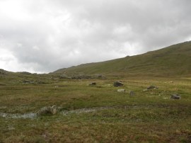
(7) The summit plateau |
(8) Descending down from Greenup Edge |
(9) Heading towards Helm Crag |
Reaching the summit of the pass, photo 7, we headed across a very boggy and wet area of ground, and my fabric boots, which had not fully dried out despite spending the night in the drying room at the hotel, were soon completely drenched again. Having crossed the the rather featureless summit plateau by Greenup Edge, where there were paths heading off to Ullscarf and High Raise, the route descends quite steeply down, photo 8, to another small boggy area of flat ground. While we were heading down to this we stopped for a snack break at a place were some rocks provided some shelter and a dry area to sit on. After crossing a couple of streams we reached a point where there was a choice for routes, photo 9, one path heading steeply downhill into Easedale and the other route, which we took, bearing to the left along a ridge which runs high above the valley to Helm Crag.
 |
 |
 |
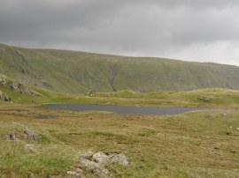
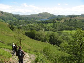
(10) Tarn at Brownrigg Moss |
(11) View towards Widermere |
(12) Calf Crag |
From the junction of paths the route heads by a small tarn at Brownrigg Moss, photo 10, Whilst this route gave excellent views across the surrounding countryside, over Grasmere and at one point to Windermere, photo 11, it was extremely difficult to walk. The surface was either very boggy or littered with sharply angled rocks which meant all concentration was required on finding decent footholds as the path undulated across the top of the ridge where there are a number of small sub summits, the first of these being Calf Crag, photo 12.
 |
 |
 |
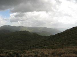
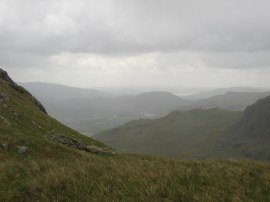
(13) View down to the Easedale Valley |
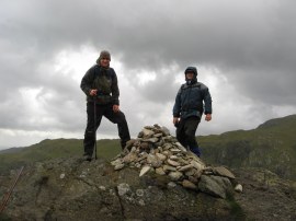
(14) Group Photo |
(15) Approaching Helm Crag |
We then continued along the ridge enjoying the views on either side, photo 13, before heading up the short slope at the end of the ridge which leads up to Helm Crag, photo 15.
 |
 |
 |
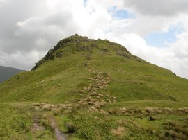
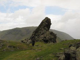
(16) Helm Crag |
(17) View down over the A591 |
(18) Heading down to Easedale |
Eventually we reached the summit of Helm Crag, photo 16, where we stopped for another short break. It was however quite exposed in the wind and there was another short hail shower so we soon got on our way again. Away to our left we could see down towards the A591 road and the Travellers Rest Inn where we were staying for the night, photo 17. From Helm Crag we then began our descent along a path that leads down to the Easedale Valley. One advantage of the strong wind was that the occasional showers were blowing over very quickly and we were soon back walking in sunshine as we headed downhill, photo 18.
 |
 |
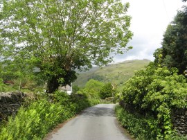
(19) Lane nr Goody Bridge |
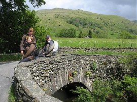
(20) Bridge over the River Rothay |
While we had all felt quite warm when walking we soon began to feel quite chilly in the strong wind on top of the fells and it was very pleasant to be walking in the much warmer and calmer conditions once we reached the valley floor. The Coast to Coast route doesn't actually go into the center of Grasmere but instead follows the Easedale Road before heading to the left along another lane by Goody Bridge, photo 19. This attractive lane was followed up to the A591 Keswick Road where our accommodation for the night, the Travellers Rest Inn, was just a few yards to the right down the road.
This was the day I had felt most tired and lacking in energy on the whole walk and I was glad we were having a couple of short days walking. After freshening up myself and Sara went into Grasmere. We had been going to walk but delayed our departure for a few minutes to allow a rain shower to blow over and ended up meeting a couple who kindly gave us a lift down to the village. There I brought a new long sleeve T shirt, despite being May the weather was cool enough to be wearing two T shirts and I always prefer having my arms covered under my waterproof jacket which if the weather forecasts were anything to go by I would be needing for most of the remaining walking days. We then all met up and had a very nice dinner at the Potters Out in Stock Lane before myself and Chris went over to Tweedies Bar and met up with Ralph and Denis and Sylvie, a French Canadian couple we had met the previous evening in Rosthwaite for a couple of beers. The three girls we had met at Black Sail were also staying at the Travellers Rest and they confirmed they had made it across Loft Beck and on to Rosthwaite along with two guys they had met up with. As we had been descending from Helm Crag we had also once again met up with the driver of the large group of people we had seen who was once again out looking for his charges. He told us that yesterday, to avoid Loft Beck, they had headed up towards Haystacks where one of their party had broken their ankle which required the mountain rescue team to come out to them and they had eventually descended down to the road through Scarth Gap Pass.
As usual I have uploaded the route of the walk which can be accessed here: Coast to Coast Path Day 3.
If you would like to comment on this walk you can do so here:
![]() Back to:Walk index page
Back to:Walk index page
| ©2012 Bertuchi.co.uk. Please contact me using the email button on the right if you have any questions or comments regarding the site. Any feedback and additional information about places of interest on the walks is always welcomed. All rights reserved. Please contact me if you want to use any of the images or information from the site. ENJOY YOUR WALKING |
|