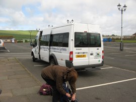
(1) Packhorse Minibus
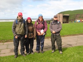
(2) Group photo at the start
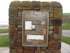
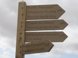
(3) Sign marking the start of the path
Other Links >>> |
|
COAST TO COAST PATH - Day 1
St Bees to Ennerdale Bridge
Sara, Valerie, Chris and myself started our walk along the Coast to Coast path on Sunday May 22nd 2011. We had had an early breakfast at the Jolly Farmers B&B in Kirkby Stephen, having driven up there the day before, and then took the Packhorse bus, photo 1, over to St Bees for the start of the walk. The journey took about an hour and a half and for much of the time as we made our way through the Lake District there was heavy rain and strong winds. Fortunately though by the time we arrived at St Bees the rain had stopped and we only had the wind to contend with when we set off.
|
|
|
|
(1) Packhorse Minibus |
(2) Group photo at the start |
(3) Sign marking the start of the path |
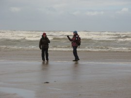
After taking various photos at the start of the path, photo's 2 and 3, we headed down the beach, it was near low tide, to dip our boots in the Irish Sea, photo 4, and to pick up a few pebbles to take with us on the trek; tradition dictating that you pick up a pebble at St Bees and then throw it into the North Sea at the end of the walk over at Robin Hoods Bay.
 |
 |
 |
(4) Val and Sara wetting their boots |
(5) St Bees Head |
(6) Coast to Coast Way Marker at St Bees |
That done we set off up the coast along the cliff top path, photo 5, over St Bees Head. It was very windy on the cliffs, enough to occasionally make me lose my step, although luckily for us the wind was blowing in from the sea so there was no danger of being blown away. At the end of the beach was a wooden way marker showing 191 miles to Robin Hoods Bay, photo 6
 |
 |
 |
(7) View over St Bees |
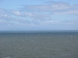
(8) Looking across to the Isle of Man |
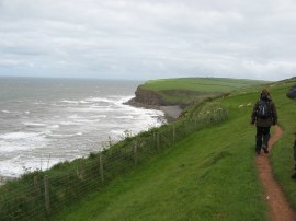
(9) Cliff top path from St Bees |
As we headed up over St Bees Head good views opened out back over the village, photo 7 and also as the weather steadily brightened we had been able to see the Isle of Man in the distance, with Snaefell rising prominently above the Irish Sea, photo 8 as we headed along the cliff top path, photo 9.
 |
 |
 |
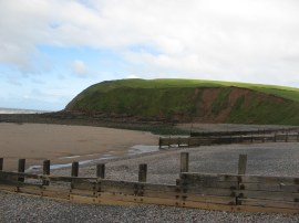
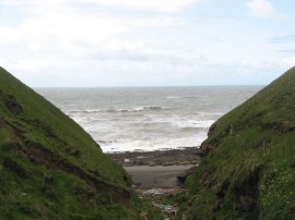
(10) Fleswick Bay |
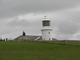
(11) St Bees Lighthouse |
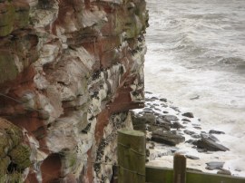
(12) Nesting Seabirds |
The path descends down slightly to pass Fleswick Bay, photo 10, before continuing along the cliff top passing St Bees lighthouse, photo 11. The current lighthouse was built in 1822 after the previous coal fired version had burnt down. The sea cliffs around St Bees are popular with nesting birds and there were a number to be seen bobbing about on the choppy sea as well as darting about on the wind. There were also a couple of RSPB viewpoints to see the birds nesting on the cliffs, photo 12, although it was impossible to get a decent photo due to the wind shaking the camera so much.
 |
 |
 |
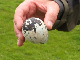
(13) The large bird egg |
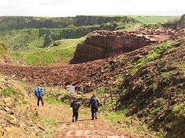
(14) North Circular Aqueduct |
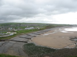
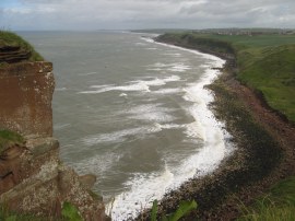
(15) View towards Whitehaven |
Chris found a really large blue and black speckled hatched bird egg lying on the grass above the cliffs, photo 13, although I am not sure what bird it had belonged to. Continuing on, the cliff top path passed a small quarry, photo 14, before joining a surfaced track by a white cottage where the Coast to Coast path starts heading inland. Looking up the coast we could see the town of Whitehaven, photo 15, and in the distance the Scottish hills over the Solway Firth.
 |
 |
 |
(16) Heading along the road from Sandwith |
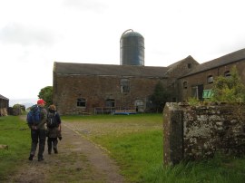
(17) Demesne Farm |
(18) St Bees Rail Line |
The lane led to the village of Sandwith where we turned to our left, following the road out of the village, photo 16, up to a T junction. Here we continued ahead along a track that leads down past Demesne Farm, photo 17, to the B5345 St Bees Road. Crossing this we joined another track that headed steadily downhill between fields before passing under the St Bees railway line, photo 18. Shortly before reaching the railway line we met up with a German walker, Ralph, who accompanied us for the remainder of the days walk and who we would subsequently meet up with a number of times over the following days. After crossing a boggy area of pasture the path began heading steadily uphill again towards the road at Moor Row. We appeared to be making quite good progress along the path and had passed quite a few walkers including a large group destined for Ennerdale Bridge we had seen when we left the coast. Although we had quite far reaching views back the way we had come as we headed towards Moor Row we did not spot them again so goodness knows what time they would have arrived, if they did make it all the way.
 |
 |
 |
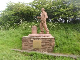
(19) Coast to Coast Statue, Moor Row |
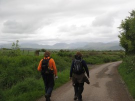
(20) View towards Dent Fell |
(21) St Leonard's Church, Cleator |
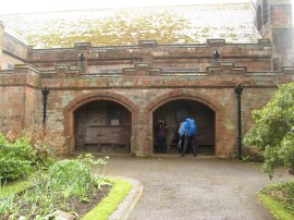
Approaching Moor Row we had our first choice of route, either to join the route of an old railway that skirts round the edge of the village or take the road through the village itself. The latter route was our choice, as there was a statue and mileage marker for the walk at the start of the village we wanted to see, photo 19. We followed the road as it headed through the village, turning to the right at the end of the road before joining a field edge footpath on the left that makes its way over to Cleator. Ahead of us we could see Dent Fell, photo 20, which we would soon be crossing, rising above the surrounding land. Just as we started this section of path we got caught in quite a heavy downpour so it was fleece off, coat on and the rain cover for the rucksack. The path heads through a small kissing gate on the right and heads down to cross over the old railway once again before joining a footpath that continues ahead leading to Wainwright Passage, which runs alongside Cleator cricket club. The band of rain soon stopped and we all stopped for lunch in the large sheltered porch of St Leonard's Church, photo 21, although after a hearty breakfast I wasn't feeling that hungry and struggled to eat even my sandwich.
 |
 |
 |
(22) Main Street, Cleator |
(23) River Ehen, Cleator |
(24) Red Squirrel |
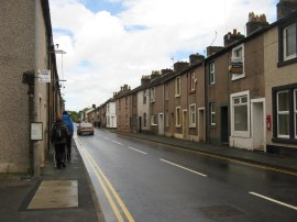
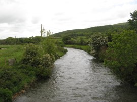
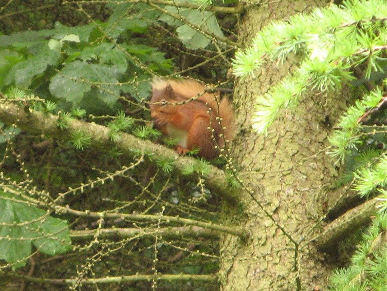
We then headed up to Main Street in Cleator, photo 22, where the route turns briefly left before heading to the right down Kiln Brow. Opposite the entrance to Kiln Brow was a small store although I did not need to buy anything. A short distance down Kiln Brow we joined a track on the right which led over the River Ehen, photo 23, before following a farm track that works its way round to Black How farm where once again it started raining. From the farm buildings the path joins a forestry track running through an area of woodland where we spotted a red squirrel, photo 24, crossing the path and heading up a tree, at first glance on the ground I thought it might have been a pine marten but this was sadly not the case.
 |
 |
 |
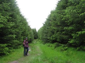
(25) Path through Blackhow Wood |
(26) Rest stop on Dent Fell |
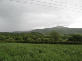
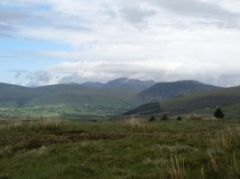
(27) View towards the Lakes from Dent Fell |
The path headed uphill, joining a rather boggy grassy section of path, photo 25, on the left which continued to head uphill and out of the trees, photo 26, to the summit of Dent Fell. Ahead of us excellent views opened up over the Lakeland mountains, photo 27, and away to the right we could see the Sellafield nuclear power plant. The rain had stopped before we had left the trees and we were now walking in warm sunshine and although we could see a very heavy band of rain moving in from the sea fortunately this hit the coast several miles to the south of where we were.
 |
 |
 |
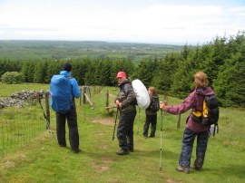
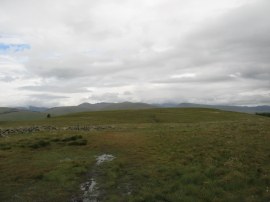
(28) View over Dent Fell |
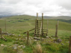
(29) Tall deer stile |
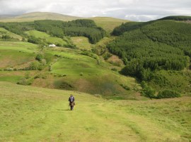
(30) View down to Uldale |
Heading across the top of the fell, photo 28, we crossed over a tall deer stile, photo 29 and joined a grass path that began descending ever more steeply down towards Uldale, photo 30. This is apparently the steepest descent on the coast to coast walk and yesterday we had met a woman who had broken her wrist while heading down the slope although she did continue walking the Coast to Coast. This it was with some relief when we all reached the attractive narrow valley floor safely, photo 31, and began heading upstream alongside Nannycatch Beck.
 |
 |
 |
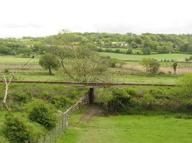
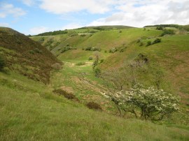
(31) View along Uldale |
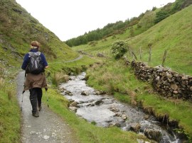
(32) Nannycatch Beck |
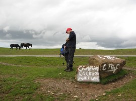
(33) The end of day 1 |
We followed the beck, photo 32, up to Nannycathc Gate, where the path entered the Lake District National Park, then followed the path around to the right as it eventually headed up to join a small road, photo 33. Here the Coast to Coast path headed to the right but we had reached the end of our walk for the day and after saying goodbye to Ralph headed to the left for a few yards before turning down the driveway which led to Low Cock How Farm, our accommodation for the night. Arriving at the farm the total distance we had walked for the day was 13.9 miles.
This had been an excellent days walking through varied terrain from the coastal cliffs to the foothills of the Lake District. The previous day a lot of the walkers we had spoken to had said this was walk was the hardest day however I personally had found it quite easy. Perhaps the people we had overtaken during the day would have a different view but on paper tomorrows walk to Rosthwaite seems a much more strenuous affair. The accommodation was plain but perfectly acceptable. There was no choice of dinner and we were served roast pork, which came with a selection of six vegetables and a small bottle of beer with a very nice sticky toffee pudding for dessert which was a fitting end to the day.
As usual I have uploaded the route of the walk which can be accessed here: Coast to Coast Path Day 1.
If you would like to comment on this walk you can do so here:
![]() Back to:Main index page
Back to:Main index page
| ©2012 Bertuchi.co.uk. Please contact me using the email button on the right if you have any questions or comments regarding the site. Any feedback and additional information about places of interest on the walks is always welcomed. All rights reserved. Please contact me if you want to use any of the images or information from the site. ENJOY YOUR WALKING |
|