Chiltern Way
Other Links >>> |
|
CHILTERN WAY - Part 13
Breachwood Green to Harpenden
|
|
Chiltern Way |
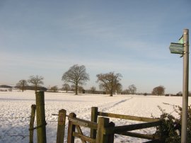
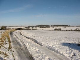
I did this walk on Saturday 26th January 2013. It had snowed quite heavily the previous Monday and there was still quite a lot of snow on the ground for this walk although the temperature had risen considerably overnight and the remaining snow started thawing fast later on in the day as I made my way back to the car although the trip along the Chiltern Way itself was glorious. I had an easy journey up to Breachwood Green and was able to park on the road at the point where I had finished the last stage of my walk back in December, photo 1.
 |
 |
 |
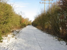
(1) Start point at Breachwood Green |
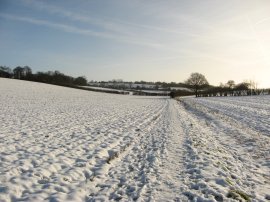
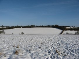
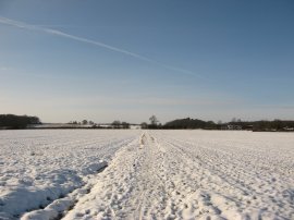
(2) Fields nr Breachwood Green |
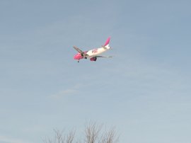
(3) Plane approaching Luton Airport |
From here the Chiltern Way heads down Chapel Road and continues on ahead at T junction along Lye Hill. The road was quite slippery with black ice and I needed my wits about me as I headed along the road. Reaching a bend in the road the route joins a footpath that heads down over a field to the bottom of a shallow valley, photo 2. Here I headed to my left before joining a footpath on the right that heads through a gap in a spindly hedge and uphill over a field on the other side of the valley. While I was walking along this stretch of path I passed under the flight path of the planes coming in to land at the nearby Luton Airport, photo 3. As well as the planes there were also a number of red Kites flying round overhead, the most I'd seen out on the walk for quite some time.
 |
 |
 |
(4) View back to Breachwood Green |
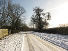
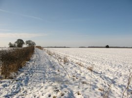
(5) Road by Wandon Green Farm |
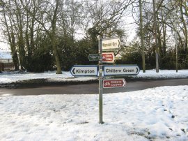
(6) Peter's Green |
The path heads uphill over two fields from where there were good views back towards Breachwood Green, photo 4. The path then heads besides a paddock and past a very rundown old wooden barn before joining a road by Wandon Green Farm, photo 5. Here I headed down the rather slippery road for a few yards before turning to the right along Lawrence End Road which is followed for quite some distance down the hamlet of Peter's Green. This was the first of a couple of long stages of road walking along this stage of the Chiltern Way although the icy road was very quiet and I was only passed by a couple of cars the whole way to Peter's Green. Despite the snowy surroundings I was soon feeling quite warm and able to remove one of the three fleeces I was wearing. Peter's Green marks the point where the Northern Extension of the Chiltern Way, which had headed off back at Sharpenhoe Clappers, rejoins the main route of the path at the end of Lawrence End Road, photo 6.
 |
 |
 |
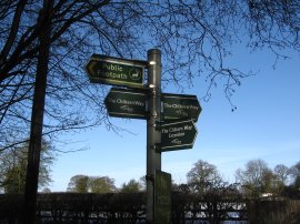
(7) Chiltern Way signpost |
(8) Fields nr Peter's Green |
(9) Fields heading down towards East Hyde |
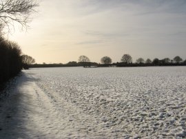
At the road junction the main route heads briefly to the right along Chiltern Green Road before joining a footpath on the left that soon heads out across more open fields, photo 8. It really was glorious walking across the snowy landscape with the bright blue sky overhead. This path is followed ahead, joining a hedge lined track between the fields as the Lea Valley gradually comes into view ahead. The route heads to the left at a field boundary before joining another path on the right that heads down towards the houses at East Hyde. Reaching the houses the path heads left towards Farr's Lane which the Chiltern Way follows the short distance down to the B653 Lower Harpenden Road at the bottom of the valley.
 |
 |
 |
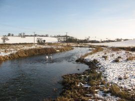
(10) River Lea, East Hyde |
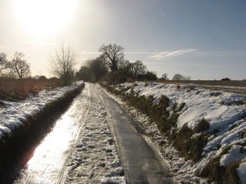
(11) Cooters End Lane |
(12) View back over the Lea Valley |
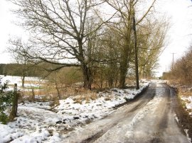
Crossing the road the route joins Thrales End Lane and soon crosses over the River Lea, photo 10. Continuing up the road the route heads under a rail bridge and heads to the left along Cooters End Lane. This road, which climbs gently up the other side of the Lea Valley was particularly icy and water from the rapidly thawing snow and ice was running over the surface of the compacted ice on the road, photo 11, making walking particularly difficult and for a while I diverted up into the neighbouring field. As the road headed up good views opened up back over the valley, photo 12.
 |
 |
 |
(13) Signpost at Jenkins Lane |
(14) Fields Nr Harpenden |
(15) Nickey Line Sign |
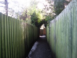
This second long stretch of road is followed down to the A1081 on the outskirts of Harpenden. Here the Chiltern Way heads to the left alongside the main road up to the junction with Roundwood Lane. Just past this junction I joined a footpath on the left that heads up between houses and across a small playing area before joining a fence lined footpath, photo 13, that is followed through the suburban housing across several minor road and past a school and its playing fields before heading back out to open fields on the far side of Harpenden, photo 14. Here the path curves round to the left to reach the Nickey Line, photo 15.
 |
 |
 |
(16) View along the Nickey Line |
(17) Redbourn Golf Course |
(18) Lower Wood |
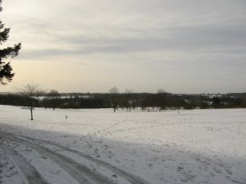
The Nickey Line, photo 16, is a footpath and cycle track the follows the route of the old railway line which used to run between Harpenden and Boxmoor and is one of the paths I hope to walk later in the year. The Chiltern Way heads to the right along the track for just a short distance before joining a footpath on the right that heads down towards the grounds of the Redbourn Golf Course, photo 17. The weather was starting to cloud over at this point and the thaw really beginning to take effect with the snow becoming ever more slushy under foot. I also noticed my right foot was feeling quite wet although I was unsure if this was due to lack of waterproofing or whether a slight gap has opened up between the sole and upper of the boot. With one slightly squelchy foot I made way along a tree lined path along the edge of the golf course before joining a path that skirts round a paddock and small riding area where some horse riding lessons where taking place. The path soon leads to a small unsurfaced lane which I followed a short distance off to the right down to the buildings of Harpendenbury Farm where I finished this stage of my walked along the Chiltern Way having walked a further 6.86 miles along the path.
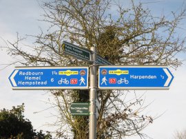
As usual I have uploaded the route of the walk which can be accessed here: Chiltern Way Stage 13 Route.
This stage wasn't the best for making a circular walk with lack of footpaths in the area of Luton Hoo Park however from my end point I made my way over towards Rothamsted and then down into Harpenden where I felt rather conspicuous walking through the town full of Saturday shoppers in all my winter walking gear. I made a more or less straight line up to Batsford and one up to Common Lane where I then followed a footpath over to East Hyde before making my way back up to Peter's Green from where I had to more or less retrace my outward route for the last couple of miles back to the car at Breachwood Green. Reaching the car I had walked a total distance of 15.7 miles, somewhat surprisingly my longest walk since early October.
![]() Back to:Main index page
Back to:Main index page
| ©2012 Bertuchi.co.uk. Please contact me using the email button on the right if you have any questions or comments regarding the site. Any feedback and additional information about places of interest on the walks is always welcomed. All rights reserved. Please contact me if you want to use any of the images or information from the site. ENJOY YOUR WALKING |
|