Chiltern Way
Other Links >>> |
|
CHILTERN WAY - Part 12
Warden Hill to Breachwood Green
|
|
Chiltern Way |
I did this walk on 16th December 2012, almost a month after I had walked the previous stage. I drove up from Walthamstow and parked up at the small car park close to the entrance of the South Beds golf course. I hadn't done any other walking in between times either and it felt really good to be back out in the countryside once again.
 |
 |
 |
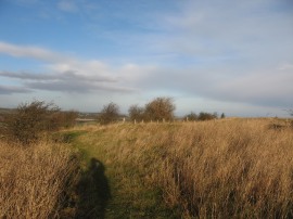
(1) Warden Hill |
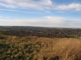
(2) View over Luton from Warden Hill |
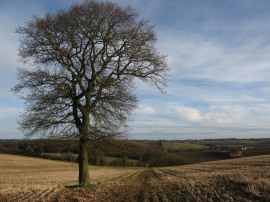
(3) Approaching Lilley |
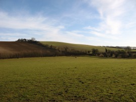
From my parking spot it was a 0.4 mile walk back up to the top of Warden Hill, photo 1, where I resumed my walk along the Chiltern Way. I made way via a rather circuitous route down from the top of the hill, from where there were good views over Luton, photo 2. I then headed to the left along a footpath at the bottom which headed past the scrubby trees the line the flank of the hill before continuing on between fields. This footpath heads gently uphill before bending round to pass besides Whitehill Wood before joining a broader farm track which is followed up Butterfield Green Road. Here the Chiltern Way heads briefly to the right before joining a footpath on the left that heads across the middle of a grassy field with the buildings of Whitehill Farm away to the left. This path then continues on across the middle of another field through gently rolling countryside, passing an isolated tree, photo 3, as the Chiltern Way heads over to the village of Lilley.
 |
 |
 |
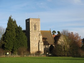
(4) Lilley Church |
(5) Hollybush Hill |
(6) Path alongisde the estate wall |
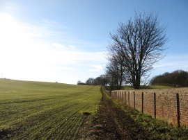
This path heads past passing by the trees of Lilleypark Wood, and a small childrens playground and the village church, photo 4, to reach West Street. Here I headed a few yards up the road to the left before joining another footpath opposite the church which runs between houses and soon leads out to a paddock. Crossing this paddock, the footpath heads diagonally to the right over the next field, where there was a rather flighty horse that started galloping across the field as I approached, before joining a field edge footpath that heads up and over the top of Hollybush Hill, photo 5, from where there were good views in all directions although there was also a lot of intrusive road noise coming up from the nearby A505 road. Reaching Lilleyhoo Lane the route heads to the right, following the lane under the A505 up to Hollybush Hill. Here I headed to the left before soon joining a byway that leaves the road on the right by the buildings of Glebe Farm. This pleasant byway is followed up to a road where the route heads to the right up to Lilley Bottom. Crossing the road the route follows a byway that heads up to East Lodge where the Chiltern Way bears to the left along a footpath that runs alongside a long brick wall which once ran round the Putteridge Bury estate, photo 6, with large open fields on the left.
 |
 |
 |
(7) Mangrove Green |
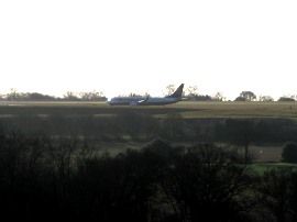
(8) Luton Airport |
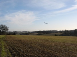
(9) Path at Wandon End |
This stretch of path eventually leads up to a road in the village of Mangrove Green, photo 7. The Chiltern Way follows the Mangrove Road through the village and continues on the short distance to the neighbouring village of Cockernhoe where the route joins another footpath on the left. This heads through a narrow band of trees running between fields before winding its way round a small patch of woodland. I was now very near to the runway of Luton Airport, photo 8, which I could see off to the right. The path continues on with a field on the right and the Tea Green golf course on the left up to the road at Wandon End. From there I continued ahead along a footpath that runs besides the road with a steady stream of planes flying low overhead coming in to land at the airport, photo 9.
 |
 |
 |
(10) T junction on the Darley Road |
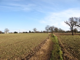
(11) Approaching Breachwood Green |
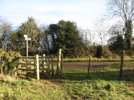
(12) The end point of this stage |
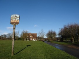
Reaching a T junction, photo 10, the route continues ahead along the Darley Road for a short distance up to a corner where the Chiltern Way joins a footpath that heads out across fields towards the village of Breachwood Green. The path heads gently down and up between the fields before skirting a paddock and heading alongside one more field, photo 11, up to Chapel Road in Breachwood Green, photo 12, where I finished this stage of my walk along the Chiltern Way having walked a further 7.86 miles along the path.
As usual I have uploaded the route of the walk which can be accessed here: Chiltern Way Stage 12 Route.
Arriving back at the car I had walked a total distance of 14.1 miles, having managed a reasonable circular route back from Breachwood Green, details of which can be seen by following the link above. Depsite not having done much walking just recently I felt quite fit and could have easily walked a bit further although I was still pleased with the distance I had done. I have now crossed back into Hertfordshire and ready to start heading in a generally southern direction back to Hemel Hempstead.
![]() Back to:Walk index page
Back to:Walk index page
| ©2012 Bertuchi.co.uk. Please contact me using the email button on the right if you have any questions or comments regarding the site. Any feedback and additional information about places of interest on the walks is always welcomed. All rights reserved. Please contact me if you want to use any of the images or information from the site. ENJOY YOUR WALKING |
|