Chiltern Way
Other Links >>> |
|
CHILTERN WAY - Part 14
Harpenden to Hemel Hempstead
|
|
Chiltern Way |
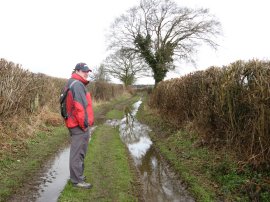
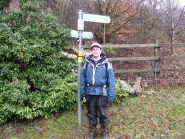
I did this walk on Sunday 17th March 13 which saw me complete the original route of the Chiltern Way, a full year after I had set out on the first stage. Greg, photo 1, accompanied me on this walk as he also had done for the first stage. We met up in Hemel Hempstead before heading over to Redbourn for the start of the walk where I was able to park in the small free car park just off the High Street. From Redbourn we had just under a miles walk back towards Harpenden to the point where I had finished the previous stage of my walk back in January. The weather forecast had been for showers however after a short dry interlude at the start it rained pretty much throughout walk with damp waterlogged paths for much of the way.
 |
 |
 |
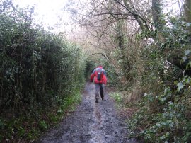
(1) Greg on one of the drier paths |
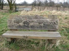
(2) River Ver walk bench |
(3) Track from Harpendenbury Farm |
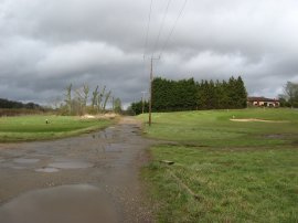
For part of the walk back to the Chiltern Way we were following the route of the River Ver Walk and we passed one of the decorative benches that display the route of the walk, photo 2, This well way marked route is another path I must walk one day although much of its route appears to be shared with the old Ver Colne Valley walk which I walked in 2012. Reaching the buildings of Harpendenbury Farm we then followed a track, photo 3, that ran along through the grounds of the Redbourn Golf Course with the River Ver running alongside to the left. In a couple of places there were golf tees besides the path with the golfers hitting the balls across the track which is something that always makes me rather wary of a sliced shot.
 |
 |
 |
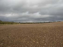
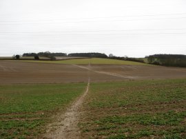
(4) A rather muddy field to cross |
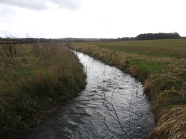
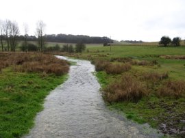
(5) River Ver |
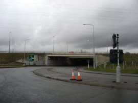
(6) The M1 and A5 road junction |
This path is followed up to the Luton Road where the Chiltern Way continues ahead across a large field, photo 4. This had recently been ploughed, and after all the rain was completely waterlogged, and we soon had great clumps of mud stuck to our boots as we made our slippery way slowly across the field. I also found a rather wayward golf ball that had somehow made its way over from the golf course! Eventually the sanctuary of the field edge was reached as we headed along another field edge up towards an isolated bungalow. Here the route heads to the left, crossing over the River Ver, photo 5, before following another field edge path round alongside the river up to the junctions of the M1 and A5.
 |
 |
 |
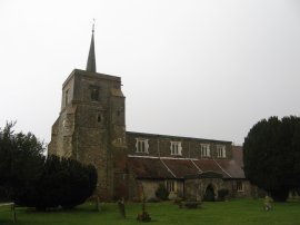
(7) St. Leonard's church, Flamstead |
(8) Path over Trowley Bottom |
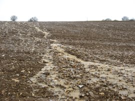
(9) Another flooded field |
After a rather convoluted crossing of the slip road and roundabouts of the junction we eventually joined a footpath that headed uphill over another muddy ploughed field towards a patch of woodland. Here the route heads to the right, skirting the edge of the woodland round to join a road on the outskirts of Flamstead. Here the route heads briefly to the left along Chequers Hill before heading left down Delmerend Lane. Soon, reaching a left hand bend in the road the route joins a footpath on the right that heads alongside a field up to the houses on Church End. This road is followed to the left before the route joins a footpath running through the grounds of St. Leonard's Parish church in Flamstead, photo 7. At this point it had started raining particularly heavily and we stopped for a short break under a yew tree while the worst of the rain and occasional sleet passed over. I had last walked through Flamstead when doing the Hertfordshire Way back in May 2007 on what had been an equally rain soaked day; one day I may get to see the village in the sun. From the churchyard the route crosses over Trowley Hill Road and heads along a footpath running alongside houses which is followed out to a large open field. The Chiltern Way heads over this field to reach a road, Pietley Hill, which is followed to the left for a short distance, before the route joins another footpath on the left which heads downhill across another field as the path heads down over Trowley Bottom in an area of open arable farmland, photo 8. Heading up the other side of the valley we crossed over another ploughed field which had water running down it like a river, photo 9, before joining a waterlogged footpath running over a paddock which leads up to Wood End Lane at the top of the hill. The Chiltern Way then heads to the right along the road before joining a footpath on the right, opposite a patch of woodland.
 |
 |
 |
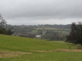
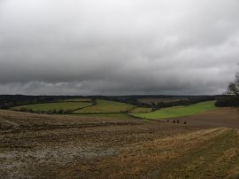
(10) View towards Great Gaddesden |
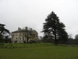
(11) Gaddesden Place |
(12) River Gade |
This footpath heads across a level stretch of field towards another patch of woodland with good views back to Flamstead on the right. The path runs along the edge of the wood for a while before joining a footpath that runs through the middle of the trees. The ground was covered by large numbers of bluebell plants which are going to look spectacular when they are in flower later in the year. Leaving the trees the path heads across a field to join a field edge path that is followed down past more trees to reach Puddephats Lane. Here the Chiltern Way heads briefly to the left before joining a footpath on the right that heads over a field to join a farm track which is then followed down to Gaddesden Row. Crossing the road we continued along a driveway before heading left just before a house is reached. At the end of this paddock the route bears right into an area which looked like old parkland with a fine looking brick built house off to the left. This leads up to a farm track which is followed for some distance along to the buildings of Home Farm, the path running along the high ground between the valleys of the River Ver and River Gade. The rain continued to fall steadily as we headed through another small patch of woodland before heading out across another large expanse of grass, following a line of telegraph poles towards Gaddesden Place from where there were good views down towards Great Gaddesden in the bottom of the valley, photo 10. Approaching the house, photo 11, we joined a footpath that headed down towards the bottom of the valley. Reaching the end of the grassy slope we headed across the A4146 to join a path running besides a house which leads down to the river Gade. We crossed a small wooden footbridge over the river, photo 12, and then headed left across a stretch of very waterlogged ground over to Nettleden Road.
 |
 |
 |
(13) View towards Nettleden |
(14) Path leading to Hemel Hempstead |
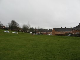
(15) Chaulden |
Here we headed to the right before joining a path on the left that headed uphill over another damp and slippery field up to Heizden's Wood where the Chiltern Way bears to the right, continuing gently uphill through the trees. Leaving the trees the path heads across another hilltop field with views away to the valley bottom on the right, photo 13, before joining a hedge lined track that runs between gardens to reach Potten End Hill. Here the Chiltern Way heads to the right before joining a footpath on the left which runs between fields towards the buildings of Boxted Farm. The official path heads over a couple of stiles and across a small paddock to reach the farm friveway which is then followed the short distancde down to the Berkhamsted Road. Crossing the road another footpath is then followed over a field down to Fields End Lane, the surrounding countryside looking rather grim in the damp wet weather. Here the route heads to the right for a short distance before joining a hedge lined footpath on the left, photo 14. Initially this runs between fields but soon reaches the housing on the outskirts of Hemel Hempstead. The path was very muddy with plenty of puddles and at times it proved very hard not to slip over. The path heads gently downhill, crossing over Long Chaulden Road and along over Shrub Hill Common. The path then heads through one final area of trees before reaching an area of mown grass surrounded by houses, photo 15.
 |
 |
 |
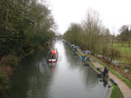
(16) Grand Union Canal |
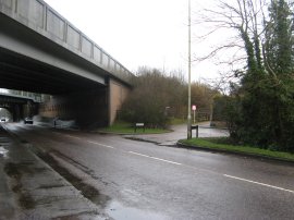
(17) London Road, Boxmoor |
(18) The end of the path |
Here we joined Jocketts Road before turning right into Northridge Way where I was feeling rather conspicuous walking through the suburban housing estate with my legs covered in mud almost up to my hips. The path follows Northridge Way as it curves round to the left towards a sports ground where the Chiltern Way heads down Old Fishery Lane on the right. This lane soon leads down to a bridge over the Grand Union Canal, photo 16, at Boxmoor. Having crossed over the canal the route headed under the midlands rail lines and the A41 to join a footpath on the right that headed along the edge of a grassy area to the A4251 London Road, photo 17. Here we just had to cross the road to complete the circuit round the Chiltern Way, photo 18, back where we had started last March.
As usual I have uploaded the route of the walk which can be accessed here: Chiltern Way Stage 14 Route.
From here it was just a short walk through the rain back up to the car. Reaching the car we had walked 12.0 miles of which 10.7 had been along the Chiltern Way itself, With this circuit completed I am now going to walk the three Chiltern Way extension paths starting with the Southern Extension which runs between Bix Bottom and Ewelme so there is still a fair amount of Chiltern Way walking still to do!
![]() Back to:Main index page
Back to:Main index page
| ©2012 Bertuchi.co.uk. Please contact me using the email button on the right if you have any questions or comments regarding the site. Any feedback and additional information about places of interest on the walks is always welcomed. All rights reserved. Please contact me if you want to use any of the images or information from the site. ENJOY YOUR WALKING |
|