Chiltern Way
Other Links >>> |
|
CHILTERN WAY - Part 5
Maidensgrove to Northend - including the Ewelme Loop
|
|
Chiltern Way |
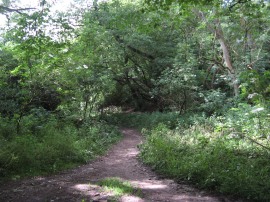
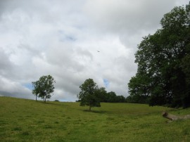
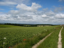
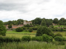
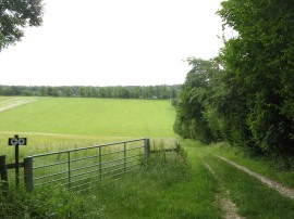
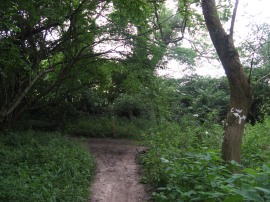
I did this walk on Sunday 1st July 2012. I drove over to Russell's Water and parked in a small lay-by close to the village pond. From the there it was a 0.5 mile of a walk down hill towards the link path which runs between the two arms of the Ewelme Loop which is where I resumed my walk along the Chiltern Way. The Ewelme Loop is a 10 mile almost circular meander of the main route of the Chiltern Way, and the link path, photo 1, I was now walking on links the two arms of this meander from its start and finish points close to Russell's Water.
 |
 |
 |
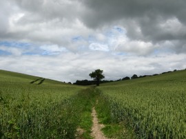
(1) The start of the link path |
(2) Path, Upper Maidensgrove |
(3) The end of the link path |
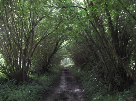
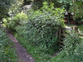
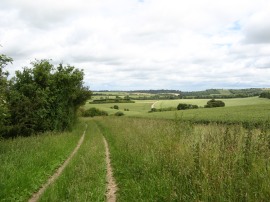
The link path, photo 2, follows a tree lined bridleway running along the bottom of a narrow valley with fields heading uphill on either side. After half a mile I reached the end of the link path, photo 3, and once again joined up with the main route of the Chiltern Way at the start of the Ewelme Loop and at the point where I had finished the previous stage of my walk a week before.
 |
 |
 |
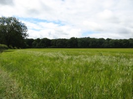
(4) Heading towards Park Corner |
(5) Field nr Park Corner |
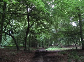
(6) Hazel Wood |
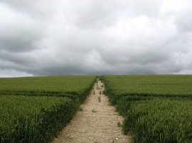
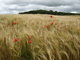
Here a path headed off to my right through a gate through a small area of trees before joining a footpath running the edge of some meadows, photo 4. This path makes its way steadily up to the top of the hill and joins an enclosed, and rather muddy stretch of bridleway which leads up to a road at Park Corner. This road is followed for a short distance before the route crosses over the slightly busier B481 road and heads out into a field that was planted with Barley when I went through, photo 5. The footpath heads to the left along the field edge towards an area of trees. At the end of the field the Chiltern Way heads to the right along a bridleway that runs along the edge of the trees. This then continues ahead along a hedge lined track running between fields before once again entering another larger patch of woodland, photo 6, where the path eventually begins descending gently downhill through the trees.
 |
 |
 |
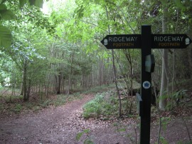
(7) Crossing the Ridgeway |
(8) View over the Thames Valley |
(9) View over the Chess Valley |
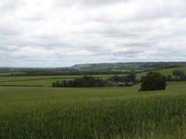
The path then enters a narrower band of younger trees and after quite some distance the path crosses over the route of the Ridgeway National Trail, photo 7, continuing ahead downhill through this narrow strip of woodland. Eventually the route leaves this narrow band of trees, turning briefly left and then right, to join a byway. This initially runs past a few scattered houses before heading out along a path running between fields. These were mainly arable fields although in some there were herds of Alpaca's. Heading along this path I went slightly off course (which seems to be becoming a bit of habit on this walk) as I missed a turning on the right and continued a bit too far along the byway. I hadn't gone too far before I realised I had gone wrong and turned around to retrace my steps back to where I should be. There were very good views from the byway down from the Chilterns across the Thames Valley, photo 8, and I could also see the cooling towers of the Didcot power station which brought back memories of last years walk along the Thames Path when the power station seemed to remain in view for an inordinate amount of time. I had also been able to see these in the distance when I had done a circular walk from Hungerford a few months earlier. Leaving the byway the Chiltern Way joins a field edge track, photo 9, that runs along down to a small patch of woodland where the route joins a footpath on the left that heads up over the middle of a large field, photo 10.
 |
 |
 |
(10) Field nr Potter's Farm |
(11) Path nr Potter's Farm |
(12) Approaching Ewelme |
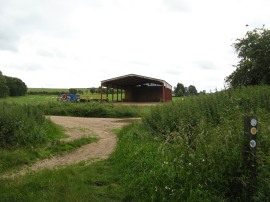
At the end of this field the footpath heads to the right along the edge of the field to join another farm track by a rather large manure heap. This track soon leads down to the farm buildings at Potter's Farm where the Chiltern Way briefly links up with the route of the Swans Way bridleway. This is another key spot on the Chiltern Way as it also marks the point where the southern extension of the Chiltern Way rejoins the main original route of the path. From the farm, photo 11, the route heads along an enclosed bridleway called Potters Lane that leads up to a road. Here the route continues ahead joining a footpath that runs with fields to the right and an old quarry to the left although this generally remains completely hidden from view behind an embankment. This stretch of path is followed down to another road where the Chiltern Way turns right to join another footpath that heads down towards the village of Ewelme, photo 12.
 |
 |
 |
(13) Piggery nr Ewelme |
(14) Field by Warren Bottom |
(15) View from Swyncombe Downs |
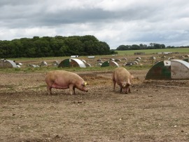
The path leads through a small patch of trees and along the edge of a playing field before turning to the right for a short distance along a road up to a junction where the Chiltern Way heads sharp left, almost doubling back on itself. The route then heads along this road until just before the first house on the left where the Chiltern Way joins a track on the right which also heads sharply back on itself at first before joining a footpath heading out alongside fields; the Ewelme Loop of the Chiltern Way not actually going into the village itself. The footpath heads up to a broader farm track before heading past a large enclosure of pigs, photo 13, before heading downhill to join a minor road at Warren Bottom where the route continues ahead for a short distance. The route the joins a byway on the left that runs along the edge of a field, photo 14, before joining another byway on the right, the route doing a dog leg round the field almost back to the road I had just left. However just before the road is reached the Chiltern Way heads through a parking area, bearing half left, before bending round to join a footpath that heads uphill through trees. On this section of path I saw one of the large Roman Snails, the first I had seen for quite some time. Leaving the trees the route then heads across a wild flower meadow on top of a chalk ridge at Swyncombe Downs. This very pleasant section of path leads up to a tree lined path continuing on across the top of ridge where a handy fallen tree made a useful seat for my lunch stop. Having eaten I continued on along the tree lined track over the downs from where there very good views off to the left over the surrounding countryside, photo 15.
 |
 |
 |
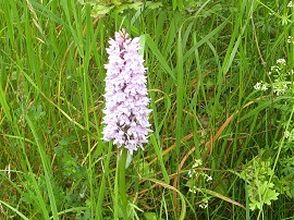
(16) Common Spotted Orchid |
(17) Approaching Swyncombe |
(18) St Botolph's Church, Swyncombe |
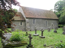
Besides the path there were a lot of Common Spotted Orchids, photo 16, a plant that appears to have benefitted from the wet summer we have been having so far this year. From the downs the path curves gently round to the right to one again link up with route of the Ridgeway in Dean Wood. The Chiltern Way then shares its route with the Ridgeway for the next mile or so as the path heads through woodland. Continuing on, the route then heads down and up the sides of a V shaped valley, photo 17, to reach a road where the Chiltern Way continues ahead along a track that leads down the 11c St Botolph's Church at Swyncombe, photo 18. Here the route leaves the Ridgeway, joining a path which heads through the churchyard and around the church before crossing back over the driveway leading to Swyncombe House.
 |
 |
 |
(19) Cookley Green |
(20) Back at the start of the link path |
(21) Heron, Russell's Water Pond |
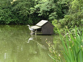
Here it joins a footpath that leads out into an area of parkland, the Chiltern Way heading gently uphill towards some trees. The route then heads through the trees up to join a road where the Chiltern Way then heads to the right along the road up to Cookley Green. Crossing a road the path then continues on along the left hand edge of the village green, photo 19, whilst once again linking up with the route of the Shakespeare's Way. This stretch of path curves round to a road where the Chiltern Way heads across before joining a driveway which heads down past a couple of houses before continuing on along a narrow bridleway which heads back down to Upper Bix Bottom. After about half a mile I reached the end of the Ewelme Loop, or the start of link path between the two arms of the loop, where I had started my walk earlier on in the morning, photo 20. Having completed this circle I then followed the main route of the Chiltern Way uphill along a sunken lane into the village of Russell's Water. Reaching the road, I then headed to the left before joining a driveway which curves round the village pond where there was a heron sitting in the duck island, photo 21.
 |
 |
 |
(22) Shambridge Wood |
(23) Foxgloves, Greenfield Wood |
(24) Approaching Northend |
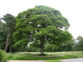
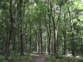
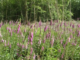
I had a short snack stop on a bench besides the pond before following the driveway down to a bridleway on the left which heads out to join a footpath running along the edge of a large grass meadow. There then followed a woodland interlude as the path heads downhill through trees, quite steeply for a while, to reach the road at Pishill Bottom where the Chiltern Way heads to the left, following the road up to Grove Farm. Here the route heads through a tall metal gate and through the small farmyard before joining a footpath that bears uphill to the left, once again heading out into through area of woodland. There then follows a fairly long stretch of woodland walking as the Chiltern Way heads down and up through the trees, the route always clearly marked by a succession of white arrows on the tree trunks. Amongst the trees there were several areas with large stands of foxgloves out in flower, photo 23, providing a bright splash of colour along the path. After one final section of uphill path the route links up with that of the Oxfordshire Way and leaves the trees to join a path running along the edge of a field. This leads up to a paved farm track which the route crosses, continuing ahead along the edge of the next field. This path soon bears to the left across a field, heading downhill before descending even more steeply through another area of trees. The path heads across the bottom of the small wooded valley, heading gently uphill to leave the trees join a path running between fields. This path heads by a lone tree, photo 24, and, approaching some houses, bears to the left and crosses a style into a meadow which soon leads up to an enclosed section of footpath running between gardens.
 |
(25) The end of this stage at Northend |
This path leads up to a driveway which leads up to the road in Northend which is were I finished this stage of my walk along the Chiltern Way for the day, photo 25. Reaching the road the GPS showed 15.4 miles which meant I that had walked a further 14.65 miles along the Chiltern Way which was very pleasing progress for a non linear walk.
As usual I have uploaded the route of the walk which can be accessed here: Chiltern Way Stage 5 Route.
I then retraced my steps back to College Wood where I followed the route of the Oxfordshire Way back to the village of Pishill, taking a slightly more circuitous route back to the car in Russell's Water, walking a total of 19 miles for the day. This had been another pleasant walk through the Chilterns and despite the rather grey and very windy weather it stayed dry all day. The route was quite hilly throughout the day, with good views and a good variety of landscapes including plenty of woodland.
If you would like to comment on this walk you can do so here:
![]() Back to:Main index page
Back to:Main index page
| ©2012 Bertuchi.co.uk. Please contact me using the email button on the right if you have any questions or comments regarding the site. Any feedback and additional information about places of interest on the walks is always welcomed. All rights reserved. Please contact me if you want to use any of the images or information from the site. ENJOY YOUR WALKING |
|