Chiltern Way
Other Links >>> |
|
CHILTERN WAY - Part 4
Hambleden to Maidensgrove
|
|
Chiltern Way |
I did this walk on Sunday 24th June 2012. After my holidays, and long period without the car while I was waiting for the new gearbox, it was really nice to be able to go out and do a normal Sunday walk back on the Chiltern Way; a good two months after I had walked the last stage. It took just over an hour to drive up to Hambledon where I parked in the village car park.
 |
 |
 |
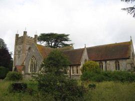
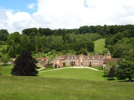
(1) St. Mary the Virgin Church, Hambleden |
(2) Hambleden |
(3) Carnivorous Hedge? |
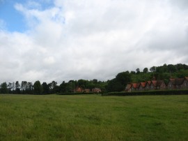
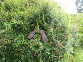
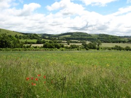
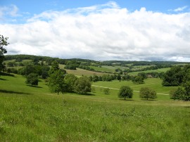
From the car park I headed down past the church, photo 1, to the spot where I finished the previous stage. From there, I headed along the road that runs round the left hand side of the church which is followed for a short distance out of the village before the Chiltern way joins a footpath on the right. This bears to the right, heading across the bottom of a broad valley, photo 2, as the route begins making its way up towards Skirmett. This path mainly runs along the edge of open fields on the valley floor although as the path headed by the hamlet of Pheasant's Hill the route joined an enclosed section of path running between gardens, the narrow path being very muddy with lots of standing water after the recent rain which the fences on either side made rather difficult to avoid. At least I was wearing my new gaiters, only the second time they have had an outing, and these did keep the worst of the mud of my trousers. At one point there were a pair of boots sticking out from the edge, photo 3, looking almost as if it had turned carnivore and devoured a passing walker.
 |
 |
 |
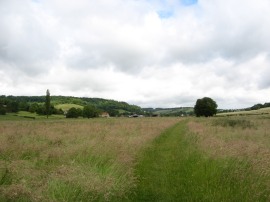
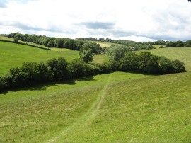
(4) Field nr Skirmett |
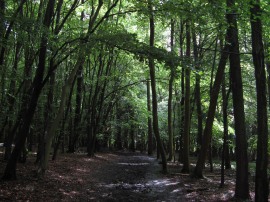
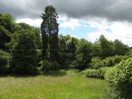
(5) Adam's Wood |
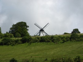
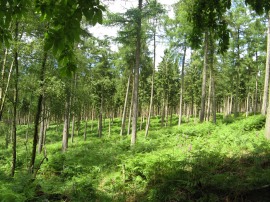
Reaching the attractive buildings of Colstrope Farm the route continues ahead along a minor road for a few yards before continuing ahead where the road turns to the right along a farm track that soon leads out to another field edge path the route still heading in a generally northern direction gently uphill along the side of the valley towards Skirmett. A short tree lined section of path leads up to cross a minor road where a Red Kite took off just in front of me, the closest I have ever been to one of these wonderful birds. From the road the route then continues ahead crossing the middle of a couple of grass covered meadows. Reaching Skirmett, the route heads to the right along the road and just before the road bends round to the left the Chiltern Way joins a footpath on the left which heads out across another grassy paddock, photo 4, with the Cobstone Windmill, which featured in the film Chitty Chitty Bang Bang, becoming more prominent on the hill ahead. The route heads across this meadow towards a white bungalow before turning sharp right back across the meadow. A lot of the gates along this part of the Chiltern Way have small plaques attached to them and this stretch of path led across to a gate sponsored by Cherry Red Records which rather randomly brought back memories of the Dead Kennedys whose first couple of singles were on the label many moons ago. The path then joins a hedge lined bridleway that starts heading uphill on the first proper hill of the day towards Adam's Wood. Entering the trees the route continues uphill along a damp, muddy and slippery path through the densely packed trees, photo 5. Reaching the summit of the hill the route bears sharp left to cross over a small meadow before beginning to descend down through the trees of Fingest Wood. Leaving the trees the path then heads more steeply downhill skirting the edge of a large field, which was being grazed by sheep, to join a road at the edge of the village of Fingest.
 |
 |
 |
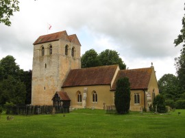
(7) Fingest Church |
(8) Cobstone Windmill |
(9) View back to Fingest Wood |
Here the Chiltern Way heads to the left, passing the village church, photo 7, before joining an enclosed footpath on the right. This path heads gently uphill and to reach a small section of trees where the route joins a level footpath that bears off to the left running along the bottom edge go the trees. The route continues ahead where this path crosses a road and a narrow and rather overgrown path is then followed for some distance before the route heads through a kissing gate and bears downhill to the left across a paddock to reach the village of Turville with the Cobstone Windmill just uphill away to the right, photo 8. Heading to the left the route heads through the village where there were a number of very attractive houses around the tiny village green, although these all had cars parked in front of them spoiling the views. Continuing on, the route heads up a lane which runs past the primary school, and then out alongside a meadow, the path making its way over to Dolesden Lane.
 |
 |
 |
(10) Approaching Southend Farm |
(11) Balham's Wood |
(12) Stonor House |
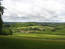
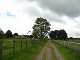
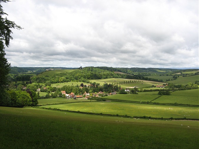
Crossing the lane the path heads uphill to join a concrete track heading between a small band of trees which soon leads to a farm track running between meadows which heads up towards the top of the hill by Southend Farm, photo 10. The path then joins the start of minor road which is followed down to Southend where, at a T junction, the route heads to the left along Drovers Lane for a short distance before joining a track that heads off to the right. This runs past an attractive brick and flint built cottage and leads into the grounds of the Stonor Estate, the path running through an area of woodland and on this stretch of path I had once again linked up with the Shakespeare Way. To the left of the path the tall pines trees were growing up through an area of rhododendrons, some of which were still in flower and on the other side the ground was carpeted with bracken and the occasional stand of foxgloves, photo 11. In places there were also honeysuckle flowers were draped across the rhododendrons giving off a very pleasant scent and this section of path through the trees was probably the most attractive part of the Chiltern Way so far although my photo doesn't really do it justice. Continuing on through a tall metal gate the route enters the Stonor deer park although I didn't actually see any deer. The path heads past Stonor House, photo 12, and follows a broad a grassy track that winds its way through the grounds of the estate with good views out across over the surrounding hills, photo 13. Adding to the view was a game of cricket being played down in the floor of the valley.
 |
 |
 |
(13) View from Stonor Deer Park |
(14) Heading up to Park Wood |
(15) Maidensgrove Common |
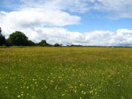
Reaching the end of the estate the route heads through a tall kissing and heads to the left along the road towards the village of Stonor. The Chiltern Way continues ahead past a road on the right before taking a footpath a few hundred yards further down on the right. This heads out across the middle of a couple of paddocks, photo 14, the route climbing uphill to enter a small patch of woodland at Park Wood. As I was heading across these paddocks it started to rain however it was so warm I didn't bother putting my jacket on and the heavy shower soon blew over on the strong wind, although I did have a spare lightweight fleece and coat with me if I had got soaked. Leaving the trees the path headed across the middle of a field that had been planted with oilseed rape, the seed heads bent over the path by the wind and rain. Reaching the end of this field the route heads to the left along a driveway past a cottage, very briefly linking up with the route of the Oxfordshire Way, before bearing to the right along the start of a small lane. This soon leads up to a track running along the edge of Maidensgrove Common, photo 15. The track is then followed up to a road where the Chiltern Way joins a byway on the left although the sign was hidden by the large hedge besides the track and I continued on along the road towards Russell's Water for about half a mile before I realised I had headed off course.
 |
 |
 |
(16) Approaching Upper Bix Bottom |
(17) Path from Upper Bix Bottom |
(18) The end point of stage 5 |
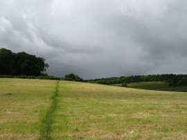
I then retraced my steps back to the byway where I thought about finishing my walk for the day however after a short lunch stop I decided to continue on along the correct route of the path for another mile or so as this would leave at a more convenient start point for the next leg. Thus I headed down the byway which I should have gone down earlier before soon joining a footpath on the right that heads downhill across a field. This leads into an area trees, managed as a nature reserve by Wildlife Trust. The path heads through the trees before cutting across the corner of a field and descending down a flight of wooden steps through another area of trees. Leaving these trees the path then heads downhill across one more paddock, photo 16, to reach the bottom of the valley at Upper Bix Bottom. Crossing a stile the route reaches a junction of paths which is a significant point for the Chiltern Way as it marks the start point of the southern extension, which heads off to the left from the main route, so once again I will be coming back to this place at some point. Meanwhile I headed off to the right, following the original route of the Chiltern Way along a rather muddy hedge lined path, photo 17. I then followed this stretch of path up to the start point of the Chiltern Way's Ewelme Loop, photo 18, which is where I finished this stage of my walk, having walked a further 10 miles along the path.
I then headed up a footpath on the right which heads steeply up Little Cookley Hill and leads up to the road near Russell's Water which I had walked along when I went off course earlier. I then started making my way back to the car, retracing my route back as far as Stonor before taking a more direct route back to Hambleden. Arriving back at Hambleden I had walked a total distance of 17.5 miles. This had been a good walk and I did not have any of the aches and pains that had troubled me most days on the Coast to Coast path. The weather had turned out far better than predicted with only two showers and plenty of warm bright sunshine. Due to the forecast I had worn my Paramo waterproof trousers which were a bit too warm for the weather conditions and not needed due to the lack of rain and I was rather hot and sticky when I got back.
I have uploaded the route of the walk which can be accessed here: Chiltern Way Stage 4 Route.
If you would like to comment on this walk you can do so here:
![]() Back to:Main index page
Back to:Main index page
| ©2012 Bertuchi.co.uk. Please contact me using the email button on the right if you have any questions or comments regarding the site. Any feedback and additional information about places of interest on the walks is always welcomed. All rights reserved. Please contact me if you want to use any of the images or information from the site. ENJOY YOUR WALKING |
|