Chiltern Way
Other Links >>> |
|
CHILTERN WAY - Part 3
Sheepridge to Hambleden
|
|
Chiltern Way |
I did this walk on Tuesday 10th April 2012. I parked in the small lay-by outside the Crooked Billet pub in the Sheepbridge where I had finished the last stage of my walk a couple of days earlier. It had been a rather slow journey over due to traffic problems and it was well after 10 o'clock when I started walking which is rather later than I would have liked to have started.
 |
 |
 |
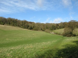
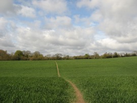
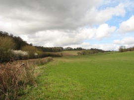
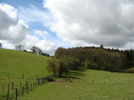
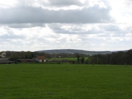
(1) Field nr Sheepridge |
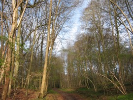
(2) Warren Wood |
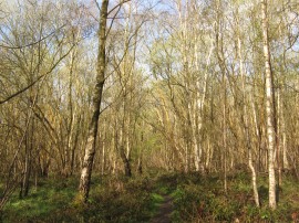
(3) Warren Wood |
From the pub a narrow hedge lined path leads up out into a field, photo 1, the path then continuing on along the field edge to soon enter a patch of woodland, the path steadily ascending uphill through the trees of Warren Wood. At first the route follows a fairly broad track through the wood, photo 2, before continuing ahead at a crossing track along a much narrow section of path that winds its way through the trees, photo 3. This leads down to a forestry track where the Chiltern Way continues ahead through a more open area of trees. The path passes an old earthwork enclosure, which it is reckoned was once a stock pen, before starting to head downhill. The path then continues straight ahead, heading steeply downhill to join a minor road in the bottom of the valley. The route then heads to the left along the road about a third of a mile before taking a track on the right that begins heading uphill through the woodland once again. Whilst the southern part of the country may be officially in a drought situation, in true bank holiday fashion it had rained almost all day throughout the bank holiday Monday and there was a lovely moist earth and damp leaf smell as I headed through this area of woodland. This path then bends round to the left through the trees to reach the A404. On the OS map the route of the Chiltern Way is marked as heading straight across the road, but the official route, as mentioned in bold text in the Chiltern Way guidebook, heads to the left along a minor road, Monkton Lane, which runs parallel with the main road. Looking at the traffic, while it was running normally on the nearside carriageway, on the other side there were two lanes of almost nose to tail traffic heading along the road at about 30mph which would have been almost impossible to cross even if I had wanted to take the short cut. I thus followed the official route as the lane bends round under A404 before turning to the right along a track running past the buildings of Woodbarn Farmhouse. This soon leads to a footpath running back up besides the main road to rejoin the path I had originally been walking on the other side of the road.
 |
 |
 |
(4) Field nr Wycombe Road |
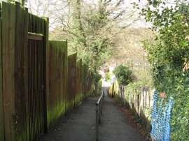
(5) Footpath in Marlow Bottom |
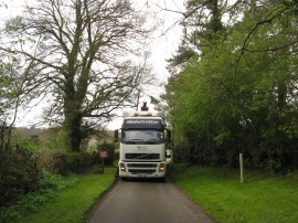
(6) Seymour Court Lane |
Here, by a metal fenced enclosure I headed to my left along a path that runs along the edge of a couple of paddocks to reach a road, Pump Lane North, where the Chiltern Way heads up to the right. Reaching the end of the road the route continues ahead across the Wycombe Road and through a gate to join a footpath running across the middle of a field, photo 4. The day had started quite bright and sunny after the previous days rain but clouds were steadily building up all around and I was wondering as I walked whether I would be able to complete all of the walk in the dry. Leaving the fields the route joins a bridleway that heads through a thin strip of scrubby woodland before continuing ahead along an un-surfaced lane. Reaching a road on the outskirts of Marlow Bottom the Chiltern Way continues ahead along a footpath with houses away to the left and reaching a fork in the path joins the fence lined footpath on the right. This is followed across a couple of road up to Beechtree Avenue where the route heads briefly to the left before joining another fenced lined footpath running between houses on the right. This surfaced path is followed as it heads quite steeply downhill, photo 5, to a road called Marlow Bottom where the route heads to the left. After a hundred yards or so another similar footpath is joined on the right that starts heading gently uphill and away from the houses of Marlow Bottom. This leads up to a playing field where the path follows the left hand edge of the playing field before turning right along a path that soon heads into a small patch of woodland scattered with tall Beech trees. Reaching a track by a house the route heads to the left to head down to the Marlow Road. Here the route once again heads briefly left before heading to the right up Seymour Court Lane. As I was heading along this road there were good views over to Marlow and the Thames Valley although I was never able to spot the river itself. Halfway down the road was a large vehicle transporter, photo 6 which was delivering a JCB to a farm which was almost completely filling the road. Earlier on I had spotted some rather odd tire marks snaking on and off the road verge which was now explained by this vehicle that had had to reverse down to its delivery point.
 |
 |
 |
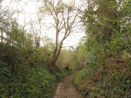
(7) Path from Seymour Court Lane |
(8) View from Mundaydean Lane |
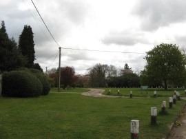
(9) Bovingdon Green |
At a bend in the road the Chiltern Way heads to the left along a sunken footpath, photo 7, that heads downhill between fields. This path is followed for some distance down to a valley bottom, photo 8, where the route crosses Mundaydean Lane and joins an enclosed footpath that continues ahead uphill on the other side. This path is followed round to the right through some trees before heading to the left along a surface driveway at the top of the hill. This leads to Chalkpit Lane where the route heads to the right, past the Royal Oak pub, before turning to the left into Bovingdon Green, photo 9.
 |
 |
 |
(10) Approaching Davenport Wood |
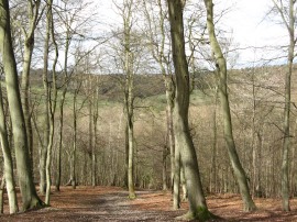
(11) Davenport Wood |
(12) Heading towards Homefield Wood |
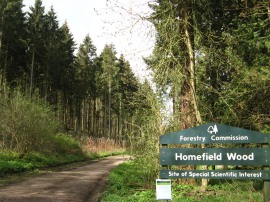
Here the Chiltern Way soon bears half right along an unmade section of road that continues across the green to join a track that bends round past some houses before joining a footpath running between fields and paddocks. This straight, level section of path, photo 10, is then followed into Davenport Wood. The route continues through the trees, crossing over a couple of paths before turning the right at a crossing track where the route also links up with that of the Shakespeare's Way, a path I have bumped into many times when out walking. While this stretch of path was not quite as studiously way marked as on my earlier walks at all the crossing paths there was always a Chiltern Way marks present where needed to indicate the correct route and I only had to stop and check my map a couple of times during the walk to confirm I was heading in the right direction. Shortly after crossing a minor road the route bears half right and stars descending quite steeply down, photo 11, to a valley bottom with equally steep hills rising ahead on the other side. Reaching the valley bottom the route leaves the trees and joins a footpath running through a narrow area of scrubby trees between fields where there was a buzzard flying around on the thermals overhead. Reaching a stile the route heads to the left across a couple of paddocks, photo 12, to reach a road where I headed to my right for a few yards before joining a broad forestry track running through Homefield Wood, photo 13.
 |
 |
 |
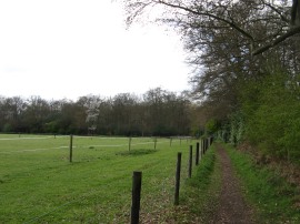
(13) Homefield Wood |
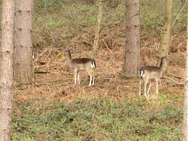
(14) Deer in Homefield Wood |
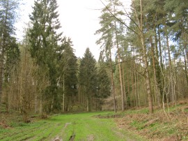
(15) Homefield Wood |
Close to the start of the forest track was an information board that gave details about the re-introduction of Red Kites into the Chilterns. The first pairs being brought in from Spain in 1989 and they began to breed for the first time three years later. Now these beautiful birds are ever present on just about any walk I do in the area having re-established themselves remarkably well. The path continues ahead along the broad track running through the trees, past several large piles of logs stacked up besides the path including one spray painted Larch which immediately reminded me of the Monty Python sketch of the same name. As I was walking along this stretch of the path I also spotted a few deer, photo 14, away to my right in the trees, the first I had seen on my walk around the Chiltern Way. Not long after the broad track has curved round to the right, photo 15, the Chiltern Way joins a much narrower path on the left that leaves the main track at an acute angle, initially almost heading back the way I had just come, which makes its way gently uphill to reach another minor country lane. It was all very peaceful in the forest with just the sound of birdsong in the air, the odd call from a Red Kites overhead and lots of Great Tits beeping away sounding very similar to the beep, beep, beep of an alarm clock.
 |
 |
 |
(16) View down to the Thames Valley |
(17) Approaching Rotten Row |
(18) Path nr Rotten Row |
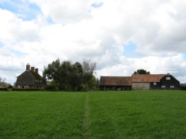
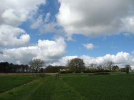
The path then heads to the right along the road, following the edge of the woodland before joining a footpath on the left that heads out across the middle of a large open grassy field where once again there were views over the Thames valley away to the left, photo 16. Then route then continues ahead over another field to reach some farm buildings, photo 17, at Rotten Row where I joined a road continuing ahead past a duck pond. Where this road bends round to the left the Chiltern Way heads half right through a gate and along an open farm track running out between fields, photo 18. The route then heads across another farm track and along a path running across the middle of another field. This field had recently been ploughed and the surface was quite uneven and my boots were sinking into the soft soil with every step although fortunately the soil was just dry enough not to stick too heavily to my boots.
 |
 |
 |
(19) Hambleden |
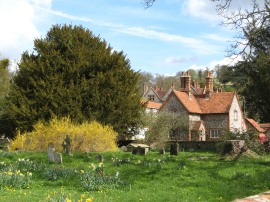
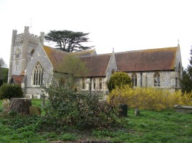
(20) St. Mary the Virgin Church, Hambleden |
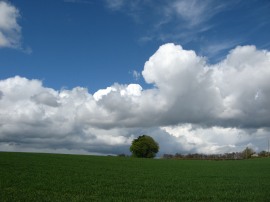
(21) Clouds building up |
Luckily this stretch did not last for long and reaching the end of the field the route heads to the left to join a footpath that runs through a patch of woodland on the edge of the Hambleden Estate. The path then heads downhill through the trees and alongside the edge of a field to reach another valley bottom by the village of Hambleden. Reaching a lane I headed to the right before joining a footpath on the left which heads across the top of a playing field towards the village car park. From the car park the route heads to the left along a narrow road to the centre of the small village which was surrounded by attractive flint cottages with red tiled roofs, photo 19, although like so many of these picturesque places almost every view was obstructed by numerous parked cars. Reaching the village church, photo 20, I finished my walk along the Chiltern Way for the day having walked a further 8.9 miles along the path. I stopped for my lunch break on a bench outside the church before turning round to start making my way back to the car.
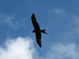 |
(22) Red Kite |
For three and a half miles I followed a different route back before re-joining my outward route close to Bovingdon Green. Quie by chance this took me past one of the B&B's I had stayed at when walking the Thames Path the year before.I had originally thought of doing a longer circular route but the opportunity for sensible path options were quite limited without adding excessively to the distance walk. On the way back a number of heavy showers passed nearby although I only got caught in one of these as I was heading back through Marlow Bottom and a thick hedge protected me from the worst of the rain and hail which soon blew over on the stiff breeze. Reaching the car I had walked 18 miles for the day and also had more than 2000ft of ascent which is the most since day 5 of the coast to coast walk last year. None of these ascents were very long though, just numerous short up and downs along the path. So far I am really enjoying the Chilterns and can't wait to get back out for the next stage.
I have uploaded the route of the walk which can be accessed here: Chiltern Way Stage 3 Route.
If you would like to comment on this walk you can do so here:
![]() Back to:Main index page
Back to:Main index page
| ©2012 Bertuchi.co.uk. Please contact me using the email button on the right if you have any questions or comments regarding the site. Any feedback and additional information about places of interest on the walks is always welcomed. All rights reserved. Please contact me if you want to use any of the images or information from the site. ENJOY YOUR WALKING |
|