Chiltern Way
Other Links >>> |
|
CHILTERN WAY - Part 6
Northend to Rout's Green
|
|
Chiltern Way |
I did this walk on Sunday 15th July 2012, parking up at Ibstone in a small parking bay besides the common. I then followed a route up over to Northend to resume my walk along the Chiltern Way through what was a very attractive area of countryside. I had had a very late start to this walk because rather foolishly I had managed to leave my map at home and as much of my walk was off the route of the well way marked Chiltern Way there was no way I would have been able to find the paths I wanted to use without a map. Having spent the time, and petrol money, driving over to the Chilterns I thought it best to head back down to High Wycombe and buy a replacement map. This detour cost me the best part of an hour and twenty minutes and it was approaching 11:00am before I was finally able to set off on my walk.
 |
 |
 |
(1) Ibstone Common |
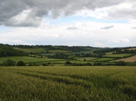
(2) View over to Northend |
(3) Start point of stage 6 |
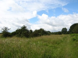
From Ibstone it was a 2.25 mile walk back to Northend and the point where I had finished the previous stage of my walk. From my parking spot I headed across the attractive common, photo 1, following a footpath round to Grays Lane before joining a footpath on the right which headed down through the trees of Great Wood, photo 2, to the valley bottom. Crossing a field the path then starts climbing up through Hale Wood and over another field to reach a small lane. Crossing this I joined a hedge lined bridleway which continued uphill to eventually reach the road in Northend from where it was just a short walk to my left to rejoin the Chiltern Way at the point it crosses the road, photo 3. In places on the bridleway the rain had washed the shallow layer of topsoil off the path exposing the solid layer of chalk that lay just underneath.
 |
 |
 |
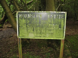
(4) Estate sign in Blackmore Wood |
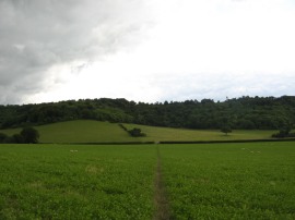
(5) View towards Ibstone |
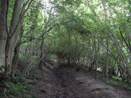
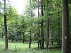
(6) Path in Commonhill Wood |
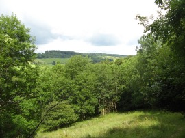
Back on the Chiltern Way the route joins a rather muddy footpath that winds its way through an area of woodland into the grounds of the Wormsley Estate, photo 4. The route soon starts heading quite steeply downhill through the trees into the valley bottom where the Chiltern Way bears briefly to the right along a track. There was a tall wall just a few yards away through the trees to the left of the path which I think must have hidden a rose garden, or at least a number of rose bushes, as the air filled with the scent of the flowers, this supposition subsequently confirmed by a look at the area on Google Earth. Leaving the trees the route heads to the right along a surfaced track before joining a footpath that heads off diagonally to the right over fields with the Ibstone ridge becoming ever more prominent ahead, photo 5. After crossing the bottom of the valley, not far from where I had crossed it on my outward leg, the path begins heading uphill over the fields before continuing more steeply up through a band of trees. In the trees the route to the right along a track that is almost like an old sunken lane, photo 6, that heads up to the top of the hill close to the village of Ibstone.
 |
 |
 |
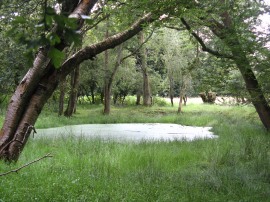
(7) Pond nr Ibstone |
(8) Hartmoor Wood |
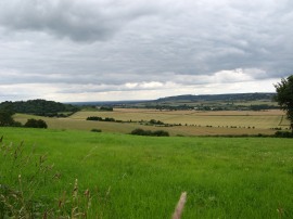
(9) View nr Studdridge Farm |
A more level section of path then continues through the trees, passing a couple of small ponds, photo 7, up to the Ibstone Road, just a few yards from where I was parked up. The Chiltern Way heads to the left down the road before soon joining another footpath on the right. This footpath skirts round the end of the last house on the right side of the road, which is not quite how the route was marked on the map, before joining a track that starts heading downhill once again through woodland, photo 8. The steep path was very slippery after all the recent rains although so far today the weather had remained dry. One strange thing about this stage of the walk was the number of people I was seeing out walking. By Ibstone I had already seen about 20 other walkers in various small groups and later on in the walk I was passed by a large group of about 30 people; quite often I hardly see anyone out walking with a rucksack on their backs.
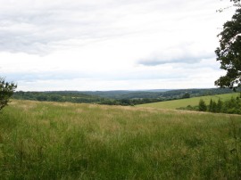
Reaching the valley floor the route leaves the trees and joins a footpath which heads up to the left alongside a large open field before heading left again back through another small area of woodland. Leaving these trees the Chiltern Way then joins another field edge path near the top of the hill. The route passes by Studdridge Farm before joining a footpath that heads off to the right running along the edge of another field. Reaching the top of the hill there were good views back over the surrounding countryside, photo 9, and I also became conscious of the traffic noise coming from the nearby M40.
 |
 |
 |
(10) Tunnel under the M40 |
(11) Looking back towards Stokenchurch |
(12) View over to the Bledlow Ridge |
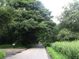
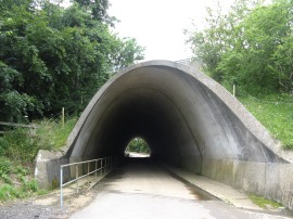
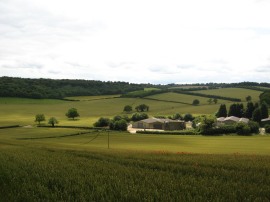
This field edge path is followed up to Coopers Court Farm where a short fence lined section of path leads down to a tall curved concrete underpass under the motorway, photo 10, a passage far bigger than the small tunnel that had carried the Chiltern Way under the motorway near Wycombe during stage 2 of my walk. Coming out the other side of the underpass the path the route immediately enters into Stokenchurch, passing through a small modern estate up to the A40 Oxford Road. The Chiltern Way then heads half right across the road and along the edge of a green before turning to the left along a small road. The route then joins another minor road, Park Lane, besides a pub on the right. Joining a track the route continues on past the entrance to the village hall before joining a footpath on the right which heads out once again running along the side of fields in an area of slightly more open and rolling countryside. The path heads downhill through fields that's were planted with wheat as it makes its way down to the valley bottom at Bennett End, crossing over Grange Farm Road, before once again heading uphill over fields towards Andridge farm. Photo 11 was taken looking back over these fields towards Stokenchurch. By Andridge Farm the route crosses a driveway and heads past a set of converted farm buildings before once again heading downhill to join Horseshoe Road with good views ahead over to the Bledlow Ridge, photo 12, which is where the path is heading next.
 |
 |
 |
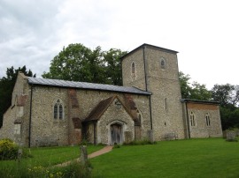
(13) St Mary's Church, Radnage |
(14) Saunderton Valley |
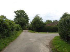
(15) Rout's Green |
Here the route heads to the left before soon turning left along Town Hill Road in the small village of Radnage. The route only heads along this road for a few yards before joining a footpath on the right that starts heading up towards Radnage Church. The route heads through the churchyard of St Mary's Church, photo 13, before heading across a number of small paddocks as the route begins ascending back up into an area of trees and the top of the Bledlow Ridge. Passing through the trees and a patch of open ground the Chiltern Way the route reaches the top of the hill where a tree lined section of path carries the route up to the Chinnor Road in Bledlow Ridge. The route then continues ahead across the road, close to the Boot pub, to join a driveway that curves round to the left and where this driveway ends the route continues straight ahead along a hedge lined footpath which was exceptionally muddy in places. This path runs between fields and away to the right there were far reaching views down across the Saunderton Valley and the Buckinghamshire countryside, photo 14. The route then heads across the bottom of some fields before joining another enclosed section of path continuing on a more or less straight course up to a minor road in the village of Rout's Green. Here I headed to the left, following the road up to a T junction, photo 15, where I finished this stage of my walk along the Chiltern Way having walked a further 7.18 miles along the path.
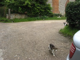 |
(16) Cats |
I then began heading back to the car, generally avoiding the paths I had used on the outward journey apart from a mile or so near Radnage. Back at the car I had walked a total distance of 14.8 miles which isn't that much although I was feeling quite tired on this walk and it felt like I had walked much further. There were a number of quite steep hills, particularly one heading up from Bennett End on the way back, and it was another walk when I ended up doing over 2000 ft of ascent on the day. As I was walking down Water End Road I passed some farm buildings where there were cats literally everywhere. If you look closely it is possible to spot 5 of them in photo 16 although there were many more.
I have uploaded the route of the walk which can be accessed here: Chiltern Way Stage 6 Route.
If you would like to comment on this walk you can do so here:
![]() Back to:Main index page
Back to:Main index page
| ©2012 Bertuchi.co.uk. Please contact me using the email button on the right if you have any questions or comments regarding the site. Any feedback and additional information about places of interest on the walks is always welcomed. All rights reserved. Please contact me if you want to use any of the images or information from the site. ENJOY YOUR WALKING |
|