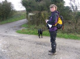
(1) Setting off on stage 2
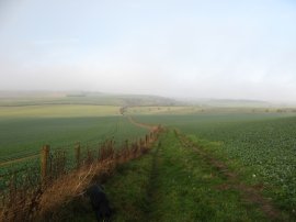
(2) View from Cottington Hill
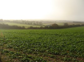
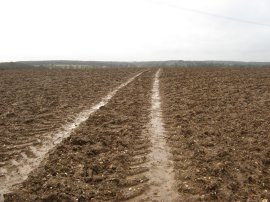
(3) Fields nr Cottington Hill
Other Links >>> |
|
WAYFARER'S WALK - Part 2
Cottington Hill to Dummer
|
|
|
|
(1) Setting off on stage 2 |
(2) View from Cottington Hill |
(3) Fields nr Cottington Hill |
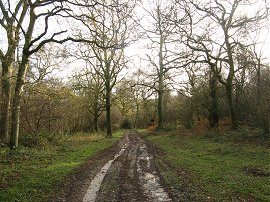
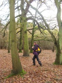
After a good nights rest in Basingstoke I headed off to meet up with Anne in Dummer before heading over to Cottington Hill, photo 1, to resume our walk along the Wayfarers Walk. There had been a little rain overnight but the day dawned bright and there was a light mist sitting on top of the hills, photo 2. As we were walking Anne gave me a number of tips on taking photo's and I spent some time adjusting the settings on my camera, 80% of which I had probably not touched before.
 |
 |
 |
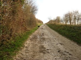
(4) Approaching North Oakley |
(5) Frith Wood |
(6) Toadstools |
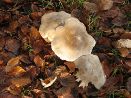
The route heads over a couple of fields down to cross Meadham Lane before continuing along through fields to reach a track, photo 4 where the route turns left to head down towards the small hamlet of North Oakley, this broad track being typical of many of the paths we walked along during the day. The route heads along a road for a short distance before joining a footpath on the right which had us guessing which side of the fence the path actually was. This path was then followed to another collection of farm buildings at Freemantle Farm before heading down into Frith Wood, photo 5. In the woodland there were a numbre of toadstools growing, photo 6, although I have no idea what type they are.
 |
 |
 |
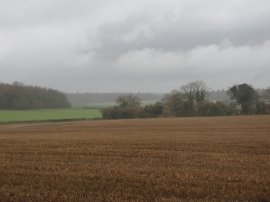
(7) Fields just past Great Deane Wood |
(8) Friendly, and pretty, horse |
(9) Approaching Deane |
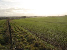
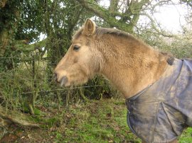
The Wayfarers Walk continues ahead alongside Great Deane Wood before joining a footpath that ran gently downhill besides a braod expanse of open fields, the footpath eventually leaving the field edge and heading diagonally across to the far corner of the field in the right of photo 7 where we turned to the right along Harrow Way. This road was followed for a short distance before we joined another footpath onth eleft that headed over a short stretch of field to a bridge over a railway line where the were a number of inquisitve horses, photo 8, huddled round the stile that led out of the field. As we were crossing over the rail bridge a train decorated in umber and cream livery pullman livery went past. Heading form the railway the route crossed over another large and muddy ploughed field, photo 9, although fortunately the soil was not the type that really sticks to your boots.
 |
 |
 |
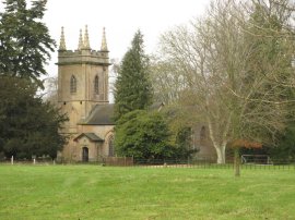
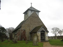
(10) All Saints Church, Deane |
(11) 17.5 miles walked |
(12) The approaching rain |
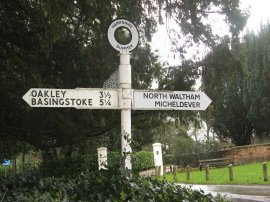
The large muddy field led us to the hamlet of Deane where we joined a road that run past All Saints Church, photo 10. The route then heads across the B3400 Andover Road where the lastest Wayfarers Walk signpost showed that we had now walked 17.5 miles from the start at Inkpen Beacon, photo 11. A short distance further on we once again left the road to join a track that ran down between fields to cross over another railway line that was busy with freight traffic. The route then gradually bends round to the right to join another road besides Bull's Bushes Copse. Since we had set off the weather had gradually been clouding over and as we were walking along this stretch of path we felt the first drops of rain start to fall. On our maps the route of the Wayfarers Walk was shown as heading diagonally through the woodland but the path has been re-routed to run alongside the northern edge of the woodland before turning to the left at the end of trees to head down to rejoin the route as marked on the map. I had wanted to avoid putting on my waterpoof but as we left the trees the rain had become just heavy enough for me to stop and put my coat. Passing by Bull's Bushes Farm the route heads over another couple of fields towards South Wood. In the distance we could see a number of heavy showers, photo 12, but fortunately the worst of these passed us by as we headed along the path.
 |
 |
 |
(13) Woodland besides the A30 |
(14) Another mushroom |
(15) Crossing the M3 |
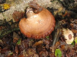
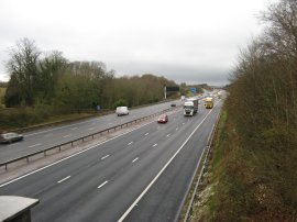
The route runs around the edge of South Wood before joining a short stretch of road that leads up to the main A30 dual carriageway, close to its junction with the M3. After negotiating a fairly circuitous route across the road the Wayfarers Way enters a small patch of woodland, photo 13, that leads to a footbridge over the M3, photo 15. In the woods there was a large number of different mushrooms and toadstools including the one in photo 14 which was growing on a dead beech log. Over the last few months I have taken quite a number of mushroom and toadstool photos and if I ever get my walk descriptions up to date I will try and put all the photos together on one page.
 |
 |
 |
(16) Road Sign in Dummer |
(17) All Saints Church, Dummer |
(18) Our end point at Dummer |
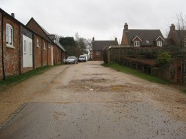
Once over the motorway the route joins a tarmac track on the right that runs parallel with the M3 motorway on one side and Dummer golf course on the other. As we were heading along this track we were caught in another heavier burst of rain although once again it did not last too long. At the end of the track we turned to the left along a road that headed into the village of Dummer. Heading up Down Road we passed an enclosed well besides the road which featured the story of a "heroic well rescue. A little further up the road we passed All Saints Church, photo 17,where we turned right into Up Street where we had parked the cars at the start of day.
Reaching the car we had walked 11.9 miles, all along the Wayfarers Walk. It had been a comparatively short walk and we just had time for a late pub lunch in the local pub. We had been debating earlier about moving our end point a bit further down the path but lack of knowledge of potential parking spaces and also the fairly negative weather forecast made us stick with Dummer which turned out to be a good choice because while we were in the pub the heavens opened. As we were leaving the pub we noticed a spot where water was pouring through the roof into the bar and alerted the staff who said leaks were not that unusual but never in that place; and it really was pouring, not just dripping. As we drove back to pick up my car at Cottington Hill the roads were awash with water and I then had a very rainy trip back to London, the rain seemingly following me all the way up the motorway.
All in all in had been a very pleasant two days walking and it was nice to have a little trip away from home. I am certainly looking forward to walking the rest of the route.
If you would like to comment on this walk you can do so here:
![]() Back to:Walk index page
Back to:Walk index page
| ©2012 Bertuchi.co.uk. Please contact me using the email button on the right if you have any questions or comments regarding the site. Any feedback and additional information about places of interest on the walks is always welcomed. All rights reserved. Please contact me if you want to use any of the images or information from the site. ENJOY YOUR WALKING |
|