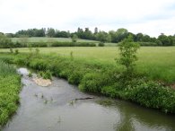
(1) River Eden, nr Penshurst
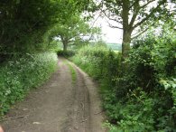
(2) Heading towards Wat Stock
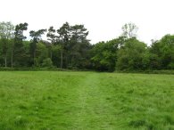
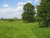
(3) Field nr Wat Stock
CIRCULAR WALK FROM PENSHURST
|
|
|
|
(1) River Eden, nr Penshurst |
(2) Heading towards Wat Stock |
(3) Field nr Wat Stock |
I did this walk on the 24 May 2007 after seeing it featured in the June 2007 issue of Country Walking Magazine. I drove down from Walthamstow and parked in a small lay-by in Penshurst, close to the church. For this walk I was accompanied by my wife which is something of a rarity.
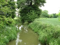
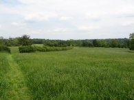
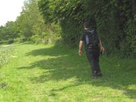
Leaving Penshurst Church we turned right up the B2176 for a short distance before taking a driveway that runs off to the left. This runs down to cross a bridge over the River Eden, photo 1, before taking a footpath that runs along a track on the right. Heading towards the River Eden I had spotted some tree creepers creeping up and down a tree trunk, the first time I had seen these birds at close quarters for about fifteen years, the last time was at Boggle Hole Youth hostel. The route heads along the track, photo 2, for some distance to reach a road just past the farm buildings at Wat Stock. After continuing ahead along the road for a short distance the route takes a footpath on the right that heads across a small grassy field, photo 3, to cross another minor road and enter into a patch of woodland.
 |
 |
 |
(4) Castle Inn, Chiddingstone |
(5) St Mary's Church, Chiddingstone |
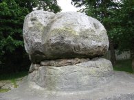
(6) The Chiding Stone |
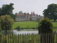
The route heads through the woodland and then on a path that runs between fields up to join a road by a farm and buildings at Hill Hoath. Here the route turns to the right and heads along the road to reach a crossroads. At the crossroads the route turns right and follows the road round into the village of Chiddingstone. The route passes a small lake in the grounds of Chiddingstone Castle and heads up to the Castle Inn where we stopped for a very enjoyable lunch and pint of bitter, photo 4. Opposite the pub was the attractive St Mary's Church, photo 5. The High Street at Chiddingstone also features a row of unaltered 16th and 17th century houses in the care of the National Trust. Having eaten we headed down the road before taking a footpath off to the left that leads round the back of a school and houses to reach the Chiding Stone, photo 6. The Chiding Stone was believed to have been a Saxon Land boundary, a Druidical altar and a place where neighbours brought their grievances to be aired in public where the declared culprits were chided.
 |
 |
 |
(7) River Eden, nr Chiddingstone |
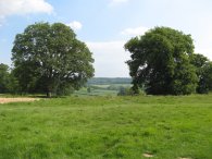
(8) Fields nr Chiddingstone |
(9) Me again |
Returning to the road the route heads continues to the right for a short distance before taking a footpath that runs downhill off to the left to cross back over the River Eden again, photo 7. Penshurst is situated in the High Weald Area of Outstanding Natural Beauty and for the next mile of so the route passes through very attractive, gently rolling, farmland, photo 8. The route crosses a road by Sandholes and heads to reach some houses by a road at Moorden. At the start of the day it was very unclear how the weather had been going to turn out but for once it had become pleasantly warm, sheep were sitting in the shade of trees and I was fast emptying my water bottle. Crossing the road the route heads down a driveway that curves round the houses before heading besides fields that were planted with Broad Beans when we went past. Photo 9 is of me walking besides the fields so now I know what I look like when I am out walking! These fields lead up to another stretch of road running besides a railway. After running parallel with the railway for a short distance the route follows the road round to the right away from the railway and gently uphill to reach a road junction.
 |
 |
 |
(10) Penshurst Place Estate |
(11) Penshurst Place Estate |
(12) Penshurst Place |
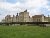
Crossing the road at the junction the route takes a footpath just off to the left which soon forks to the right along a fairly broad tracking running through a piece of woodland in the grounds of the Penshurst Place Estate. Leaving the woodland the route starts heading uphill over a wide open grassy area surrounded on either side by trees. Photo 10 was taken looking back down the way we had just walked. Reaching the top of the hill there were extensive views ahead over Penshurst and the valley of the River Medway as the ground starts sloping downhill on the other side, photo 11. The route heads downhill along a tree lined path through the Penshurst Place Estate before reaching a more open grassy area at the bottom of the hill as Penshurst Place itself comes into view, photo 12.
 |
 |
 |
(13) Penshurst Place |
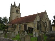
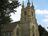
(14) Church of St John the Baptist, Penshurst |
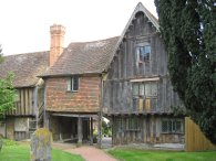
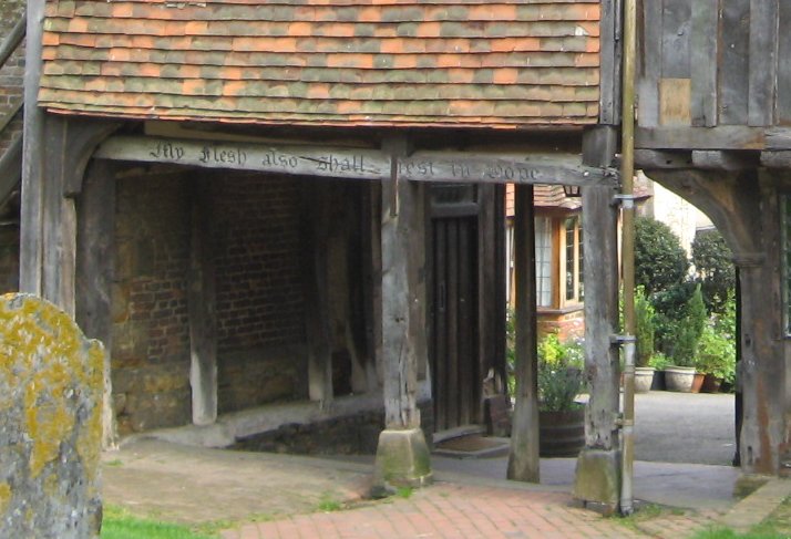
The path bears to the right around a lake and then continues ahead, passing the cricket pitch of Penshurst Park cricket club to cross a driveway and head past the right hand side of Penshurst Place, photo 13. From here a path leads into the churchyard of the Church of St John the Baptist at Penshurst, photo 14. The route leaves the churchyard under an old tudor house, photo 15, bearing the words "My flesh shall also rest in hope" written on beam from where it was just a few yards to where I had parked the car.
The GPS made the total length of this walk 6.94 miles. Penshurst is situated in an area I have done very little walking and I will definitely be returning to the area to do some longer walks in the future.
![]() Back to:Walking index page
Back to:Walking index page
| ©2008 Bertuchi.co.uk. Please contact me if you have any questions or comments regarding the site. Additional information about places of interest on the walks is always welcomed. All rights reserved. Please contact me if you want to use any of the images or information from the site. Thank you. |
|