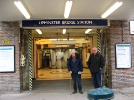
(1) Upminster Bridge Station
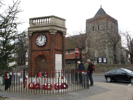
(2) Rainham War memorial
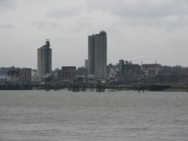
(3) View towards Erith
Other Links >>> |
|
LONDON LOOP STAGE 15
Coldharbour Point to Purfleet
I did this walk on Sunday 18th November 2007, walking from Upminster Bridge to Purfleet. The last time I had walked this part of the London Loop back in September 2005 it had rather uncermoniously ended at a set of wire gates at Coldharbour Point and there was no option for the walker other than retracing their steps back to Rainham. Since then the path has now been opened up along the side of the River Thames and it is now possible to continue along the route down to Purfleet and a far more satisfactory end to the London Loop.
I hadn't been aware that this section of path was now open until I saw the route included as part of Walk London's "Autumn Ambles". These were a series of free guided walks that were taking place over the weekend of 17th and 18th November 2007 with the aim of introducing the Strategic Walk Network to a wider public. The walk the leader had taken the previous day had attracted 18 people however for this one I was the only person who turned up at the appointed time at Upminster bridge station for the days walk and thus I was outnumbered by the two walk leaders.
|
|
|
|
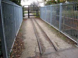
(1) Upminster Bridge Station |
(2) Rainham War memorial |
(3) View towards Erith |
Leaving Upminster Bridge Station, photo 1, we followed the London Loop path as it made its way to Rainham. Full details of that stretch of the walk can be found on the previous page from when I first did the walk and the first few photos here are of things I missed first time around. Photo 2 was taken in the centre of Rainham and shows the attractive three sided war memorial built in 1921. When I was last here I had spent ages to trying to take a photo of but it was continually obscured by a constant stream of traffic, in the background is the St. Helen and St. Giles Church. From Rainham the route heads down to the A13 and along Ferry Lane to reach the Thames where photo 3 was taken looking across the river towards the start of the London Loop at Erith.
 |
 |
 |
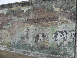
(4) Havering Riverside Mural |
(5) Approaching Coldharbour Point |
(6) Coldharbour Point |
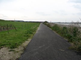
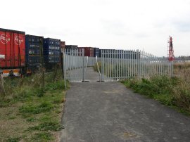
Just past the Tilda Rice Factory a mural had been painted on the flood wall, detailing the history of the area from prehistoric to the more recent industrial times, photo 4, although this is now looking rather faded. Last time I had walked down this part of the Thames it was along a grassy track but this has since been replaced by a smooth tarmac path as I headed down towards Coldharbour Point, photo 5. A little further on where the gates had once blocked the way a new metal gateway, photo 6, now led to the newly surfaced path that continued downstream besides the Thames. I have to say it felt really good to now be able to head along this section of path as it made its way around the back of the lorry depot.
 |
 |
 |
(7) Path by the Thames nr Coldharbour Point |
(8) Path by the Thames nr Coldharbour Point |
(9) View towards the Dartford Bridge |
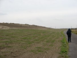
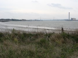
The path heads down besides a number of industrial units and then runs alongside a road besides the edge of an old landfill site, photo 7. The landfill sites had only recently been closed and were still in the process of being covered in topsoil and sown with grass, photo 8. Just past Coldharbour Point the Thames bends to the left which opens up views down the river towards the Dartford Bridge, photo 9.
 |
 |
 |
(10) Rainham Marshes |
(11) Path besides Rainham Marshes |
(12) RSPB Centre, Rainham Marshes |
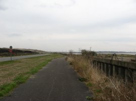
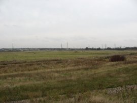
Having passed the landfill site the route joins a track that runs along the inland side of the flood wall besides Rainham Marshes, photo 10. On the far side of the marshes the tracks of Eurostars High Speed 1 line, which had started operating five days earlier, could be seen. The route passes through the site of the old Ministry of Defence shooting ranges, the old wire fence peeled back from the path, and soon joins a tarmac path, photo 11, that runs along the top of the sea wall towards the RSPB Rainham Marsh centre, photo 12.
 |
 |
 |
(13) Bridge over Mar Dyke |
(14) Thames Riverside, Purfleet |
(15) View up river from Purfleet |
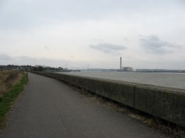
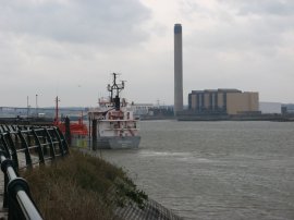
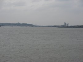
Passing round the RSPB centre the route does a dog leg round to cross a concrete bridge over Mar Dyke. Set in the concrete surface of the bridge were the remains of the rails of a narrow guage railway, photo 13. Once over the bridge the route turns to the right through a small playground and then heads down a footpath running besides houses back down to the Thames River side. The route passes the Purfleet Heritage and Military Centre which is housed in an old gunpowder magazine, originally built in 1759, which amongst its exhibits also includes a selection of memorobilia from the old Hornchurch Aerodrome which the route had passed through earlier. A little further on the path leaves the riverside, photo 14, and we headed down to join the London Road which we followed down to Purfleet Station. The boat in the photo is the 72m long Norwegian registered Yara Gas 2. On the opposite bank of the Thames is the Littlebrook Power Station. There is currently only one train an hour back towards London from Purfleet on a Sunday and with good timing we reached the platfrom with just a couple of minutes to wait. Photo 15 was taken looking back upstream towards Central London from besides the Thames in Purfleet.
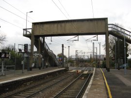 |
(16) Purfleet Station |
From Purfleet Station, photo 16, it was then just a short journey back to Barking where I had left my car in the morning. The total distance we had walked was 10.4 miles. It had been great to walk down the new section path to Purfleet and it as nice to have some company for a change even if there were slightly fewer people than I had been expecting, at least it meant we were able to walk at a decent pace!
If you would like to comment on this walk you can do so here:
![]() Back to:Walk index page
Back to:Walk index page
| ©2012 Bertuchi.co.uk. Please contact me using the email button on the right if you have any questions or comments regarding the site. Any feedback and additional information about places of interest on the walks is always welcomed. All rights reserved. Please contact me if you want to use any of the images or information from the site. ENJOY YOUR WALKING |
|