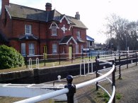
(1) Broxbourne Station
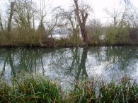
(2) River Lea, nr Broxbourne
(3) River Lea, nr Broxbourne
Other Links >>> |
|
LEA VALLEY WALK - STAGE 3
Broxbourne to Walthamstow Marshes
|
|
|
|
(1) Broxbourne Station |
(2) River Lea, nr Broxbourne |
(3) River Lea, nr Broxbourne |
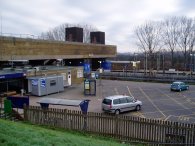
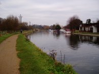
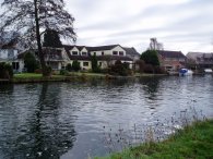
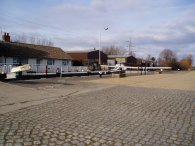
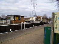
Broxbourne station, photo 1, may not be the prettiest station in the world but at least it was open unlike when I had finished my previous stage of the Lea Valley Walk. I took the photo from the banks of the New River which flows past the station. A short walk from the station past the Broxbourne Lesiure centre led back to the River Lea and the Lea Valley Path. There are a number of fine riverside houses, photo's 2 and 3, near to Broxbourne but these soon give way to Nazeing Marsh. There was also a rowing club and a number of rowing boats from large coxed boats to small single seaters were going up and down the river, some being pursued along the river bank by a trainer on a bicycle.
 |
 |
 |
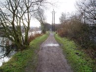
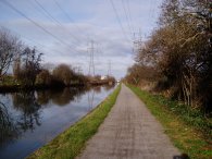
(4) Lea Valley Walk Path |
(5) Lea Valley Walk Path |
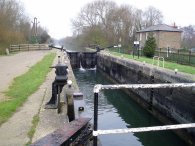
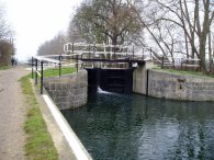
(6) Aqueduct Lock |
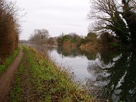
After passing Kings Weir the Lea Valley Walk path is surrounded on both sides by a number of different lakes which can be seen through the trees on either side of the path as in photo 5. These were formed after the extraction of sand and gravel and in some parts the river Lea, which once must have flowed along the low point of the valley floor, is now considerably higher than the surrounding land. All these bodies of water attract a number of birds and whilst walking through this section I spotted Comorants, Swans, Mallards, Tufted ducks, Coots, Moorhens, various kinds of geese and a lone Little Grebe. In the trees besides the path I saw a small group of long tailed tits. The path passes Aqueduct Lock, photo 6, and continues down towards Cheshunt.
 |
 |
 |
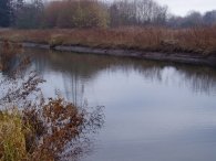
(7) River Lea, nr Cheshunt |
(8) Lea Valley Walk path nr Cheshunt |
(9) Cheshunt Lock |
Between the Aqueduct Lock and Cheshunt Lock the river level was quite low although I could not make out why, photo 7.
 |
 |
 |
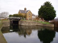
(10) Waltham Common Lock |
(11) River Lea, nr Waltham Abbey |
(12) Waltham Town Lock |
Once past Cheshunt Lock the path passes the site of the new Lea Valley Youth Hostel which has been built since I last walked this stretch of path and continues on to Waltham Common Lock, photo 10. Most of the river Lea Navigation is quite straight but on this section there were some particularly long stright stretches. As I was walking this stretch the sun broke through the clouds and I was finally able to take some brighter pictures looking back up the river, photo 11. Just before the A121 is crossed and Waltham Abbey reached the path passes Waltham Town Lock, photo 12. Between the A121 and the M25 the path passes by a number of industrial units.
 |
 |
 |
(13) Rammey Marsh Lock |
(14) Enfield Lock |
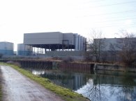
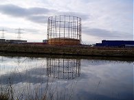
(15) Enfield Power Station |
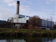
The path passes under the M25 and heads towards Rammey Marsh lock, photo 13. The bridge over the M25 can just be made out in the background of the photo. To the left of the path is a large area of housing that has recently been built on what was the site of the Royal Ordnance factories, to the right the path skirts Rammey Marsh. The next lock reached is Enfield Lock where the route of the London Loop is joined for a very short distance. The Lea Valley Walk continues past the site of the Enfield Power Station, photo 15, a 392 megawatt gas fired power station which is responsible for the electricity pylons that can be spotted in so many of the photos.
 |
 |
 |
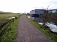
(16) River Lea by the King George's Resevoir |
(17) River Lea by the King George's Resevoir |
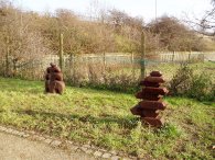
(18) Pathside sculptures |
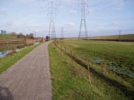
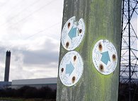
For the next couple of miles, accompanied by a pair of electricity pylons, the Lea Valley Walk path passes besides the embankments of the King George's Resevoir and then the William Girling Resevoir which rather restrict the views to the East. To the West the path is mainly flanked by a variety of industrial units which continue most of the way to the Picketts Lock Golf course. In a number of places along the course of the path there are small sculptures, photo 18, that have been placed by path, these ones are by Ponders End Lock.
 |
 |
 |
(19) Ponders End Lock |
(20) River Lea, nr Picketts Lock |
(21) Lea Valley Walk path nr Picketts Lock |
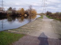
From Ponders End lock, photo 19, the Lea Valley Walk path heads down towards Picketts Lock along another very straight section of path. Photo 20 was taken looking North opposite the Picketts Lock Golf Course. Just before the Picketts Lock is reached the path has been lowered to provide what I assume is an overflow channel for the river Lea. In photo 21 this is completly dry but once several years ago I was walking along this stretch of path and it was pouring with water which made it impossible to continue up the path without getting very wet feet. It is the only place along the length of the river like this and it is strange it has not been put into a culvert of some sort. For the entire length of this walk the path has been in very good condition with only a very few sections that were slightly muddy.
 |
 |
 |
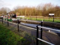
(22) Picketts Lock |
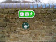
(23) Route Markers |
(24) The Edmonton Incinerator |
From Picketts Lock, photo 22, which also marks the start of the Pymmes Brook Trail, the path heads down towards the North Circular road. Being a straight walk along the river the path does not really need signpostig but in the odd place there are the occasional Lee Valley Walk markers although most seem quite old. The ones in photo 23 were taken near the Edmonton Waste recycling centre, photo 24, the chimney of which can be seen in the background along with one of the omniprescent electricity pylons.
 |
 |
 |
(25) Catkins |
(26) Tottenham Marshes |
(27) Stonebridge Lock |
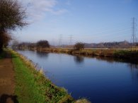
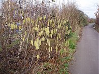
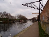
All along the path there were catkins out on the trees, photo 25, a sign that Spring is not that far off. Passing under the the A406 the riverbank was packed with anglers. It was an odd site to see them all sitting there in the gloom under the bridges. I can only presume it is a good site for fish.The path then passes besides a number of industrial estates and the path shares its route for a short while with the busy entrance road of a bus garage before reaching Tottenham Marshes, photo 26, and the banks of the Lockwood Resevoir to the East. Tottenham Marshes and the resevoir run most of the way down to Tottenham Hale, passing Stonebridge Lock on the way.
 |
 |
 |
(28) Tottenham Lock |
(29) The Black Crane |
(30) Route markers |
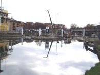
As I progressed the weather became quite gloomy which made taking decent photos a bit difficult. Passing the lock at Tottenham Hale, photo 28, and crossing Ferry Lane the path is flanked by blocks of flats and the route gets a much more urban feel. Heading towards Springfield Marina the path passes under the Black Crane, photo 29. When I walked this stretch in January 2006 a developer was seeking planning permission to have the crane removed and a seven story block of flats built on the site it currently occupies. Along this stretch of the river this is one of the few reminders of the area's industrial past that remain. At Springfield Marina the route of the Lea Valley path is joined by the Capital Ring, photo 30.
 |
 |
 |
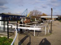
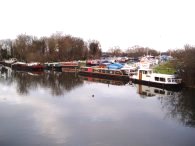
(31) Springfield Marina |
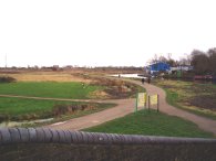
(32) Walthamstow Marshes |
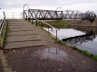
(33) Footbridge over the Lea |
The GPS made this walk 13.1 miles long.
![]() Back to:Walking index page
Back to:Walking index page
| ©2012 Bertuchi.co.uk. Please contact me using the email button on the right if you have any questions or comments regarding the site. Any feedback and additional information about places of interest on the walks is always welcomed. All rights reserved. Please contact me if you want to use any of the images or information from the site. ENJOY YOUR WALKING |
|