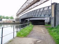
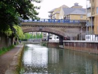
(1) Lea Bridge Road bridge
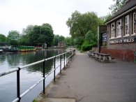
(2) Princess of wales pub, Leyton
Other Links >>> |
|
LEA VALLEY WALK - STAGE 4
Walthamstow Marshes to the River Thames
|
|
|
|
(1) Lea Bridge Road bridge |
(2) Princess of wales pub, Leyton |
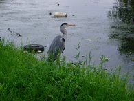
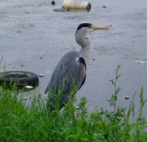
From home it was just a short bus ride down the Lea Bridge Road to the bridge over the River Lea, photo 1, where I had finished the last stage of the walk some four months earlier. The path passes the Princess of Wales pub on the other side of the road and heads off South between Leyton and Hackney. Not far past the pub I came across a very tame heron, photo 3, who stayed perched besides the canal bank even when I walked past a few feet away. I took the photo from a bit further away as I was expecting it to fly off before I got up to him.
 |
 |
 |
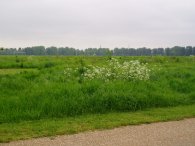
(4) Path besides Hackney Marshes |
(5) Hackney Marshes |
(6) Hertford Union Canal |
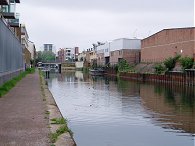
The path runs for some distance alongside Hackney Marshes, photo 4, passing the famous playing fields, photo 5. The canal passes under the rather noisy A12 flyover and continues on down towards the Thames past Hackney Wick. Shortly before the Old Ford Lock is reached the Hertford Union Canal joins the Lea Navigation on the right. This short stretch of canal was opened in 1830 and links the Lea Navigation with the Regents Canal.
 |
 |
 |
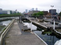
(7) River Lea, nr Old Ford |
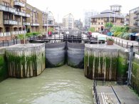
(8) Old Ford Lock |
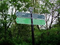
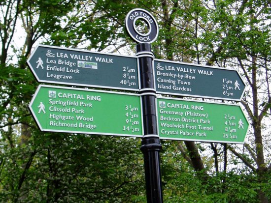
Photo 7 was taken looking South from the junction of the two canals towards the Old Ford Lock, photo 8. At the lock there was a mileage post for the Capital Ring and the Lea Valley Walk, photo 9. The sign for the Lea Valley walk showed distances to Canning Town and Island Gardens although I am unsure what route the path takes to get there. For my walk I followed the Lea Navigation along the Limehouse Cut to the Thames which how the Lea Valley walk is marked on my copy OS Explorer map 162. On the sign I also noted it was 34.5 miles to Richmond Bridge which is where I currently am on my walk round the Capital Ring so three days walking should see me back here again! Just past the lock, the Capital Ring leaves the Lea Valley walk and heads onto the Greenway as it makes it way towards Beckton.
 |
 |
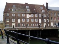 |
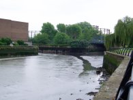
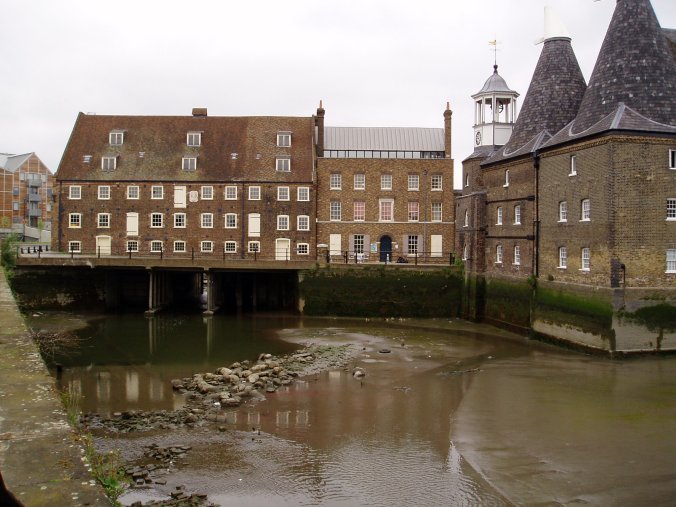
(12) House Mill |
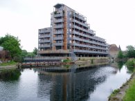
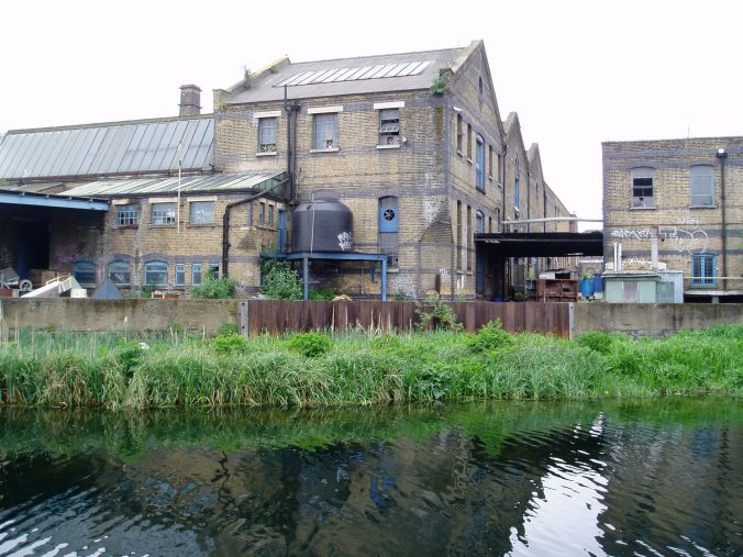
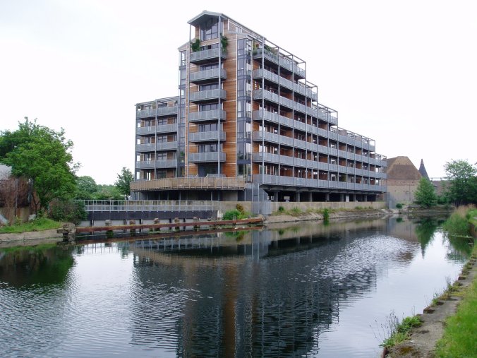
There are still a considerable number of old factory buildings lining the Lea Navigation, such as that in photo 10. Many of these are often in rather a dilapidated state but often seem still in use. There has however also been a large amount of new residential accommodation built alongside the canal such as in photo 11, with more continuing to be built. Another example can be seen in photo six beside the junction with the Hertford Union canal.
The path briefly leaves the side of the canal to cross over the A11 before descending back and making its way to House Mill, photo 12.
 |
 |
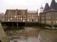 |
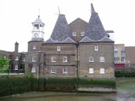
(13) Clock Milll |
(14)River Lea, Three Mills Island |
House Mill, on Three Mills Island, Bromley by Bow was built in 1776 and spans the River Lea. Photo 13 shows Clock Mill and its drying Kilns. Last time I had been here it had been high tide and I had not appreciated just how deep the channels, photo 14, around the mill actually were.
 |
 |
 |
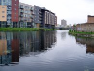
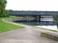
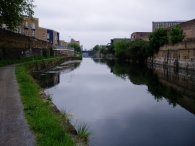
(16) River Lea, Bromley by Bow |
(17) Approaching Bow Locks |
(18) Bow Locks |
The tidal section of the River Lea seen in photo 14 runs parrallel with the River Lea Navigation, photo 16, along a narrow stretch of land that separates the two watercourses. The bridge carries the Metropolitan and District lines over the canal. With the tall building of Canary Wharf growing ever larger on the horizenthe path then makes it way down towards Bow Locks, photo's 17 and 18. It was here that the River Lea navigation used to join the tidal section of the River Lea as it made its way round Bow Creeks to the Thames itself. The Limehouse Cut leads off to the right of the locks.
 |
 |
 |
(19) Walkway besides the Limehouse Cut |
(20) Limehouse Cut |
(21) Limehouse Cut |
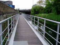
The Limehouse Cut was built in 1766 and provided a short cut from the River Lea Navigation to the Thames at Limehouse Basin which allowed the tidal Bow Creek to be avoided. Just past the lock a stretch of walkway, photo 19, has been built over the canal for a short distance near the start of the Limehouse Cut which prevents the need for a stretch of road walking away from the canal. The Limehouse Cut is more or less dead straight and this section of the walk was a little dull. Much of the path runs alongside tall housing developments which cut down on the views to the left while on the right the River Lea is fronted by what are generally rather a dull selection of buildings. Photo's 20 and 21 are typical of the views on this stretch of the canal.
 |
 |
 |
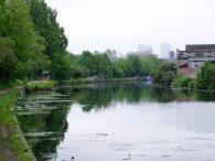
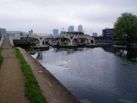
(22) Limehouse Cut |
(23) Limehouse Basin |
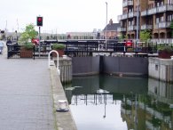
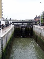
(24) Limehouse Lock |
Eventually however the River Lea navigation reaches the Limehouse basin. Not far past the bridge in photo 22, which carries the Docklands Light Railway, the path of the canal turns sharp right and the basin opens up ahead, photo 23. The route runs round the left hand side of the basin and on to the final set of locks that separate the the basin and the Lea Navigation from the Thames, photo 24.
 |
 |
 |
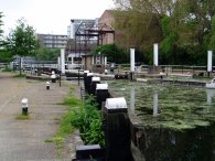
(25) Limehouse Lock |
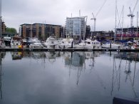
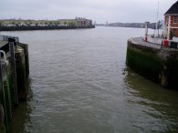
(26) River Thames, Limehouse |
Photos 25 and 26 show the final lock gate at Limehouse and the view up the river Thames from the lock. Photo 27 was taken looking back into Limehouse Basin and the end of the walk.
The GPS made this walk 4.88 miles long.
As this was such a short walk I then continued on for a few more miles through East London from Limehouse Basin to Manor Park via Stratford.
![]() Back to:Walking index page
Back to:Walking index page
| ©2012 Bertuchi.co.uk. Please contact me using the email button on the right if you have any questions or comments regarding the site. Any feedback and additional information about places of interest on the walks is always welcomed. All rights reserved. Please contact me if you want to use any of the images or information from the site. ENJOY YOUR WALKING |
|