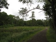
(1) Path towards Numbers Farm
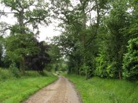
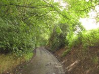
(2) Path nr Bedmond
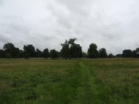
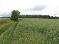
(3) Fields nr Tenements Farm
Other Links >>> |
|
THE HERTFORDSHIRE WAY - DAY 16
Kings Langley to Letchmore Heath
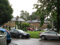
I did this walk on Sunday the 24 June I drove up from Walthamstow and parked in the rather desolate surroundings of Kings Langley station car park.
|
|
|
|
(1) Path towards Numbers Farm |
(2) Path nr Bedmond |
(3) Fields nr Tenements Farm |
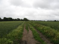
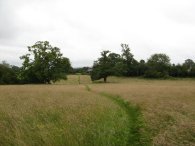
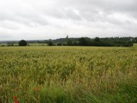
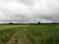
From there I made my way out of the station car park and along Station Road before turning right up Egg Farm Lane for a short distance where I took a footpath which runs just to the right of a driveway up to Numbers Farm, photo 1. The path heads up towards the farm buildings which now seem to be converted into housing and turns right following the edge of the field, then left and then right again to take a track which heads gently uphill as the route makes its way over fields towards the village of Bedmond, photo 2. This part of the walk is running roughly parallel to the M25 and I was accompanied by the constant sound of traffic coming up from the motorway. Crossing over the fields I deviated slightly from the route of the Hertfordshire Way as I followed a path that ran all along left hand hedge at the top of the field however the Hertfordshire Way had actually turned to run slightly off to the right. I rejoined the correct route along a footpath that ran off to the left over Bedmond Playing Fields to reach Meadow Lane. Heading along Meadow Lane the route turns right into Toms Lane which is followed up to a mini round where the route turns right along the main road through Bedmond before soon turning left beside the Bell pub where the route heads along an unsurfaced road between houses to eventually enter a small patch of woodland. Leaving the woodland the route heads across a grassy field, photo 3, past some farm buildings, and across another small paddock with a very large oak tree in the middle.
 |
 |
 |
(4) Peas... |
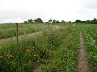
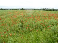
(5) and Poppies |
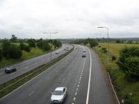
(6) Crossing the M25 |
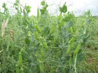
Leaving the paddock the route joins a farm track that runs between some fields which were planted with peas, photo 4, In one of the pea fields there were a large number of poppies in flower, photo 5. I like looking at all the different crops I encounter while out walking although I wish I knew more about what was what. The route leaves the fields to take a footbridge over the M25 photo 6, one of several major roads encountered on this part of the walk.
 |
 |
 |
(7) Approaching Chequers Lane |
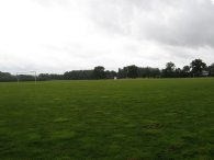
(8) Playing fields, Parmiter's School |
(9) Brickett Wood Common |
Once over the motorway the route heads over a field, photo 7, and turns left to join a farm track that runs along the edge of the field. Over the motorway the sound of the traffic was considerably diminished as I was now up wind of it. This track runs down to join a road, Chequers Lane, where the Hertfordshire Way continues ahead. Chequers Lane, which didn't have a footpath, was quite busy with a large number of cars passing along and I had to watch my step as I made my way along it as there always seemed to be cars coming in both directions at the same time. Turning to the right besides a house the route crosses a small field and then takes public footpath 63 which runs over the playing fields of Parmiter's School, photo 8, towards High Elms Lane. As I was crossing the playing fields it started raining and I sheltered for some time under some trees until the rain died down a bit. Once across the playing field the route heads down past Hertfordshire crematorium to High Elms Lane where the route turns left to head down to reach the A405 which crossed via an underpass to the right. The Hertfordshire Way then heads along Bucknalls Lane and crosses a bridge over the M1. Where the road narrows the route of Hertfordshire Way takes a bridleway off to the right that runs down beside a patch of woodland. This broad bridleway crosses a bridge over a railway line and continues through the woods of Brickett Wood Common, photo 9, for half a mile or so.
 |
 |
 |
(10) Driveway to Mundens House |
(11) Grassland nr Munden House |
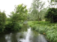
(12) River Colne |
Leaving the Brickett Wood Common the route crosses a road, School Lane, and heads down a driveway towards Munden House, photo 10. Leaving the driveway the path heads off to the right over some open parkland, photo 11, and heads gently down towards a metal bridge that crosses over the River Colne photo 12.
 |
 |
 |
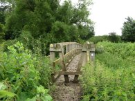
(13) Wooden Bridge nr Wall Hall |
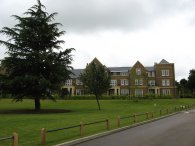
(14) New Housing, Wall Hall |
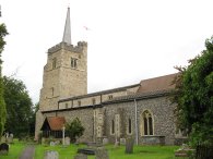
(15) Aldenham Church |
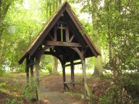
Passing over another field the route then takes a wooden bridge over a dried up pond, photo 13. Even with all the rain this bridge is rather redundant and there is a perfectly walkable path running besides it. Once over the wooden bridge the path continues ahead up a gravel track that leads to a road in the grounds of Wall Hall, photo 14. Wall Hall is the site of a fairly large housing development which is currently being built and the route follows the road through the new houses. Leaving the Wall Hall development on its access road the Hertfordshire Way the turns left along a footpath that runs over a field towards some electricity pylons. On the right the spire of Aldenham Church could be seen rising above the trees. At the end of the field the route turns right along the field edge to reach some house then heads down a track towards Aldenham Church, photo 15. The route heads down the round around the right hand side of the church and then heads off to the left on a footpath that runs through the churchyard. Leaving the churchyard the route continues along the tree lined track of the aptly named Church Alley.
 |
 |
 |
(16) Fields nr Letchmore Heath |
(17) Letchmore Heath |
(18) East Lane |
The path then goes across the top of Church Lane and continues ahead along the main road. A short distance further on a Hertfordshire Way marker points into a field through a kissing gate on the left although this is not the correct route for the walk. I can only assume it is the remains of an earlier route or the sign has been moved to point in the wrong direction. The actual route continues ahead along the road a short distance further to reach the edge of Round Bush where the route crosses the road and runs along beside a group of houses set back from the road on a lane called the Spinney before crossing over a road at the end and heading down a bridleway signposted Letchmore Heath ½ mile, photo 16. As I headed over the bridleway towards Letchmore Heath it started raining again, this time much heavier and more persistently than earlier. At the end of the bridleway the route turns to the right along a road and passing the village hall takes another road that heads down to the right. The GPS said 8.3 miles when I finished my walk in Letchmore Heath besides the Three Horseshoes pub, photo 17. I once again waited for some time under the trees by the Three Horseshoes pub before giving up any hope of remaining dry and turned to head back to Kings Langley. On the way back I more or less followed the same route that I took on the outward journey. The Southern part of the county is more suburban than the very rural North and the options available for circular walks are much more limited. Every time I stopped to look at my map to try and find an alternative route it was pouring with rain and the map was getting soggier and soggier. However once I crossed back over the A405 rather than cross back over the playing fields of Parmiters School I continued up High Elms Lane to its end and then turned right onto Chequers Lane. This was a pleasant walk along a footpath often set back from the road and with good views off to the right. I only followed Chequers Lane for a short distance before turning left down East Lane, photo 18.
 |
 |
 |
(19) East Lane Cemetery |
(20) Approaching the M25 nr Kings Langley |
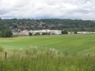
(21) Ovaltine Egg Farm |
As I was walking along East Lane the rain finally stopped and within a short distance the sun soon came out. East Lane winds its way gently uphill towards an isolated house opposite an old open cemetery hidden amongst the trees, photo 19. Soon the lane turns to the right along a tarmac track that must have once been a road that has now been closed to traffic. Reaching a footpath that crosses the lane I turned to my left and headed over a field of oilseed rape. The plants were covered in rain and I got absolutely soaked passing through them, more so than during any of the showers during the day. Crossing the field the path joins a tree lined track that reaches the outskirts of Abbots Langley. I turned right onto Bedmond Road before turning left down Dairy Way a little way further on. At a bend in the road I continued ahead along a track running to the right of Abbots Langley school. The path continues along with a field to the right and gardens on the left until the end of the field where I turned right down a farm track that runs between fields, photo 20. This leads to a concrete track that crosses over the M25 motorway and winds its way down towards Kings Langley. This joins the road I was on earlier that leads up to Numbers Farm and I was able to take a path that led directly into the Kings Langley station car park. To the right there were views across to the old Ovaltine Egg Farm, photo 21.
Reaching the car I had walked a total distance of 15 miles for the day. Although the weather brightened up at the end this had been one wet walk too many. I don't mind being out in the rain but it would be nice to see a bit more of the sun rather than having to walk round the streets in a full set of waterproofs which look fine out in the Lake District but a bit out of place in Kings Langley.
![]() Back to:Walk index page
Back to:Walk index page
| ©2012 Bertuchi.co.uk. Please contact me using the email button on the right if you have any questions or comments regarding the site. Any feedback and additional information about places of interest on the walks is always welcomed. All rights reserved. Please contact me if you want to use any of the images or information from the site. ENJOY YOUR WALKING |
|