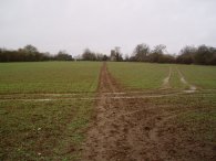
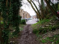
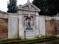
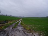
(1) Path towards Reed Church
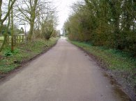
(2) Reed High Street
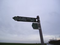
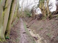
(3) Signpost to Royston
Other Links >>> |
|
THE HERTFORDSHIRE WAY - DAY 7
Reed to Therfield
I did this walk on Sunday 4th March 2007. I drove up from Walthamstow and parked besides the Church at Reed which is on the route of the Hertfordshire Way.
|
|
|
|
(1) Path towards Reed Church |
(2) Reed High Street |
(3) Signpost to Royston |
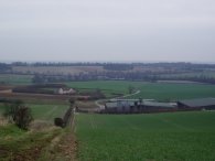
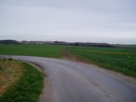
From there it was just a short walk of 0.3 of a mile through the churchyard and over a field to reach the spot where I had ended my last walk, photo 1. I then had to retrace my steps back over the muddy field to the Churchyard. The Sunday morning church service was just ending as I returned to the churchyard and I attracted a few quizzical looks as I completed this part of my journey, my boots caked in mud, having just walked across the field on the other direction. The route of the Hertfordshire Way loops round the church before heading across a field down to Reed High Street, photo 2. The route then turns left along the road to head to a T junction with Crow Lane where there is a bench commemorating the award of the best kept small village 1996. Here the Hertfordshire Way continues on straight ahead along a footpath across a field which leads up to another road. The route turns left along this road for a very short distance before turning right on a footpath signed Royston 2 1/2 miles, that once again runs over fields. To the left on the horizon I could see the water tower near the village of Therfield that I would be passing later in the day on the Hertfordshire Way and had passed last year when walking the Hertfordshire Chain Walk.
 |
 |
 |
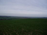
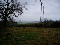
(4) View over Cambridgeshire |
(5) Fields nr Royston |
(6) Fields nr Royston |
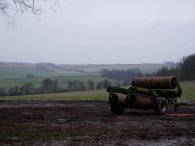
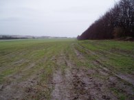
A couple of hundred yards further on the route reaches the brow of a hill where there are distance views across over Cambridgeshire, although it being a rather grey day, and quite windy too, meant that these views were somewhat limited and unclear, photo 4. The path here is actually a bridleway and with the recent heavy rain it had become very churned up and muddy which made waking rather tricky as the path began to descend, quite steeply at first, towards Royston, photo 5. As I made my way down the path I was sliding all over the place with tons of mud stuck to my shoes. The route levels out and passes some farm buildings before joining a tarmac track for a short distance of mud free walking however at a bend in the track, photo 6, the route once again continues straight ahead on a muddy bridleway running between fields.
 |
 |
 |
(7) Fields nr Royston |
(8) Path into Royston |
(9) War memorial, Royston |
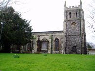
Once over the fields the route continues along to a hedge lined track heading gently downhill past a very impressive stable complex. At the bottom of the hill I detoured slightly from the path, the correct route being partially obscured behind a hedge, and had to retrace my steps to take the correct route as the Hertfordshire Way detours round the buildings of the Grange from where the route heads uphill and through a small patch of woodland before heading across another field. It had started raining earlier and as I headed across the field the rain became much heavier and I was forced to stop and put my waterproof over trousers on. It then continued to rain with varying intensity for the rest of the walk. Photo 7 was taking looking back across the area I had just walked. The route then descends on a tree lined track towards the outskirts of the town of Royston, photo 8. The path makes its way through Royston heading first down Bottom Grange before bearing left into the Barkway Road then right into Priory Lane. Crossing Priory Lane the route heads through Priory Gardens, past the side of the Priory Church, to Melbourn Street. Turning to the left along Melbourn Street the route passes the war memorial in photo 9,
 |
 |
 |
(10) Priory Church, Royston |
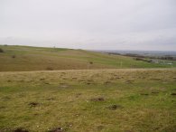
(12) Therfield Heath |
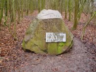
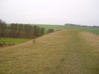
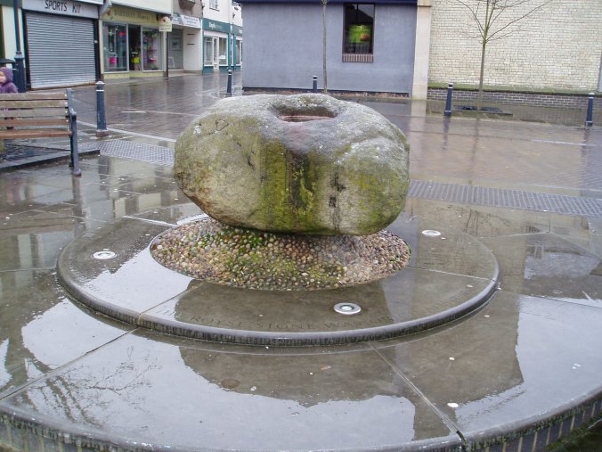
and heads on past the church, photo 10, to reach the centre of Royston. Here, at the Royse Stone, photo 11, is the official start (and end!) of the Hertfordshire Way as described in the Hertfordshire Way guidebook, (although personally I still have to get all the way back to Cuffley to complete my circuit!). Close to the stone is an information board about the stone which was originally the base for a cross. The Hertfordshire Way continues ahead, heading uphill into Baldock Street and then Baldock Road which takes the route up to the edge of Therfield Heath, photo 12. Therfield Heath contains Hertfordshires oldest monument, a 5000 year old neolithic long barrow, and has been used by man ever since. The Hertfordshire Way turns left into the open spaces of Therfield Heath besides a golf club and after stopping to look at an information board I headed past round the front of the Golf clubhouse and then uphill along a path that roughly follows the left hand edge of the heath.
 |
 |
 |
(13) Path, Therfield Heath |
(14) Jubilee Wood, Therfield |
(15) Church Hill, Therfield Heath |
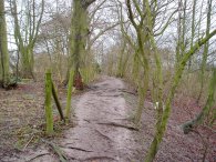
Right at the top of the hill the path turns right and takes a muddy track that runs through a patch of scrubby woodland, photo 13. Leaving the woodland the path skirts round the top of Therfield Heath besides the golf course before heading down through another small patch of woodland to cross over a road into the Therfield Heath Nature Reserve. The Heath is a site of special scientific interest as it is one of the best remaining chalk grassland sites in the country. The path runs besides another patch of newer woodland at Jubilee Wood, it planting commemorated on a large boulder, photo 14, and continues along the top of the heath, passing into the Beech woodland of Fox Covert Nature Reserve. From here the Hertfordshire Way passes through a kissing gate into a grassy area at the top of Church Hill, photo 15.
 |
 |
 |
(16) Therfield Heath |
(17) Thrift Farm, Therfield |
(18) Fields nr Therfield |
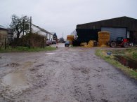
From Church Hill the route descends steeply down to join a track that runs to the right before bearing left besides a hedge which is then followed over Therfield Heath, photo 16, towards the farm building of Thrift Farm. The route over the grassland, which was rather damp and muddy, running parallel to the route of the A 505 which runs along the edge of the heath a few hundred yards to the right. At Thrift Farm, photo 17, the route turns left and heads up through the middle of the farm buildings to take a path that starts running steadily uphill towards the village of Therfield, gradually regaining all the height lost earlier in the day. A short distance past Thrift Farm the route links up with part of the last link of the Hertfordshire Chain Walk, photo 18, which I had walked last May, heading in the opposite direction to this walk.
 |
 |
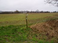 |
(19) Heading towards Therfield |
(20) View North over Slipes Wood |
(21) Hertfordshire Way Marker |
The rain continued to pour down and as I headed up the path towards the village of Therfield, the rain being blown by the wind directly into my face on a strong wind. The Hertfordshire Way makes its way gently uphill over fields before a final steep ascent along a sunken tree lined track, photo 19. On the way up to Therfield I saw a couple of herds of deer and, in the field to my right, there were quite a number of hares and I stood for some time in the pouring rain watching a couple have a proper boxing match as they chased each other too and fro across the field, periodically joined by a third combatant. Reaching the road at the top of the hill in Therfield I took a quick photo back over the area I had just walked, photo 20.
At the road the Hertfordshire way turns right for a short distance before turning left down a track that runs past the Therfield water tower. The route of the Hertfordshire Way through Therfield has been slightly revised from the 1st Edition of the guidebook and just past the water tower takes a footpath over a stile into a patch of open ground on the left. The original route, which I followed, continued ahead besides a field to reach another footpath which is where I finished this stage of my walk along the Hertfordshire Way, photo 21. I had wanted to walk further but it had been raining steadily for several hours which in itself was not too much of a problem but the accompanying strong winds that were blowing directly into my face which was making walking quite unpleasant and it was a relief as I turned to the left down the footpath to start the journey back to Reed that I no longer had the wind and rain in my face. This footpath forms part of the new route of the Hertfordshire Way, although I was now walking in the wrong direction, as it heads past the Church and into the centre of Therfield. From Therfield I followed the road round back to the A10 and Reed, passing through Reed End on the way.
The total distance I walked for the day was 11.8 miles of which 8.9 miles were along the Hertfordshire Way. Despite the rain it had been a relatively pleasant walk and I have now passed the Northern most point of the path.
![]() Back to:Walk index page
Back to:Walk index page
| ©2012 Bertuchi.co.uk. Please contact me using the email button on the right if you have any questions or comments regarding the site. Any feedback and additional information about places of interest on the walks is always welcomed. All rights reserved. Please contact me if you want to use any of the images or information from the site. ENJOY YOUR WALKING |
|