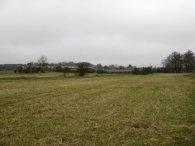
(1) Field besides Little Hormead Brook
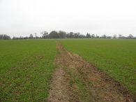
(3) Heading towards Great Hormead
Other Links >>> |
|
THE HERTFORDSHIRE WAY - DAY 6
Little Hormead to Reed
I did this walk on Sunday 18th February. I drove up from Walthamstow and parked besides the roadside in the village of Hare Street from where it was just a 0.6 of mile walk back to where I had finished my last walk along the Hertfordshire Way besides Little Hormead Brook.
|
|
|
|
(1) Field besides Little Hormead Brook |
(3) Heading towards Great Hormead |
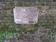
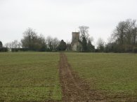
From Little Hormead Brook I then retraced my steps as I followed the Hertfordshire Way back up to Hare Street. The path runs alongside the brook, photo 1, to a road where the path turns left over a bridge before bearing right along a path that runs diagonally over a field to the main road in the village of Hare Street. On the bridge there was an old metal sign, dated 1899, which amongst other things stated that "all other ponderous carriages are warned against attempting the passage of the bridge". Once in Hare Street the main road is followed for just a short distance before the route takes a footpath off to the right running downhill besides a house. The path heads downhill, over a small sports ground, and then takes a small footbridge back over Little Hormead Brook before heading uphill across a field towards Great Hormead, photo 3.
 |
 |
 |
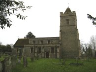
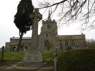
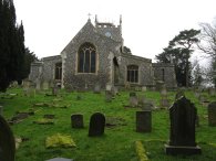
(4) Great Hormead Church |
(5) Track nr Hormead Hall |
(6) Path towards Anstey |
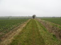
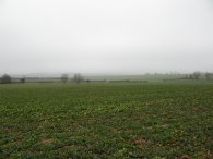
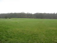
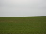
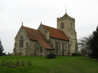
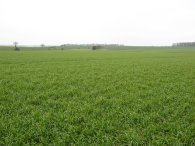
The weather had started quite grey and overcast and there was a steady wind blowing from the North which made it feel a little bit cooler than of late. At the top of the field the route continues ahead, crossing the driveway of a large house before turning right down a tree lined path that runs down besides the gardens of the house that leads to Great Hormead Church, photo 4. All the way up from Hare Street the bells of the church had been ringing although it was a rather dull sound. When I arrived at the Church the Sunday service was just beginning and I could hear the organ music coming from inside. I also noticed as I went past a freshly dug grave with boards over the top so I wondered whether the mournful bell ringing might be due to the fact that a funeral service was being held. Passing through the Churchyard the Hertfordshire Way heads across a road and continues on a muddy track across fields. Once across the field the path turns left along a farm track for a short distance before then turning right to take a path down besides fields. In the hedgerow besides the path I spotted a nice flock of Long Tailed Tits. The path heads across two short fields down to a footpath that leads between houses to the road in Great Hormead. The path turns right along the road then left along a road that heads towards Great Hormead Hall. Just before the entrance to the hall the path bears to the left running alongside the edge of a field. The village had a number of pretty thatched cottages. The path then takes a stile to a footpath that runs diagonally over a field off to the right besides the farm buildings of great Hormead Hall before turning left along a farm track running besides a hedge between fields over wide open countryside with extensive view on either side, photo 5; well there would have been extensive views if the weather was quite so misty with low lying cloud. The path heads towards a couple of electricity pylons and passing under the second set of electricity pylons the Hertfordshire Way turns right along a minor road to run directly underneath the overhead cables. The route leaves the road to the left by a small patch of woodland and heads diagonally across a field heading for a small gap in the hedge opposite. To the left, against the hedge there was a herd of deer resting which kept a close eye on my movements. Passing through the hedge the path crosses a little bridge and turns right and then left to take a path that is followed for some distance over fields, photo 6, towards the village of Anstey.
 |
 |
 |
(7) Fields nr Anstey |
(8) Anstey Church |
(9) Anstey |
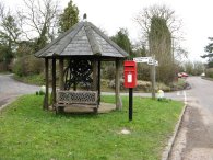
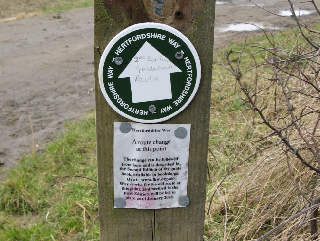
Once again any views, photo 7, were obscured by the low lying cloud, although at least it stayed dry all day. The path crosses a road and then heads downhill over a paddock towards a bridge over a stream. Here the path turns left to head down to the road in Anstey. On my map the Hertfordshire Way is shown as continuing straight ahead at this point over the wooden bridge but the route has been revised in the second edition of the Hertfordshire Way guidebook. I had a look the other day at the latest version of the Ordnance Survey Explorer map for the area and that too showed the new revised route for the Hertfordshire Way. The old route, as shown on my map, is no longer marked. This was one of a number of minor changes to the route that I encountered on this stage of my walk along the Hertfordshire Way. Reaching the road in Anstey the route turns right along the road to head up to the church, photo 8. This section of the walk had been accompanied by the sound of bird scarers banging away which I always find quite irritating, particularly when they go off when I am close besides them! The Hertfordshire Way follows the road through Anstey, passing the little village green with its old well, photo 9, in the direction of Neasden before taking a track off to the left just before the last houses in the village, where the original route of the Hertfordshire Way is rejoined. This track soon leads to a path that runs over a field and then alongside a small patch of woodland.
 |
 |
 |
(10) Nuthampstead Airfield |
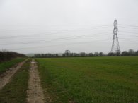
(11) VOR Radio Navigation Ground Station |
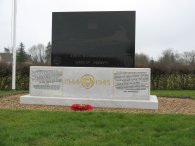
(12) 398th Bombardment Group Memorial |
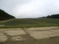
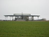
Reaching a concrete path, photo 10, the route turns left then bears round to the right. During World War 2 this area was the site of the Nuthampstead Airfield, Army Air Force Station 131, which began service in 1943. The path heads along a broad track towards some farm buildings where the route turns left. To the right is a VOR Radio Navigation Ground Station, photo 11. The Hertfordshire Way reaches the road in the small village of Nuthampstead by the Woodman Pub where there is a small memorial to the air crews that served at the aerodrome, photo 12. Turning right the route heads down the lane where it is joined buy a road on the left. A little further on the taking the next left and then almost immediately turning left along a footpath by a house heading across a field to pass some farm buildings at Caylers Farm.
 |
 |
 |
(13) Path nr Bury Farm, Nuthampstead |
(14) Approaching Earls Wood |
(15) Path besides Earls Wood |
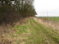
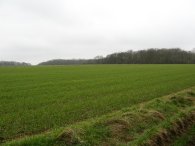
The route heads across a field and through a small patch of woodland before heading downhill across open fields, photo 13, towards Bury Farm. Although the footpath had been re-instated across the field the earth was very sticky and left my boots covered in mud. Skirting the farm buildings the route briefly joins a road before heading to the right across open ground on an indistinct path towards Earls Wood, photo 14. The Hertfordshire Way then turns left and follows the edge of the woodland, photo 15, round to a field above the village of Barkway.
 |
 |
 |
(16) Barkway |
(17) St Mary Magdalene Church, Barkway |
(18) Lane nr Barkway |
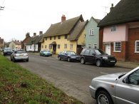
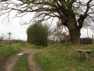
The route then heads downhill passing some farm buildings before taking a track that leads on between houses and some rather dilapidated sheds to the B1368 in the village of Barkway. Here the route turns right and heads through the village, photo 16, deviating from the route marked on my map which is shown as taking a footpath off to the left almost as soon as the main road is reached. The new route, as described in the second edition of "The Hertfordshire Way", now continues further along through the village before turning left into Church Lane. The route passes through the churchyard of St Mary Magdalene church, photo 17, and continues along the lane which, by some farm buildings, becomes a track. A little further on the route turns right, just past the bench in photo 18, which is where I stopped and had my lunch. This spot also marks where the original route of the Hertfordshire Way is re-joined.
 |
 |
 |
(19) Heading towards Rokey Wood |
(20) Mast nr Barkway |
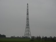
The path runs alongside a field, photo 19, as it heads towards Rokey Wood. Passing along the lower edge of the wood the path then heads on past Bush Wood a little further on, crossing the Greenwich meridian line in the process. There are a couple of tall radio masts that have been visible in the area for quite some time, photo 20 is of one near the village of Barkway. Just past the end of Bush Wood the route heads diagonally to the right over a small patch of field and passes through a hedge to join a farm track. This track is followed round to the left running alongside a small patch of trees. At the end of these trees the route of the Hertfordshire Way once again deviates from its original course. This time the fact that it was the revised route was clearly indicated as shown in photo 21. Strangely, the route as marked on my map follows neither the old or new route but for a few hundred yards takes its own course towards Reed.
 |
(22) Path towards Reed Church |
From the sign in photo 21 the route leaves the farm track, which turns to the right, and continues ahead across a field. Passing through a hedge the route crosses another farm track with the Hertfordshire Way continuing ahead over another field towards Reed Church, photo 22. I however stopped here and turned left along the farm track to start my return journey to Hare Street.
According to my GPS I had walked a total of 8.76 miles along the Hertfordshire Way from where I had resumed my walk besides Little Hormead Brook.
 |
 |
 |
(24) Buckland Church, Herts |
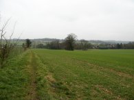
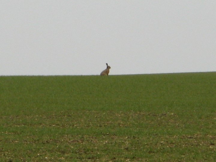
It was a very pleasant walk back to Hare Street; the first section of footpath taking me due South towards the village of Buckland. The path running between wide open fields with extensive views although in some places the path itself ran along a narrow tree lined track between the fields. On the way I spotted a large number of hares in the fields although they all seemed intent in running off before I could get a decent photo although the one in photo 23 did look quite good silhouetted against the horizon. (As ever click the green text to see a larger version of the photo).
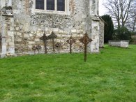
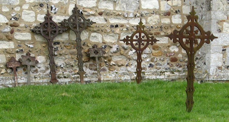
Reaching the road at Buckland after a particularly muddy section of path a footpath was signed diagonally across the field opposite, heading towards the church, however there was no sign of the footpath itself in the field so I headed right along the road before turning left down the road to the church. The footpath passed through the churchyard of the church, photo 24, which featured a number of unusual metal crosses, photo 25, before continuing on towards some houses.
 |
 |
 |
(26) Fields nr Buckland |
(27) Field nr Hare Street |
(28) Fields nr Hare Street |
Here the footpath headed of gently downhill over a number of fields towards Capons Wood which can just be made out on the skyline in the top right hand corner of photo 26. The actual route of the path was not evident on the ground even though it was signposted and my feet got very, very wet walking through the damp young crops. Reaching Capon's Wood the path turns right, then left and left again as it makes its way around three sides of the wood which was liberally marked with no entry signs. Leaving the edge of the woodland the route heads gently uphill to turn right onto a track before turning left a few hundred yards further on to take a path that heads down to Home Farm and the road at Wyddial. The route heads across the road and takes a farm track that leads down past Moles Farm. Just past a large stable block, level with the second set of overhead electricity pylons I turned left along the edge of a field on a very muddy patch of ground to join another footpath that runs off to the right past Beauchamp's Plantation. A little further on I took a path off to the left to cross a field before turning right once again to take a farm track that headed towards the B1038. A short distance before the road is reached a footpath was marked on the map heading off to the left down over fields towards the B1368 in Hare Street and a helpful sign, photo 27, pointed the way however there was absolutely no trace of the path, which was actually marked not as a footpath but as a RUPP, across the field at all. I debated for some time whether to go across the crops or take the road to Hare Street however the road seemed quite busy so in the end I opted to plough my way across the field. Initially I headed a bit far to the left but after following the field edge for a bit and making my way through a patch of scrubby trees I found a more prominent path, photo 28, that led across a couple of fields down to the road at Hare Street from where it was just a short walk back to the car.
The total distance I walked for the day was 15.0 miles of which 8.76 miles were along the Hertfordshire Way. This had been a very enjoyable walk through a very rural area punctuated by the occasional small village. Although sometimes the paths on the return leg were not evident on the ground they were all well signposted which left little doubt over the correct route and it was nice to be able to do a decent circular walk.
![]() Back to:Walk index page
Back to:Walk index page
| ©2012 Bertuchi.co.uk. Please contact me using the email button on the right if you have any questions or comments regarding the site. Any feedback and additional information about places of interest on the walks is always welcomed. All rights reserved. Please contact me if you want to use any of the images or information from the site. ENJOY YOUR WALKING |
|