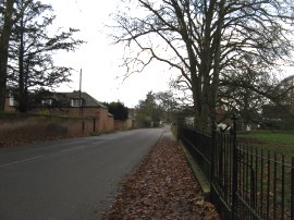
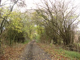
(1) The Street, Manuden
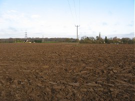
(2) Field nr Maggots End
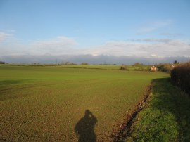
(3) Fields approaching Peyton Hall
Other Links >>> |
|
THE HARCAMLOW WAY - PART 14
Newport to Manuden
I did this walk on Tuesday 23rd November. I drove up to Manuden where I parked on The Street, close to Manuden House. Although it was actually the end point of this stage it was easy to get too and I was able to park close to the actual route. Having said that the journey had taken a little longer than I had expected as the A120 was closed just past Bishops Stortford which had caused considerable queues of traffic on all the surrounding roads. Despite the early promise of sunshine the weather remained quite grey through the day which was worse than had been forecast.
|
|
|
|
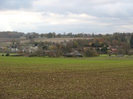
(1) The Street, Manuden |
(2) Field nr Maggots End |
(3) Fields approaching Peyton Hall |
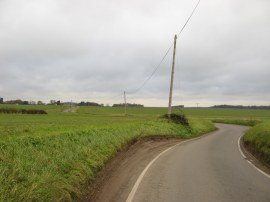
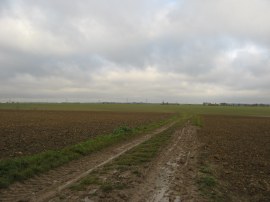
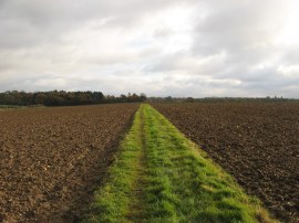
From my parking space I headed up the road, photo 1, before turning to the left along a footpath than runs past a small allotment and then alongside a field to reach a minor road, Sheepcote Lane. Here my route turned briefly to the left, then right along Butt Lane, following the road as it bends round towards some isolated houses. Reaching the first house I headed to the right along a footpath that runs between fields before heading across the middle of another field. This field, photo 2, had recently been ploughed and the surface was quite uneven to walk over, however the soil was dry enough not to stick to my boots in any great quantities. At the end of this field the footpath runs alongside a garden and goes down a few steps to reach a road. The route then continues across the road and up the driveway to another house before heading to the left across another wide open field. This time the mud did stick to my boots as the path heads under a couple of sets of electricity pylons, coming form the nearby electricity transformer station, towards Battle's Wood. The path then continues ahead alongside the trees before following the field edge round, photo 3, first to the right and then left. Leaving the field edge the route joins a short section track that leads to a road where my route headed to the left towards the buildings of Peyton Hall. Here the route bears to the left across a paddock before heading right along a field edge path. After heading alongside a couple of fields the route then joins a short section of driveway known as Sawpit Lane to reach a road in the hamlet of Little London where I headed to my right.
 |
 |
 |
(4) Fields nr Rickling Hall |
(5) Road nr Rickling Hall |
(6) Path nr Church End Farm |
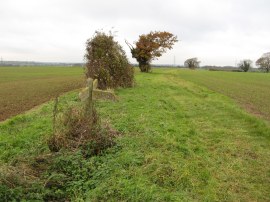
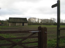
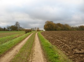
I followed this unnamed road down to its junction with another road. Crossing this the road the route continues ahead along an enclosed footpath running between fields. The route then crosses a wooden footbridge over what looked to me like a drainage ditch but was in fact the River Stort before continuing ahead along the right hand edge of a field, the path starting to head gently uphill. Just after the route has passed a band of trees on the right the footpath crosses over through the hedge into the neighbouring field. Reaching the end of this field the path crosses over a small wooden bridge at the end of the field before continuing along the left hand edge of another of the large open fields the characterise the area. The path soon reaches a gap in the hedge where it turns left before continuing along a broad green pathway running along the field edge. It is always so much more pleasant walking along field edges when a decent area has been left unploughed at the side of the field rather than the field being ploughed right up to the hedge line. Just before a weathered old oak tree is reached a concrete footpath sign, photo 4, heads the route to the right across the middle of the field. On the map there are two paths marked as heading across the field but only one of these was marked on the ground. Once over the field the path heads to the right for a short distance before heading to the left through a gap in the hedge. The route then continues across the middle of the next field, aiming for the right hand edge of a group of fir trees. Once at the trees the path joins a track which runs along the edge of the trees with the fine brick building of Rickling Hall away to the right. Leaving the track the route turns to the left along the driveway that leads away from the hall before. Once through the gates at the end of the drive I continued ahead along a lane, photo 5, as it winds its way between fields towards Rickling Church. Reaching the church I turned to the right along a driveway to Church End Farm. The route passes two attractive thatched cottages before heading to the left down a bridleway just before a large barn is reached. This bridleway soon leads out to a rather muddy farm track, photo 6, that continues straight ahead across more open fields.
 |
 |
 |
(7) St Margarets Church, Wicken Bonhunt |
(8) The start point of stage 14 |
(9) Byway from St Helens Chapel |
This bridleway soon leads out to a rather muddy farm track that continues straight ahead across more open fields. As I headed along the path I could make out the tower of the church in Newport and the tall steeple of the church in Saffron Walden away to my right. The route drops down slightly before heading gently uphill to cross the brow of the hill. The path follows a hedge as it bends to the left for a few yards before soon crossing into the field on the right. The route then heads the short distance down to the end of this field, following the field edge round to the right before turning left again. This path continues downhill towards a road, running along the edge of a field with a hedge to the right and a church visible ahead. Leaving the field the route heads down a track to reach the road opposite the rather garishly painted Coach and Horses pub in Wicken Bonhunt. I headed across the road to the church, photo 7, before heading down to the left behind the pub and left along the main road. Just before the end of the village I joined a footpath on the right that heads down besides a cottage before bending round to the right to join a path running along the edge of a field. The path follows the field edge before bearing to the left across another field to head back up towards the main road. This field contained the stickiest mud so far and my boots were covered in mud by the time I had crossed the short distance to the road. From the road I headed the few yards towards the motorway before joining the byway on the left that soon carried me round to the point where I had finished my previous walk along the Harcamlow Way a couple of days earlier, photo 8. Heading through the gate I headed down besides a small chapel building along the track that bends to the left over a stream before heading uphill over a small section of field to join another byway where the route heads to the right. St Helen's Chapel is of 11th to 12th century origin and was much repaired in the 13th century. The chapel was dissolved in 1543 and left to decay before being further restored in the early 20th century. The byway, photo 9, at first running between a narrow band of trees, is followed for one and half miles along a fairly straight course as it heads gently uphill before bending round to approach Church End Farm and Rickling Church.
 |
 |
 |
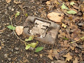
(10) Cats Eye Holder |
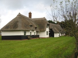
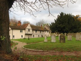
(11) Cottages by Church End Farm |
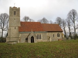
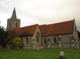
(12) Rickling Church |
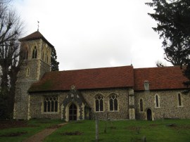
Fortunately the byway had a fairly solid surface, I think at one point it must have been surfaced with the remains of an old road as there were a number of old cats eyes, photo 10, lying around the path which definitely wasn't their original home. Reaching the farm I briefly rejoined the route I had walked on the way out from Manuden heading back past the attractive thatched cottages, photo 11, and along the driveway to Rickling Church, photo 12. I had also walked past the church as part of my stage 5 Harcamlow Way circular walk when the lawn in front of the church had been covered with Daffodils.
 |
 |
 |
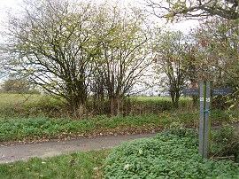
(13) Footpath nr Quendon |
(14) Path nr Rickling Hall |
(15) Brixton Lane |
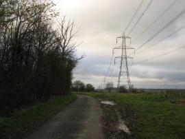
From the church I headed to the left and a short distance down the road I left my earlier route, turning to the left down a long footpath that runs along a straight course along a field edge with a hedge on the left in the direction of Quendon. Reaching the end of the field the route passes through the hedge and bears half right across the middle of the next field where fortunately the farmer had an unploughed strip of grass for the footpath to go across which is always appreciated, photo 13. Once over the field the route of the Harcamlow Way joins a farm track that continues ahead, heading downhill slightly before bending round to the right. The route continues along the track, running alongside some woodland on the left to head down to join a road. It was quite a cold day and everywhere was quite damp however I stopped for a quick sandwich break by the trees although I was unable to find a suitable log to sit on. Reaching the road the route heads to the right along Brick Kiln Lane down to a small group of houses before turning to the left along another field edge footpath, lined by a hedge on the right. The route continues ahead, almost to the buildings of Rickling Hall, before reaching a farmyard and turning to the left along a farm track that heads out into fields between large brown painted barns. This track, photo 14, heads gently uphill before the route bears to the left across a small field, passing a pond, before reaching the opposite field edge where the route continues ahead for a short distance before heading to the left along a short section of path between to fields to reach the trees of Catherine Grove. The path turns right by the grove, continuing along the field edge to join a small section of tree lined track that runs down to Brixton Lane where the Harcamlow Way heads to the right, running parallel to one of the sets of electricity pylons coming from Crabbs Green, photo 15. Whilst I didn't see any deer while I was out walking I did see their tracks numerous times in the muddy tracks I was walking along.
 |
 |
 |
(16) Track by Burney Wood |
(17) Approaching Manuden |
(18) The church of St Mary the Virgin, Manuden |
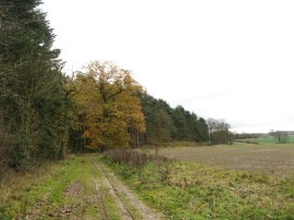
The route follows the road as it bends round to the left before joining a footpath on the left where the road bends sharply round to the right. The route then winds its way round the edge of the field with a hedge to the left. The wind, which was coming from the north, had been getting steadily stronger throughout the day. Luckily for most of the journey back to the car it was behind my back however it did make the temperatures feel considerably colder than they actual were. Reaching the end of the field the route joins a track that runs to the left of a small area of trees, Burney Wood. The route then follows this track as it heads through the woodland, under another set of the electricity pylons, and back out into fields, photo 16. Eventually this track reaches the tarmac driveway to Wades Hall where the route bears to the right. The route heads along the road, passing a large red brick house, before heading to the right along a bridleway where the road bends round to the left. The bridleway soon leaves the tree lined path to run alongside the edge of a field. Reaching the end of the long, long field the route passes through a hedge and bears briefly to the left before turning to the right across the middle of the next field. Once over the field the route heads downhill alongside the next field towards the village of Manuden, photo 17. Reaching the bottom of the hill the path heads around the side of a small bungalow before turning to the left along a road. The route follows the road round over a small bridge to join the main road in Manuden where the Harcamlow Way heads briefly to the left before turning right into the churchyard of St Mary the Virgin church, photo 18.
 |
 |
(19) Cottages by Manuden Church |
(20) The end point of stage 14 |
Lining the churchyard to the south were a number of attractive cottages, photo 19. The path heads uphill through the churchyard on a track that leads to a small byway. Crossing this the route continues ahead along a field edge path that heads up to Dogden Lane, photo 20, which is where I finished this stage of my walk along the Harcamlow Way. I then headed to the right along Dogden Lane before heading right down a minor road that led back into Manuden from where it was just a short walk along The Street to my parking place.
Reaching the car I had walked 15.9 miles in total of which 7.8 had been along the Harcamlow Way. The route today had been very rural, passing through almost no built up areas at all. A lot of the paths, both on my outward and return journeys today, had been very similar running alongside the edge of large open arable fields over the gently rolling Essex countryside. While very pleasant the best thing about this walk was that I walked almost 16 miles and was still back at home by half past three.
I have uploaded the route of the walk which can be accessed here Harcamlow Way 14 Route.
If you would like to comment on this walk you can do so here:
![]() Back to:Walk index page
Back to:Walk index page
| ©2012 Bertuchi.co.uk. Please contact me using the email button on the right if you have any questions or comments regarding the site. Any feedback and additional information about places of interest on the walks is always welcomed. All rights reserved. Please contact me if you want to use any of the images or information from the site. ENJOY YOUR WALKING |
|