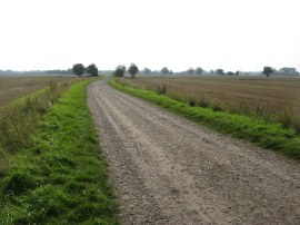
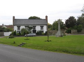
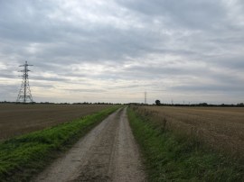
(1) The start of stage 10
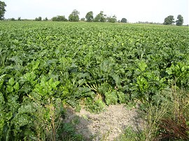
(2) Sugar Beet
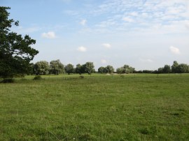
(3) Stow cum Quy Fen
Other Links >>> |
|
THE HARCAMLOW WAY - PART 10
Horningsea to Fulbourn
I did this walk on Sunday 5th September 2010; reaching Horningsea just after 9.00am where I was able to park at the spot I had finished the last stage of my walk along the Harcamlow Way. The day started reasonably bright but soon clouded over although there was a patch of blue sky which remained just to the north of where I was walking for most of the day; as usual it was also quite windy, this time the wind blowing from the East rather the than the WNW last week.
|
|
|
|
(1) The start of stage 10 |
(2) Sugar Beet |
(3) Stow cum Quy Fen |
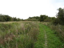
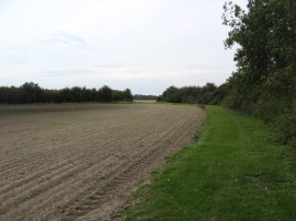
From the parking place besides the Clayhithe Road I set off along a farm track running between the open flat fields, photo 1, as the route starts winding its way towards the village of Lode. After about half a mile the route turns to the right down a field edge path, the field to the right being planted with sugar beet, photo 2, which is not a crop I have seen growing before. Reaching the end of the field by some electricity pylons the route turns half left along a broad hedge lined track that runs past Allicky Farm which was a hive of activity despite it being Sunday morning. A little further on the route heads to the left along another farm track before passing through a kissing gate on the left into Stow cum Quy Fen, photo 3.
 |
 |
 |
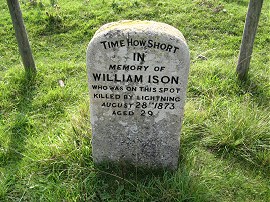
(4) William Ison Memorial |
(5) Quy Fen Sign |
(6) Lode Watermill |
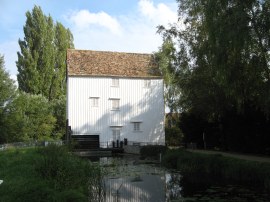
The route runs alongside the edge of the fen although I detoured slightly across the grassy meadow to see the small stone memorial to a William Ison, photo 4, who was killed by lightening at the spot in 1873. I was also rather intrigued by a sign on leaving the fen with its list of prohibited activities, photo 5. Leaving the fen the route heads to the right through a kissing gate over a small open patch of grass to run besides a pond before bearing left to join a farm track for a short distance. The route soon turns down Drove Lane, just past an old abandoned prefabricated hut. Reaching the end of the short green lane the route turns to the left along what used to be the course of an old railway but is now another farm track. On the map the route is shown as then going diagonally across the top of a small field on the right but in fact follows the field edge track before turning right onto a path at the start of the trees. This soon leads to a path on the left where the route rejoins the way as marked on the map. Leaving the trees it was just a short walk alongside the next field, with woodland to the right to reach Quy Water and Lode Watermill, photo 6.
 |
 |
 |
(7) Quy Water |
(8) Red Arrows |
(9) Path under the A14 |
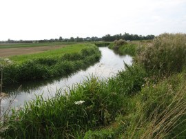
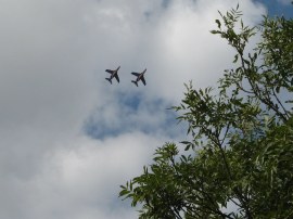
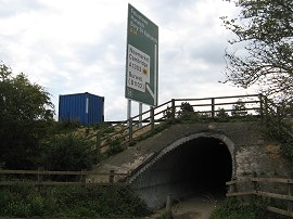
From the watermill the route follows the course of Quy Water as it heads upstream through a thin band of woodland, passing by the grounds of Anglesey Abbey although this remained quite hidden from view, before heading out into more open ground. The level of the stream was considerably higher than the surrounding fields and reminded me a bit of the New River Path as it wound its way through the countryside, photo 7. The Duxford Airshow was taking place and a number of planes flew over including the red arrows which grouped together within seconds of taking photo 8.The route follows the river bank for some distance down to Station Road on the outskirts of Stow cum Quy. Here the route turns to the left along the road crossing over the stream by a duck pond where there were a number of geese, ducks and couple of swans. The route soon leaves the road, joining a footpath on the right. This passes the side of a house, where a man was busy burning a bundle of paperwork on a rather smoky fire in the back garden, before heading out over a grassy field. Leaving the field the route passes through a small area of trees before turning to the left along a broad concrete track which seemed far to grand for its surroundings. Immediately at the end of this broad concrete track the route turns to the right along Orchard Street and after a few houses right again along a track that heads past some stables before bending round to the left to lead round to a field. This stage of the walk was accompanied by the continued drone of the traffic from the nearby A14 although generally the stretch of path from the start of the stage to Stow cum Quy had been one of the most pleasant parts of the entire walk so far. The route then heads across the middle of this field towards the buildings of Quy Mill Hotel. Leaving the field the path heads through a small area of scrubby trees to reach the hotel car park where the Harcamlow Way heads to the left to join the driveway to the hotel. This is followed for a short distance before the route turns to the right to take a tunnel that runs under the A14, photo 9.
 |
 |
 |
(10) Path alongside the Little Wilbraham River |
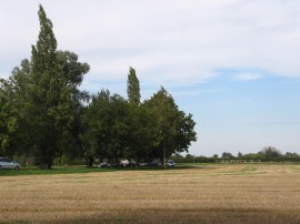
(11) Fields nr Hawk Mill Farm |
(12) S&B herba Food Mill, Fulbourn |
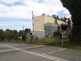
Once under the road a small section of track leads down to the A1303 where the route heads to the right before crossing the road to join a path that ran back alongside Quy Water. Most of the footpaths in this area were very well signposted and a new sign at the start of the path indicated it was three miles to the village of Fulbourn. At first the path was quite overgrown but gradually it became more open, photo 10, and just past the rather overgrown New Cut drain joins a broad grassy track, now running alongside the edge of the Little Wilbraham River. A fallen branch from a willow tree made an ideal spot for my first break of the day in very pleasant and tranquil surroundings. Reaching the buildings of Hawk Mill Farm the route turns to the right along a farm track before joining a field edge path on the left, photo 11. Reaching the end of the hedge the route heads diagonally to the right across the next field along a section of path that was covered in numerous small black caterpillars as well as quite a few ladybirds. Crossing a small ditch the route heads to the left along a farm track running alongside the New Cut drain. At a road the Harcamlow Way heads to the right before joining a footpath on the left just before a bend in the road is reached. This footpath heads across as short section of field towards a large factory which had been visible for some time. At the factory the route turns to the right alongside a tall mesh fence to head down to Station Road on the outskirts of Fulbourn. As I was approaching the factory a tiny one carriage train went past in front of me on the nearby railway lines however was out of sight before I could get my camera. At Station Road the route turns to the left passing the front of the factory to cross over the railway lines, besides where Fulbourn Station used to be, photo 12, before it closed in 1967.
 |
 |
 |
(13) The end point of stage 10 |
(14) Fulbourn |
(15) Teversham Road, Fulbourn |
The route continues down Station Road and at the junction with Church Road takes a footpath on the left that heads along a hedge lined path running between fields. The path had recently had a layer of bark chipping put down which made it pleasantly spongy to walk along. The path runs alongside the grounds of the Fulbourn Manor Estate and before bending round to the left where there is a kissing gate which leads into Fulbourn Fen, a SSSI which is managed by the wildlife Trust. The Harcamlow Way however continues ahead along a tree lined track to reach Stonebridge Lane. Here I turned to my left for a few yards, heading up to the end of the lane which is where I finished this stage of my walk along the Harcamlow Way, photo 13. Looking at my GPS I was very pleasantly surprised to see I had walked a further 9.81 miles along the path. I also noted there was a small parking area close to the end of the lane which meant I would be able to start the next stage where I had finished this one. After a short lunch break admiring the views I then set about my return trip to the car. Briefly retracing my steps, I then headed along the remainder of Stonebridge Lane to reach Manor Walk. Here I turned to my right heading towards the centre of Fulbourn. The road passes a small village green with a war memorial, photo 14, before running alongside the patchwork brick and stone wall surrounding Fulbourn Manor. Just past the entrance to the manor house I crossed over the road to head down the High Street before turning left along Pierce Lane. Reaching Cow Lane I then headed to the left for a short distance before turning to the right up the Teversham Road, photo 15, by the Bakers pub.
 |
 |
 |
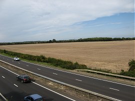
(16) Fields nr Teversham |
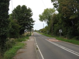
(17) Crossing over the A14 |
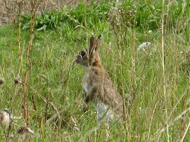
(18) Hare |
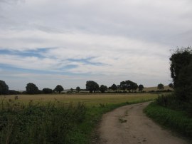
There then followed a long straight stretch of road walking and I was very pleased to see that there was pavement alongside the road. Crossing the railway lines the road become Fulbourn Road as it heads out over more open country to eventually reach Teversham. I followed the road through the village almost as far as its junction with Church Road before joining a track on the right which heads round the buildings of Hall farm and back out into open countryside. The track heads alongside a hedge lined drainage ditch with fields to the right, photo 16, the route gradually heading back in the direction of Quy Water before taking a footpath through the hedge that heads across the corner of a field to reach the A1303, only a short distance down from where I had crossed it on the Harcamlow Way earlier in the walk. Reaching the end of the field I had turned round to look back over the way I had walked and by pure chance I was able to see the Red Arrows performing their flight over Duxford on the horizon. I turned to the left along the A1303 for a short distance before heading to the right along High Ditch Road. Of all the roads I had to walk along as I made my way back from Fulbourn this was the only one that did not have a pavement to walk along. Fortunately this road was not too busy and I was soon turning to my right along the Low Fen Drove Way to cross a bridge over the A14, photo 17. The route then follows the drove way all the way to the Horningsea Road. There were a large number of drains lining the bridged and the metal covers for all of them had been taken and were now replaced by road cones which peeped up above the road surface. The tarmac soon ends and the track becomes an un-surfaced byway heading between fields. The byway passes a very isolated house which had numerous pens of Spaniels in the garden which all began barking as I went past; and I assume the house must belong to a dog breeder. A short distance past the house a field was being harvested and a hare, photo 18, was looking anxiously towards the combine harvester, more or less oblivious to my presence.
 |
 |
 |
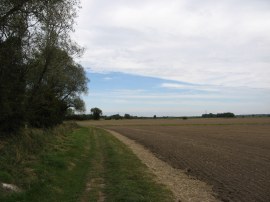
(19) The Low Fen Drove Way |
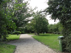
(20) Horningsea Cemetery |
(21) Approaching the car |
Eventually the byway, photo 19, reaches the Horningsea Road where I headed to my right and soon was at the point where I had joined the road, heading up from Bulls Bait Lock, on my last walk along the Harcamlow Way. It was then just a case of following the road back through Horningsea, passing the small cemetery where I had had a break last time, photo 20, back to my parking spot besides the Clayhithe Road, photo 21.
Back at the car I had walked 17.5 miles in total. This had been a far better walk than I had been expecting, passing through some pleasant bits of countryside and covering a good distance along the route.
I have uploaded the route of the walk which can be accessed here Harcamlow Way 10 Route.
If you would like to comment on this walk you can do so here:
![]() Back to:Walk index page
Back to:Walk index page
| ©2012 Bertuchi.co.uk. Please contact me using the email button on the right if you have any questions or comments regarding the site. Any feedback and additional information about places of interest on the walks is always welcomed. All rights reserved. Please contact me if you want to use any of the images or information from the site. ENJOY YOUR WALKING |
|