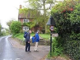
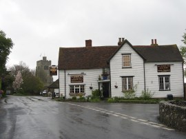
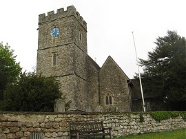
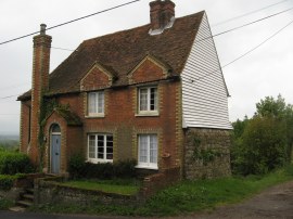
(1) Leaving Pluckley
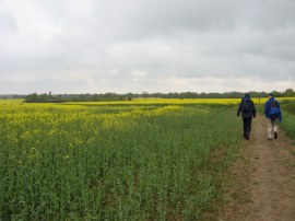
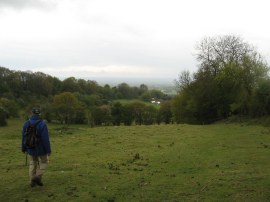
(2) Fields nr Pluckley
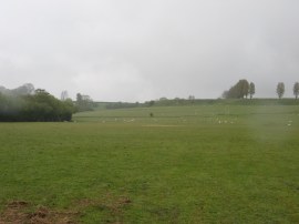
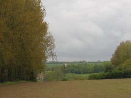
(3) Heading towards Greenhill Farm
Other Links >>> |
|
GREENSAND WAY - Part 2
Pluckley to Linton
Myself, Dave and Derek did this walk on Sunday 9th May 2010. Weatherwise it was a very disappointing day with intermittent drizzle and low grey cloud restricting the views from the top of the Greensand Ridge. Aside from that it was another good days walking and great to be making more progress along the trail.
|
|
|
|
(1) Leaving Pluckley |
(2) Fields nr Pluckley |
(3) Heading towards Greenhill Farm |
Rejoining the route of the Greensand Way we headed a few yards down the Smarden Road before joining a footpath on the right, photo 1. This path soon leads out into open countryside heading downhill over grass covered fields towards a field planted with rape, the yellow flowers providing a little bit of brightness in the gloomy weather, photo 2. The path then heads towards the Elvey Farm Guest House before turning to the right to climb back up the Greensand Ridge, photo 3, to the buildings of Greenhill Farm.
 |
 |
 |
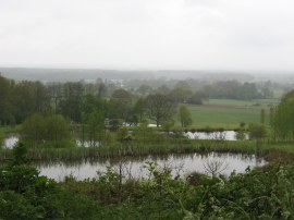
(4) View nr Stone Hill Lane |
(5) George Inn, Egerton |
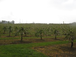
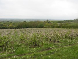
(6) Orchard nr Egerton |
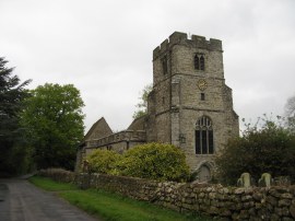
Here the route joins a short driveway which leads to the Greenhill Lane, the route heading across the road to the right to join another footpath running just below the top of the ridge. As the route approaches Stone Hill Road it passes above a number of ornamental ponds, photo 4, stretching down the hillside. At the road the Greensand Way head to the right before taking a footpath on the left that runs alongside a field edge path to join a road, Elm Close, in the village of Egerton. Reaching the main road through the village the route heads to the right, passing the George Inn, photo 5, before turning left into the churchyard of St James Church. Leaving the churchyard the route heads through an orchard where the trees were just beginning to come into bloom, photo 6, before continuing along the edge of another orchard to reach a track that runs besides Egerton House to Egerton House Road.
 |
 |
 |
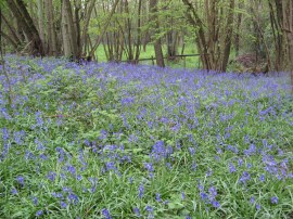
(7) Bluebells nr Coldbridge Wood |
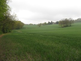
(8) Heading towards Boughton Malherbe |
(9) St Nicholas church, Boughton Malherbe |
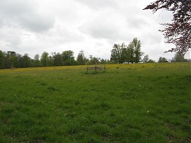
Here the route heads across the road running across a number of small fields close to Foxden Woods. The route passes through a small wooded area and crosses a small stream between a couple of the fields, the ground underneath the trees carpeted in bluebells, photo 7. The path then continues ahead alongside Coldbridge Wood before the route gradually swings to the right heading uphill across a field, photo 8. The path continues uphill, passing below Pope Hall Cottages and on alongside a number of fields and an area of rough ground being grazed by sheep before eventually reaching a lane by a small pond where the route continues ahead up to Church Road in Boughton Malherbe. Here the Greensand Way heads to the right along the road, passing St Nicholas church, photo 9. Where the road bends to the left the route continues ahead, turning first right, then left between some farm buildings before continuing ahead along a path running between fields. While it was pleasant enough to be winding our way along the Greensand Ridge there was little of specific interest to see, a fact probably not helped by the weather, and in the next hour and half I only took three or four photos.
 |
 |
 |
(10) Path from Windmill Hill |
(11) View towards Ulcombe |
(12) All Saints Church, Ulcombe |
The route soon crosses the Headcorn Road at Liverton Street, heading out to a slightly wooded area before heading alongside a small field to reach another area of orchards. The Greensand Way crosses Elmstone Hole Road before continuing ahead the short distance to Green Hill Lane. Crossing the road the route heads diagonally to the left passing through some trees and then across a field, close to the top of Green Hill where the route reaches a height of 160mtrs. Crossing yet another minor road the path heads along the side of a field to reach another road, Windmill Hill. Here we headed downhill to our left along the road, following the road as it bends sharply round to the left. A short distance further on the route joins a footpath on the right which also heads downhill across a field, photo 10, from where there would have been good views down across the weald if the weather had been brighter. The Greensand Way soon joins a footpath on the right that passes through a hedge to descend more gently to a side valley running down from the ridge. The path crosses the edge of one field, runs alongside the edge of the next field for a while from where photo 11 was taken looking towards Ulcombe. The path the crosses into a neighbouring field to head down to an area of scrubby ground where there was the remains of an old pond before heading uphill to reach the road at Ulcombe Hill. Here the route continues ahead along a farm track however we headed the short distance up to All Saints Church, photo 12, where we stopped for our lunch break. In the churchyard there are a couple of extremely large yew trees believed to be at least 1,000 years old, one of which can just be seen in the corner of photo 12.
 |
 |
 |
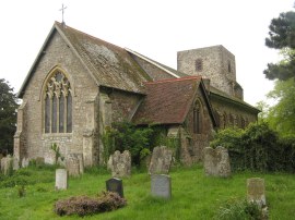
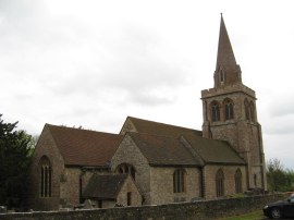
(13) St. Peter and St. Paul's Church, East Sutton |
(14) Asparagus |
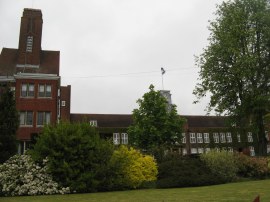
(15) Sutton Valance School |
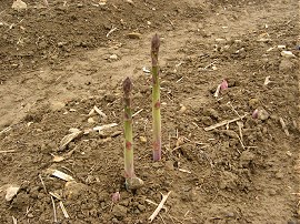
After lunch we continued along the path that heads past a parking area out along a track the takes a fairly straight course, running alongside fields and orchards to Morry Lane. Here the route turns to the left, heading down hill, before joining a footpath on the right that heads over to Charlton Lane. This was an area that I knew very well from when I was younger and I had a friend who had lived just down the road at Parsonage Farm. Crossing the lane the route heads along Church Lane in East Sutton, passing by the entrance and grounds of East Sutton Park Prison and then St. Peter and St. Paul's Church, photo 13. Reaching the end of the lane the greensand way continues ahead, crossing a couple of fields that were planted with Asparagus, photo 14, which looked ripe and ready to eat. After the first small field the route heading diagonally to the left to join East Sutton Road. The route then continues along the road before bearing to the left along a footpath that runs past some allotments and the bottom of a playing field to join the unsurfaced School Lane which runs between the buildings of Sutton Valance School, photo 15, to reach the A274 in Sutton Valence. Again another very familiar area as I went to the school for four years.
 |
 |
 |
(16) St Michael's Church, Chart Sutton |
(17) Cottage, Chart Hill |
(18) Orchards nr Chart Sutton |
The route heads uphill along the main road for a short distance before joining a footpath on the left by an old garage which soon leads out to a track running between fields to reach yet another church, St Michael's, in Chart Sutton, photo 16. Heading besides the churchyard the route turns left into Church Road and then right into Chart Road which is followed to its junction with Chart Hill Road. Here the route continues ahead, past the cottage in photo 17 and the buildings of Ladds Farm along a track that runs alongside orchards with good views down to the left over the weald of Kent. The route runs alongside orchards for a short distance, photo 18, before turning briefly left then right between the trees to reach a set of stone steps that carry the path steeply uphill through an area of trees at the field edge. Reaching the top of the steps the path follows the field edge round to the left before continuing ahead along a track to East Hall Hill. Turning to the right the route follows the field edge for a short distance before joining the road.
 |
 |
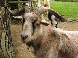 |
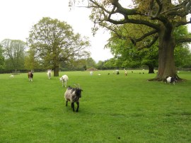
(19) Buttercups Sanctuary for Goats |
(20) Buttercups Sanctuary for Goats |
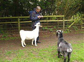
(21) Buttercups Sanctuary for Goats |
The route heads up the road, continuing ahead past the junction with Wierton Hill before joining a path on the left. This was an unexpected highlight of the day as we found ourselves walking through the Buttercups Sanctuary for Goats at Wierton, photo 19. All the goats were clearly well cared for and were also very sociable and inquisitive, photo 20, heading over to us as we crossed through the paddock. More details of the goat sanctuary can be found here: Buttercups Sanctuary for Goats.
 |
 |
 |
(22) Linton Park |
(23) Linton Park |
(24) Linton Church |
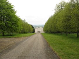
Leaving the goats the route crosses over a driveway and along a tree lined section of path where once again we saw a few bluebells. The route then crosses the top of a couple of small fields with a hedge to the right before heading over the middle of another field to reach Church Lane in Boughton Monchelsea. Here the route heads down to the left before joining a footpath on the right. The church itself was just a little further down the road and was advertising afternoon teas however we were nearing the end of the walk so decided to press ahead. The path heads alongside some more fields and orchards to Loddington Lane. Here the route continues ahead along a track lined with a metal fence running alongside the grounds of Linton Park, photo 22. The path crosses the driveway to the building Linton Park, photo 23, before heading across more of the park grounds to reach Linton Church, photo 24, and the large car park alongside which is where we finished this stage of our walk along the Greensand Way.
The GPS made this walk 14.3 miles long.
In better weather this would have been a very scenic walk with the spring flowers and the wide reaching views from the Greensand Ridge however the low cloud rather put a dampner on things.I have uploaded the route of the walk which can be accessed here Greensand Way 2 Route (pt1).and here Greensand Way 2 Route (pt2). For some reason the walk got split into two tracks while we stopped for lunch at Ulcombe.
If you would like to comment on this walk you can do so here:
![]() Back to:Walk index page
Back to:Walk index page
| ©2012 Bertuchi.co.uk. Please contact me using the email button on the right if you have any questions or comments regarding the site. Any feedback and additional information about places of interest on the walks is always welcomed. All rights reserved. Please contact me if you want to use any of the images or information from the site. ENJOY YOUR WALKING |
|