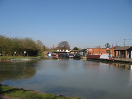
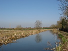
(1) The start of the Northampton Arm
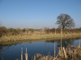
(2) Gayton Marina
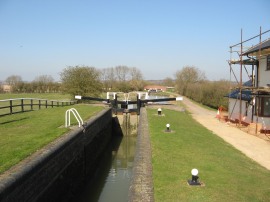
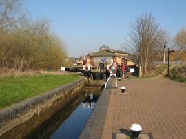
(3) Rothersthorpe Top Lock
Other Links >>> |
|
GRAND UNION CANAL - Part 12
The Northampton Arm - Gayton Junction to Northampton
I did this walk on Wednesday 29th March 2012, after having walked up the main route of the Grand Union Canal from Wolverton. As can be seen from the photo's it was a bright sunny day, warm with hardly any breeze. The Northampton Arm of the Grand Union canal was opened in 1815 and runs for 4 3/4 miles from Gayton Junction to the centre of Northampton where the canal connects with the River Nene.
|
|
|
|
(1) The start of the Northampton Arm |
(2) Gayton Marina |
(3) Rothersthorpe Top Lock |
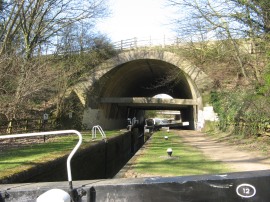
From the junction with the main arm of the canal, photo 1, the route heads along a minor road for a short distance before joining the canal itself by bridge two. The canal then starts to curve it way round the large area of moorings at Gayton Marina, photo 2. There are 17 locks on the Northampton Arm of the canal and most of these are encountered in the Rothersthorpe flight of 13 locks, close to the start of the canal and I was soon passing by lock 1, the Rothersthorpe Top Lock, photo 3. Yet again there were more warnings about the water shortages and restricted opening hours for the locks with certain locks being chained shut from 3:00pm.
 |
 |
 |
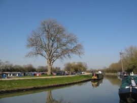
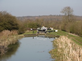
(4) Looking down the Rothersthorpe flight |
(5) Reeds besides the canal |
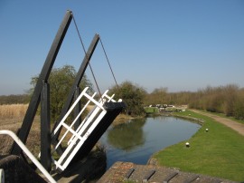
(6) Swing Bridge, 5 |
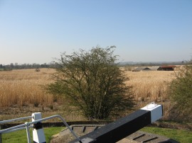
There were expansive views from the towpath across the surrounding countryside as the canal heads towards Northampton and the Nene Valley. Away to the left, besides locks 3 and 4 was a big area of reed beds stretching away of into the distance, photo 5. As well as noise from the nearby A43, which the canal runs parallel with for some distance I was also heading towards the M1 motorway which was also producing a considerable amount of traffic noise. One feature of this stretch of canal was a number of swing bridges, photo 6, that crossed the canal. These were the type that pivoted up rather than turning round alongside the canal bank when not in use.
 |
 |
 |
(7) The M1 road bridge, 6b |
(8) Canal nr the M1 |
(9) View across to the lift tower |
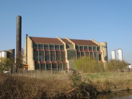
A mile and half down the Northampton Arm the towpath reaches lock 12 and bridge 6b which carries the motorway over the canal, photo 7. The route then continues with the main road still running a field away and a large area of warehousing one field away to the left of the canal, photo 8. A little further on a large area of building work for a new housing estate was taking place immediately besides the towpath, close to lock number 14. The towpath then heads by an area of fairly new housing, separated from the canal by a thin strip of parkland before passing under bridge 9a as the route gradually bends round to the right to make its way in towards the centre of Northampton. Ahead of me I could see a tall concrete chimney rising up over the surrounding landscape, photo 9, something I had originally spotted from back on the main arm of the canal. This building turned out to be far more interesting than I had realised and is actually the National Lift Tower. The 418 foot tall structure was built as a lift testing tower, opening in 1982, and is the only such tower in the UK, and one of only two in Europe. The tower is 47 feet in diameter at the base and tapers to 27.9 ft at the top. The only lift testing tower in Britain, it was granted Grade II listed building status on 30 October 1997, which at the time made it the youngest listed building in the UK.
 |
 |
 |
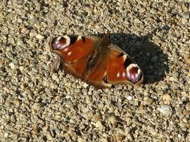
(10) Peacock Butterfly |
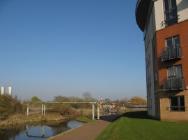
(11) Approaching Northampton |
(12) Approaching Cotton End Lock |
The route passes under a new green painted footbridge, which will soon connect the towpath with the Upton Country Park, before passing under the low concrete bridge which carries the A5076 over the canal. A broad surfaced section of path then continues ahead, past lock 15, where I stopped for a short snack break in the warm afternoon sunshine. This warm spring weather had brought out a lot butterflies, including a number of Peacocks, photo 10. A much more level section of canal follows as it heads along the valley of the river Nene with the buildings of Northampton visible away to the left, photo 11. Shortly after passing the four mile marker for the canal the route passes lock 16 and heads under bridge 15 which carries the mainline rail services, which I would soon be using, out of Northampton, the towpath running alongside a brick wall besides an industrial estate. Next up comes a disused rail bridge as the path heads by an area of rough ground with some shops off to the left. Passing under bridge 17 the route then heads besides an area of new housing, photo 12, for the final quarter of a mile down to Cotton End Lock.
 |
 |
 |
(13) Carlsberg Brewery |
(14) Cotton End Lock |
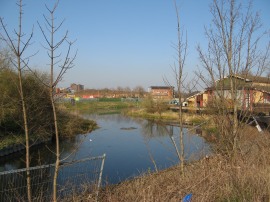
(15) View down to the River Nene |
Away to the left of the canal was the tall buildings of the Carlsberg Brewery, photo 13. Reaching the lock, photo 14, the GPS said 18 miles which made it a 4.9 mile walk from Gayton Junction. I continued on for a few yards past the lock to look down at the waters of the river Nene, photo 15, before turning round and making my way over to Northampton Station for the train back to Wolverton.
The train was already in the platform when I arrived so I only had the shortest of waits for the journey back, having walked a total distance of 19 miles for the day. Along with my earlier walk from Wolverton to Gayton Junction this had been one of the most enjoyable walks I had done for some time, mainly due to the fantastic weather and helped by the attractive rural scenery along the main arm of the canal. I did however develop a large blister on the sole of my right foot. Blisters are something I only very rarely suffer from and for the last few miles this had been quite painful as there was no way I could avoid walking on it. Fortunately it soon cleared up. The blister was caused by not having my boot laced up tightly enough, something which at the time had been deliberate. Like my last walk along the Grand Union canal from Leighton Buzzard, I had had a slight twinge from the top of foot when I set off walking and I had loosened the laces to relief the pressure on this to avoid the issues I had on that walk. I hope that I have now got the laces right, I walked 31 miles over the following weekend with no problems at all.
As usual I have uploaded the route of the walk which can be accessed here: Grand Canal Stages 11 and 12 Route.
If you would like to comment on this walk you can do so here:
![]() Back to:Walk index page
Back to:Walk index page
| ©2012 Bertuchi.co.uk. Please contact me using the email button on the right if you have any questions or comments regarding the site. Any feedback and additional information about places of interest on the walks is always welcomed. All rights reserved. Please contact me if you want to use any of the images or information from the site. ENJOY YOUR WALKING |
|