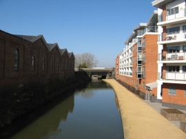
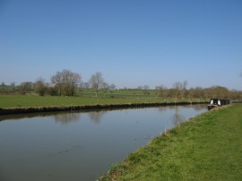
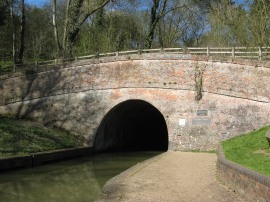
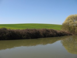
(1) View from Bates Bridge
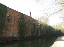
(2) Old rail buildings, Wolverton
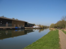
(3) Galleons Wharf
Other Links >>> |
|
GRAND UNION CANAL - Part 11
Wolverton to Gayton Junction
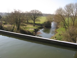
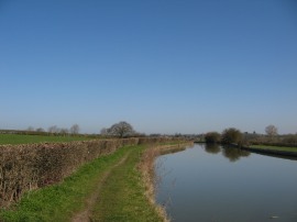
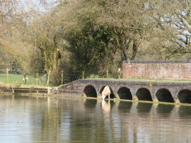
I did this walk on Wednesday 29th March 2012. A combination of some of the hottest March weather ever and a week without meetings meant it seemed like a very good idea to take a rare midweek day off work and get some walking done in the spring sunshine. I had a very slow trip up to Wolverton in the car and taking the train would have probably been a much better option for this walk. Thus it was about quarter past ten when I was finally parked up in a small car park just off the Newport Road from where it was a 0.42 mile walk back to rejoin the Grand Union Canal at the spot by Bates Bridge, photo 1, where I had finished the last stage back in February.
|
|
|
|
(1) View from Bates Bridge |
(2) Old rail buildings, Wolverton |
(3) Galleons Wharf |
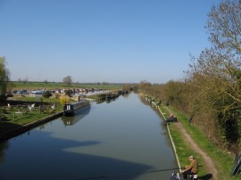
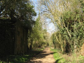
I didn't actually get to see much of Wolverton itself as the canal makes its way through the town, passing the large buildings of the old railway yards away to the left, photo 2, and with a very thick hedge obscuring most of the views off to the right. Just after passing under bridge 69 there was another of the small metal mileage markers that are counting down the distance to Braunston, this one showing that I now only had 28 miles left to go. Passing under bridge 68 the canal heads by Galleons Wharf, photo 3, and then joins a fairly long straight section of canal with the church tower in Cosgrove visible ahead as the route starts heading out into open countryside.
 |
 |
 |
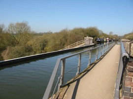
(4) Cosgrove "Iron Trunk" Aqueduct |
(5) River Ouse |
(6) The Grove Bridge |
Here the towpath is running along an embankment, some distance above the surrounding countryside which leads up to the Cosgrove "Iron Trunk" Aqueduct, photo 4. This embankment was built to carry the canal across the river Ouse, photo 5, the current aqueduct which was opened in 1811 replacing an earlier aqueduct that collapsed and an older series of locks. The crossing of the River Ouse marks the lowest point between the Tring and Braunston summits. It really was an absolutely glorious day for the end of March, the temperatures already approaching 20c with not one single cloud in the sky and only the merest of breezes gently rippling the surface of the canal. The canal was lined with canal boats and also a large number of fisherman, photo 6, as the canal heads up to Cosgrove Lock where the now disused Buckingham Arm of the canal headed off to the left.
 |
 |
 |
(7) Cosgrove Lock |
(8) Bridge 65 |
(9) Fields nr Cosgrove |
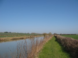
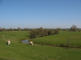
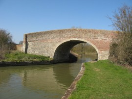
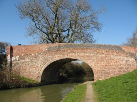
From the Cosgrove Lock, photo 7, the towpath heads on to reach the attractive stone bridge number 65, photo 8, which was more reminiscent of one of the bridges over the upper reaches of the Thames than the normal canal bridge. Here the route crossed over to the opposite bank before making its way out alongside fields with wide open views over the surrounding Northamptonshire countryside, photo 9.
 |
 |
 |
(10) Towpath by Thrupp Wharf |
(11) Grand Union Canal, Northamptonshire |
(12) Flush Bracket 647 |
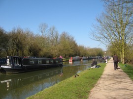
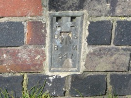
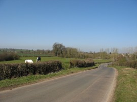
At newly built, and considerably less attractive bridge 64 the route crosses back over to the other bank of the canal again by the Navigation Inn and heads by Thrupp Wharf, where for a while the canal bank was once again lined by fisherman, photo 10. These were a sociable bunch and I got a steady stream of hello's and good morning as I went by. This was quite a remote section of the canal, photo 11 and bridge 63, besides a large waterfront house, was the first sign of habitation that I had passed for some considerable time. Heading under bridge 60 the route passes Yardley Wharf and the Kingfisher Marina. For a while the route runs close to the A 508, the noise from the traffic slightly disturbing the peace and tranquillity of the canal. Also as I was walking along the stretch of path a flight of 13 swans came flying across the canal, forming a very impressive sight against the clear blue sky, with their wings whirring through the air. On bridge 58, nr Grafton Regis, I spotted an Ordnance Survey trig point bracket, BM 648 attached to the end of the bridge, and then trig point bracket 647 at Bridge 57, photo 12.
 |
 |
 |
(13) Sheep having a drink |
(14) Sheep and a heron |
(15) Old Mill building, Apsley |
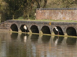
A little further on, away to the left across a field I could see the tower of the church in Grafton Regis, which had been a landmark visible from the towpath for quite some time. Just before the 23 miles to Braunston marker the towpath passes over a slightly raised section of arches which act as an overflow channel for the canal. Looking out of one of these arches was a sheep having a drink, photo 13, and as I was watching a heron then appeared out from under one of the other arches, photo 14, which made an amusing sight which I just about caught on camera. At this point the canal was now primarily running through an area of pasture, being grazed by sheep and their young lambs, photo 15, the fairly open views from the canal bank making for some very pleasant walking.
 |
 |
 |
(16) Grand Union Canal, Northamptonshire |
(17) Bridge 56 |
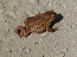
(18) Common Toad |
Heading under bridge 56, photo 16, the route passes over another of the overflow channels from the canal situated by mileage maker 22, as the route heads on through the flat Northamptonshire countryside, photo 17. For a while the towpath then continues ahead with the small river Tove, running besides it to the right. Just before reaching Stoke Bruerne the towpath crosses over the river and heads past some moorings up to Stoke Bruerne locks where the towpath crosses banks at the bottom of the locks. As I was approaching these locks I spotted a large toad on the towpath, photo 18, at least I think it is a toad rather than a frog given the colouring.
 |
 |
 |
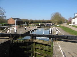
(19) Stoke Bruerne locks |
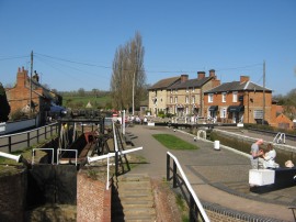
(20) Stoke Bruerne |
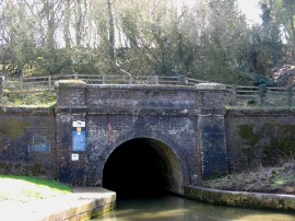
(21) Blisworth Tunnel, Southern portal |
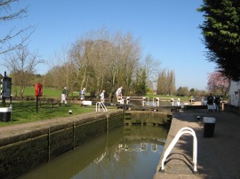
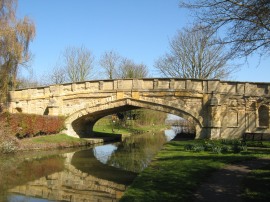
After almost eight miles of walking in which I had passed only one lock the Stoke Bruerne flight, photo 19, comprises of seven locks which raises the canal a total of 17 meters. At the locks there were more signs warning of the current water restrictions on the canal, a situation that won't have been helped by the current bout of warm weather. A notice stating that locks 16 - 20 of the flight were only open between 10:00am and 3:00pm each day in effort to conserve water. Between the locks the A508 Northampton Road crosses over the canal, the rather dull utilitarian bridge brightened up slightly by a number of mosaics by local school children placed on either side of the canal. At the top of the flight the route crosses banks at bridge 53 where there is an attractive set of houses and waterside pubs, photo 20, and also the Stoke Bruerne Canal museum. A short distance further up the canal from Stoke Bruerne I reached the southern portal of the Blisworth Tunnel, photo 21. At 3,076 yards long it is the third-longest navigable canal tunnel on the UK canal network and at its deepest point it is 143 feet below ground level.
 |
 |
 |
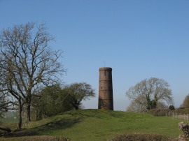
(22) Path leading from the tunnel |
(23) Tunnel Ventilation Shaft |
(24) Stoke Road, nr Blisworth |
Besides the tunnel entrance was part of the circular concrete lining of the tunnel from when the tunnel was refurbished in 1984 which gave a good idea of the diameter of the tunnel. There was also a small blacksmiths besides the tunnel entrance, housed in what used to be the old tug boat shed. Here the towpath has to leave the canal, heading along a broad tree lined track running above the tunnel. At one point this track passes between a couple of brick abutments, photo 22, which I guess once must have been the supporting structure for an old railway bridge. This track leads up to Stoke Road which follows a fairly straight course over the top of Blisworth Hill with the occasional ventilation shaft, photo 23, marking the course of the canal. This road, photo 24, is followed for just under one and half miles before the route reaches a car park from where a path on the left leads back down to the canal by the Northern entrance to the tunnel.
 |
 |
 |
(25) Blisworth Tunnel, Northern portal |
(26) Now only 18 miles to go |
(27) Blisworth Mill |
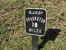
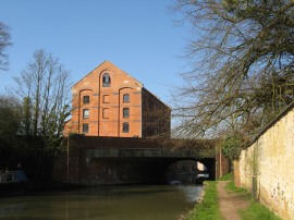
Back on the towpath I stopped for my lunch break, sitting on a low wall besides the canal. Due warm and sunny weather I also had to put some suntan cream on my neck and arms as they were starting to feel a little bit warm, probably a first for March. From the Northern tunnel entrance, photo 25, the canal continues on along a tree lined cutting towards the village of Blisworth where there was another of the marker counting down the mileage to Braunston, photo 26. Here the route heads under bridge 51 and past the old Blisworth Mill, photo 27, now converted into housing.
 |
 |
 |
(28) Candle Bridge |
(29) Canal nr Blisworth |
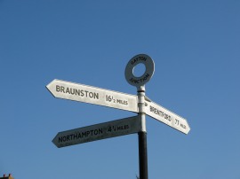
(30) Signpost at Gayton Junction |
The towpath then runs alongside a small area of new housing in the village before heading back out into the countryside once again. Leaving the village the route heads under bridge 50 which I known as candle bridge, photo 28, as a candle seller used to live nearby, selling candles to boatmen about to pass through the tunnel. Once again there were good views out over the surrounding countryside, photo 29. Approaching Blisworth Junction the canal heads under bridge 48b which carries some rail lines across the canal and then heads gently round to the left, continuing on to bridge 48a which carries the rather noisy a A43 over the canal. The towpath then heads alongside Blisworth Marina and up to bridge 48 where Northampton Arm of the Grand Union Canal branches off to the right at Gayton Junction where a metal sign, photo 30, showed I was now 77 miles from Brentford.
 |
 |
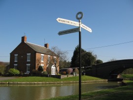
(31) Gayton Junction |
(32) Start of the Northampton Arm |
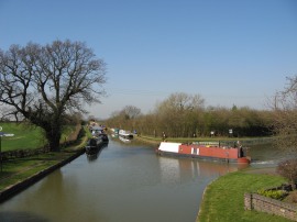
Reaching Gayton Junction I had walked a further 12.7 miles along the main arm of the canal from Wolverton. I then crossed over the bridge and began my walk along the Northampton Arm of the canal, photo 32.
As usual I have uploaded the route of the walk which can be accessed here: Grand Canal Stages 11 and 12 Route.
This had been one of the most enjoyable walks I had done for some time, mainly due to the fantastic weather and helped by the attractive rural scenery along the main arm of the canal.
If you would like to comment on this walk you can do so here:
![]() Back to:Walk index page
Back to:Walk index page
| ©2012 Bertuchi.co.uk. Please contact me using the email button on the right if you have any questions or comments regarding the site. Any feedback and additional information about places of interest on the walks is always welcomed. All rights reserved. Please contact me if you want to use any of the images or information from the site. ENJOY YOUR WALKING |
|