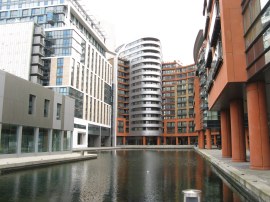
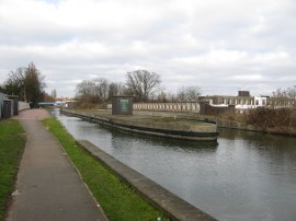
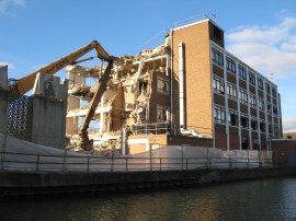
(1) New building surrounding the end of Paddington Basin
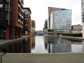
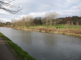
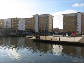
(2) View from the end of Paddington Basin
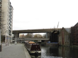
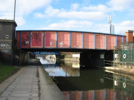
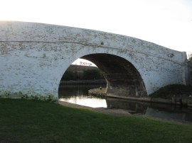
(3) Approaching the Westway
Other Links >>> |
|
GRAND UNION CANAL - Part 1
The Paddington Arm
I did this walk on Sunday 30th January 2011. The walk along the Paddington Arm of the Grand Union Canal was the first ever walk I wrote about on this website which I did back on a very hot summers day in June 2005. That time I had walked along the canal into London from Hayes and it has always been my intention to walk the full length of the path at some point. While my main walk in 2011 is going to be the Thames path I am walking this with a friend and in anticipation that there might be dates we both cannot make leaving me with the odd free day I thought now would be an ideal time to make a start on the canal path as an alternative. It seemed even better to walk the section I had already done on a grey January day, although as can be seen from the photos it did brighten up considerably as the day progressed.
|
|
|
|
(1) New building surrounding the end of Paddington Basin |
(2) View from the end of Paddington Basin |
(3) Approaching the Westway |
From Paddington Station I made my way along London Street and down South Wharf Road to access the far end of Paddington Basin where I started my walk along the Grand Union Canal Path. The far end of the basin was surrounded by a large number of new buildings, photo 1, both private housing and what seemed like parts of St Mary's Hospital. Last time I had walked the Paddington Arm of the Grand Union Canal, photo 2, I had not been able to access this part of the basin to the then ongoing construction works and it was nice to be able to access the very waters end this time around. Following the basin around, I crossed over a white metal footbridge over the water to the other side of the basin before passing under the Bishops Bridge Road. (The footbridge was actually closed for maintenance works at the time although I couldn't see any work taking place and access was only obstructed by very small plastic barriers). I then continued along the basin, past the large shiny housing and office developments, before heading under the Westway, photo 3, to reach the basin at Little Venice where the Regents Canal joins the Grand Union Canal.
 |
 |
 |
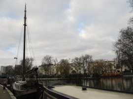
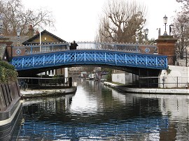
(4) Little Venice |
(5) Leaving Little Venice |
(6) The towpath in Westbourne Green |
From Little Venice, photo 4, the towpath heads under the brightly painted bridge, photo 5, that carries Westbourne Road over the canal as it sets off on its journey towards Bulls Bridge. From here the canal bank is followed down through Westbourne Green, where the route passes under Harrow Road then curves round, photo 6, to briefly run underneath the rather noisy Westway. Just before the Westway is reached the towpath passes some artists studios located in a building besides the canal where there was all manner of interesting artefacts visible through the windows.
 |
 |
 |
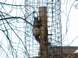
(7) Squirrel Feeder? |
(8) Houses lining the Harrow Road |
(9) View back to Kensal Green Gasworks |
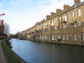
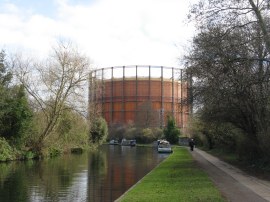
Continuing ahead the route passes the 322ft tall Trellick Tower where some efforts had been made to landscape the gardens alongside the riverbank. There were a number of bird feeders attached to the trees although they also had attracted other visitors despite the barriers erected to keep them out, photo 7. As often happens when writing up my walks I have just spent the last half hour completely side tracked, this time reading about the Trelllick Tower. Whilst I can understand it as an architectural concept how anyone could have ever imagined it would make ideal living conditions is beyond me. Back on the path the canal heads towards Kensal Green, the towpath running parallel with the Harrow Road for a few yards to head by an older brick built terrace although the buildings were very liberally adorned with an array very modern satellite dishes. Near Kensal Green the route heads over a couple of old entrances to canal side basins and the last of these gave good views into the Kensal Green Cemetery which runs along the other side of the canal bank for some distance. This area was very popular with joggers and just before the gasometer at Kensal Green, photo 9, I saw my first fishermen on the bank. Throughout the walk I was also passed by a large number of cyclists, almost none of which bothered to use a bell when coming up behind me. I have no problem with sharing the path with cyclists but it would be useful to know of their impending arrival.
 |
 |
 |
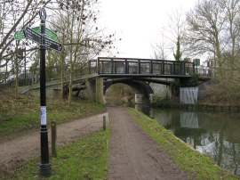
(10) Mitre Bridge |
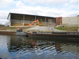
(11) Old Oak Wharf |
(12) Acton Electric Substation |
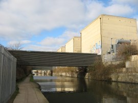
There then follows a comparatively straight stretch of canal with rail lines that run into Paddington on the left behind a wall and the grounds of Kensal Green Cemetery and St Mary's Roman Catholic cemetery away to the right. Passing under the Mitre Bridge, photo 10, which carries Scrubbs Lane over the canal, the towpath reaches an area where the canal bank is lined by a series of industrial units and a small nature reserve alongside the Old Oak rail sidings. The path also passes the Old Oak Wharf, photo 11, which was opened in 2006 to try and stimulate a canal freight revival. As the towpath makes its way out of London the points of interest alongside the canal diminish although one thing I noticed which I hadn't last time I walked the path was evidence of people sleeping in sheltered areas along the canal bank under concrete bridges and alcoves alongside the towpath. There was also a fair amount of litter, particularly empty beer cans, and few surfaces seemed to have escaped unmarked by graffiti in this area. Heading into Harlesden the canal heads under Old Oak Lane and just before Acton Lane is reached passed a large electrical sub station on the north bank, photo 12
 |
 |
 |
(13) View towards Wembley Stadium |
(14) North Circular Aqueduct |
(15) Coconut on the Grand Union Canal |
Continuing on towards Park Royal the canal runs alongside a number of different industrial estates including a large Royal Mail building on what was clearly a fairly newly built estate. Reaching the end of this building I got my first glimpse of Wembley Stadium away to the right, photo 13, although it comes much more clearly into view a little further down the path. Since Kensal Green I had been passing a number of mileage signs that were occasionally placed besides the path and the distances stated on some of these was a bit erratic; at one point the distance towards Greenford increasing by half a mile despite me walking at least half a mile towards Greenford along the towpath from the first sign. A short distance further on the canal reaches its aqueduct over the busy A406 North Circular Road, photo 14, before continuing on towards Alperton. As ever there were a considerable number of coconuts floating on the canal surface which are always a feature of this part of the walk, photo 15.
 |
 |
 |
(16) New canalside housing in Alperton |
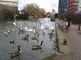
(17) Feeding the birds |
(18) View towards Horsenden Hill |
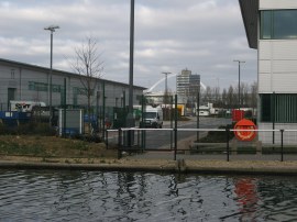
As along all the urban canals in London redevelopment is continuing at a rapid pace and approaching the centre of Alperton the towpath headed by another area of new housing and a soon to be opened footbridge, photo 16, across the canal. A little further on the canal passes a Sainsbury's where a couple of Asian ladies where feeding copious amounts of bread and grain to an ever growing flock of birds that assembled around them, photo 17. Continuing ahead the route then passed under a road bridge where a sign said it was seven miles to Bulls Bridge so this marks roughly the halfway point of the walk along the Paddington Arm of the Grand Union Canal. Leaving Alperton the canal towpath heads alongside an area of boat mooring's with Alperton Cemetery on the right and residential housing to the left before reaching the extensive grounds of Sudbury Golf Course with Horsenden Hill rising away to the right, photo 18.
 |
 |
 |
(19) Ballot Box Bridge |
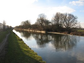
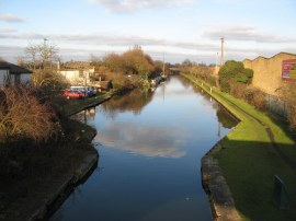
(20) Grand Union Canal, nr Greenford |
(21) Dawoodi Bohra Mosque |
At Ballot Box Bridge, photo 19, the Grand Union Canal path links up with the route of the Capital Ring where there was the first proper metal sign post that I had seen for the Grand Union Canal path, the sign indicating it was now 5 ¾ miles to Bulls Bridge. The path surroundings have now become slightly greener as the path heads towards Greenford, passing the small Perivale Wood and after about half a mile, Paradise Fields Wetlands where the Capital Ring heads off to the left. A short distance further on the route crosses under the Greenford Road, the first major road that has crossed the canal for some distance, and reaches the outskirts of Greenford. As well as entering another industrial area, this point also marks the point where the canal bank path first started to deteriorate and become muddy, the route up to this point having either been tarmac or compacted clay. Reaching bridge 16 over the canal by the Dawoodi Bohra Mosque, photo 21, the route links up with that of the Dog Rose Ramble for a couple of miles.
 |
 |
 |
(22) Abandoned Factory nr Northolt |
(23) Grand Union Village, Northolt |
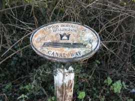
(24) London Borough Boundary Marker |
The route heads under the rather noisy A40 road with the canal curving its way round the edge of Northolt, the mosaics under the bridge in need of a very good clean. When I had walked the Dog Rose Ramble at the end of October 2010 I had commented on an abandoned factory building nr Northolt and how no doubt it was likely to be soon turned to housing and sure enough, just a couple of months later the building has almost been completely demolished, photo 22. A little further on the towpath passes the Grand Union Village, photo 23, gives an idea of what the factory buildings will be replaced with. For a while the canal runs alongside the boundary between the boroughs of Ealing and Hillingdon, the point the boundaries cross the path marked by a couple of small metal plaques, photo 24.
 |
 |
 |
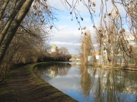
(25) Grand Union Canal, nr Southall |
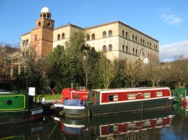
(26) Bulls Bridge |
(27) Grand Union Canal from Bulls Bridge |
The route then makes its way down to Southall, passing through areas of residential housing interspersed with the occasional playing field and parks, photo 25. Just past the Uxbridge Road was another area which seemed popular for feeding birds and still further on, as the canal bends round to the right, another large and exceptionally shiny gold dome of a temple was visible away to the right on the other side of some playing fields. Eventually, as the canal bends round under one final set of railway lines, Bulls Bridge came into view crossing over the canal in the distance. Due to the low winter sun being almost directly behind the bridge, photo 26, it proved almost impossible to get a decent photo to mark the end point of my walk along the Paddington Arm of the Grand Union Canal. Photo 27 was taken from the top of the bridge looking back down the way I had just walked.
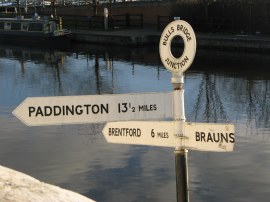 |
(28) Mileage Post, Bulls Bridge |
On the other side of the bridge was a mileage signpost, photo 28, which points the way ahead although the sign to Braunston was broken and no longer shows the distance.
Reaching Bulls Bridge I had walked 13.7 miles from the end of Paddington Basin. I then turned to my right and headed the short distance up the canal into the centre of Hayes where I left the towpath, just passed the Nestles factory, to take the train back home from Hayes and Harlington station.
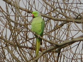
During the walk I had seen a large number of different birds, a few of which are shown below.
 |
 |
 |
(29) Ring Necked Parakeet |
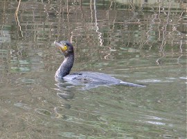
(30) Cormorant |
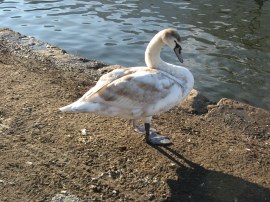
(31) Swan Cygnet |
As usual I have uploaded the route of the walk which can be accessed here: Grand Canal Stage 1 Route.
This has been any easy walk and one I was glad to get completed, the Paddington Arm of the path being the only major stretch of the Grand Union Canal that I have walked previously.
If you would like to comment on this walk you can do so here:
![]() Back to:Main index page
Back to:Main index page
| ©2012 Bertuchi.co.uk. Please contact me using the email button on the right if you have any questions or comments regarding the site. Any feedback and additional information about places of interest on the walks is always welcomed. All rights reserved. Please contact me if you want to use any of the images or information from the site. ENJOY YOUR WALKING |
|