The Green Chain Walk
Other Links >>> |
|
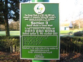
THE GREEN CHAIN WALK - PART 3
Bostall Heath to Oxleas Meadows
|
|
The Green Chain Walk |
Stage three of the Green Chain Walk starts from the small car park on Longleigh Lane and I walked this stage immediately after completing stage 2 on Sunday 9th January 2011.
 |
 |
 |
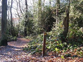
(1) The start of Section 3 |
(2) Bostall Woods |
(3) East Wickham Open Space |
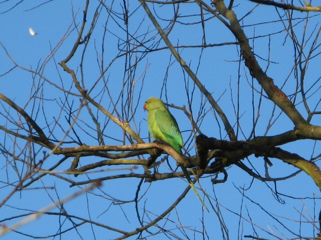
Crossing the lane for the car park the route joins a footpath that bears to the left and heads downhill through the trees of Bostall Woods, photo 2; my progress through the woods accompanied by the noisy squawking of Parakeets. Leaving the trees the route joins a surfaced track on the left that runs along the edge of Plumstead Cemetery although this remains largely hidden from view behind a brick wall. Reaching the end of Cemetery Road the route turns briefly to the left along Wickham Lane before turning to the right, heading up along Highbanks Close to reach the East Wickham Open Space. Initially the route follows a narrow tarmac path running through the open space up until a finger post where the Green Chain Walk heads to the right across the grass, photo 3, to join a broad path running between two narrow bands of trees that heads across the centre of the park. After all the recent gloomy weather it was so unbelievably pleasant to be out walking on such a bright sunny day without a single cloud in the bright blue sky and excellent visibility all around.
 |
 |
 |
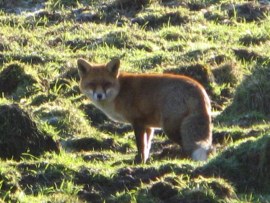
(4) Fox |
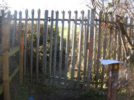
(6) Locked Gate Woodlands Farm |
Leaving the park the route once again heads briefly to the left along Glenmore Road before turning right down Dryden Road. Continuing ahead over Edison Grove the Green Chain Walk heads past the suburban semi detached houses before joining a narrow footpath running between scrubby trees and a rather overgrown paddock which is reached at the end of the road. There were a few horse grazing in the paddock and as I was walking along I spotted another fox, photo 4, sunning itself nearby as well as more parakeets in the trees, photo 5. Reaching the end of this section of footpath I was confronted by a tall, locked metal gate, photo 6, where the route passes into the grounds of Woodlands Farm. A notice lying on the ground stated that the gate was locked due to vandalism and threats to the farm staff and suggested an alternative route round to the other side of the farm property on the A207 Bellegrove Road, that involved retracing my steps back to Dryden Road and then heading up Keats Road. Woodlands Farm covers approximately 89 acres and is run by a charitable trust. It is an educational Farm managed under the Natural England Higher Level Countryside Stewardship Scheme and was formed in 1997 after planned road and hosusing developments that had threatened the site of the original farm were withdrawn.
 |
 |
 |
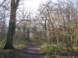
(7) Oxleas Woods |
(8) Oxleas Woods |
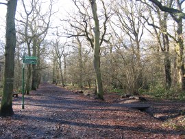
(9) Oxleas Meadows |
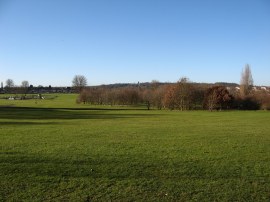
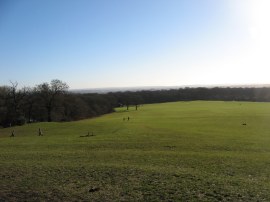
When I had last walked this section of the Green Chain Walk, some five or six years earlier, there had been no such problems with access and once through the gate the original route of the Green Chain Walk continues alongside the edge of hedge which gradually bends around to the left along the bottom of a large grassy field. Reaching a kissing gate the route headed to the right for a short distance before turning to the left through a wooden five bar gate to join a short section of path that heads over an area of scrubby ground to join the A207, Bellegrove road, close to a petrol station with a handy convenience store, ideal for anyone who has discovered they have left there water bottle at home! The revised route had joined the main road a short distance earlier and re-united with the original route of the path, the Green Chain Walk heads to up the busy main road for the a short distance further to the point where Bellegrove Road become Shooters Hill. Here the route heads to the left to join a footpath that starts running through the trees of Oxleas Woods, photo 7. The rather muddy path then winds its way through the trees, much like many of the paths I had walked on earlier in section two when heading through Lesnes Abbey and Bostall Woods. Not too far through the trees the route reaches a finger post which marks the point where the stage 6 of the Green Chain Walk continues off ahead while stage three heads off to the right, photo 8. This spot also marks the point where the Green Chain Walk links up with the route of the Capital Ring. Following stage 3 as it heads uphill to the right through the trees the path makes its way to an open space, close to the top of hill at Oxleas Meadows from where there very good views across South London and on into Kent, photo 9.
 |
 |
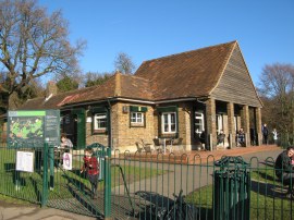
(10) Cafe, Oxleas Meadows |
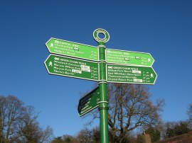
(11) Green Chain Walk Finger Post |
A short distance further on, past an impressive selction of outdoor gym equipment, there is a café, photo 10 which marks the end of stage three of the Green Chain Walk. At this point my GPS said I had walked a total of 6.83 miles for the day which makes stage three 2.85 miles long from the start point by Longleigh Lane. This hilltop spot by Oxleas Meadows also marks, photo 11, the end points of one of the arms of stage four and also stage five of the Green Chain Walk which runs up from the Thames Barrier so this is a place I will be passing several more times on my trip around the Green Chain Walk.
Having finished stage three I then set off to the start point of stage four. This begins a couple of miles away in Charlton Park and the easiest way to get there on foot was to walk along the route of stage five, all be it in the "wrong" direction.
I have uploaded the route of the walk which can be accessed here Green Chain Walk Section 3 Route.
If you would like to comment on this walk you can do so here:
![]() Back to:Walk Index Page
Back to:Walk Index Page
| ©2012 Bertuchi.co.uk. Please contact me using the email button on the right if you have any questions or comments regarding the site. Any feedback and additional information about places of interest on the walks is always welcomed. All rights reserved. Please contact me if you want to use any of the images or information from the site. ENJOY YOUR WALKING |
|