The Green Chain Walk
Other Links >>> |
|
THE GREEN CHAIN WALK - PART 1
Thamesmead to Lesnes Abbey
|
|
The Green Chain Walk |
I did this walk on Friday 31st December 2010, walking the first stage of the Green Chain Walk as the final part of a longer walk across London that I had started in Stratford; making my way to Thamesmead via the Woolwich Ferry.
 |
 |
 |
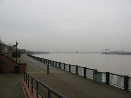
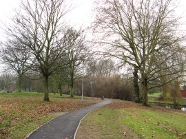
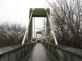
(1) The start of stage 1 |
(2) Green Chain Walk, Thamesmead |
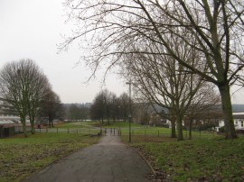
(3) Path leading to Crossways Park |
From the river front promenade in Thamesmead, photo 1, the route heads inland along a narrow stretch of parkland, passing underneath Crossway Road before turning to the left to join a short section of path running alongside an ornamental watercourse, photo 2. Thamesmead is a group of disparate mainly social housing developments built from the late 1960s onwards and one of the then radical ideas of the GLC division architect Robert Rig was taken from housing complexes in Sweden, where it was believed that lakes and canals helped to lower levels of crime and vandalism, mainly among the young. This led to the use of water in the estate as a calming influence on the residents. The route soon heads to the right, crossing a bridge over the water and continuing ahead for a short distance before turning to the left to cross a small wooden footbridge over another narrow stretch of rather stagnant water. Since I had last walked here some five or six years ago the route has been meticulously signposted with no danger at all of losing the path as it threads its way through the houses of Thamesmead. The route continues ahead along Curlew Close and then bears left into Garganey Walk crossing over yet another stretch of water, photo 3, which the route follows off to the right, passing under the Crossway Road again to reach a larger open space of Crossways Park.
 |
 |
 |
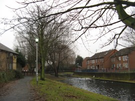
(4) Crossways Park |
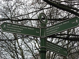
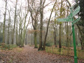
(5) Sign marking the split in the route |
(6) Southmere Park via the Underpass |
The path heads through the park, photo 4, along a newly laid tarmac path alongside the water course with a play area to the left. Just before the path reaches the A2016 Eastern Road the route of the Green Chain Walk splits into two, heading both to the left and right, as it makes its way to Southmere Park, photo 5. The left hand route to the park is half a mile and passes under the Eastern Road while the right hand route is slightly longer and takes a footbridge over the road. For the life of me I can't see why there needs to be two alternative routes at this point however I walked both of them anyway. Initially I walked the left hand path which heads through an area of scrubby trees running close to the road. This is followed round to the ground of Thamesmead Town FC where the route heads to the right to pass under the A2016 through a rather litter and graffiti ridden area, photo 6.
 |
 |
 |
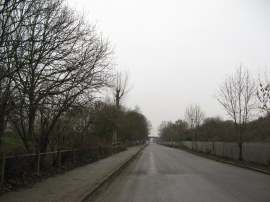
(7) Belvedere Road, Thamesmead |
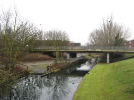
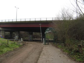
(8) Southmere Park via the Footbridge |
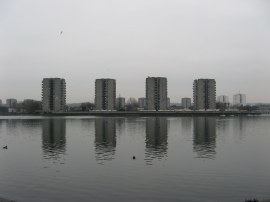
(9) Southmere Lake, Thamesmead |
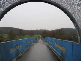
The path then bears right, heading uphill to the right as the path crosses over the Southern outfall sewer which itself forms a path known as the Ridgeway from where there were views over Erith Marshes. Heading down the other side the Green Chain Walk continues to the right along Belvedere Road, photo 7, to Southmere Lake where the two strands of the path link back up again. Having done this I then retraced my steps back to Crossways Park and then walked the other side of the two loops route to Southmere. This path continues ahead alongside the water course to the dual carriage way, following the end of the park around to the right before heading up some steps to reach a concrete footbridge, photo 8, that crosses over the Eastern Road at its junction with Carlyle Road. Once over the main road the route also crosses the Ridgeway path and descends down some more steps to reach Belvedere Road. This time I headed to the left along the road for a short distance before taking a concrete path on the right that runs down to the waters edge, photo 9. The lake was still frozen in a number of places despite the recent much milder weather and the ice was covered with an array of objects that had been thrown out on it, including a vacuum cleaner.
 |
 |
 |
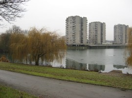
(10) Path besides Southmere |
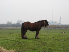
(11) View over Erith Marshes |
(12) Path through Thamesmead |
The route heads to the left along the waters edge, skirting round the edge of the lakeside pub, before rejoining the waters edge where there was a large flock of ducks, geese and swans on the water including a particularly large number of coots. The route then follows the lake side round to the right along a tarmac path, linking up with the alternative underpass route of the path that had taken from Crossness Park as the route heads through alongside a pleasant stretch of parkland towards the ever growing concrete buildings of the Thamesmead Estate, photo 10. Away to my right I could see the large wave like roofs of the Crossness Sewage Treatment Works buildings across the Erith Marshes, photo 11. Reaching the end of the water the route follows the tarmac path as it curves round to the right before heading to the left and up a small hill to join a broad section of open space running between the housing estates. Here the route heads across a footbridge over Yarnton Way before continuing ahead along the open space, photo 12.
 |
 |
 |
(13) Walkway leading to Lesnes Abbey |
(14) Green Chain Mural |
(15) Lesnes Abbey |
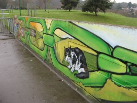
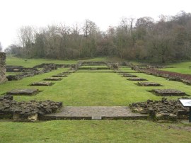
The path then reaches another, much longer footbridge, photo 13, which crosses over some railway lines. The aerial walkway then continues ahead over a patch of open space and up over another road to enter into the grounds of Lesnes Abbey. The final section of this walk way had been painted with a brightly covered green chain mural, photo 14. Lesnes Abbey, photo 15, was founded by Richard de Luci, Chief Justiciar of England, in 1178. It never became a large community, and was closed by Cardinal Wolsey in 1525 and the buildings pulled down.
 |
(16) The end of stage 1 |
Passing the remains of the former abbey buildings the route continues ahead through the abbey grounds, heading gently uphill into Lesnes Abbey Woods where after a few yards I reached the end of this stage of the walk at the point where the route joins up with the route of stage 2 of the Green Chain Walk which starts besides the river Thames in Erith.
The GPS made this stage 2.6 miles in length although having walked there and back along the left hand path between Crossness Park and Southmere Lake I had walked 3.6 miles in total.
Turning around it was then just over half a miles walk back to Abbey Wood station where I started my journey home, having walked a total distance for the day of 14.7 miles from my initial start point in Stratford.
I have uploaded the route of the walk which can be accessed here Green Chain Walk Section 1 Route.
If you would like to comment on this walk you can do so here:
![]() Back to:Main walk index page
Back to:Main walk index page
| ©2012 Bertuchi.co.uk. Please contact me using the email button on the right if you have any questions or comments regarding the site. Any feedback and additional information about places of interest on the walks is always welcomed. All rights reserved. Please contact me if you want to use any of the images or information from the site. ENJOY YOUR WALKING |
|