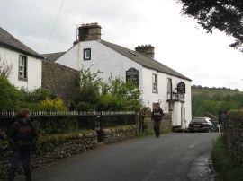
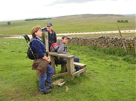
(1) Crown and Mitre, Bampton Grange
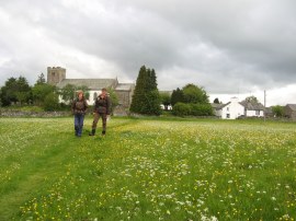
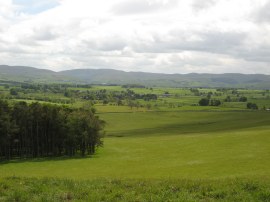
(2) Meadow leaving Bampton Grange
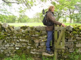
(3) A rather narrow kissing gate
Other Links >>> |
|
COAST TO COAST PATH - Day 6
Bampton Grange to Orton
|
|
|
|
(1) Crown and Mitre, Bampton Grange |
(2) Meadow leaving Bampton Grange |
(3) A rather narrow kissing gate |
Another easy day and for once a totally dry one. We set off from the Crown and Mitre in Bampton Grange,photo 1, and retraced our steps the mile and half back to Rosgill Bridge, heading across the meadows, photo 2, and through a couple of very tight kissing gates, photo 3, before joining the lane that led back to the river where we resumed our walk along the Coast to Coast path.
 |
 |
 |
(4) View back to Rosgill Bridge |
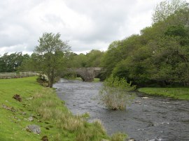
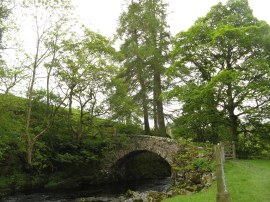
(5) Bridge over Swindale Beck |
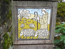
(6) An attractive waymark post |
From the bridge we sent off along a grassy path, initially running close to the river, photo 4. Now we were out of the lakes the walking was much more level as we headed across a number of fields being grazed by sheep as we steadily made our way towards Shap. The path crosses Swindale Beck over a narrow old stone bridge, photo 5, and heads round to reach the remains of Shap Abbey which marks the boundary of the Lake District National Park. At a number of places besides the path during this walk we saw some attractive tiles set into wooden posts, photo 6, although I have been unable to find out what these relate to.
 |
 |
 |
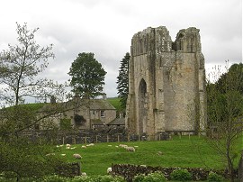
(7) Shap Abbey |
(8) View back to the Lakes |
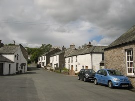
(9) Shap |
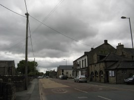
Shap Abbey was built in 1199 and was founded by the Premonstratensian order and was dissolved by Henry VIII in 1540. From the abbey, photo 7, the route crosses the River Lowther and then heads uphill along a farm tack and then a field edge path running alongside a road to reach Shap. Looking behind, back the way we had come, the Lakeland fells were gradually growing smaller although the triangular shaped summit of Kidsty Pike was still clearly visible on the horizon, photo 8. The route heads down the main A6 road, photo 9, which runs through the village although since the M6 motorway was opened the road has only been used by local traffic and was very quiet for an A road. Sara brought some supplies in the Co-op and despite having only having walked just over four miles we stopped for a coffee in a small cafe we passed. As we were heading up to Shap I was able to get a mobile phone signal for the first time for several days and made a few quick calls home.
 |
 |
 |
(10) Crossing the M6 |
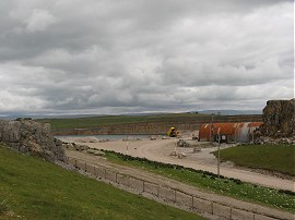
(11) Cement works nr Shap |
(12) Pony and foal |
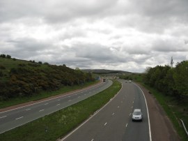
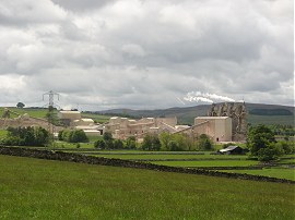
Leaving Shap the Coast to Coast route heads along a path that crosses over the west coast railway lines and continues on to cross a footbridge over the M6 motorway, photo 10, which was a landmark of sorts. We were now entering limestone country and to the right of the path was a large cement plant, photo 11, which processes limestone from a large nearby quarry. The path runs roughly parallel with the motorway for a short distance before heading away to the left, crossing over a minor road and making it way over towards the Hardendale Quarry.
 |
 |
 |
(13) A quick stop by the quarry |
(14) Hardendale Quarry |
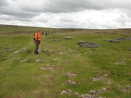
(15) Path across the fells |
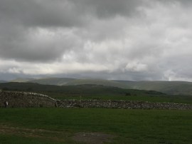
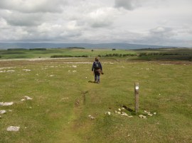
Approaching the quarry we stopped for a short break by an isolated stile, photo 13, before continuing on to carefully cross over the quarry, photo 14, access road. For most of the remainder of the day our route headed over open moorland being grazed by sheep and their lambs. We had been expecting the ground to be quite damp and boggy, especially after all the recent rain, but instead it was surprisingly dry underfoot with only a minimal number of small boggy areas to be negotiated. While the lakes were receding from view ahead, across the Eden Valley we could see the Pennines stretching to the north and to the south of us the more rounded Howgill Fells, an area I really would like to explore one day. It was easy walking across the moors, photo 15, the route of the path clearly visible on the ground and occasionally marked by small wooden poles. Now the path is out of the Lake District there is much more signage present for the route although it is by no means way marked.
 |
 |
 |
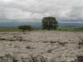
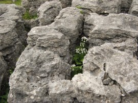
(16) Limestone pavement |
(17) Limestone pavement |
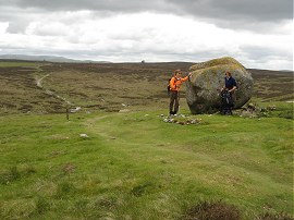
(18) Granite boulder on the fells |
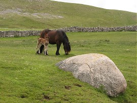
On the fells we passed a number of areas of limestone pavement, photo 16, which provided protection for various plants to grow, photo 17. There were also a large number of granite boulders which had been left on the surface by a retreating glaciers including one particularly large example over six feet high, photo 18.
 |
 |
 |
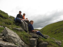
(19) Lunch Stop |
(20) Path approaching Gilts Lane |
(21) View towards Orton |
Crossing Crosby Ravensworth fell we stopped for a leisurely lunch break on some rocks besides a narrow gully near Kings Well, photo 19. It was so nice not to wear waterproofs or have the rain cover over the rucksack and not have to keep the camera inside a plastic bag which made everything so much easier and the walls of the gully provided a bit of shleter from the breeze. After luch we continued on across the fells, photo 20. Crossing Gilts Lane the route heads to the south across an area of fell between two roads. Reaching the junction of these two roads we crossed over a cattle grid and joined a bridleway, close to the edge of Orton Scar, which headed downhill, photo 21, past Broadfell Farm and along the edge of meadows to the village of Orton, which is situated in the Lune Valley.
 |
 |
(22) Orton |
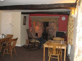
(23) Our accommodation for the night |
In Orton, photo 22, we visited the small chocolate factory at Kennedys Fine Chocolates and stopped for another drinks break in the cafe there. There was a well stocked gift shop at the chocolate factory and I saw a couple of really nice mugs I would have liked to have brought although unfortunately I had nowhere to put them and imgined them soon getting broken. From the factory we then headed out of the village over fields and then up Street Lane to our overnight accommodation at the very pleasantly located Scar Side Farm, photo 23.
We were having our luggage transported by Packhorse and their minivan passed us just before we reached the farm house. The luggage deliveries follow the route from St Bees so the further down the path you get the later the bags arrive, the next day at Kirkby Stephen we arrived before our bags did. Reaching the farm we had walked 13.9 miles for the day. Although we had been out for about seven and half hours under five of these had been spent walking; a very leisurely day.
There was another couple staying at the farm house who were also walking the Coast to Coast Path who had started a day later than us but caught up by walking the Rosthwaite to Patterdale stretch in one go rather than breaking the stage in Grasmere as we had done. Not only had they stayed in the same room at Low Cock How that Val and Chris had done they had also met up with Ralph and co in Shap the previous evening. Apparently they had wasted an hour heading up High Street before they had realised there error and returned to the correct route. It was nice to hear that they had got back on track and had made it into Shap and hopefully had a better days walk today.
As usual I have uploaded the route of the walk which can be accessed here: Coast to Coast Path Day 6.
If you would like to comment on this walk you can do so here:
![]() Back to:Walk index page
Back to:Walk index page
| ©2012 Bertuchi.co.uk. Please contact me using the email button on the right if you have any questions or comments regarding the site. Any feedback and additional information about places of interest on the walks is always welcomed. All rights reserved. Please contact me if you want to use any of the images or information from the site. ENJOY YOUR WALKING |
|