Chiltern Way
Other Links >>> |
|
CHILTERN WAY - Part 8
Little Hampden to Cow Roast Lock
|
|
Chiltern Way |
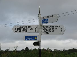
I did this walk on Sunday 2nd September 2012, I had intended to park at the car park on Cobblershill Lane however when I got there it was shut with a chain across the entrance so I drove over to Little Hampden where there is a small parking area opposite what used to be the Rising Sun pub, although this is now closed.
 |
 |
 |
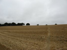
(1) Little Hampden |
(2) Forestry Vehicle |
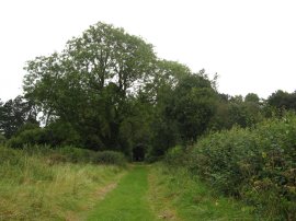
(3) Cockshoots Wood |
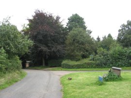
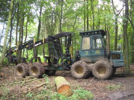
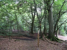
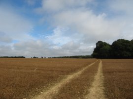
From my parking spot it was then just a short walk down the road to rejoin the Chiltern Way, photo 1. The route leaves the road on the left, heading through a patch of woodland where there was some forestry work taking place, photo 2. The path heads gently downhill through the trees. From the tree the path crossing a small valley, heading down alongside one field before climbing back uphill alongside a second field towards the trees of Hampdenleaf Wood. After heading up through this band of trees the path bears to the right across a paddock to join a driveway that leads down to cross over Cobblershill Lane. Once over the lane a track is followed a short distance up to Cockshoots Wood, photo 3, where the Chiltern Way heads to the left, leaving the route of the South Bucks Way which I had been following since Little Hampden.
 |
 |
 |
(4) Path leading from Cockshoots Wood |
(5) Crossing the rail lines |
(6) Sheep by Mayortorne Manor |
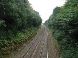
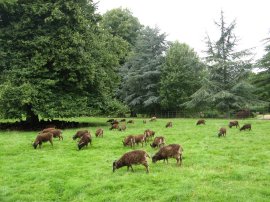
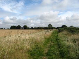
The path winds its way through the woodland, ending up on a sunken lane which was bridged by a recently fallen tree. This leads out onto a broad grass covered farm track, photo 4, running between fields which is followed down to a track that crosses over some railway lines, photo 5. Here the path continues ahead into the grounds of Mayortorne Manor where there was a large flock of small brown sheep grazing in the parkland surrounding the house, photo 6.
 |
 |
 |
(7) Poster against the HS2 rail link |
(8) Field leading up to Kings Lane |
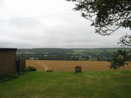
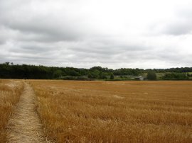
(9) View back to Cockshoots Wood |
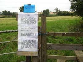
The path heads across the parkland to reach the A413 road where the Chiltern Way heads briefly to the left before turning to the right up Bowood Lane. Reaching a T junction by a house the route continues ahead over a field, heading up to the driveway leading to Durham Farm. This is almost directly on the route of the proposed High Speed 2 rail link between London and Birmingham and in the surrounding area there were a large number of signs, photo 7, and posters campaigning against the development. The route crosses two rather rickety stiles either side of the driveway and continues ahead through a run down area besides the farm at one of the very few points of the walk where I had to stop and consult my map to determine where the path headed. The footpath takes a more or less straight route from the second stile up to a gate which leads into a field that was being grazed by cows. The footpath continues straight ahead up across this field before crossing another stile and bearing half left uphill across an arable field, photo 8, as the footpath heads up towards a white painted house on top of the hill. Here the path heads through the small garden besides the house to Kings Lane from where there were very good views looking back, photo 9, over the area I had recently walked.
 |
 |
 |
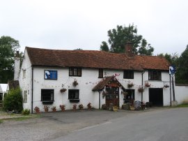
(10) Old Swan at Swan Bottom |
(11) Field Beans |
(12) Path leading to Oak Lane |
The route then heads across the road and continues ahead over two fields. At the boundary between these two fields the Chiltern Way crosses over the route of the Chiltern Link path which runs between Wendover and Chesham. At the end of the second field the route heads through a hedge before turning to the left along a path running besides some very run down and partially collapsed bands. This stretch of path soon leads down to the road in Lee Gate besides the Gate Inn pub although this is now also closed. The route heads to the right along the road before soon heading to the left at Furze Field Lane to join a footpath that makes its way over a couple of fields towards Swan Bottom where the Old Swan pub looked very tempting, photo 10. Here the Chiltern Way crosses the road by the pub and joins a field edge path with houses to the left. This path then heads sharp left, following a broad strip of grass separated from the fields on the right by an electric fence. This leads down to a small patch of woodland which the route heads through before bearing to the left across the middle of a large open field, photo 11. This had been planted with a crop of field beans, the dark black plants providing a stark contrast to the green of the surrounding trees and hedges. This heads up to Arrewig Lane where the route heads briefly right before joining another footpath running across a field. In the middle of this field was a small group of trees enclosing a little pond. The path then heads through a small patch of woodland, Lady Grove wood, before crossing another field to join a broad green track running between fields, photo 12.
 |
 |
 |
(13) Signpost at Jenkins Lane |
(14) Drayton Wood |
(15) Approaching Shrubb's Wood |
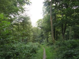
This green lane leads on to a driveway and then reaches a minor road, Oak Lane, where I headed to the left, following the road to a T junction, photo 13, where the route heads to the left along Jenkins Lane. The road is followed up to the White Lion pub where the route heads to the right alongside the pub car park to cross a small field up to Bottom Road. The route crosses this and then heads over another small field before heading to the left along Little Twye Road. Where this road bends to the right I joined a footpath on the left that headed diagonally across another field planted with Linseed. The footpath crosses over a track leading to Bucklandwood farm and continues on along a field edge path to Drayton Wood, photo 14. Here the path heads through the trees to Shire Lane. Crossing this, the footpath continues through a small area of trees before bearing to the left to join a tree lined path running between fields. The path crosses a byway and heads over a section of open field before entering into the edge of Shrubb's Wood, photo 15. As with most the fields in the area the wheat had been harvested leaving only the short stubble behind.
 |
 |
 |
(16) Beech trees in Wick Wood |
(17) Approaching Wiggington |
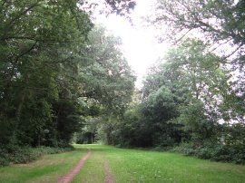
(18) Lower Wood |
The path then runs along the edge of the wood, following the course of Grim's Ditch with the actual ditch and raised earthwork for once clearly visible (although my attempts at a photo failed!). Grim's Ditch is a series of linear earthwork in the Chilterns and pottery shards have been unearthed in excavations during the 1970s and '80s suggesting its origin may have been during the Iron Age and this section is one of the larger sites. The path crosses over Kiln Road and heads by the small Wick Wood, photo 16, where there were stands of tall Beech trees before joining a tree lined footpath running between trees, still following the course of Grim's Ditch. Eventually the trees finish as the path follows the field edge, photo 16, down to Chesham Road on the outskirts of Wiggington. I headed across the road, joining a path that heads down past some trees and then a tennis court and house to reach the road at Wiggington Bottom. I had originally intended finishing my walk here however I was till feeling fit and thus decided to push on a bit further along the path. The Chiltern Way heads to the right along Wiggington Bottom for a short distance before joining a footpath on the right that curves down around the edge of a couple of fields to reach Lower Wood, photo 18, where the path then begins heading more steeply downhill through the trees.
 |
 |
 |
(19) Approaching the A41 |
(20) Chiltern Way signpost |
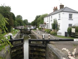
(21) Cow Roast Lock |
At a T junction the route heads to the right, soon leaving the trees to cross a large paddock being grazed by horses, one of which seemed intent on following me rather too closely. The path then heads across another field, photo 19, to join a concrete track running alongside the A41. This is followed down to Crawley's Lane where the route heads to the left to pass under the dual carriageway. Soon after the underpass the route heads down a public byway on the right, which was also signposted for the Icknield Way, photo 20. This leads past a house and then out between fields before reaching some playing fields on the right, and then the left, as the Chiltern Way heads down to the A4251 at Cow Roast. Here the route heads briefly right by the Cow Roast pub before crossing the road and heading to the left down Wharf Road from where it is just a very few yards to the Grand Union Canal by the Cow Roast Lock, photo 21, I finished my walk at this point having walked a further 9.4 miles along the path. Before heading back I headed a short distance done the canal and sat on a bench while I had my lunch, thinking back to when I had walked by here whilst walking along the Grand Union Canal.
As usual I have uploaded the route of the walk which can be accessed here: Chiltern Way Stage 8 Route.
I then headed back up to Lower Wood before heading up to Wiggington from where I made my way over to the Ridgeway. I then followed this for some distance before starting to cross over back to the car at Little Hampden, walking a total distance of 19.0 miles for the day. This was another good distance although this stage had not been quite as hilly as some of the previous ones.
![]() Back to:Main index page
Back to:Main index page
| ©2012 Bertuchi.co.uk. Please contact me using the email button on the right if you have any questions or comments regarding the site. Any feedback and additional information about places of interest on the walks is always welcomed. All rights reserved. Please contact me if you want to use any of the images or information from the site. ENJOY YOUR WALKING |
|