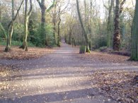
(1) Leaving Hendon Park
(2) River Brent
(3) North Circular Road
Other Links >>> |
|
CAPITAL RING STAGE 11
Hendon Park to Highgate
I walked this, the 11th stage of the Capital Ring on the 29th November 2006, immediately after the 10th stage. This was one of the more urban stretches of the walk with the path confined to small patches of green space among the urban sprawl until Highgate Woods are reached near to the end of the stage.
|
|
|
|
(1) Leaving Hendon Park |
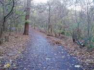
(2) River Brent |
(3) North Circular Road |
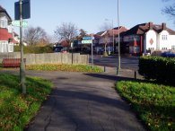
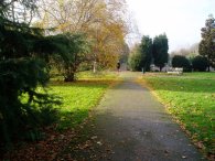
The Capital Ring Path leaves Hendon Park, photo 1, and runs along Shirehall Lane, then turns right into Shirehall Close, left into Shirehall Park and finally right into a turning that leads to Brent Street although I can't see this named in either the A-Z or on StreetMap. I did not see a Capital Ring marker from the end of Hendon Park until I reached Brent Street, only a short stretch of walking but one with a number of different turns to follow to stay on the exact route.
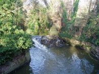
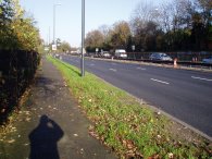
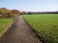
From Brent Street it is just a short walk down to the River Brent, photo 2 and the North Circular Road, photo 3.
 |
 |
 |
(4) River Brent |
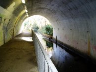
(5) Tunnel under the North Circular |
(6) Brookside Walk |
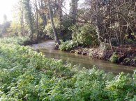
The route heads along the North Circular Road for a short distance before passing through a metal gate and into Brent Park, a narrow stretch of parkland besides the North Circular, photo 4. The path winds its way through Brent Park, crosses over Bridge Lane and head a few yards further on to a small bridge over Mutton Brook. Here the path turns to the right to follow Mutton Brook through an underpass under the North Circular Road, photo 5, and into Brookside Walk, photo 6, briefly sharing its route with the Dollis Valley Greenwalk.
 |
 |
 |
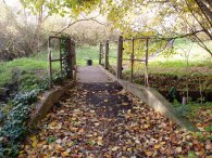
(7) Bridge over Mutton Brook |
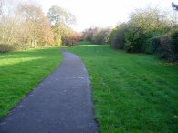
(8) Brookside Walk |
(9) Northway Gardens |
The path then follows the Brookside Walk as it runs alongside Mutton Brook. The path crosses over the Finchley Road and takes a small bridge over Mutton Brook, photo 7. The whole area is far more developed than the photo's make it look with houses to the right and the first the North Circular Road running just to the left, then the A1 Falloden Way. Leaving the Brookside Walk, photo 8, the Capital Ring briefly joins Addison Way before heading through Northway Gardens, photo 9.
 |
 |
 |
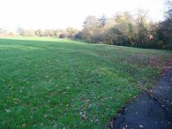
(10) Lyttleton Playing fields |
(11) Vivian Way, N2 |
(12) East Finchley Station |
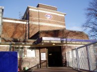
Crossing Kingsley Way the path heads into Lyttleton Playing fields, photo 10. At the far side of the playing fields the path turns left into Norrice Lea, crosses the A1, and heads up Vivian Way, photo 11. The path then turns left into Deansway and right into Edmunds Walk where a footpath leads to the back entrance of East Finchley station, photo 12.
 |
 |
 |
(13) Highgate Wood |
(14) Queens Wood |
(15) Queens Wood |
The path passes through the station concourse and crosses the Finchley road to Cherry Tree Wood. Leaving the park the path heads along Fordington Road and crosses over Woodside Avenue into Lancaster Road where after a short distance a footpath heads uphill to the left to reach Highgate Woods, photo 13. Once again I had lived near here many years ago and hadn't been back since. Re-visiting these places more than made up for the rather urban nature of this stage of the Capital Ring. While in Highgate Wood I passed a small and rather unimpressive plaque that stated "The Capital Ring was launched here on 21st September 2005 by Jenny Jones, Green Party member of the London Assembly and the Mayors walking advisory panel". Passing through Highgate Wood the Capital Ring crosses Muswell Hill Road into the neighbouring Queens Wood, photo 14. The path heads downhill and then back uphill to cross the aptly named Queens Wood Road where photo 15 was taken, the distance back to the Woolwich foot tunnel now down to 17.5 "ring" miles.
From Queens Wood Road it is a short walk to a path that heads steeply up between houses to Priory Road. The steep nature of the ground along Priory Road means that the houses along one side of the street have to be accessed via long flights of steps, very inconvenient if you are a postman or have young children. A few hundred yards along he road the Capital Ring turns of to the left and takes its own steep path up between the houses to reach Shepherds Hill and the end of this section of the Capital Ring.
The GPS made the length of this stage 4.1 miles long.
![]() Back to:Walking index page
Back to:Walking index page
| ©2012 Bertuchi.co.uk. Please contact me using the email button on the right if you have any questions or comments regarding the site. Any feedback and additional information about places of interest on the walks is always welcomed. All rights reserved. Please contact me if you want to use any of the images or information from the site. ENJOY YOUR WALKING |
|