(1) Preston Park
(3) Glendale Gardens, Wembley
Other Links >>> |
|
CAPITAL RING STAGE 10
South Kenton to Hendon Park
I walked this, the tenth stage of the Capital Ring on the 29th November 2006. I had been going to walk this stage the day before but the weather was so wet I ended up staying at home! Today there was not a cloud in the sky, hardly any breeze and once again unseasonably warm temperatures.
|
|
|
|
(1) Preston Park |
(3) Glendale Gardens, Wembley |
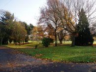
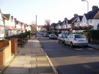
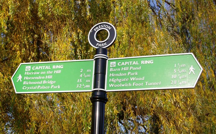
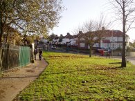
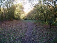
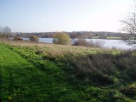
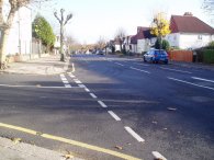
I arrived at South Kenton station to resume my walk after a rather slow trip up on the Bakerloo line. From South Kenton station the Capital Ring passes through a number of suburban streets before making its way into Preston Park, photo 1. A Capital Ring fingerpost in the park showed that it was now only 28 miles back to the Woolwich foot tunnel. Leaving Preston Park the path makes its way through more quiet suburban streets, photo 3, up to the main road by Preston Park Tube Station.
 |
 |
 |
(4) West Hill, Wembley |
(5) Barn Hill Open Space |
(6) View back to Harrow |
The Capital Ring crosses the road opposite the entrance of the tube station before turning right down Uxendon Crescent, the path heading gently downhill towards the Avenue. Passing under a rail bridge the path turns left into West Hill, photo 4; the couple on the path were also out walking the Capital Ring. From West Hill the route soon turns left once again into Uxendon Hill before taking a short footpath between houses which leads into the Freynt Country Park. The path follows the side of the Jubilee line for a short distance before turning to cross the Barn Hill Open Space, photo 5, up to the top of Barn Hill. Although grassy the ground was completely saturated, with standing water in places, which meant my feet were soon soaked. As much of the day was going to be along tarmac surfaces I had worn my Merrel walking shoes rather than my leather walking boots which was probably a mistake they don't have much (any) water resistance. Photo 6 was taken looking back towards Harrow, just before entering the wooded area at the top of Barn Hill.
 |
 |
 |
(7) Trig point, Barn Hill |
(8) Descending from Barn Hill |
(9) Fryent Country Park |
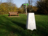
Heading through the trees the path soon reaches a pond at the top of the hill. Just to the right of the pond is a trig point, photo 7. Looking ahead from the trig point there was an excellent view of the new Wembley Stadium however this was directly into the sun so it was impossible to get a photo. While I was there a couple of Parakeets were squawking high up in the trees around the pond, I still can't get over how common they are becoming around London. Leaving the top of the hill the path makes its way round the side of the pond before heading downhill through trees, photo 8. Just before an open space is reached, photo 9, the path turns to the right running just inside the trees towards a car park besides A4140 Fryent Way.
 |
 |
 |
(10) Fryent Country Park |
(11) View back to Barn Hill |
(12) Brent Reservoir |
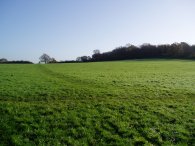
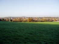
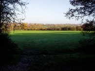
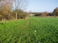
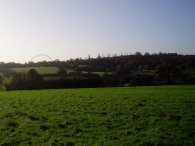
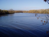
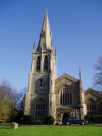
Crossing the road the Capital Ring continues its way on a rather circuitous route through the Fryent Country Park, photo 10. The route makes its way up to the top of Gotfords Hill where there were fine views all round. Photo 11 was taken looking back towards Barn Hill. Descending from the top of hill the path makes its way down to join Salmon Street, leaving the park on a particularly muddy stretch of path. The path then runs through another selection of suburban streets, this time in Kingsbury, before heading down Old Church Lane and heading on to Birchen Grove which leads into the grounds of the Brent Reservoir, photo 12. In Church Lane the route passes St Andrew's Church, (photo 19 at foot of page). This church had been originally built in the West End but was moved to Kingsbury between 1931 and 1934. The church sits in a 3 and half acre graveyard which the route runs alongside. The graveyard was extremely overgrown however is gradually being reclaimed by the Ethel Haywood Memorial Trust. The following is a quote from the church website: "We are proud of the achievement of recent years but at the same time understand the reactions of those who see it for the first time if they assume that this is as bad as it could get. It has certainly been much worse".
 |
 |
 |
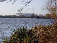
(14) Brent Reservoir |
(15) Crossing the M1 |
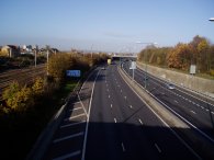
Photo 13 was taken looking across the Brent reservoir towards Wembley Stadium. The Brent Reservoir was formed in 1835 when the River Brent was dammed to provide water for the Grand Union Canal, over 140 different species of bird have been seen at the site. The walk along the reservoir was accompanied by a constant rumble of traffic from the North Circular Road over on the other side of the water. Photo 14 was taken from the bridge over the reservoir on Cool Oak Lane. The Capital Ring follows Cool Oak Lane runs up to the A5, West Hendon Broadway. For the first time for quite some distance there were a few gaps in the signage for the path, most of the main junctions were signed but not much in between to help confirm you are on the right route. Crossing the the West Hendon Broadway the route heads up Park Road which is followed to the A41 Hendon Way. On the way it crosses a bridge over the M1 motorway, photo 15, another clear indicator of my progress round London.
 |
 |
 |
(16) Park Road, NW4 |
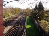
(17) Northern Line nr Brent Cross |
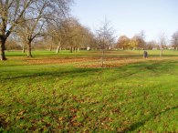
(18) Hendon Park |
At the end of Park Road, photo 16, the Capital Ring takes a subway under the A41 and heads along Beaufort Gardens turning right into Cheyne Walk and then left along an alleyway between houses that leads to a footbridge over the Northern Line, photo 17 was taken looking down to Brent Cross Station. Crossing down over the other side of the footbridge the path enters Hendon Park and the end of this stage. I once spent six months living in a house that over looked the park in 1981/82 and I don't think I had been back since then.
 |
(19) St Andrew's Church, Kingsbury |
The GPS made the length of this stage 5.5 miles long.
![]() Back to:Walking index page
Back to:Walking index page
| ©2012 Bertuchi.co.uk. Please contact me using the email button on the right if you have any questions or comments regarding the site. Any feedback and additional information about places of interest on the walks is always welcomed. All rights reserved. Please contact me if you want to use any of the images or information from the site. ENJOY YOUR WALKING |
|