(1) Deal Station
(2) Marsh Lane, nr Deal
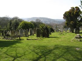
(3) Fields nr Sholden
Other Links >>> |
|
WHITE CLIFFS COUNTRY TRAIL - Part 1
Deal to Dover
I have been meaning to walk the White Cliffs Country Trail, which runs in a series of loops between Sandwich and Dover, for some considerable time and on 5th April 2009 I finally got round to walking the first section. My first decision was to decide in what order I walked the route which I have split into three stages. In the end I started at Deal and followed the path inland as it gradually curves round to Dover. The second stage runs along the coast between Dover, passing through Deal to reach Sandwich, and is a stretch of path that is entirely shared with the Saxon Shore Way. The third stage is a circular walk from Sandwich which links up with the first stage at Betteshanger. Following the route in this order allows me to make an almost continuous circuit around the trail and also means that I will be walking all the sections of path I have I walked before in an opposite direction.
I was up bright and early and having arrived at Dover Station had a half hour wait for the 9:30 train to Deal which was the first train of the day. My single ticket for the journey cost £4.00.
|
|
|
|
(1) Deal Station |
(2) Marsh Lane, nr Deal |
(3) Fields nr Sholden |
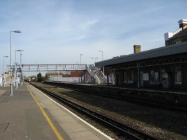
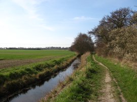
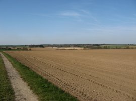
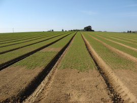
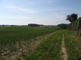
It was a lovely bright sunny day as I set off from Deal Station, photo 1, which is right on the route of the trail. From the station I headed to my right up London Road to the junction with Albert Road before joining a footpath that runs between houses to cross Middle Deal Road before heading up South Wall Road and in to South Wall. This dead end road, which did not have a footpath besides it, seemed surprisingly busy for a Sunday morning however a little further down I passed the local recycling centre which was the destination for all the traffic. A little further on the tarmac ends and the route joins a track that continues ahead between fields. Ahead of me to the right I could see the low hills of the newly created Fowlmead Country Park which was created on land regenerated from former Betteshanger Colliery spoil tip. The White Cliffs Country trail however soon turns to the left along another track, Marsh Lane, that runs besides an open field on the left and a line of trees and a drainage ditch on the right, photo 2. The path gradually becomes more enclosed as it makes its way besides some greenhouses before joining the Sholden New Road in the village of Sholden. A short distance up the road the route joins a footpath on the right that runs alongside the edge of a field turning left at the end of the field to head up to cross the A258 London Road. Once over the road the route continued ahead along a farm track running between fields, photo 3.
 |
 |
 |
(4) Broad Dike |
(5) Fields nr Northbourne |
(6) Site of Betteshanger Colliery |
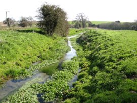
The track starts descending gently downhill and eventually reaches a hedge where the route turns to the left for a few yards before turning to the right to pass through the hedge and over a stile. The White Cliffs Country Trail is not waymarked although I did spot a rather worn marker attached to a post by the gap in the hedge, one of only three I noticed all day. The route then continues across a grassy field with a small stream flowing through it. Reaching the end of the linear field the route crosses over Broad Dike, photo 4, and starts heading uphill between more fields towards what was once the location of the Betteshanger Colliery, although little evidence of its existence now remains. A multitude of seedlings had just sprouted in the fields besides the path, photo 5, although I was unsure what the crop was. Reaching a track the route turns to the left heading up towards the village of Northbourne with the site of the old colliery off to the right, photo 6.
 |
 |
 |
(7) View back towards Pegwell Bay |
(8) Path towards the Betteshanger Circle |
(9) Insulators |
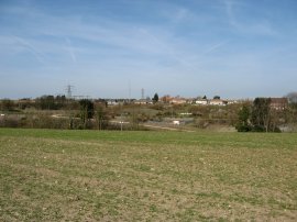
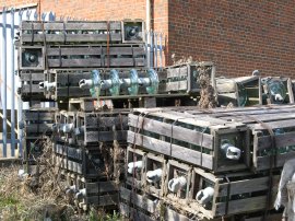
At a bend in the track the route heads briefly to the left before taking a footpath on the right that runs through a plantation of new trees to join a road close to Northbourne Church. The path had been ascending slightly and just before entering the trees there were good views looking back towards the coast and Pegwell Bay although photo 7 doesn't really do the view justice. I was also able to see the three cooling towers at the old Richborough power station, a feature of many of the different walk I have done in this area. As mentioned earlier the White Cliffs Country Trail forms a number of loops and by St. Augustine's church in Northbourne the route heads off in two directions. One path turning to the left through the grounds of church and the other heading to the right across fields, photo 8, towards the houses of Betteshanger Circle where the path joins up with the circular walk I will be doing from Sandwich in stage three. In order to link the two parts of the walk, and make sure I walk the entire trail, I headed down the footpath on the right towards the houses of the circle, passing by an electricity sub station with a number of glass insulators sitting in crates besides the path, photo 9.
 |
 |
 |
(10) Miner's Way Information Board |
(11) St. Augustine's church, Northbourne |
(12) Path up Sutton Hill |
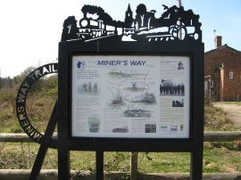
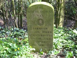
Reaching the houses I noticed there was an information board for the Miner's Way, photo 10, outside the Betteshanger Social Club, similar to the one I had seen at Shepherdswell Station when walking the North Downs Way last year. This is doubtless a walk I will be doing one day!
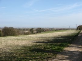
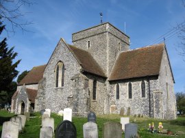
I then retraced my steps the half a mile back to Northbourne where I headed off through the grounds of St. Augustine's church, photo 11, back on the main route of this stage of the walk to Dover. Leaving the churchyard I turned right along Northbourne Road and then left at a crossroads along Deal Road. Leaving the village the route takes a footpath on the right that runs diagonally over fields; the start of a very pleasant stretch of walking. The path heads gently uphill over the fields before descending towards a farm at Little Mongeham where I had two very friendly sheep come running up to greet me. Joining a road the route turns to the left for a few yards before taking a track on the right that heads up Sutton Hill, photo 12.
 |
 |
 |
(13) Path from Sutton Court Farm |
(14) Celandines |
(15) Reaching Roman Road, West Langdon |
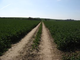
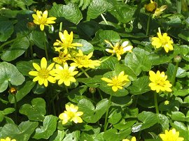
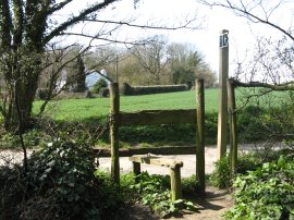
The White Cliffs Country Trail heads over the hill, which gave decent views over the surrounding countryside before heading down to join the road at Church Hill in the small village of Sutton. Here I headed to the left along the road for a short distance before passing through a metal gate on the right that marks the entrance to the driveway of Sutton Court Farm. Here the route passes between a number of farm buildings and then crosses through a couple of paddocks, which were being used for riding lessons when I passed by. The route then joins a field side path, photo 13, that runs in a more or less straight line along the edge of valley for one and half miles. Along the path I passed a number of clumps of Celandines, photo 14, growing next to the hedge. Eventually the path reaches farm yard and crosses over a stile to join Roman Road near West Langdon, photo 15. Here the route of the White Cliffs Country Trail links up with the route of the North Downs Way, sharing a common path for the next four and half miles to Dover.
 |
 |
 |
(16) Wood Anemones |
(17) North Downs Way Milestone |
(18) Track nr Pineham |
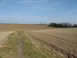
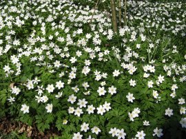
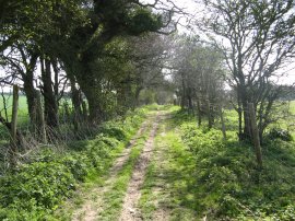
I turned left down the road, continuing ahead at a crossroads, before taking a footpath on the left that runs between fields. A short distance along the path I stopped and had my lunch sitting on the bank besides the path in the warm Spring sunshine. After eating I continued down the path passing through the edge of Cane Wood where under the trees was a massive carpet of Wood Anemones, photo 16. I also passed one of the seemingly randomly located North Downs Way milestones, photo 17, besides the path. From Cane Wood the route continues between two fields before crossing a road and heading down a track to reach the small village of Pineham. Here the route turns to the left and follows the road round to the left before joining a hedge lined track on the right, photo 18, that runs between fields down to eventually reach the dual carriageway of the A2. This stretch of path is officially a byway and the surface seemed much more rutted than when I had last walked along it back in September 2008. At one point I had to stand aside while a quad bike went passed but this was the only traffic I saw on the path.
 |
 |
 |
(19) Path besides the A2 |
(20) Statutory Diversion |
(21) Cemetery by Connaught Road |
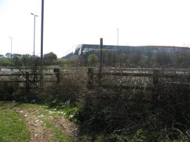
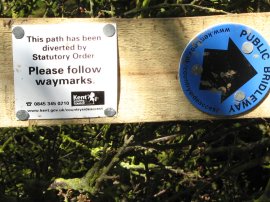
At the A2 the route turns to the left and heads down beside the road to join the Dover Road, close to the village of Guston. Here the route turns to the right to take the road bridge over the A2 before taking a footpath on the right that heads back up the other side of the main road, the route having been diverted from that marked on my map due to the construction of the large new B&Q that can be seen in photo 19. The route turns to the left to cross over a field before heading along the field edge to rejoin the original route of the White Cliffs Country Trail along Roman Road where a small notice, photo 20, marked the diversion of the path. The route then continues along the hedge lined track before starting to descend down to join a road. At one point I spotted a Blackcap close by in the hedge and spent a while watching it. As it stayed reasonably still I slowly I got my camera out which led to the bird hopping behind a twig, slowly moving to get a better angle it then hopped behind another twig, still close to the path but quite obscured. As I moved round again the bird flew off so in the end I didn't get my photo. The path had reach a height of about 125 meters and I was looking forward to getting some good views towards Dover Castle and over Dover to the Channel but due to the enclosed and slightly sunken nature of the path there was very little to actually see which was rather a shame. The path heads down the road, crossing over some railway lines and passing besides a large cemetery to reach the Old Charlton Road. The route crosses over the road and heads along a sunken track, which passes under two low bridges before turning to the right and heading down besides another cemetery, photo 21, to Connaught Road.
 |
 |
(22) Biggin Street, Dover |
(23) Dover Castle |
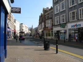
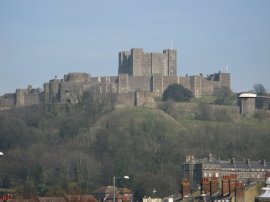
Crossing Connaught Road I then headed down Park Avenue and crossed over Maison Dieu Road into Park Street. Reaching the end of this road I turned left into the High Street and then continued ahead into Biggin Street, photo 22, as the High Street bends to the right, where I ended this stage of my walk along the White Cliffs Country Trail. From this point it was just a short distance back to where I had parked my car close to Dover Station. As I was walking back to the car I was able to get a reasonable good view of Dover Castle, photo 23 over on the other side of town.
Reaching my car I had walked 13.6 miles in total on what had been a very satisfying days walking. I had had an easy journey to Dover and the weather was great all day and the countryside was generally very pleasant to walk through. It had also been great to start a walk I had been meaning to do for so long. The route is not way marked so a map is essential for route finding however all the footpaths used were in good condition and easy to follow.
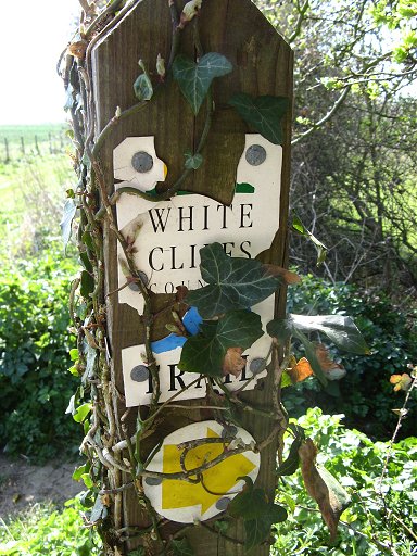 |
A rare sign for the White Cliffs Country Trail |
If you would like to comment on this walk you can do so here:
![]() Back to:Main walk index page
Back to:Main walk index page
| ©2012 Bertuchi.co.uk. Please contact me using the email button on the right if you have any questions or comments regarding the site. Any feedback and additional information about places of interest on the walks is always welcomed. All rights reserved. Please contact me if you want to use any of the images or information from the site. ENJOY YOUR WALKING |
|