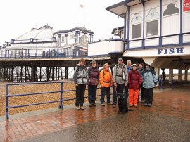
(1) Group photo at the start
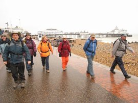
(2) Eastbourne Seafront
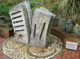
(3) Taking a stone for a walk
Other Links >>> |
|
WEALDWAY Part 1
Eastbourne to Arlington
I am walking the Wealdway with a group of friends, walking one stage a month. We did this, the first stage, on Sunday 16th March 2008. We met up at Arlington and then took a couple of the cars down to Eastbourne to commence the walk.
|
|
|
|
(1) Group photo at the start |
(2) Eastbourne Seafront |
(3) Taking a stone for a walk |
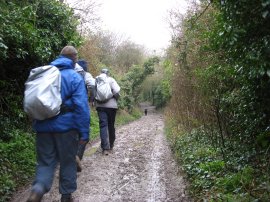
On my Ordnance Survey map the route of the Wealdway is marked as starting at the Eastbourne Youth Hostel on the outskirts of the town however the guidebook we had described the walk as starting from either Eastbourne Pier, or as alternative Beachy Head, and we had chosen the pier, photo 1, as our start point. It has been raining heavily when I left London but by the time we started the walk this had changed to a light drizzle although the cloud base was very low and the weather grey and overcast as we made our way along the promenade, photo 2, towards the South Downs. There had been a plaque besides Eastbourne Pier describing the benefits of walking and a little further along the seafront we past a small sculpture titled "Taking a stone for a walk", photo 3. This sculpture by Jackie Brown "celebrates walking as part of the pathway to health project". A nearby notice described the benefits of walking half an hour each day, our walk was going to be slightly longer!
 |
 |
 |
(4) Approaching the South Downs |
(5) Path onto the Downs |
(6) Wealdway, South Downs |
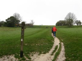
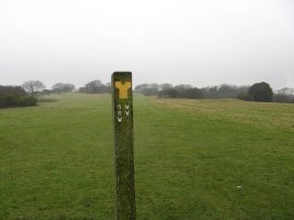
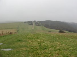
As we headed down the promenade alongside the damp and deserted beaches the South Downs gradually appeared out of the mist, photo 4. At the far end of the beach there were a few small piles of the timber that had been washed from the wood from ship, The Ice Princess, which had sunk off Portland Bill in January. Leaving the seafront the route headed steeply up a footpath to briefly join Cliff Road. Where the road bends round to the right our route continued ahead, climbing steeply up a grassy slope onto the South Downs, passing the first waymarker of the day for the Wealdway, photo 5. I had walked this stretch of path a couple of times before when walking over the Seven Sisters between Seaford and Eastbourne however soon the route of the Wealdway headed off to the right, photo 6, and I was on new ground as the route started to makes its way over the South Downs.
 |
 |
 |
(7) View over Eastbourne |
(8) Trig point above Eastbourne |
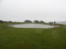
(9) Dew Pond |
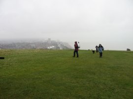
Photo 7 was taken looking back towards Eastbourne which was rapidly disappearing under a cloud of drizzle. Buffeted by a rather brisk wind we made our way along the path, crossing over the B2103 by its junction with Beachy Head Road and continuing on to a trig point, photo 8, and dew pond, photo 9 where we stopped for a short break. I had had a cold a couple of weeks earlier and as usual it seemed to have settled on my chest and I found myself quite out of breathe as I was walking up this stretch of path which was rather irritating. I hadn't done much walking so far this year and I could definitely notice a difference in my fitness levels.
 |
 |
 |
(10) Wealdway, South Downs |
(11) View back to the coast |
(12) Trig point above Eastbourne |
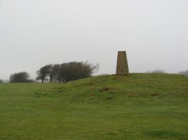
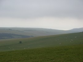
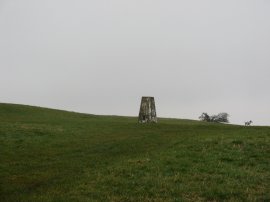
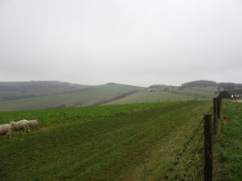
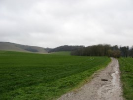
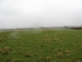
Just past the dew pond the route links up with the route of the South Downs Way and continues ahead to cross A259 where the path runs alongside a golf course, photo 10. Crossing the road we spotted a number of misplaced golf balls along the path which might mean that this stretch needs to be walked with caution when play is in progress! The route follows the top of a ridge and in better weather there would have been commanding views across the Sussex countryside but on the day everything was very much shrouded in mist, photo 11. Just past the trig point in photo 12, which has a height of 201 metres, the Wealdway leaves the route of the South Downs Way, turning to the right and heading towards Cold Crouch.
 |
 |
 |
(13) Heading towards Butts Lane |
(14) View over Tas Coombe.... |
(15) Lost in the mist |
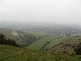
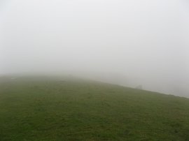
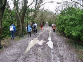
The route continues along the ridge, photo 13, following a track that was rather waterlogged in places. The route passes the end of Butts Lane where ther was a parking area and on a gate post I spotted a way marker the 1066 Country Walk Eastbourne Link, an extension to the path that wasn't marked on my map which just has the walk running from Pevensey Castle. This is a walk I hope to do at some point in the future as it is the natural continuation along the coast of the Saxon Shore Way. The Wealdway then headed through a field of large brown cows and continues over the top of Tas Coombe, photo 14, from where there was a brief glimpse down to the suburbs of Eastbourne before the clouds closed in once again, photo 15.
 |
 |
 |
(16) Approaching Jevington |
(17) The lane from Jevington |
(18) Approaching Folkington |
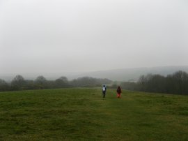
The Wealdway continues making its way over the Downs, crossing over the top of Coombe Hill, where we all went slightly off route, before steadily descending down to the village of Jevington. Here the route turns to the right for a short distance along the road before turning to the left up a rather muddy track. A short distance up the track we found a relatively sheltered space under some trees beside the to stop for lunch; not the most scenic lunch stop but at least it was reasonably dry. The next stretch of the walk was rather uninspiring along a rather muddy and enclosed track, photo 17, that went on for some distance. Approaching Folkington the path did open up for while with views towards the downs, photo 18, however the hedges soon closed in again.
 |
 |
 |
(19) Leaving Folkington |
(20) Zuka |
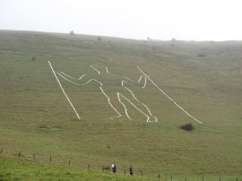
(21) Long Man of Wilmington |
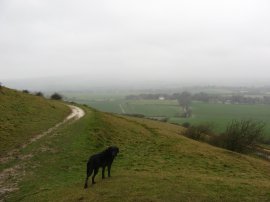
Leaving Folkington the route continued on along the enclosed and rather muddy track, photo 19, before eventually leaving the track and taking a footpath off to the right that runs along the base of the downs towards the Long Man of Wilmington. As always Anne's dog Zuka, photo 20, was having a great time bounding up and down the hillsides with a seemingly endless supply of energy, probably running three or four times the distance that we were walking. Somewhere in the distance Arlington Reservoir could occassionaly be glimpsed through the low grey cloud. The Long Man of Wilmington, photo 21, is a chalk figure that has been carved into the edge of the downs although its origins and history are rather vague.
 |
 |
 |
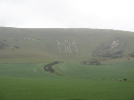
(22) Long Man of Wilmington |
(23) One of many stiles we crossed |
(24) Crossing the A27 |
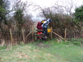
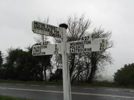
Below the long man, photo 22, the route turns to the right, taking a track that runs down towards the villlage of Wilmington where there was a car park with some handy public toilets. The Wealdway heads to the right down the road through the village before taking a footpath off to the left. This runs over fields, crossing a number of stiles on the way, photo 23, to reach the road to Milton Street. Here the route turns right to head the short distance down to the rather busy and noisy A27 road, photo 24.
 |
 |
 |
(25) Field nr Arlington |
(26) Cuckmere River |
(27) Approaching Arlington |
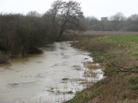
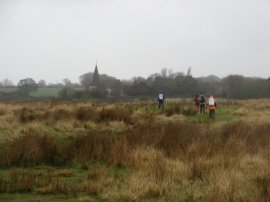
Having crossed the A27 the route continues ahead, passing a couple of building before heading out into a field. Here we took a considerable detour, walking round three sides of the field in photo 25, when in fact all we had to do was walk across the top and then turn right to head down over another field to take a crossing over some railway lines. The weather had become quite damp at this point with the wind blowing the rain directly into our face which made the walking rather unpleasant, the area was also heavily populated with stiles and I lost count of the number we had to negotiate before we go to Arlington. Having crossed over the railway lines the route continues along a field edge before turning to the left and taking a path that runs alongside the banks of the Cuckmere River, photo 26. The route then crosses a minor road, close to the banks of Arlington Reservoir which was on the other side of the river, although this remains hidden from view, and continues ahead to cross a patch of marshy ground on the outskirts of Arlington, photo 27. A short distance further on, Arlington Church, which can just about be made out in photo 27, marked the end of our first stage of the walk along the Wealdway.
Despite the inclement weather it was nice to be out walking again with pleasant company, along a path that I had planned to walk for quite some time. Both myself and Sara had a GPS and reaching the church mine said 13.0 miles while hers said 13.6 miles, and that excluded a short distance where her unit needed new batteries. This kind of confirmed what I always new about my GPS tending to under recording the mileage that I have walked. Hopefully when we walk the next stage we will be a bit luckier with the weather!
If you would like to comment on this walk you can do so here:
![]() Back to:Walk index page
Back to:Walk index page
| ©2012 Bertuchi.co.uk. Please contact me using the email button on the right if you have any questions or comments regarding the site. Any feedback and additional information about places of interest on the walks is always welcomed. All rights reserved. Please contact me if you want to use any of the images or information from the site. ENJOY YOUR WALKING |
|