St Peter's Way
Other Links >>> |
|
ST PETER'S WAY - Part 2
St Lawrence to Mundon
|
|
St Peter's Way |
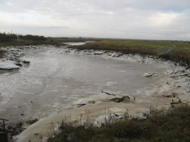
I did this walk on Sunday 18th December 2011. I drove over from Walthamstow and parked up close to the waterfront in Maylandsea. There was a complete lack of suitable footpaths to form a convenient circular route on this stage of the walk so I more or less followed the St Peters Way as I made my way over to St Lawrence to resume the walk from where I had finished last time. For one of the first times this winter it was a very cold day and the head of Mayland Creek was covered in a layer of ice left behind by the outgoing tide, photo 1. Eventually, after 4.85 miles I was back where I had finished the previous stage at Southminster Road and it was time to turn around and start retracing my steps back to Maylandsea along the St Peters Way proper.
 |
 |
 |
(1) Mayland Creek |
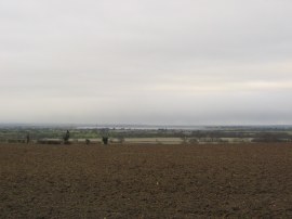
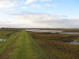
(2) View towards the Blackwater Estuary |
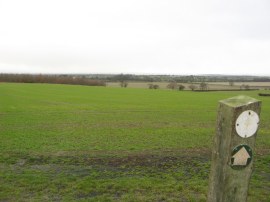
(3) Field nr St Lawrence |
From the Southminster Road the route heads along the edge of a large field with views away to the right down to the Blackwater Estuary, photo 2. As I had been walking out I had seen a number of wintry showers on the other side of the estuary and as I started heading back I also got caught in a sleet shower. The path heads along the edge of a second field, photo 3, and then through a small patch of trees where I sheltered from the worst of the shower which in the end didn't last very long. I was in two minds whether to put my waterproofs on or not, there is nothing worse than being wet on a bitterly cold day, however the weather looked brighter ahead and in the end I kept them in my rucksack.
 |
 |
 |
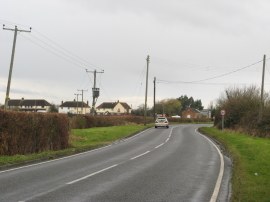
(4) Steeple Road |
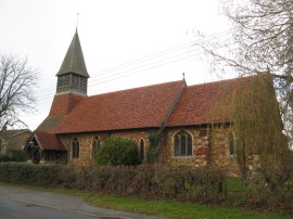
(5) St. Lawrence and All Saints church, Steeple |
(6) Canney Road |
The path leaves the trees and then heads gently downhill alongside another set of fields to reach Steeple Road. This is then followed for just over a mile or so into, and through, the village of Steeple where the road is named Bradwell Road and then The Street. There is no pavement besides the road for the first half mile, photo 4, and in a number of places the verge was sometimes quite narrow and overgrown which meant there were a couple of times I had to stop to allow cars to go past. One of the reasons I had parked in Maylandsea rather than St Lawrence was to avoid having to walk this stretch at the end of the day when I thought the traffic might be busier. Eventually the safety of pavement is reached as the road heads through Steeple, passing St. Lawrence and All Saints church, photo 5, with its patchwork walls constructed from a seemingly random selection of bricks and tiles. The village also had an unusual bus shelter which also housed a large old metal pump. Reaching the end of the village the route bears to the right along a minor road, Canney Road, photo 6, which is signposted to Steeple Bay Holiday Park before continuing ahead through some metal farm gates at the first corner.
 |
 |
 |
(7) Path leading Mayland Creek |
(8) Path alongside Mayland Creek |
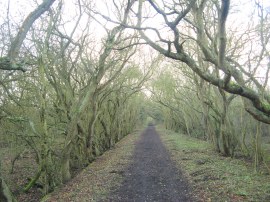
(9) Path from Mayland Creek |
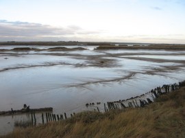
The route then heads through the farmyard, where there were a number of calves feeding in a pen besides the path, before joining a broad grassy track, photo 7, which heads down between fields to reach Mayland Creek. Here the route heads sharp left to join a footpath running along the flood wall, photo 8. The path then heads up along the creek, passing numerous little sub channels and small islands. It was low tide and there was not a drop of water in the creek although the mudflats had drawn a large variety of birds which were twittering away as they prodded about in the mud. There was also a very large flock of Canada Geese in a nearby field. Reaching the end of the creek, where by now most of the earlier ice had melted, the path heads briefly to the right before heading to the left along a tree lined stretch of footpath that is followed up to a minor road, Mill Road.
 |
 |
 |
(10) Path leading to Maylandsea |
(11) Mundon Creek |
(12) Boats by the Blackwater Marina |
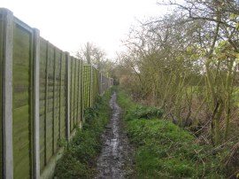
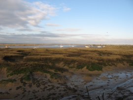
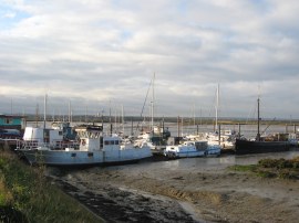
Here the St Peters Way heads to the right for a short distance and, reaching the end of the road, bears to the left to head down a path running alongside a small sewage farm. This leads out into a large paddock where there were two very friendly horses present when I went by. The path heads diagonally across the paddock and then joins a small stretch of footpath that heads up to some houses at the end of a road. The route continues ahead to join another fairly long stretch of footpath running alongside the back gardens of houses on the left and with fields to the right, photo 10. By this stage the wintry showers had all blown over and there were even a few patches of blue sky to be seen overhead. At the end of the footpath the route heads to the left for a few yards before heading to the right down Imperial Avenue in the village of Maylandsea. This road is followed for just a short distance before the St Peters Way heads to the right down North Drive. However I missed this turning and continued on along the road a bit further before heading to the right down the Promenade; which, like North Drive heads down to the waterfront. After crossing a road and a small area of green space I reached the sea wall running alongside Mundon Creek, photo 11 and was able to rejoin the correct route of the path, a few yards further down than I should have been. I then headed to my left, passing the boats at Blackwater Marina, photo 12, and then the Maylandsea Sailing Club; where a sign stated motorboats not allowed on the slipway.
 |
 |
 |
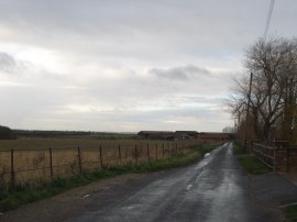
(13) Mundon Creek |
(14) Footbridge nr Mundon Creek |
(15) Field heading towards Mundon |
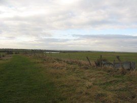
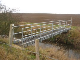
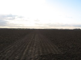
This was very close to where I had parked but as I had made reasonably good time I decided to push on a bit further. Thus I followed the sea wall as it headed away from Maylandsea, running alongside Mundon Creek, photo 13. Despite the slightly brighter weather it remained very cold with a strong wind blowing in my face and at times I could have done with my woolly hat to keep my ears warm. I could also feel myself getting slightly dehydrated as I was finding it almost impossible to drink any water as it was so cold. The next cold day I am definitely bringing my flask! Reaching a gate across the path, close to the end of the creek, the St Peters Way heads to the left along a path running besides a drainage ditch and heading away from the creek. This path soon crosses a metal footbridge, photo 14, before heading to the left along the other side of the drainage ditch. After just a few yards the footpath then heads to the right across a corner of a field. This had been recently ploughed quite finely and the almost waterlogged soil visible in photo 14 stuck to my boots in vast clumps. Reaching the field edge the footpath then heads to the right alongside another smaller drainage ditch up to another footbridge. Here the route then heads left, over the drainage ditch and across the middle of another ploughed field, photo 15, of incredibly sticky almost clay like mud which was soon plastered all over my boots.
 |
 |
 |
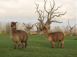
(16) Llamas |
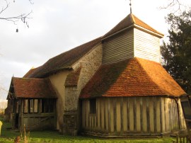
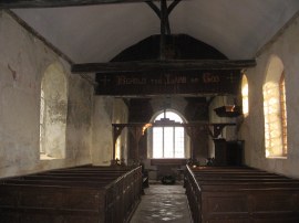
(17) St Mary's Church, Mundon |
(18) St Mary's Church, Mundon |
At the other side of this field the route then heads to the right along another field edge path towards Mundon Hall. I have two Ordnance Survey maps for this area and the route across the stretch of path I had just walked has changed slightly between the publication of the first and second map which shows the path as it currently is; a couple of small signs also noted the statutory diversion of the path. This field edge path is followed up to a strange field of petrified oaks which was also being grazed by a small herd of Llamas, photo 16, at least I think they were Llamas, they seemed a bit too big for Alpacas. The route briefly heads left, then right alongside a pond before heading through a gate on the left to cross a small paddock which leads up to St Mary's Church at Mundon, photo's 17 and 18, which is where I finished my walk for the day having walked a further 7.05 miles along the St Peters Way.
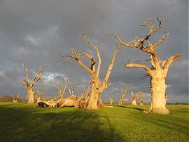 |
(19) The Petrified Oaks |
I was able to avoid much of the mud on the way back to the car by taking a slightly longer route along the field edges back to the sea wall alongside Mundon Creek before retracing my steps back to Maylandsea.
As usual I have uploaded the route of the walk which can be accessed here: St Peters Way Stage 2 Route.
All in all I had walked 14.1 miles for the day. Despite having to walk most parts of this walk twice, the cold weather and the mud I really enjoyed doing this walk as was glad I had made the effort to get out.
If you would like to comment on this walk you can do so here:
![]() Back to:Walk index page
Back to:Walk index page
| ©2012 Bertuchi.co.uk. Please contact me using the email button on the right if you have any questions or comments regarding the site. Any feedback and additional information about places of interest on the walks is always welcomed. All rights reserved. Please contact me if you want to use any of the images or information from the site. ENJOY YOUR WALKING |
|