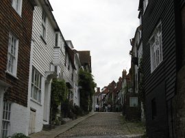
(1) Mermaid Street, Rye
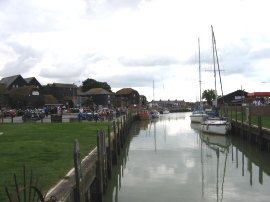
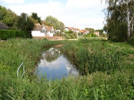
(2) River Brede, Rye
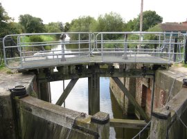
(3) Brede Sluice
Other Links >>> |
|
SAXON SHORE WAY
Rye to Hastings
I did this walk on Sunday 9 September 2007. I drove down to Hastings and got the 10.57 train from Hastings Station to Rye, the journey took 17 minutes and the single ticket cost £3.80. It was a bit of later start than I would have hoped for but there is only one train an hour on Sundays and I had had a few sleepless nights so I didn't hurry to get up in the morning. On the way down the A21 had been closed between Sevenoaks and Tonbridge which meant a rather slow detour but fortunately I still made the train with time to spare.
|
|
|
|
(1) Mermaid Street, Rye |
(2) River Brede, Rye |
(3) Brede Sluice |
Leaving Rye Station I had a little look round the town, photo 1, before heading down to the Winchelsea Road where I rejoined the route of the Saxon Shore way that I had left almost a year earlier. I crossed over the river Brede, photo 2, and followed Winchelsea Road round to the left before taking a turning on the left signposted Rye Harbour. A very short distance along this road the route crosses the lock gates of Brede Sluice, photo 3, and takes a gravel track on the right.
 |
 |
 |
(4) Royal Military Canal, Rye |
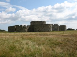
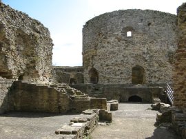
(5) Camber Castle |
(6) View back to Rye |
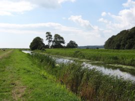
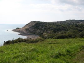
This track is followed to some houses where the Saxon Shore Way bears left on to a grassy footpath that curves round the houses and back down to join the Royal Military Canal, photo 4. The route heads along side the canal for a while and then bears to the left across the Rye Harbour nature Reserve, heading for Camber Castle, photo 5, which grew ever closer as I progressed down the path. To my left I could hear the bells of Rye, photo 6, ringing out Midday.
 |
 |
 |
(7) Camber Castle |
(8) Royal Military Canal, Winchelsea |
(9) Fields nr Winchelsea |
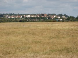
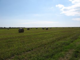
The Castle was shut when I reached it but I was able to have a little look at the grounds, photo 7, through the entrance gate. The 16th century castle was built by Henry VIII in 1539 on the coastline to defend Rye Harbour from invasion. It was abandoned in 1640 as the receding coastline made it redundant. Leaving the castle the route gradually curves round to join a gravel track by the River Brede Farm which leads to a minor road where the route turns left. Reaching the busy Seaview Road the Saxon Shore way continues straight ahead. This road is followed almost all the way to the junction with the A259 where the Saxon Shore Way takes a broad path off to the left, running once again alongside the Royal Military Canal, photo 8. To the right the village of Winchelsea was sitting high on the hill above the canal. This was a far more attractive stretch of the Royal Military Canal path than the part that I walked earlier on along the Saxon Shore Way, down below Appledore. There were great views ahead to hills by Fairlight Glen and across to the left over fields the sea wall could be seen on the horizon and beside me the reed lined banks of the canal. It really was a tranquil peaceful scene with bales of freshly cut hay in the fields on my left and cows standing in the shade of the trees beside the waterside on the other bank.
 |
 |
 |
(10) Seafront, Pett Level |
(11) Seafront, Pett Level |
(12) Royal Military Canal, Pett Level |
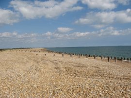
After the best part of three miles the Royal Military Canal heads down towards the road and the sea wall at Pett Level. Here I left the canal side path for a short distance and headed up to the sea wall to walk alongside the beach. Looking to the left back the way I had come I could see the shingle stretching out along the shore, all away round towards the sands of Camber and on to Dungeness Power Station, photo 10. Ahead of me I could see the Sandstone cliffs of Fairlight beginning to rise above the sea, photo 11. The path leaves the sea wall by the Smugglers Inn pub and heads down to cross over the road and through the pub car park to cross the Royal Military Canal on the wooden footbridge. Once over the bridge the route then turns to the left along the canal bank for the final few yards of the Royal Military Canal, photo 12.
 |
 |
 |
(13) Approaching Fairlight Cove |
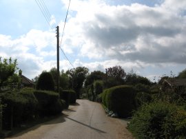
(14) Lower Waites Lane, Fairlight Cove |
(15) Hastings Country Park |
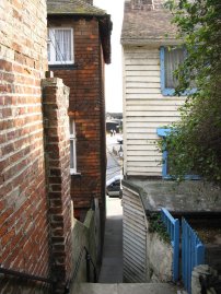
Reaching the road at the end of the Canal the route of the Saxon Shore Way turns right along the road for a short distance before turning left up footpath besides a driveway, more or less opposite the road signposted Pett Village on the right hand side of the road. This rather narrow and enclosed path heads steadily uphill running between gardens on either side. Eventually the path levels out and the sea can occasionally be seen through the trees down to the left and the path enters the grass land of the National Trust Fairlight Reserve, photo 13, from where the route makes its way down towards the village of Fairlight Cove. Fairlight Cove has suffered very badly from coastal erosion losing a number of houses and gardens to the sea and as I approached I could see a mechanical digger working away on the coastal defences. Reaching Fairlight Cove, the path curves round to the right and just past a house leaves a field through a gap in the hedge to join a road called Sea Wall. This is followed off to the right for a short distance before the Saxon Shore way turns left into Lower Waites Lane, photo 14. This is followed to the very end of the lane where the route turns left up Smugglers Way. The route heads uphill along Smugglers Way and turns right into Brambles Way then left at the end of that road to head up Shepherds Way to reach a track, Channel Way running along the top of the cliff. Reaching the end of Channel Way the route heads into Hastings Country Park beside Firehills for the final three and a half miles to Hastings.
 |
 |
 |
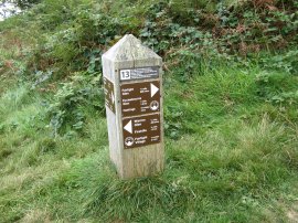
(16) Way Marker, Hastings Country Park |
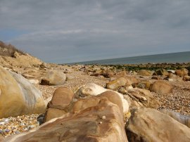
(17) Beach at Fairlight Glen |
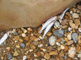
(18) Fish on the beach, Fairlight Glen |
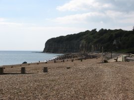
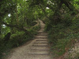
The path makes it way over the hills to the small coast guard radar station before heading very steeply downhill to cross over Warren Glen. There was quite a lot of water flowing through the stream at the bottom of Warren Glen, which once crossed, the path starting heading back uphill again to heads towards Fairlight Glen. Entering a patch of woodland the route heads up a very steep flight of steps before entering an area of slightly more level open ground at the top of the hill, before again descending down steeply through more woodland into Fairlight Glen. Reaching the Glen I headed down the new steps to the beach and stopped for a 45 minute break beside the sea. It was a fairly chilly day and the beach was quite quiet with only one or two people swimming however it was nice to have a proper rest besides the sea. Whilst on the beach I noticed there were a large number of small fish that had been washed up on the shore, photo 18.
 |
 |
 |
(19) Heading towards Ecclesbourne Glen |
(20) East Hill, Hastings |
(21) East Hill steps |
Leaving the beach I continued my walk through Hastings Country Park heading uphill towards Ecclesbourne Glen, photo 19. Out at sea I could see a steady stream of large ships sailing down the middle of the English Channel and ahead of me, looking down the coast line I could see Beachy Head in the far distance. Reaching Ecclesbourne Glen the path descends steeply downhill before ascending equally steeply up the other side. Reaching the top of the hill the path heads over the more level grassy ground of East Hill, photo 20, before dropping down into Hastings Old Town down a long flight of steps that run beside the East Hill Funicular, photo 21.
 |
 |
 |
(23) Tamarisk steps, Hastings |
(24) Fishermans Huts, Hastings |
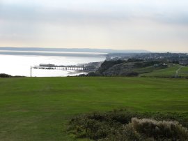
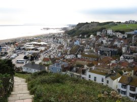
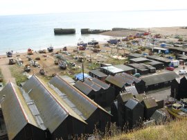
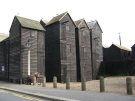
From the steps there were good views over Hastings Harbour and the old fishermens huts that line the beach, photo 22. At the end of the steps the route turns left along Tackleway for a short distance and then right down the Tamarisk steps at the end of the road. These lead down to the Rock-a-Nore Road, opposite the old fishermans huts at Hastings, photo 24, where the Saxon Shore Way ends, some 163 miles from its start point at Gravesend.
 |
 |
 |
(25) East Hill Funicular, Hastings |
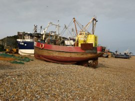
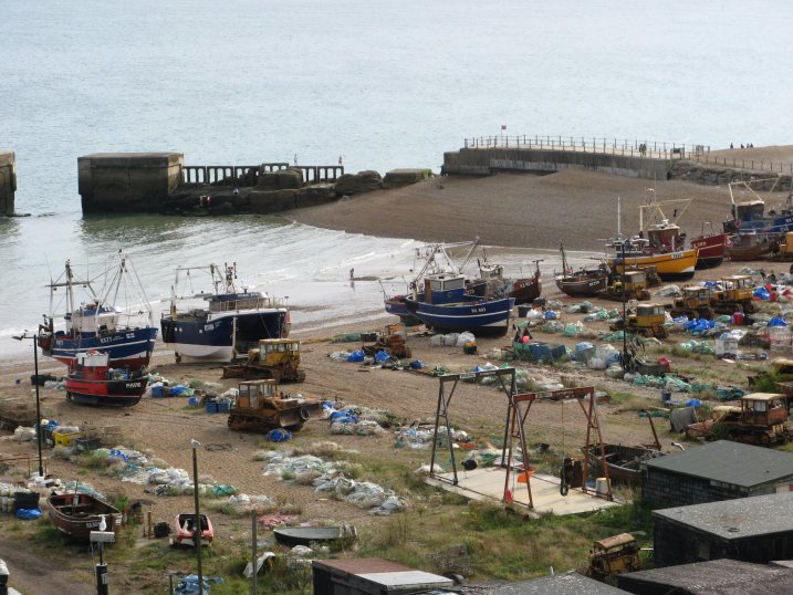
(26) Fishing Boats, Hasting Beach |
(27) Fishing Boats, Hasting Beach |
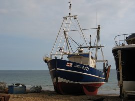
Having reached the end of the Saxon Shore Way I had a little wander round the town. I headed down the Rock-a-Nore Road, past a number of rather tempting freshfish shops, past the bottom East Hill Funicular, photo 25, and on to the beach. The East Hill Funicular was built in 1902 as apparently has the steepest gradient, at 38 degrees, of any in the country, although when I was there (Sept 07) the funicular was closed for repairs. Hastings doesn't have a proper harbour as such and its fairly extensive fishing fleet is "moored" on the beach. Photo's 26 and 27 show just a couple of boats from the fleet.
 |
(28) Hastings Pier |
From here I made my way past the fishing boats on the beach and along the sea front towards the pier, photo 29, before turning up Harold Place and then heading into Havelock Road to reach the station and my car. Reaching the car I had walked 13.5 miles.
Without doubt the Saxon Shore Way has been the most enjoyable long distance path that I have walked along. One of the things I liked most about the walk was that it was generally quite easy to do it in linear stages between rail stations and I was able to walk from station to station all the way from Strood to Hastings. The only really long stage was the 19 miles between Herne Bay and Sandwich but the scenery after leaving the coast and heading across the Kent Countryside more than compensated. The scenery itself was varied too from the high chalk cliffs between Dover and Folkestone to the wild bleak marshlands of the Thames Estuary. The route also passes through a number of interesting towns including Whitstable and Deal as well as my favourites, Faversham and Rye, as well as the city of Rochester and countless small villages and isolated country pubs.
I haven't done pages for the first four or so stages that I did as I walked most of these without a camera and have little record of what I saw although one day I might walk them again.
![]() Back to:Walk index page
Back to:Walk index page
If you would like to comment on this walk you can do so here:
| ©2012 Bertuchi.co.uk. Please contact me using the email button on the right if you have any questions or comments regarding the site. Any feedback and additional information about places of interest on the walks is always welcomed. All rights reserved. Please contact me if you want to use any of the images or information from the site. ENJOY YOUR WALKING |
|