(1) Field nr Sandling
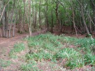
(2) Chesterfield Wood
(3) Chesterfield Wood
SAXON SHORE WAY
Sandling to Hamstreet
|
|
|
|
(1) Field nr Sandling |
(2) Chesterfield Wood |
(3) Chesterfield Wood |
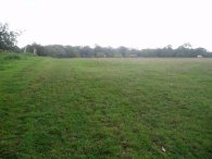
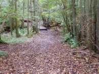
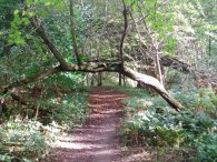
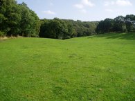
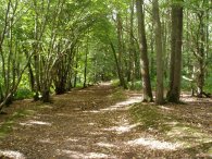
Leaving the Sandling Road the path heads along the side of a field behind a house, photo 1, and continues on to Chesterfield Wood, the first patch of woodland of the day. The path turns left and heads over a small bridge, photo 2, before continuing along the forest track, photo 3.
 |
 |
 |
(4) Approaching Pedlinge |
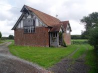
(5) Pedlinge Chapel |
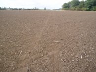
(6) Field nr Pedlinge |
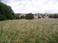
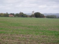
Leaving the forest the path heads across a field, photo 4, where there were views between the trees down to the coast on the horizon although this was beyond the capabilities of my camera to pick up it was a reasonably good view in real life, the patch of woodland in the centre of the photo is Harp Wood. At the end of the field, just before the village of Pedlinge the route passes an old church, photo 5. Crossing the A261 the path heads past the buildings of Oxenden Farm and on between fields below Folks Woods. One sure sign that it is now Autumn and Winter is fast approaching is that despite the continuing unseasonably warm weather, only a T shirt needed again today, is that a number of fields have been cropped and recently ploughed as in photo 6. Often these can be a nightmare to cross with the newly ploughed earth sticking to your boots in great lumps however the earth is so dry I was able to walk across without any difficulty. It will probably be a different story after a few days heavy rain. Once over the ploughed field the Saxon Shore Way joins a minor road and heads off to the right.
 |
 |
 |
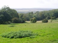
(7) View over Romney Marsh |
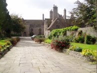
(8) Lympne Castle |
(9) View over Romney Marsh |
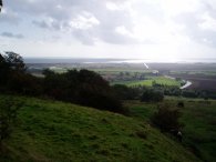
A short distance down this road the path passes the Shepway Cross which marks the place where the Court of Shepway of the Confederation of Cinque Ports used to meet. From the road there the occasional views down across Romney Marsh, photo 7. A little further past the cross the Saxon Shore Way heads down a driveway leading to Lympne Castle. The path passes between the buildings of the castle, photo 8, and then turns left down a tree lined path that leads to the top of the old cliff, overlooking Romney Marsh, photo 9.
 |
 |
 |
(10) The cliff top path |
(11) View over Romney Marsh |
(12) An Ostrich |
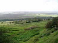
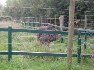
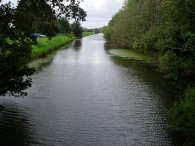
The path continues along the edge of the old cliff top, photo 10, high above the flat ground of Romney Marsh, photo 11. The waterway in the middle of the photo is the canal cutting which joins the Royal Military Canal by West Hythe Dam. The path leaves the cliff top, gradually cutting back to the road before turning sharp left down what is initially a tarmac track past a farm. Further on the track becomes unsurfaced as it descends downhill, steeply in places, besides the Port Lympne Wild Animal Park. I was able to see a few horse like animals in the park in the distance but the only creature I saw close up was the Ostrich in photo 12 which I passed at the bottom of the hill just before I reached the Royal Military Canal.
 |
 |
 |
(13) The Royal Military Canal |
(14) Path by Honeypot Cottage |
(15) The 'cliff' top path |
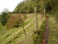
The Saxon Shore Way turns right and follows the Royal Military Canal path, photo 13, for about a mile and a quarter. I had been looking forward to this stretch of the walk but actually it was not that great. The canal bank was covered in trees which meant that the canal itself was seldom clearly seen and for much of its length the actual path was quite bumpy and difficult to walk on. Further on the path runs along a track on the far side of the canal embankment which was slightly easier going but meant there were no views of the canal at all. Reaching a stretch of concreted lane the Saxon Shore Way leaves the Royal Military Canal besides Honeypot Cottage and takes a path that heads uphill over rough ground, photo 14, to regain the cliff top, photo 15. Near the top of the hill I stooped near the ruins of an old chapel and had my sandwiches while I admired the views out over Romney Marsh.
 |
 |
 |
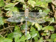
(16) Peacock Butterfly |
(17) Dragon Fly |
(18) View over Aldington Church |
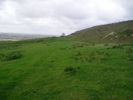
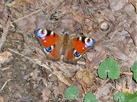
The path then passes along the top of fields following the line of the cliff top for about half a mile until, just below an impressively sited house, the route heads off downhill from the main track to the left besides a small patch of woodland, Dunk's Wood. The path then makes its way around a number of field edges to Curtis Wood. Besides the edge of the wood I spotted the Peacock Butterfly in photo 16 and the Dragon Fly in photo 17, still active in the warm weather. There were also a large number of acorns on the ground which crunched underfoot as I walked past. From the wood the path heads up through a field to the B2067, crosses the road and runs behind some houses and over a field to reach another road. From this road there were views over the church at Aldington and on to the North Downs which can be seen on the horizon in photo 18.
 |
 |
 |
(19) Saxon Shore Way markers |
(20) Park Wood |
(21) Park Wood |
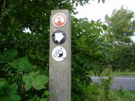
The Saxon Shore way heads to the left along the road until just past the turning down to the church the path crosses into a field on the left and heads downhill through a couple of fields and under two sets of overhead power cables before heading up besides Blackthorn Wood to reach another road. Photo 19 shows the Saxon Shore Way markers as I reached the road. Generally the all of the last few stages of the Saxon Shore way have been quite well signposted and there have only been a few occasions where I needed to refer to my maps to make sure I was on the correct route. The path runs along the road for a short distance before cutting across a field towards a driveway type road which runs past a few houses, through the garden of the last house and then over more fields to reach another road. This is only followed for a few yards before the way heads into a bigger area of woodland at Park Wood, photo 20. The path runs along the side of the woodland up to Priory Road, photo 21 was taken looking back the way I had come from Park Wood in a rare moment of sunshine.
 |
 |
 |
(22) Priory Wood |
(23) Clouds over Dyne's Wood |
(24) Hamstreet Station |
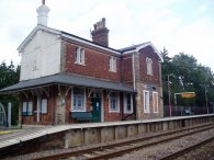
The route turns to left to head down towards the old priory buildings before once again heading into another stretch of woodland, Priory Wood, where photo 22 was taken. Leaving the Priory Wood the path crosses a road and heads across a field before entering Dyne's Wood. On the way down to Ham Street I had driven through numerous heavy showers and on the coach to Ashford Station there was another heavy downpour. As I had been walking along over looking Romney Marsh I saw many showers in the distance and sometimes the cloud built up overhead, as in photo 23 however I managed to avoid any rain all day. From where photo 23 was taken the Saxon Shore Way passes into Dyne's wood, over another field and into Norland Wood. The path joins a track from the wood and heads across a field to another road at Horton Green. This field had some kind of leaf crop growing in it and there was no sign of the footpath across it even though I could see the stile on the far side of the field so I deviated slightly from the route and walked round the edges of the field although this was not too easy as it had been ploughed right up to the hedge, (it would have been easier to continue down the track and walked along the road rather than enter the field at all). I always have a dilemma what to do in such circumstances but more about that another time. Anyway from the road at Horton Green the path heads to the left towards Gill Lane where the Saxon Shore Way joins up with the Greensand Way. The Kent section of the Greensand Way was the first long distance path I walked along, many years ago now, and I found myself lost in memories of that walk as I made my way down Gill Lane and into the Ham Street Woods National Nature Reserve. The Saxon Shore Way follows the Greensand Way through the nature reserve and, at the edge of the woodland I left the Saxon Shore Way and continued along the Greensand Way over a couple of fields up to Ham Street station, photo 24, and my car. As I stopped to take the photograph of the station I felt a few large drops of rain however looking a few hundred yards down to my left the rain was falling like a curtain across the track. I made my way very quickly to the car but the heavy rain never came any closer, it was quite a remarkable sight to see such heavy rain so nearby whilst remaining almost completely dry.
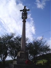 |
(25) Shepway Cross |
The GPS made this walk 12.6 miles
![]() Back to:Walk index page
Back to:Walk index page
If you would like to comment on this walk you can do so here:
| ©2008 Bertuchi.co.uk. Please contact me if you have any questions or comments regarding the site. Additional information about places of interest on the walks is always welcomed. All rights reserved. Please contact me if you want to use any of the images or information from the site. Thank you. |
|