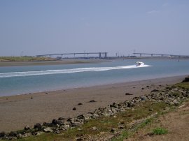
(1) Gillingham Strand
(2) Path nr Gillingham Strand
(3) A nautical front garden
Other Links >>> |
|
THE SAXON SHORE WAY - PART 3
Gillingham Strand to the Sheppey Crossing
I did this walk on Sunday 17th August 2008. I met my friends Derek, Dave, Chris and Val at the new bridge over to the Isle of Sheppey and we then drove over to Gillingham Strand to resume our walk along the Saxon Shore Way. The day had started off cloudy and wet but by the time we reached Gillingham it was starting to brighten up and the weather remained fair all day.
|
|
|
|
(1) Gillingham Strand |
(2) Path nr Gillingham Strand |
(3) A nautical front garden |
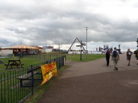
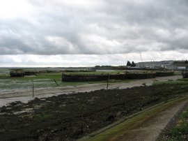
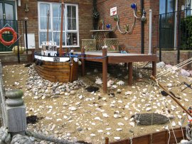
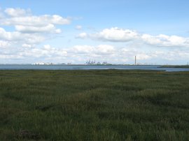
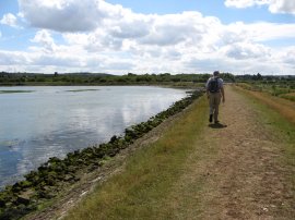
From the car park at Gillingham Strand we briefly headed back up to the A 289 to re-join the route of the Saxon Shore Way which then turns to the left to make its own way through the car parks and past the Lido and amusements of the strand, photo 1, down to the banks of the Medway Estuary. The route then follows the river banks, photo 2, for some distance as it makes its way steadily downstream, away from the built up areas of the Medway Towns, and out into open countryside. On the opposite bank of the river we could see the Kingsnorth power station which would remain in our sight for much of the day and much further away we could see the Sheppey Crossing bridge in the distance, our final destination for the day. Soon after leaving the strand we also passed a small group of new riverside houses where we spotted a couple that had decorated their front gardens with a nautical theme, photo 3.
 |
 |
 |
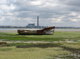
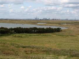
(4) Copperhouse Marshes |
(5) View over Rainham Creek |
(6) Otterham Creek |
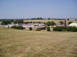
The path has to detour up round some old factories to briefly join Pier Road before heading down a rather dingy path back to the waterfront by Copperhouse Marshes, photo 4. From here the Saxon Shore Way heads down through the Riverside Country Park, passing Horrid Hill, and alongside Rainham Creek, photo 5, towards Motney Hill. Here the route turns to the left to join a road that runs up over the top of Motney Hill before taking a footpath over a field that leads back down to the flood wall, running alongside Otterham Creek, photo 6. At the end of the creek the route heads inland past some old factory buildings and down to join a road where the route turns left along Otterham Quay Lane.
 |
 |
 |
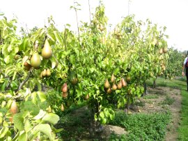
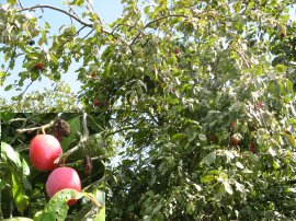
(7) Pears |
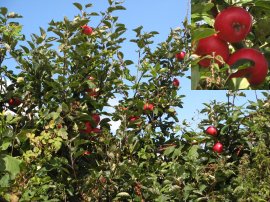
(8) and Apples |
(9) View towards the Isle of Grain |
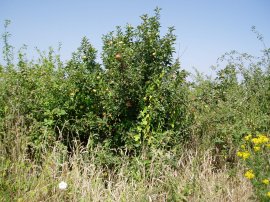
A short distance down the road the route takes a footpath off to the left that runs through a pear orchard, photo 7, before rejoining the road once again which is now known as Horsham Lane. There was no footpath besides this stretch of road and the road was often quite narrow which meant we had to pay careful attention to any cars coming along. The route follows the road towards the village of Upchurch before taking a footpath on the left that heads through a tall pine hedge to join a farm track. As we were walking along this section of track we spotted the brightest red apples, photo 8, I have ever seen, growing on an old apple tree that was standing in the middle of a very thick and overgrown section of hedgerow. Dave very kindly fought his way through the nettles and brambles and managed to reach four of the apples which tasted as good as they looked with a sweet, crisp white flesh with a few streaks of red in the apple itself. The route then headed into a modern apple orchard, the rows of short apples trees looking nowhere near as impressive as the tree we had just seen. At the end of the orchard the route once again joined a minor road at Wetham Green, turning to the left. The route heads along this road before taking a narrow footpath off to the left that runs past some stables. Towards the end of the stable complex the route turns to the left, crossing a dusty paddock between two new metal kissing gates before heading through more orchards to reach a road at Hall Green. Here the Saxon Shore Way turns briefly right before turning to the left down another road. At the end of this road the route takes a short stretch of footpath off to the right that runs back down to the flood wall alongside the edge of the Medway Estuary. The route then heads down besides the Estuary towards Lower Halstow. On the way we stopped and had our sandwiches, sitting on the flood wall, opposite the Isle of Grain, photo 9. The tide was steadily coming in as we ate, filling all the little creeks that spread through the marshy ground besides the estuary.
 |
 |
 |
(10) Path along the flood bank |
(11) Danger! |
(12) St Margaret's of Antioch church, Lower Halstow |
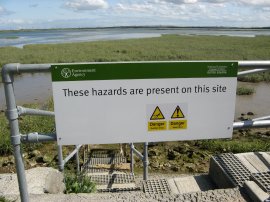
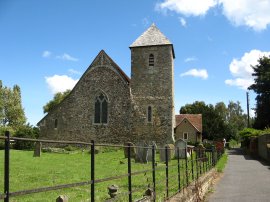
Finishing lunch we continued along the floodbank, photo 10, towards the village of Lower Halstow. One feature of this stretch of path was the large number of warning signs, photo 11, that had been erected alongside the estuary. This one warned of a steep drop, despite the flood bank being only a few feet high, and deep mud! Heading into Lower Halstow the route passes a small boatyard and then turns left onto a minor road besides the historic St Margaret's of Antioch church, photo 12.
 |
 |
 |
(13) Plums |
(14) Maize across the footpath |
(15) View towards the Thames |
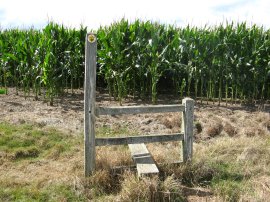
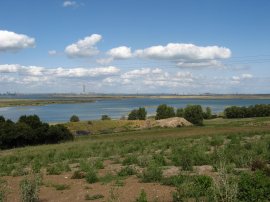
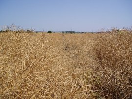
Leaving the church the route crosses over a road and heads into a field that had been divided up into a number of small paddocks, each separated by a metal kissing gate. Leaving this set of fields the route then passes through an orchard of fine plums trees, which were heavy with fruit, much of it ripe and ready to eat, photo 13. Leaving the orchard the route rejoins the road and makes its way along to the junction with Barkshore Lane where the Saxon Shore Way takes a footpath that runs diagonally uphill to the right across a field, except on this occasion the field had been planted by an extremely tall crop of maize with no footpath being re-instated across it. Photo 14 was taken from the other side of the field where the footpath should have come out however we were forced to make our way around the field edges. The next field we passed alongside was also planted with maize however it was nowhere near as tall as in the previous field. Reaching a third field we were confronted by yet another field of maize without a path across it, which caused another minor detour as we headed downhill to the boundary fence of the Funton brickworks to walk alongside the edge of the field. This was the way I remember taking at this point when I had last walked the Saxon Shore Way although the path besides the field edge was now quite overgrown and all that remained of the Saxon Shore Way marker was the three nails which had attached it to a fencepost. After crossing this short section of field edge we spotted a new way marker a little further up the field to the right marking the correct, but over grown with maize, course. The route then headed slightly to the right over a large field with lots of bare patches of earth interspersed with large areas of low weeds. The path headed gently uphill, a telegraph pole acting as a good marker of the correct direction to head in over the trackless field. From the hill above the brickworks there were very good views across the Medway Estuary to the Isle of Grain and it was also possible to see out to the Thames, photo 15, further away in the distance. Reaching the top of a slight ridge we were able to make out the exit gate on the other side of the field. Leaving the field the route crossed a bridleway where the official route of the Saxon Shore Way heads to the left for about 20 yards before turning to the right and then to the right again a few yards further on crossing through an overgrown field boundary to join a track which had started a few yards away opposite the exit from the field! This time we had taken the more direct route and headed along the track, which had unfortunately been used for fly tipping, although we found a perfectly good mini trampoline which Chris enjoyed jumping on until his water bottle bounced out his rucksack.
 |
 |
 |
(16) Crossing Raspberry Hill |
(17) View from Upnor Road |
(18) Canada Geese |
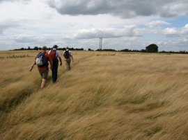
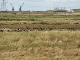
Crossing over a stile the route joins a path that heads between some small ponds and over an open area of grass that is cut for turf. Last time I had been here the ponds were in the process of being dug and the area was very overgrown and the route of the path very unclear. There had been so many thistles and weeds I remember having to change out of my shorts into long trousers to get through them and even then I ended up getting a very bright red rash on my legs, which although not painful persisted for some time. I also ended up wandering off course as I tried to find a way through the area. Now there are two ponds with a grassy path between them with a Saxon Shore Way marker on stake and it took less than a minute to walk through the area and across to the turf and it seemed completely unfeasible that such a short section of path could have caused such problems only three years earlier, (I had last been here on 15 July '05). Leaving the grassy area the route headed past a pond and up to the right to enter into another rather scrubby field with no clear indication of the correct route of the path across it. For a major recreational path the quality of the paths over the fields in this area had been a bit poor but eventually we crossed the scrubby field and passed through a gate to join a path alongside the edge of another field with an old orchard of mixed fruit trees on the left. This led down to a farmyard where the route joins a driveway. To our right we could see the large numbers of new houses that had been built in Iwade, and ahead the Sheppey Bridge, now quite close ahead. The route heads along the driveway for some distance before taking a footpath on the right that ran over an open grassy field at Raspberry Hill, photo 16. Reaching a road the route continues across and starts descending back down to the flood wall besides the mudflats of the Medway Estuary once again, photo 17. Having got quite close to the Sheppey Bridge the route at this point starts heading away from our destination as the path makes its way for some distance around the edge of the marshes. On the marshes there were lots of rabbits scurrying about and I spotted flocks of both Canada, photo 18, and Bean Geese as we went by.
 |
 |
 |
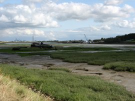
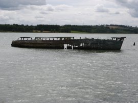
(19) An abandoned boat |
(20) Path besides the Swale |
(21) Approaching the Sheppey Crossing |
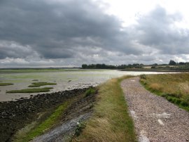
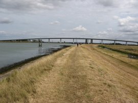
In the water was yet another old abandoned boat slowly rotting away, photo 19. It never ceases to amaze me how many such abandoned boats can be seen around the shoreline. Reaching Chetney Marshes the route turns to the right, heads past some old farm buildings and continues along a track that joins the flood wall besides the Swale, photo 20, from where we had a fairly straight walk back to our parking place under the Sheppey Crossing, photo 21.
Reaching the car we had walked 14.7 miles according to my GPS, or a more realistic 16.2 miles according to Dave's brand new model. The fast pace we had walked at meant we had an early finish to the walk for a change which was appreciated as I was driving down to Cornwall the next day and still needed to pack although it did leave a number of us feeling quite tired at the end. The route of the Saxon Shore Way, once out of the Medway towns was generally very well signposted although in a number of places the signs were rather hidden in the hedgerows! Below are a few photos taken when I had previously walked this section of path.
 |
 |
 |
(22) The red apple tree |
(23) Funton Brickworks |
(24) Path nr Raspberry Hill |
As mentioned earlier I had previously walked this section of the Saxon Shore Way in July 2005. It was a very hot day without a cloud in the sky and hardly any breeze. It was interesting to note that many of the photos I took then were from the same locations as this time around. I had a photo of the 'red' apple tree, photo 22, although the fruit was not so ripe at that time of year and also a photo of some unripe plums. The fields by the Funton Brickworks, photo 23, were smooth grass rather than the tall crop of maize that we encountered this time around. I had no photos of the overgrown area around the ponds but the scrubby field close to Raspberry Hill was covered in a very prickly crop of dried rape with the crop very much hanging over the path, photo 24.
 |
 |
 |
(25) Cows |
(26) Path besides the Swale |
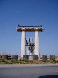
(27) The Sheppey Crossing |
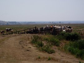
There are a number of cattle grazing the marshland besides the Swale and last time a large group of them, photo 25, had been very much blocking a gateway across the path and I ended up having to make a detour to get past them. The Sheppey Crossing was still in the process of being built with the central spans still waiting to be completed, photo's 26 and 27.
If you would like to comment on this walk you can do so here:
![]() Back to:Walk index page
Back to:Walk index page
| ©2012 Bertuchi.co.uk. Please contact me using the email button on the right if you have any questions or comments regarding the site. Any feedback and additional information about places of interest on the walks is always welcomed. All rights reserved. Please contact me if you want to use any of the images or information from the site. ENJOY YOUR WALKING |
|