The Medway Valley Walk
Other Links >>> |
|
MEDWAY VALLEY WALK - Stage 2
Maidstone to Tonbridge
|
|
The Medway Valley Walk |
I did this walk on Sunday 19th August 2012. I drove over to Tonbridge where I met up with Sara before driving over to Maidstone where we parked up at Maidstone West Station. There we met up with a couple of other friends for the start of the walk.
 |
 |
 |
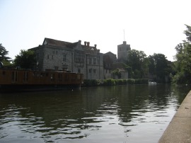
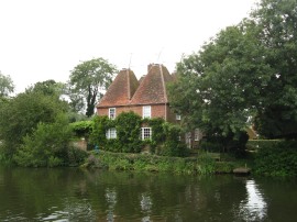
(1) Archbishops Palace, Maidstone |
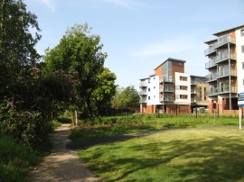
(2) New riverside housing in Maidstone |
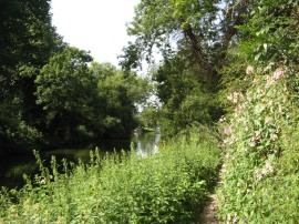
(3) River Medway, Maidstone |
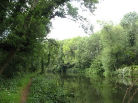
It was only a short walk down from the station back to the River Medway and the Medway Valley Walk, close to the Archbishops Palace, photo 1. From there we made our way up stream along the riverbank past a fairly lengthy stretch of new housing, photo 2, that has been built on the old industrial sites that used to line the river Medway in the Maidstone. It was a very warm day although there was a considerable amount of trees lining the path as it headed out of Maidstone, photo 3, which provided some very welcome shade. The path also passed besides one of the brick pillars that had supported the single-track branch line over the River Medway to the Tovil Papermills which crossed the river on a substantial girder bridge. This closed to traffic in 1977 and the bridge over the river was then removed.
 |
 |
 |
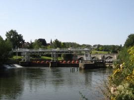
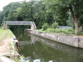
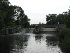
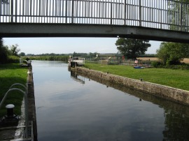
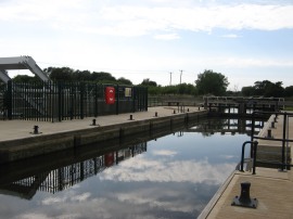
(4) East Farleigh Lock and Weir |
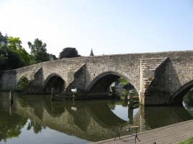
(5) East Farleigh Bridge |
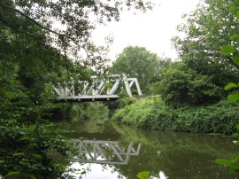
(6) Barming Bridge |
After a while the route passes an area of housing on the opposite bank with large gardens running down to the river as the path makes its way up to East Farleigh Lock and Weir, photo 4. Just upstream from the lock is the very attractive East Farleigh Bridge, photo 5, which was constructed in the 14th century out of the local Kentish Ragstone. Above the bridge the path headed past an area of moorings and along the shady riverbank up to Barming Bridge. There used to be an old wooden bridge here although this was replaced by the current structure in 1997, photo 6. The Medway Valley rail line follows the course of the river and was often visible away to the left of the path.
 |
 |
 |
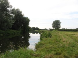
(7) River Medway near Barming |
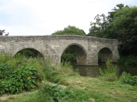
(8) Teston Bridge |
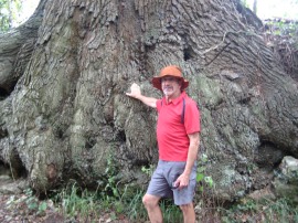
(9) Oak tree roots |
Above Barming Bridge the route heads through a more open area of grassland lining the river, photo 7, where there were a few cows grazing. This heads up to Teston Bridge, photo 8, another old Kentish Ragstone Bridge which carries the B2163 road across the river. On the other side of the road is the Teston Bridge Country Park, a 32 acre site consists of three meadows nestling beside the River Medway. we stopped here briefly to use the toilets and have a quick drink at one of the picnic benches. Although we had not been walking that long the clear blue skies of earlier had been replaced by some quite dark clouds and we felt a few spots of rain although we luckily we missed any of the heavier downpours. Despite the clouds it was still very warm and also quite humid. The Medway Valley Walk crosses the Teston bridge over the river, heading a short distance uphill alongside Teston Lane before joining a paved driveway on the right which leads up to the buildings of Tutsham Hall. On the way we passed a large oak tree growing besides the drive with its huge roots, photo 9, anchoring it to the bank besides the drive.
 |
 |
 |
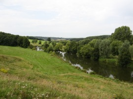
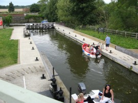
(10) River Medway |
(11) Teston Lock |
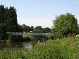
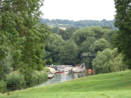
(12) Bow Bridge Marina, Wateringbury |
The gentle ascent up towards the farm buildings gave good views down over the river Medway flowing in the valley below, photo 10, and looking back we were able to catch a quick glimpse of Teston Lock, photo 11. From Tutsham Hall the path heads down across a couple of paddocks back towards the river to join a short stretch of path running through the edge of Waregrave's Wood. Leaving the trees the route then heads across another open area of rough ground up to Bow Hill in Wateringbury, close to the Bow Bridge Marina, photo 12.
 |
 |
 |
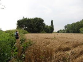
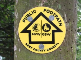
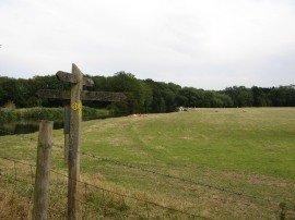
(13) Field nr Yalding |
(14) Walk way marker disc |
(15) Hampstead Lock |
Here we headed to the right across Bow Bridge where we said goodbye to Lyn and Trev who were heading back to Maidstone. It had been great to have their company on the first part of the walk and hopefully we had not bored Sara too much with all our football talk. Sara and I then set off along the riverbank. At first there was another tree lined section before the path began running along the edges of fields, photo 13, as we followed the river round towards Yalding. Some sections of the path were a bit overgrown with plenty of stinging nettles to attack our legs, I really cannot remember a year when the have been quite so many nettles leaning across the paths. As we approached Yalding the Medway Valley Walk links up with the route of the Greensand Way for a short distance and there was a neat way marker disc for both walks, photo 14. Reaching Hampstead Lane the route joins the road, heading to the left past the Hampstead Lock, photo 15.
 |
 |
 |
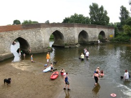
(16) Twyford Bridge, Yalding |
(17) Oast House at Yalding |
(18) Stoneham Lock |
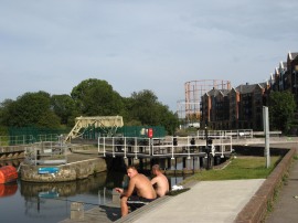
The road is then followed alongside the Hampstead Road Canal, which carries the river Medway round the Yalding Sluice, up to the Anchor Inn. Here the path leaves the road, heading round to the right across the top of the sluice. This is a popular area with for picnics and there were a number of people playing in the water in the water between the sluice and the Twyford Bridge, photo 16. We also stopped for our lunch break here, watching as a horse was also taken for a paddle up and down the river. Leaving Yalding the path heads over the entrance to another small marina and past an attractive old oast house, photo 17. Earlier in the walk we had been talking about how very rare it is to see hops being grown in Kent although the number of converted oast houses that we passed gives an indication of how widespread their cultivation must have once been. The path heads past a small area of mobile homes and then joins a tree lined path running along the edge of fields which is followed up to the disused Stoneham Lock, photo 18.
 |
 |
 |
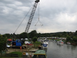
(19) Rail Bridge |
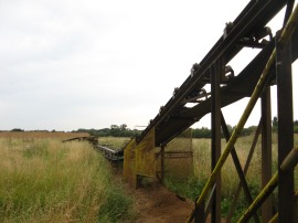
(20) Passing the gravel Conveyor Belt |
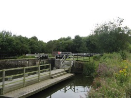
(21) Sluice weir |
From the lock the path heads through another wooded area an under the a bridge carrying the Tonbridge to Maidstone rail lines, photo 19, before passing under a narrow conveyor belt, photo 20, that links two gravel pits on either side of the river although these remain hidden from view. The river then heads under the A228 road and on past a now abandoned industrial estate. I believe in the past the path went through the estate but now continues along the edge of the river up to Branbridges Road. Crossing the road the path heads down besides a car dealership following the river through another predominately wooden area up to the Sluice Weir and lock complex, photo 21.
 |
 |
 |
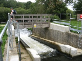
(22) Oak Weir Lock Canoe and Fish Pass |
(23) Path nr Oak Weir Lock |
(24) River nr Ford Green Bridge |
Despite it being quite cloudy at this stage of the walk it was still exceptionally warm and big biting insects were out in force under the trees to add to the discomfort from our earlier nettle stings. Reaching a footbridge over the river we had a bit of confusion over the route as a rather wayward footpath sign seemed to be directing us into a dead end of greenery when the actual route heads more to the left along a farm track which leads back round to the river. We had a quick look round the Oak Weir Lock, which is just off the route of the path, and we got to see a canoe use the canoe and fish pass, photo 22, that was opened in the spring of 2011 to by pass the lock. After another small woodland interlude, photo 23, the path runs along the edge of a large meadow, photo 24, up to the Ford Green Bridge where the route of Medway Valley Walk links up with the Wealdway which shares the path for the remainder of the walk.
 |
 |
 |
(25) East Lock |
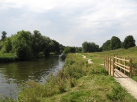
(26) Path heading towards Tonbridge |
(27) Porters Lock |
Heading up to East Lock, photo 25, the path crosses over to the other bank of the river and for most of the remainder of its journey into Tonbridge follows the river alongside a grass covered meadows and fields, photo 26. We had another short rest stop at the lock before following the path round to Hartlake Bridge where we remembered having a rest stop when we walking the Wealdway, sitting in the shade under the bridge, before continuing on up to Porters Lock, photo 27.
 |
 |
 |
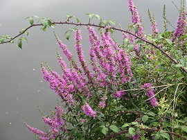
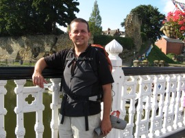
(28) Flowers besides the river |
(29) Eldridge's Lock |
(30) Modelling the new rucksack |
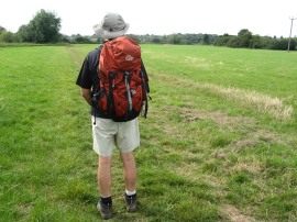
In a number of places there were pretty purple flowers, photo 28, growing next to the river although I not identified what they are yet. Next up on the lengthy and rather featureless stretch of walking, comes Eldridge's Lock, photo 29, which is about a mile upstream from the previous lock. One thing of note about this walk was that I was wearing my new rucksack for the first time. For a number of years I have been using a Berghaus Freeflow 50 l rucksack which I really, really like however despite its excellent design it is just a little to big for me, due to me being a bit on the short side, and the rucksack hangs a little too low down my back. After much consideration I have purchased a Lowe Alpine 45+10l rucksack, photo 30, that has an adjustable back system which allows a far better fit on my back which in turn makes the rucksack feel considerably lighter on my back when carried and I have to say I was very impressed with it.
 |
 |
 |
(31) Town Lock, Tonbridge |
(32) Approaching the end of the walk in Tonbridge |
(33) Myself at the end of the walk |
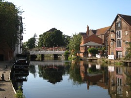
The route passes under a quarry access road and heads alongside three more meadows of gradually decreasing size before joining a more enclosed stretch of path which leads up to Cannon Bridge which carries the A26 across the river. The route has now reached the outskirts of Tonbridge and crosses the bridge over the river to join a path on the opposite bank. This path heads down past some gas holders and on past an area of new waterfront housing up to the Town Lock, photo 31. From there it was just a short distance further along the river, photo 32, up to the end of the walk by Tonbridge High Street.
At this point my GPS said we had walked 16.7 miles which was a bit more than we had been expecting to do. We were both feeling quite tired due to the hot humid weather and had a nice refreshing drink in a pub besides the river before driving over to Maidstone to pick up my car. So another short recreational trail completed and it had been a very pleasant and easy one to walk.
As usual I have uploaded the route of the walk which can be accessed here: Medway Valley Walk 2 route.
If you would like to comment on this walk you can do so here:
![]() Back to:Walk index page
Back to:Walk index page
| ©2012 Bertuchi.co.uk. Please contact me using the email button on the right if you have any questions or comments regarding the site. Any feedback and additional information about places of interest on the walks is always welcomed. All rights reserved. Please contact me if you want to use any of the images or information from the site. ENJOY YOUR WALKING |
|