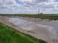
(1) River Thames at Erith
(2) View towards Coldharbour Point
(3) River Thames at Erith
LONDON LOOP STAGE 1
Erith to Bexley
|
|
|
|
(1) River Thames at Erith |
(2) View towards Coldharbour Point |
(3) River Thames at Erith |
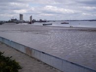
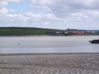
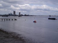
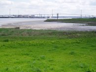
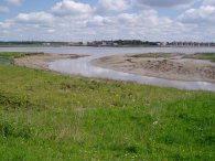
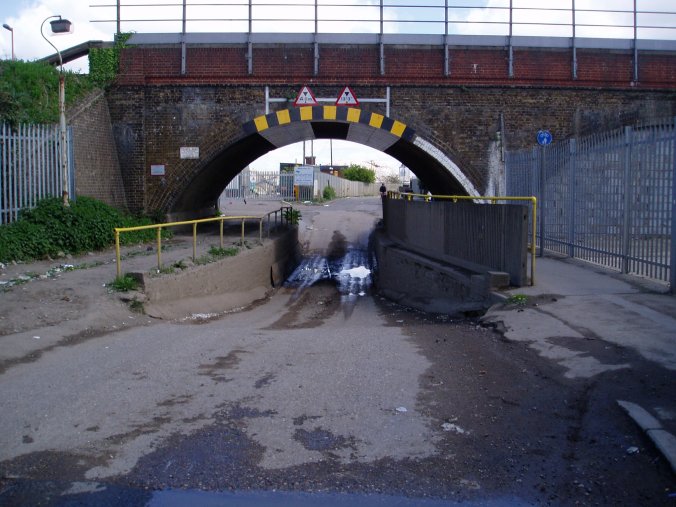
I had been planning to walk the top stretch of the Darent Valley Path from Sevenoaks but the trains were only running as far as Orpington and the replacement bus service was adding to almost an hour to the journey so I decided to re-walk the first stage of the London Loop instead, some 18 months after I first walked it. I parked the car in a car park on Stone Wood Road, just below Erith Station (which fortunately was free on Sundays) and made the short walk along past the Riverside Gardens to Erith Pier and the start of this stage of the London Loop. Photo 2 was taken from the pier, (or the Erith Deep Wharf Jetty as it is more correctly called), looking across to Coldharbour point where the London Loop currently ends at the container yard in the right of the photo. Only about 1/2 a mile across the river but 150 miles by the London Loop path. Photos 1 and 3 are of the view up the Thames towards London.
 |
 |
 |
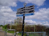
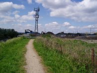
(4) Manor Road, Erith |
(6) Fields Nr Erith |
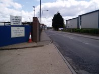
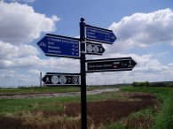
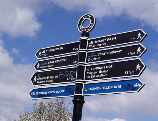
The route of the London Loop shares its first couple of miles to Crayford Ness with the route of the Thames path. The path is unable to follow the river Thames all the way through Erith but heads up Appold Street and into Manor Road. The route passes through the Manford Industrial Estate, photo 4, before a track leading to the Erith Yacht club takes the path back towards the Thames. Since I had last walked this stage far more London Loop signs had been added, including the one in photo 5, which showed a distance of 53.5 miles to Kingston Bridge. At this point the route of the London Loop is also following the route of the Cray Riverway which is followed almost all the way to Bexley Station.
 |
 |
 |
(7) Path besides the Thames |
(8) Car Breakers |
(9) Dartford Bridge |
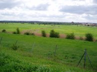
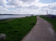
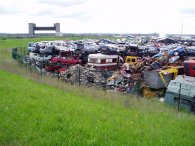
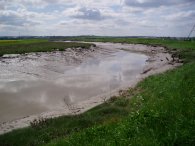
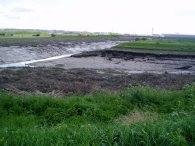
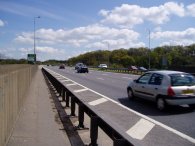
The path runs along the top of the flood embankment, photo 7, and follows the river Thames downstream skirting the Darent Industrial park which amongst other things contains a large car breakers yard, photo 8. On the way the path passes Crayford Ness which is currently the end of the Thames Path extension, a rather strange end to a path as it is in the middle of nowhere. Downstream the Dartford bridge, photo 9, has been growing ever closer however level with the car breakers the London Loop path turns up Dartford Creek and begins heading towards Crayford.
 |
 |
 |
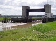
(10) Dartford Creek Flood Barrier |
(11) Dartford Creek joins the Thames |
(12) Dartford Creek |
Near the start of Dartford Creek there is a massive flood barrier, photo 10, just past where Dartford Creek joins the river Thames, photo 11. Dartford Creek is where the river Darent enters the Thames and a bridge at this point would be very useful for any walkers following the Thames downstream, at present to rejoin the Thames requires a diversion of several miles round the Dartford and Crayford Creeks. With the incoming tide, water was flowing up the creek almost as fast as I was walking.
 |
 |
 |
(13) Dartford Creek |
(14) Loop fingerpost |
(15) Crayford Creek |
The London Loop path continues up Dartford Creek, photo 13, passes a side path that leads to Slade Green station, photo 14 and then turns right alongside Crayford Creek and the River Cray, photo 15.
 |
 |
 |
(16) Crayford Creek |
(17) Loop path nr Crayford |
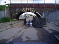
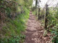
The path follows Crayford Creek, photo 16, for a short distance before reaching another industrial area which can be seen in the background of photo 17. The path passes under the Dartford - Woolwich rail line going under an unusual bridge where the road surface has been lowered, photo 18, to allow tall lorries through. The roof of the bridge has also been lined with steel plates. Not a particularly attractive area, but it is only a short stretch of the walk. The London Loop makes it was up to the A206 road by the Jolly Farmers pub where after a very short distance the River Cray is re-joined.
 |
 |
 |
(19) River Cray |
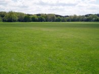
(20) Crayford Sports Ground |
(21) Path besides Hall Place Gardens |
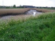
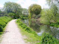
The river Cray is no longer tidal at this point and has changed completely in nature from a reed lined muddy creek to a tree lined river, photo 19 where I spotted the first ducklings of the year. The path follows the river Cray almost to the centre of Crayford itself apart from a short stretch of road walking along Barnes Cray Road. The path crosses Crayford High Street by the Bear and Ragged Staff pub and heads gently uphill along the London Road past the Crayford Baptist Church on the right before turning left down Bourne Road. The path the turns left immediately past the Mazda garage and heads across the sports fields, photo 20, to rejoin the river Cray once again. The path then follows the Cray to a bridge besides the Hall Place gardens where the river Cray is crossed. The path then follows round the edge of the gardens, photo 21, to a set of steps besides the railway line that lead up to the A2.
 |
 |
 |
(23) Besides the A2 |
(24) Churchfield Wood |
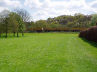
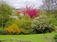
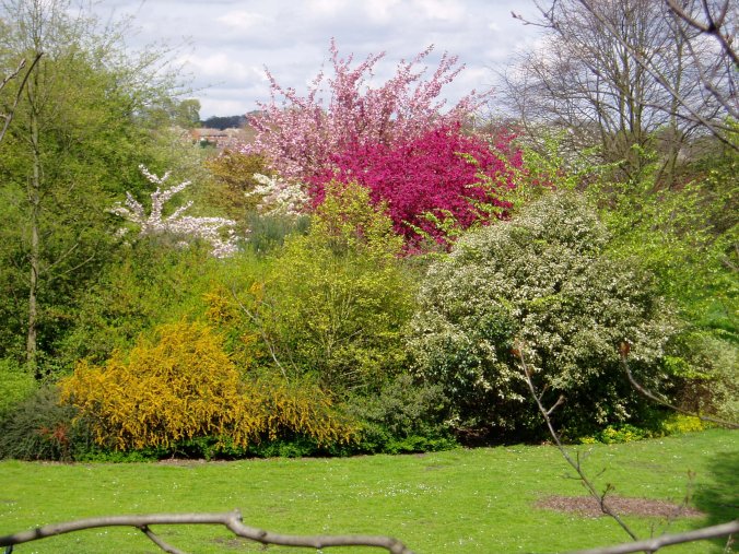
Climbing up the steps to the A2 there was a good view into Hall Place Gardens. The flowering trees looking particularly impressive after the cold Spring, photo 22.
The London Loop path crosses over the railway line via the A2, photo 23, and then descends down again to cross under the A2 on the other side of the railway lines. Once under the A2 a short stretch of path leads to Churchfield Wood, photo 24, a thin stretch of woodland that is followed into Bexley.
 |
 |
 |
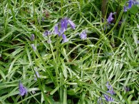
(25) Bluebells, Churchfield Wood |
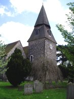
(26) Church of St Mary the Virgin, Bexley |
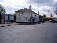
(27) Bexley Station |
In Churchfield wood I spotted the first Bluebells of the year, photo 25, which were just coming into flower in the lighter patches of the wood. At the end of the woodland the path takes a tarmac track over some waste ground and down besides the graveyard of the Church of St Mary the Virgin, photo 26. Here the Cray Riverway finally leaves the route of the London Loop. Past the church the path enters Bexley where a short stretch of road walking along Bexley High Street leads to Bexley station and the end of the walk.
When I first walked this stage in August 2004 I estimated it was about 8 miles long and sure enough when I got to Bexley station the GPS said 8.18 miles.
From Bexley it was a £1.90 rail journey back to Erith and the car. The journey took about 35 minutes although most of that was spent waiting at Dartford station for the connecting train.
This was an enjoyable walk through quite varied scenery from the Thames Estuary, the Creeks, the river Cray, the parkland in Crayford and the woodland on the approach to Bexley as well as a couple of industrial estates. Hopefully I will have the opportunity to walk some more of the earlier stages of the London Loop so I can add a bit more detail to those pages too.
| ©2008 Bertuchi.co.uk. Please contact me if you have any questions or comments regarding the site. Additional information about places of interest on the walks is always welcomed. All rights reserved. Please contact me if you want to use any of the images or information from the site. Thank you. |
|