Other Links >>> |
|
LEA VALLEY WALK - STAGE 1
Leagrave - Hatfield
|
|
|
|
The Lea Valley walk runs from the source of the River Lea at Leagrave, just North of Luton, down to the Thames at Limehouse Basin, a total of about 50 miles. I walked this stage on the 26th September 05.
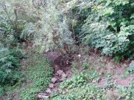
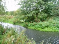
I took the train to Leagrave Station from where it is only a short walk to Leagrave common and the springs that form the start of the river Lea and the Lea Valley walk. There are a number of springs, photo 1, and ponds in the area from which the river Lea flows, photo 2, as it starts it journey to the Thames.
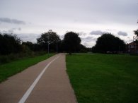
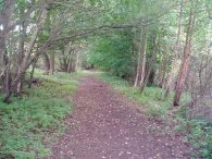
The first part of the walk is through the suburbs of Luton, although for much of the route the path manages to avoid roads, following a thin strip of open space that runs between the houses either side of the river, photo 3. For a short while on this section the Lea Valley path shares its route with the Icknield Way.
 |
 |
 |
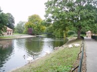
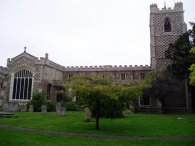
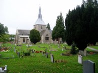
Although not always clearly marked on the ground this part of the Lea valley path was relatively easy to follow. After passing through Wardown park, photo 4, the path joins the main A6 road into the centre of Luton.The path makes its way through the town centre, goes past St Mary's church, photo 5, and then heads out in a loop towards the runways of the Luton Airport. Despite the odd marker placed in the pavement the route was a bit harder to follow at this point and I was glad I had brought a copy of the explorer 193 map in the town centre.
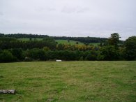
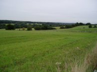
Once the busy A505 is crossed a steep flight of steps leads up to the end of the airport runways and open countryside, photo 7, as the path makes its way through the Lea Valley towards Harpenden. This makes a pleasant change from the first part of the walk which had mainly been on tarmac.
 |
 |
 |
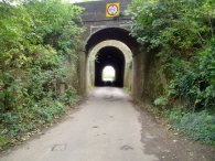
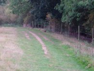
The path descends back down into the Lea Valley, passes under the railway lines, photo 8, before crossing the B653. Much of the route towards Harpenden seemed to follow the route of an old railway line, photo 9, which was once the Luton, Dunstable and Welwyn junction line. This generally made for easy walking although there was quite a long stretch where the path was squeezed besides the high fence of a sewage works, which felt a bit enclosed, and there were often trees besides the path which restricted the views.
 |
 |
 |
In Harpenden I deviated off the path for a while which I didn't realise till I was on the disued railway line heading out of the town and met up with the path again coming in from a different direction. From Harpenden it is a short walk to the village of Wheathampstead. About half way to Wheathampstead the Lea Valley path leaves the disused railway line and heads uphill across farmland into Wheathampstead, photo 12. Here the path heads down through the village, past the church, photo 13, and crosses over to the other bank of the river Lea.
 |
 |
 |
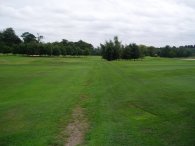
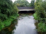
The path, then follows the river towards Waterend and the grounds of Brocket Hall where the path heads across the middle of a large golf course. By this time I was starting to fell a bit tired. I had originally intended to walk to Hertford but I realised this was going to be too far and decided to end my journey at Hatfield instead. From Brocket Hall the path heads towards Lemsford and under the A1(M), photo 18, to Stanborough Park with its big boating lakes. This involved going under a very shallow bridge and for once I was glad I was not any taller! I also noticed that the path, which can just be made out to the left of the bridge, was only just above the water level. I think in times of rain the path under the bridge might not be readily passable. From Stanborough Park it was a short walk to the A1000. As it crossed the A414 the Lea valley path headed of to the left but I continued ahead up the road to Hatfield station and the end of the wak.
 |
 |
 |
The GPS made this walk, including the short diversions I made, 19.9 miles long.
![]() Back to:Walking index page
Back to:Walking index page
| ©2012 Bertuchi.co.uk. Please contact me using the email button on the right if you have any questions or comments regarding the site. Any feedback and additional information about places of interest on the walks is always welcomed. All rights reserved. Please contact me if you want to use any of the images or information from the site. ENJOY YOUR WALKING |
|