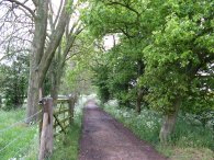
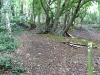
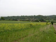
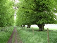
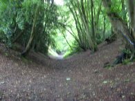
(1) Path besides Ayot Park
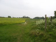
(2) Heading towards Kimpton Mill
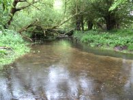
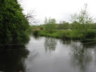
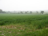
(3) River Mimram
Other Links >>> |
|
THE HERTFORDSHIRE WAY - DAY 11
Codicote to Sandridge
I did this walk on Sunday 13th May. I drove up from Walthamstow and parked in the village of Ayot St Lawrence, close to the Brocket pub.
|
|
|
|
(1) Path besides Ayot Park |
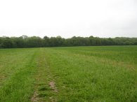
(2) Heading towards Kimpton Mill |
(3) River Mimram |
From there I made my way along a bridleway that runs past the grounds of Ayot House and Park, photo 1. Reaching a minor road by some houses at Abbotshay the route then turns right for a short distance along Tanyard Lane before turning left down another bridleway, photo 2, that runs all the way down hill to the River Mimram by Kimpton Mill. Crossing the road I took a footpath that runs diagonally over a small paddock and crossed the river, photo 3, to rejoin the footpath to Codicote Bottom where I had finished my last stage of the Hertfordshire Way, a distance 1 ½ miles.
 |
 |
 |
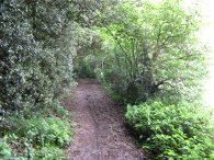
(4) Footpath to Codicote Bottom |
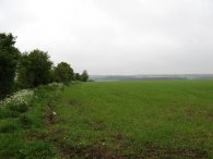
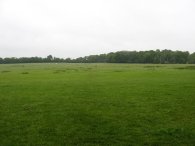
(5) Path nr Codicote Heath |
(6) Codicote Heath |
Back on the Hertfordshire Way I continued along the footpath, photo 4, until I reached a patch of woodland where the route takes a footpath that bears uphill to the left. Leaving the woodland up a short flight of wooden steps, photo 5, the route passes through three grassy fields by Codicote Heath, photo 6, before heading through a small bit of woodland down to a road. Here the route turns left for a short distance, bearing right at a road junction before taking another footpath off to the right, signposted St Giles Church ½ mile, through a rather scrubby bit of wood. Leaving the footpath there was a Hertfordshire Way sign that was pointing in the wrong direction off to the right while the correct route headed off to the left along a more open path that runs besides a field into Codicote. It was a very grey day and quite still with the odd shower passing over. I had started the day wearing my Berghaus fleece which is relatively shower proof however the rain was a bit heavy for this and it was also quite mild so I soon switched to my Paclite Mac which I wore rather like a cape, just fastened at the neck. There was a charity cycle tour taking place in the surrounding area and during the day I passed the cyclists and race marshals on numerous occasions throughout the walk.
 |
 |
 |
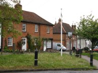
(7) Codicote |
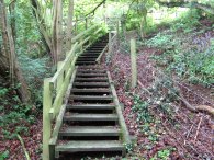
(8) Wooden Steps |
(9) Path nr Codicote Bottom |
Entering the village of Codicote the route heads the right along the main road. Here I went a little off course, heading too far down the High Street, while the route actually bears to the right just past the red house stores by the village sign, along the St Albans Road. However it was quite an interesting village to have a wander around with plenty of attractive building and also a notice on the fishmongers sadly stating that one of the business partners (who was known for his campaign to retain
the use of imperial weights and measures) had fallen to his death while painting his house.
The route leaves the St Albans Road along a tarmac footpath that runs down besides number 48. This soon leads past a school onto a grassy footpath running besides a field. Crossing over a stile the route starts heading fairly steeply downhill on a muddy track besides woodland. Reaching a flight of wooden steps the path crosses a driveway and continues down more steps, photo 8, along to a road where the route turns left to head to cross over the River Mimram once again. At a T junction the route turns left for a short distance before turning right up a gravel track that runs steadily uphill between fields. Photo 9 was taken looking back downhill to the road.
 |
 |
 |
(10) Path towards Ayot St Lawrence |
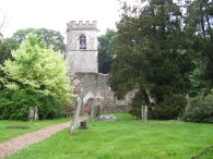
(11) Ayot St Lawrence old church |
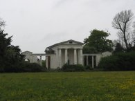
(12) Ayot St Lawrence new church |
At the top of the hill this track becomes a grass covered path, photo 10, that eventually leads to the road in the village of Ayot St Lawrence, besides the bridleway that I had headed down at the start of the day. Turning right onto the road I passed my car, which was parked on the route, and headed past the old church at Ayot St Lawrence, photo 11. According to a sign outside the church this was the parish church of Ayot St Lawrence from c1150 until Sir Lionel Lyde constructed the new greek revivalist church in the late 18th century. The old church was subsequently robbed of materials, and at least in part, deliberately ruined for romantic effect in the early 19th century. Past the church I took a footpath off to the right which runs over paddock past the more modern Greek Styled church, photo 12. Passing the church the route heads to the left down a track that runs round the back of a church down to a road. Here the Hertfordshire Way heads to the left before following the road round to the right.
 |
 |
 |
(13) Path towards Lamer House |
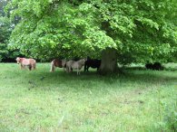
(14) Shetland ponies |
(15) River Lea, Wheathampstead |
Just past the new church I stopped for a quick snack under an enormous old oak tree which provided fairly good shelter from the rain which had now become quite persistent. In fact in continued to rain, often heavily, without stopping for almost all the remainder of the day. The amount of rain cut down the number of photos I was able to take on the remainder of the walk as I did not want to get my new camera too wet. Leaving the road the route heads along a footpath on the left before turning right along a track for a short distance besides Harepark Spring. Turning to the left the route then heads along an attractive tree lined track with farmland to the right and a golf course to the left, photo 13. On the way I passed a group of Shetland ponies and their even smaller foals sheltering under an old oak tree, rather like I had done earlier, photo 14. Reaching a driveway the route turns to the left, continuing ahead along a track when the driveway bears to the right. Amongst a lightly wooded area the route takes a tall metal gate that leads into the grounds of the golf course. After some distance along a good track the path bears right through some trees down towards the ninth tee where a little further on the route takes another large metal deer gate out of the golf course and turns right down the side of a small field to reach a road. Crossing the road the Hertfordshire Way continues ahead downhill on a rather muddy track with a number of quite deep puddles. The route continues downhill, linking up with the route of the Lea Valley walk for a short distance to cross under the B653 before continuing on to take a road over the River Lea, photo 15.
 |
 |
 |
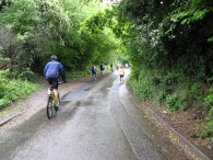
(16) Cyclists |
(17) Devil's Dyke, Wheathampstead |
(18) Approaching Titnol's Wood |
The route then heads uphill along Sheepcote Lane and across the Marford road, and on up Dyke Lane where once again I was passed by people on The Rotary Clubs of St Albans 2007 charity cycle ride, photo 16. A little way up the lane the route then bears left along a very deep ditch known as the Devil's Dyke. A stone plaque states that this was once part of a British City built in the 1st century BC.
Leaving the Devil's Dyke on its left bank the path heads to the right then to the left round the corner of a field before turning right past the building of Beech Hyde farm. The Hertfordshire way is not marked on my edition of the Ordnance Survey Explorer map and this section of footpath is not quite as marked on the map although it was a more obvious path on the ground that that shown, which is marked as leaving the Dyke to the right to join the road for a short distance before heading along the driveway of the Beech Hyde farm.
The route then heads to the left (or straight ahead if you have come from the road) up a farm track. This runs uphill to a road which the Hertfordshire Way heads across and continues up along a track over a field to enter a bit of woodland. Passing through the woodland the route reaches the John Bunyan pub in Coleman Green where it turns right then left to cross a road and head uphill over another field. Reaching the top of the hill the route turns right and, at a bend in the hedge, continues straight ahead across a large open field towards another patch of woodland at Titnol's Wood, photo 18.
 |
 |
 |
(19) View towards Sandridge |
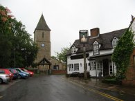
(20) Sandridge Church |
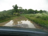
(21) Flooding |
Reaching the woodland I turned right along a path that runs just inside the woodland, the trees providing a little bit of shelter from the rain. Leaving the woodland the route then crosses a small field which leads down to Hammond Lane where the route turns to the right heading gently downhill along the road. After about a third of a mile the route takes a footpath off to the left that runs down over a number of fields, photo 19, to the outskirts of the village of Sandridge, my destination for the day.
When I finished the walk opposite the church in Sandridge, photo 20, I had done 10.2 miles. This made 8.53 Hertfordshire Way miles for the day. I then began my walk back to the car in Ayot St Lawrence.
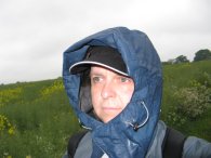 |
(22) Self Portrait |
I headed down besides the B651 to Wheathampstead. For much of the distance there was a footpath that ran inside the edge of a field, a little way away from the road. Crossing Nomansland Common the path follows the road to the outskirts of the village where I crossed the road and headed to the right along a footpath that ran over fields back to the Devils Dyke. I then retraced my earlier route back over the River Lea to the edge of the Golf Course where I turned to the right to reach Bride Hall Lane which I then followed for some distance back to Ayot St Lawrence. Reaching the car I had walked a total distance for the day of 14.7 miles.
It had been one of the wettest days walking I have had for a long time but my waterproofs worked well and I was relatively dry when I reached the car. Given how dry the weather has been generally I can't believe how much wet weather I have encountered when out. Photo 21 was taken from the car on the way back, the road completely flooded for some distance, and photo 22 a self portrait from near the Devils Dyke.
![]() Back to:Walk index page
Back to:Walk index page
| ©2012 Bertuchi.co.uk. Please contact me using the email button on the right if you have any questions or comments regarding the site. Any feedback and additional information about places of interest on the walks is always welcomed. All rights reserved. Please contact me if you want to use any of the images or information from the site. ENJOY YOUR WALKING |
|