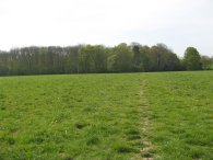
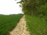
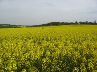
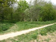
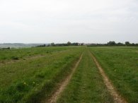
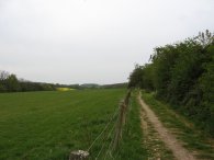
(1) Fields nr Weston
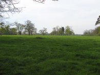
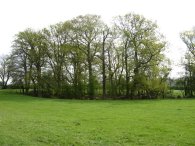
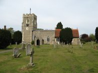
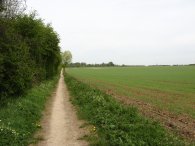
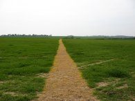
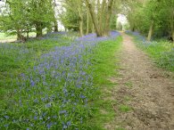
(2) Path towards Weston Church
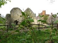
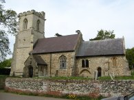
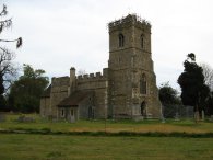
(3) Holy Trinity Church, Weston
Other Links >>> |
|
THE HERTFORDSHIRE WAY - DAY 9
Weston to Almshoe Bury
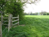
I did this walk on Sunday 22nd April, I drove up and parked in the centre of the village of Weston in Hertfordshire, from where it was just a 0.34 of a mile walk back to where I had finished the last stage of my walk around the Hertfordshire Way at the gate in photo 1 just over a month earlier.
|
|
|
|
(1) Fields nr Weston |
(2) Path towards Weston Church |
(3) Holy Trinity Church, Weston |
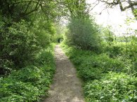
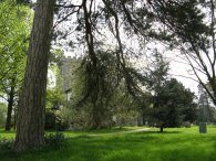
From the gate the route heads downhill over a corner of a field, over a stile, and across another short section of field down to a road. Here the route turns briefly right, then left to take a path up besides a driveway into another couple of small paddocks. At the end of the second paddock the Hertfordshire Way turns left along a tree lined footpath that heads towards Weston Church, photo 2. The sound of the Sunday morning church bells becoming ever louder as I approached the church. Reaching the edge of the churchyard the route turns right to take another tree lined path heading back towards the village, away from the church which itself remained shrouded in the trees, photo 3.
 |
 |
 |
(4) Speckled Wood butterfly |
(5) Fields nr Weston |
(6) Fields nr Weston |
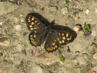
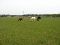
On the path from the church I spotted a Speckled Wood butterfly sunning itself on the path. A short distance further on the route turns to the left the path and heads over a field towards a small patch of woodland, photo 5, which after a short distance leads to another field, the path heading gently uphill besides tall trees to a minor road. Crossing the road the route heads under the branches of a large Horse Chestnut Tree into more grass covered fields, these ones being grazed by cattle, photo 6.
 |
 |
 |
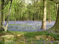
(7) Park Wood, Weston |
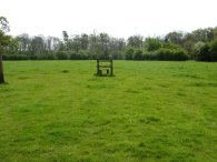
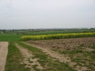
(8) Fields nr Warren's Green |
(9) Field, Warren's Green |
The route turns to the left over a stile by some woodland at Park Wood which was carpeted with bluebells, photo 7, before heading over the fields, photo 8, to reach a road by Warren Green Farm. On thing the photo can't capture is the scent of all the flowers that filled the air. The Hertfordshire Way then continues ahead along the road following it round to the right at a sharp bend before continuing ahead at the next bend alongside a large wheat field, photo 9. It was really pleasant countryside with woodland to the right; Probably one of the most scenic stretches of the Hertfordshire Way that I have walked along. It was a warm day, but slightly overcast which was a good thing as last week on the London Loop my ears had ended up getting sunburnt. There was also quite a strong wind which was pleasantly cooling, all in all ideal walking weather.
 |
 |
 |
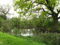
(10) Dell Spring |
(11) Church of St Etheldreda |
(12) Field nr Graveley |
A little further on I past an unusual deep tree lined hollow in a field with a small pond in the bottom marked on the map as Dell Spring, photo 10, which had me speculating about its formation, an old quarry, bomb crater, or collapsed cave? Leaving the field the route reaches a driveway of a group of houses that is followed round to the right where the Hertfordshire Way turns to the left along a road. The route then leaves the road along a footpath to the right, signposted "Manor Farm ½ mile". The route then heads over fields to another road, opposite the remains of the ruined church of St Etheldreda at Chelsfield, photo 11. Once again the route turns left along the road. Heading a short distance down to a road junction the Hertfordshire Way turns right along the road although for once I did not see a Hertfordshire Way marker and had to get my map out to check the route. One of only a very, very few instances where this has been necessary on what is generally a very well marked and easy trail to follow thanks to the work of the Friends of the Hertfordshire Way (add link). Leaving the road the Hertfordshire Way heads into a corner of a field with a thin strip of woodland running down to besides the path on the left which was filled with bluebells. To the right was an enormous field of Oilseed Rape, its bright yellow flowers giving of a rather pungent scent, photo 12. Looking across the field there was a broad valley which stretched over to a line of low hills on the horizon. Heading down besides the field the town of Letchworth Garden City became visible away to the right and to the left, the tower block of the Lister Hospital in Stevenage came into view and remained a prominent landmark for much of the rest of this stage of the walk.
 |
 |
 |
(13) Field nr Graveley |
(14) St Mary's Church, Graveley |
(15) Path towards Willian |
At the end of the field the path turned right to head gently downhill. Photo 13 was taken looking back up to the where the path had entered the field. Reaching a hedge the route turns right once again to head down to a road opposite some houses in the village of Graveley. Away to the left I could hear the ever increasing noise of the traffic coming from the A1. The route turns left onto the road before taking a turning that heads down to the right towards St Mary's Church at Graveley, photo 14. The route heads round the church before joining a gravel covered farm track that heads uphill to reach a road. The route heads down a few steps to cross the B197 and then heads along Gravely Lane which passes under the A1. Just past the road bridge the Hertfordshire Way turns right to make its way along a bonded gravel path towards Willian and soon I was heading up the Willian spur of the Hertfordshire Way, photo 15. This rather unusual part of the route diverts from the main circular walk and heads up towards Willian. Reaching the village it then turns round and retraces its route back.
 |
 |
 |
(16) Willian Church |
(17) Path nr Willian |
(18) Great Wymondley church |
The footpath becomes a track which runs down besides fields to a tarmac lane. This heads downhill, under some electricity pylons and eventually on to a road junction where the Hertfordshire Way turns right to head into Willian. The church at Willian, photo 16, marks the official end of stage two of the Hertfordshire Way. On the face of it this was quite a pointless piece of walking however it does allow for a visit the town and there are places for parking, it is alos a sensible walking distance from start of the leg. The Fox pub in Willian had plenty of tables outside and would have made a good rest stop although I continued on to make a bit more progress around the route. On the way back you pass Manor Wood picnic place which also has a small parking area. The total length Willian spur was 1.1 mile each way. Returning to the start of the spur, photo 17, I turned right and headed down an attractive tree lined path besides a field. Reaching a road the Hertfordshire Way once again turns left.This stretch of road was quite busy and there was no footpath so it needed a bit of care to walk down. This road leads into the village of Great Wymondly where just past a pub, the Hertfordshire Way turns left along a driveway. At the end of the driveway the route squeezes down the left hand side of a garage along the path the leads round to Great Wymondley church, photo 18.
 |
 |
 |
(19) Pond nr Little Wymondley |
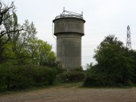
(20) Water Tower, Little Wymondley |
(21) Hermit of Redcoats pub |
Passing the church the route then heads across grass covered fields towards Little Wymondley. Passing by a little pond, photo 19, I stopped and had my lunch. The route goes down to Priory Lane and turns right to cross under some railway lines. The route then turns right besides the Plume and Feathers pub and a little further on, left through the car park of the Bucks Head pub to join a footpath. This footpath runs uphill behind houses to reach a field. This leads up towards a water tower, photo 20, and passes the edge of some football fields before heading down to cross the dual carriage way of the A 602. Once across the road the route heads along an enclosed footpath that leads to a road at Titmore Green. Here the route turns right for a short distance before then heading off to the left up a path that is opposite the Hermit of Redcoats pub, photo 21.
 |
 |
 |
(22) Heading towards Almshoe Bury |
(23) View back to Titmore Green |
(24) Almshoe Bury |
In a short while the route reaches a couple of houses by a minor road where the route does a sharp right up the corner of a field before heading into another much more wide open area of fields with expansive views opening up in all directions, photo 21. The route heads uphill over the field towards the farm at Almshoe Bury where I ended this stage of my walk along the Hertfordshire Way. Photo 23 was taken looking back down the way I had just come towards Titmore Green. At this point I had walked exactly 11 miles and thus I had walked 10.66 miles along the Hertfordshire Way for the day. The Hertfordshire Way heads off to the right of photo 24 but I turned through the five bar gate on the left to commence my walk back to the car at Weston.
 |
 |
 |
(25) View back to Almshoe Bury |
(26) Bluebells |
(27) Horses, nr Stevenage |
I followed a footpath that ran off to the east in the direction of the A1M. Photo 25 was taken looking back along this towards Almshoe Bury. I then turned left and began heading in a generally northern direction towards Lucas's Wood. The footpaths and track ran over fields and at one point the path was lined with bluebells, photo 26. From the map it looked like a footpath ran under the A1M to Fishers Green but I could not see any trace of it so I made my way up to a road to cross over the motorway and enter the northern fringes of Stevenage.
 |
 |
 |
(28) Stevenage suburbia |
(29) Path towards Stonesley Wood |
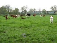
(30) Calves nr Weston |
Once over the motorway I crossed some greenspace and joined a track that ran around the back of houses to cross a bridge over the railway lines. The path then made its way between houses, photo 28, down to the A602, opposite the Lister Hospital. Turning to the right I took an undepass that led to the hospital and then made my way through the hospital grounds and buildings to the B197. Crossing the road I took a footpath that ran rounsd the back of houses before turning left to join a path that ran uphill to rejoin the Hertfordshire way in the large field of oilseed rape that I had passed through earlier in the day. At the top of the field I joined the road but instead of following the route of the Hertfordshire Way I continued ahead at a bend in the road and took a track that headed over fields and between Stonesley Wood and Harbourclose Wood, photo 29. These where once again carpeted in Bluebells, it has definitely been the best year I can remember bluebells. Reaching a road I turned right than left by Friends Green Farm to take a footpath over fields, photo 30, that joined up with the route of the Hertfordshire Way close to Park Wood. In the field there were a number of quite young calves. I then retraced my earlier steps back towards Weston.
Reaching the car the total mileage I had walked was 17.0 miles.
After the limited walking I have been able to do recently it was nice to be able to do a decent distance. I find that when I don't walk regularly I soon lose what I term my walking fitness which then takes a while to get back.
![]() Back to:Walk index page
Back to:Walk index page
| ©2012 Bertuchi.co.uk. Please contact me using the email button on the right if you have any questions or comments regarding the site. Any feedback and additional information about places of interest on the walks is always welcomed. All rights reserved. Please contact me if you want to use any of the images or information from the site. ENJOY YOUR WALKING |
|