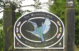
The Wendover Arm
Other Links >>> |
|
GRAND UNION CANAL - Part 7
The Wendover Arm - Bulbourne Junction to Wendover
|
|
The Wendover Arm |
I did this walk on Sunday 19th June, 2011 having first walked up the short stretch of canal between Tring and Marsworth Junction before retracing my steps to Bulbourne Junction for the start of the Wendover Arm. The Wendover Arm opened in 1797 but has been un-navigable since 1897 and in 1904 it was finally abandoned for navigation with the section west of the Tringford Pumping station closed to navigation by a stop lock. This was mainly due to the amount of water supply that was leaking from the canal. In 1989 the Wendover Arm Trust was formed with the aim of re-opening the canal to navigation and phase 1 one their work has now been completed.
 |
 |
 |
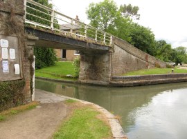
(1) The start of the Wendover Arm |
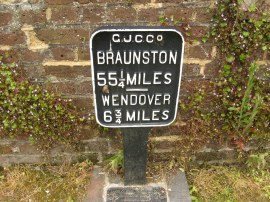
(2) Distance Marker |
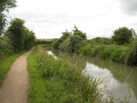
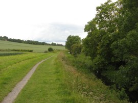
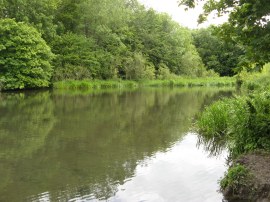
(3) Wendover Arm nr Bulbourne Junction |
From the start of the Wendover Arm the towpath heads under a metal bridge, photo 1, where a small metal plaque shows it is 6 3/4 miles to Wendover, photo 2. The towpath then heads along a hedge lined section of canal running between fields, photo 3.
 |
 |
 |
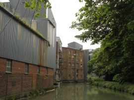
(4) Heygates Flour Mill |
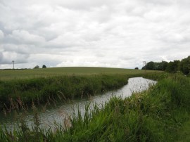
(5) Wendover Arm nr Tring |
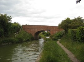
(6) Little Tring Bridge |
After just over half a mile the route reaches bridge 2 where the path crosses over to the opposite bank and heads by a large old mill buildings of the Heygates Flour Mill, photo 4, although these are still in use and packed full of modern machinery which could be seen through the windows. After the mill the route passes a few houses on the outskirts of Tring before heading back out between open fields, photo 5. The canal passes the Tringford Pumping station and the site of the old stop lock and then continues along a section of path which is followed to Little Tring Bridge, photo 6. This bridge was opened in 2001 and reinstated the original canal bridge that had been destroyed and replaced by a much lower bridge in 1973.
 |
 |
 |
(7) The end of the navigation |
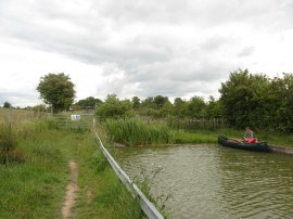
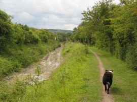
(8) Wendover Arm, nr Little Tring Farm |
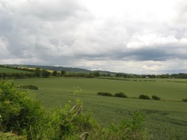
(9) View over to the Chilterns |
At Little Tring Bridge the route of the walk heads to the right along the road for a short distance however firstly I continued ahead to reach the very end of the navigable stretch of the Wendover Arm at the Little Tring winding hole, photo 7. On the way, I passed the couple with the rowing boat I had seen earlier sitting on the river bank. Reaching the winding hole, where there were a few canal boats moored up, I stopped for a short snack break before retracing my steps back to Little Tring Bridge. Here I joined the road, heading down to a footpath on the left that soon leads back to join a dry section of the disused canal, photo 8. Work is ongoing by the Wendover Arm Trust to renovate and re-water the remainder of the canal and there were truly excellent views on the part of the towpath running alongside the dry section of the canal, both across to the right, photo 9, and ahead to the Chiltern Hills and this will be a lovely stretch of canal to sail along when it is fully restored. The dog in the foreground of photo 8 was blind and I had overtaken its owner a little further down the path. The dog however insisted in walking just in front of me along the towpath. Its owner was carrying a rattle which she shook as she walked so that the dog could hear where she was however it seemed to be doing quite well navigating on its own and stopped when it reached a footpath on the right which is where they left the canal.
 |
 |
 |
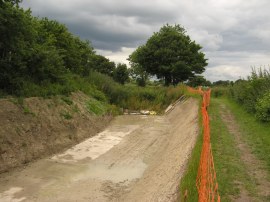
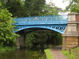
(10) The re-lined section of the canal |
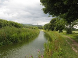
(11) Wendover Arm nr Bucklandwharf |
(12) Towpath nr Bucklandwharf |
From the dried up section of the canal, photo 10, the route then joins a part where there is water in the canal, photo 11, the two stretches separated by only a small earth bank. For the rest of the way to Wendover there was water in the canal, but only to a shallow depth and this was often overgrown with fair amounts of vegetation. The route heads under the A41 Saxon Way bridge as it makes it way to Bucklandwharf. Here the route crosses over a road then route continues along the edge of a field, photo 12, with houses lining the canal to the right and with the Chiltern Hills rising away to the left. Above the hills were three or four gliders circling around on the thermals with a steady stream of replacements being towed up into the air to replace the ones steadily descending.
 |
 |
 |
(13) Harelane Bridge |
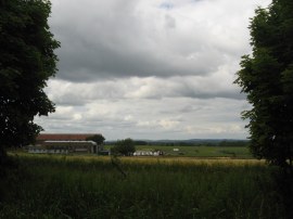
(14) Halton Airfield |
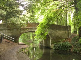
(15) Rothschild Bridge |
At Bridge 7, Wellonhead Bridge, I linked up with the route of the Aylesbury Ring which shares its route with the towpath for the rest of the way to Wendover. From the Wellonhead Bridge the canal heads through an area lined by mature trees which rather restricted the views and made the path quite gloomy. I spent a long while trying to get a photo of a female teal and its young on the canal however they all came out blurred due to the slow shutter speed caused by the gloom. After heading along a long straight section of path that comes after bridge 8, Harelane Bridge, photo 13, the route heads alongside an area of playing fields on the left belonging to the Ministry of Defence at RAF Halton and the buildings of the Halton airfield the gliders are using away to the right of the path, photo 14. As I was walking along this slightly more open bit of canal I got caught in the first rain shower of the day though this did not last too long and there was no need to get my waterproof coat out of the rucksack. The blue painted Rothschild Bridge, 8a, photo 15, was built to provide carriage access across the Wendover Arm of the Grand Union Canal for Alfred Rothschild while Halton House was under his ownership.
 |
 |
 |
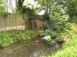
(16) The Wides |
(17) End of the Wendover Arm |
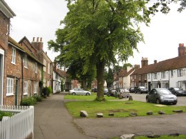
(18) Aylesbury Road, Wendover |
Just past the Rothschild Bridge the route crosses a road in the village of Halton and heads over to the opposite bank, heading down besides an attractive cottage to continue along the towpath. Next up is bridge 10, Perch Bridge, in Halton with its white painted metal framework over the main span. A short distance further on I stopped for a quick lunch break at an area known as the Wides, photo 16, which was one of the only wet areas of ground the route of the Wendover Arm went over, the springs in the area helping to provide a water source for the canal. From there I did not have much further to walk before I reached the edge of Wendover and the end of the canal, photo 17, at Wharf Road, now surrounded by modern houses although the name is clue to the previous use of the area.
The GPS miles said exactly 11.0 miles when I reached the end of the canal in Wendover which with my little diversion round the Little Tring Winding Hole meant I have walked 7.1 miles from Bulbourne Junction. From the end of the canal I headed to the right along Wharf Road and then left down the Aylesbury Road, photo 18, to Wendover High Street.
 |
 |
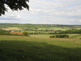 |
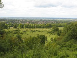
(19) View towards Ashton Clinton |
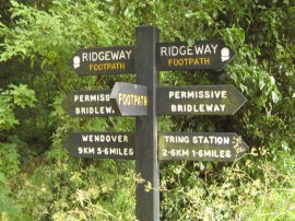
(20) Ridgeway Signpost |
(21) Approaching Tring |
Reaching the High Street I linked up with the route of the Ridgeway which I followed for most of the way back to my parking spot at Tring Station. This high level route through the Beech woodlands of the Chilterns made a nice contrast to my earlier much flatter walk along the canal making for a very pleasant walk, despite the generally gloomy and quite windy weather. In places there were views from the top of the hills across the route of the canal, photo 19, although it remained hidden from view. Arriving back at the car I had walked a total distance of 18.3 miles for the day.
As usual I have uploaded the route of the walk which can be accessed here: Grand Canal Stage 7 Route.
If you would like to comment on this walk you can do so here:
![]() Back to:Walk index page
Back to:Walk index page
| ©2012 Bertuchi.co.uk. Please contact me using the email button on the right if you have any questions or comments regarding the site. Any feedback and additional information about places of interest on the walks is always welcomed. All rights reserved. Please contact me if you want to use any of the images or information from the site. ENJOY YOUR WALKING |
|