
The Essex Way
Other Links >>> |
|
THE ESSEX WAY - PART 4
Great Waltham to Fairstead
|
|
The Essex Way |
I did this walk on Sunday 1st March 2009, starting at Great Waltham and ending at Fairstead. I parked at the roadside in Great Waltham from where it was just under a half mile walk back to where I had finished the last stage a couple of weeks ago in the grounds of the Langleys estate. The day started very grey and gloomy and it remained like that all day which was a shame as the walk passes through some nice countryside which would have looked so much better with a bit of sunshine. Typically, the next day, when I was back at work in the office, was bright and sunny with hardly a cloud in the sky all day.
 |
 |
 |
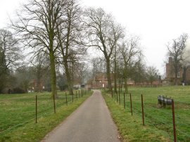
(1) Langleys estate |
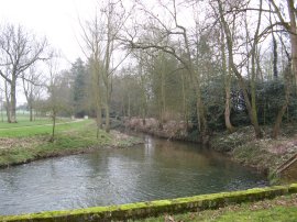
(2) River Chelmer |
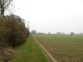
(3) Fields Nr Great Waltham |
Rejoining the route of the Essex Way, photo 1, I followed the path down the driveway, passing a small pet cemetery and a barn that was located besides the main house before heading gently downhill to take a bridge over the river Chelmer, photo 2. On the opposite bank there were a large number of snowdrops in flower under the trees, although unfortunately a little too distant to get a decent photo. The path then runs alongside river for a short while before soon turning to the left to join a footpath that runs alongside field edges, photo 3, heading gently uphill to cross over Chatham Hall Lane and continuing on to cross over the busier A130 Essex Regiment Way.
 |
 |
 |
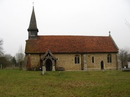
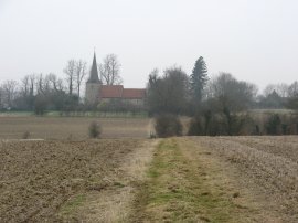
(4) St John the Evangelist Church, Little Leighs |
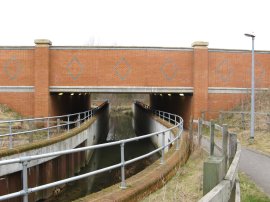
(5) The A131 underpass |
(6) Heading towards Cole Hill |
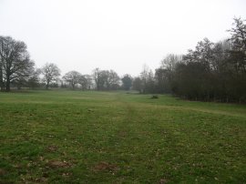
Once over the road the route continued on a more or less straight course, running besides field to reach the small village of Chatham Green. Here the Essex Way turns to the left following the road, Chatham Green, round past the houses to reach a T junction where the route continues straight ahead along a farm track that once again leads out to a footpath running alongside field edges. This is followed down, past a fishing lake to join Church Road at Little Leighs, close to the Church of St John the Evangelist, photo 4. Here the route turns to the left before taking the first road junction on the right. This short stretch of road is followed down to another junction where the route once again turns to the right, heading down Whites Lane. Whites Lane originally ran down to join Main Road on the outskirts of Great Leighs however since my version of the OS Explorer Map 183 was published a new bypass for the A131 has been built. As a result Whites Lane is now a dead end, leading to a tarmac footpath that runs down to join the River Ter as it flows under the dual carriageway, photo 5. Just before the culvert is reached there is a sculpture comprising of three bright orange ladybirds that can be seen to the left of the path. The route then continues on down to cross Main Road and heads alongside the edge of a field running next to the river. After skirting a sewage works the route turns to the left, passing through a plantation of tall willow trees before turning to the right and continuing along the field edge just above the level of the river to join Poulk Hall Lane. The short section of path just before the road was reached was quite boggy and I had to pick my route carefully as I made my way over to the stile and onto the road. Then Essex Way then heads to the right for a short distance before heading up a few steps on the left to join a path running between the grounds of a couple of fine houses. As has been the case on several occasions during my walk along the Essex Way this section of path has been re-routed from that shown on the map which continued down to cross a ford before turning left along Goodmans Lane. The revised, signposted, route cuts out a stretch of road walking and is slightly shorter although it also bypasses the church by Lyons Hall. After crossing a grassy field, photo 6 the route reaches the road, Cole Hill.
 |
 |
 |
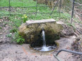
(7) Spring besides Cole Hill |
(8) Approaching Fuller Street |
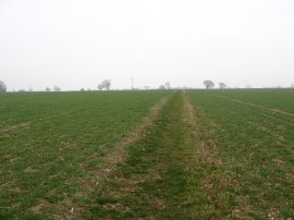
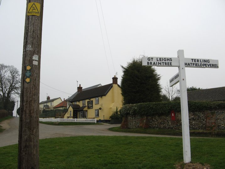
There are a number of springs in the area which feed the river Ter and one of these had been enclosed in a pipe besides the road, photo 7, the brickwork having the date 1881. The route more or less straight across the road and joins a footpath that runs gently uphill over a large open field, photo 8, where I was very pleased to see a sensible section had remained unploughed unlike many of the other fields I had passed through on earlier stages. The path gradually bends to the right, passing under two sets of electricity pylons, before turning to the left to pass between two more fields as it makes its way down to join the road in Fuller Street. Heading to the right, the Essex Way passes through the village where I spotted one of the old style Essex Way Waymarker nailed to a telegraph pole, photo 9. In the background is the Square and Compass pub.
 |
 |
 |
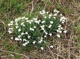
(10) Snowdrops |
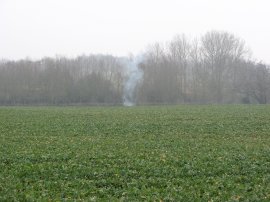
(11) Bird Scarer |
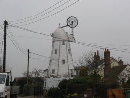
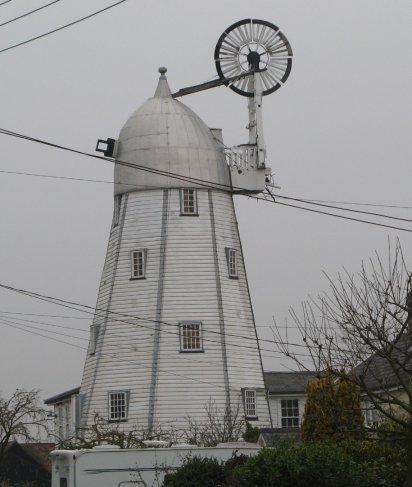
Having followed the road round a bend the route then takes a footpath that heads off to the right, past some houses and then downhill besides fields to cross back over the River Ter. Once over the river the route passes under another set of electricity pylon and heads gently uphill with a field to the right and the woodland of Sandy Wood to the left. Reaching the end of the path the route turns to the left along a farm track, keeping the trees of Sandy Wood on the left and open fields on the right. There seemed to be far less bird scarers on this part of the walk and the ones that I did notice were of a different type to the gas powered ones I had seen earlier, comprising of a white metal pole in the ground which occasionally emitted a small explosion producing a cloud of smoke as in photo 11. Leaving the edge of the trees the route heads over the middle of the field, once again on a good path, to join a farm track that leads down to join the road at Gambles Green besides a murky looking pond. Here the route heads to the left along the road continuing ahead into Hull Lane, where Terling Windmill can be seen off to the left down Mill Lane, photo 12, the colour of the windmill almost matching the overcast sky.
 |
 |
(13) Terling Ford |
(14) Approaching Fairstead |
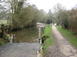
From Hull Lane the route continues ahead down Norman Hill to reach Terling Ford, photo 13. Terling Ford is a long, and in places quite deep ford, which I think must be impassable for most motor vehicles. There are a couple of small benches besides the ford where I stopped for a short break, enjoying watching the water flow down the river. Terling had been my original destination for the day however I was still feeling quite fit and thus decided to push on towards Fairstead. Having crossed over the ford I headed up River Hill. At the end of the road the Essex Way continues ahead, crossing over Fairstead Road to join a farm track that heads up to join another footpath running between fields. At the end of the field the route turns left following the field edge round before turning to the right to run alongside another field. From here the route joins a path that runs between some small newly planted trees to enter into a small patch of woodland. The path meanders through the trees for a few hundred yards before joining another field where the route turns right and then, close to a tall tree, turns left to head over fields, photo 14, towards Fairstead Church. Having reached the road besides the church I ended this stage of my walk along the Essex Way, having walked another 8.42 miles along the path.
From the church I then began making my way back to the car at Great Waltham, heading back to Terling before leaving the Essex Way and then taking a selection of roads and footpaths that headed in a reasonably straight line towards Little Waltham from where it was just a short distance back to where I had parked.
Reaching the car I had walked a total distance 15.8 miles. Despite the grey weather this had been a very pleasant days walking with the Essex Way entirely avoiding any stretch of byway for the whole walk. Almost all the field side paths were well maintained with broad grassy paths to walk along and apart from the last 50 or so yards before Fairstead church the route did not have to at any point cross over the middle of ploughed fields which made for a far more enjoyable walking experience than the previous leg.
Below is a google map of the walk, the red line is my return route to Great Waltham.
If you would like to comment on this walk you can do so here:
![]() Back to:Main Walking index page
Back to:Main Walking index page
| ©2012 Bertuchi.co.uk. Please contact me using the email button on the right if you have any questions or comments regarding the site. Any feedback and additional information about places of interest on the walks is always welcomed. All rights reserved. Please contact me if you want to use any of the images or information from the site. ENJOY YOUR WALKING |
|