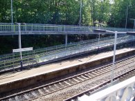
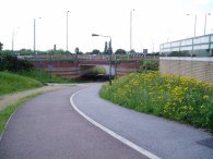
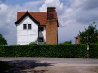
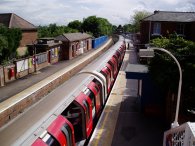
(1) Walthamstow Queens Road Station
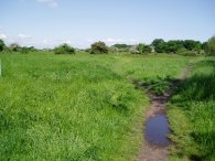
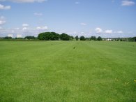
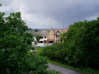
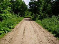
(2) Wanstead Flats
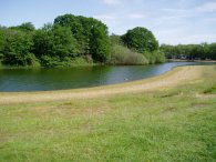
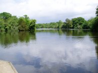
(3) Pond on Wanstead Flats
MANOR PARK TO EPPING
|
|
|
|
(1) Walthamstow Queens Road Station |
(2) Wanstead Flats |
(3) Pond on Wanstead Flats |
I did this walk on 23rd May 2006. The day started with a short walk form home to Walthamstow Queens Road station, photo 1, from where it was just an 11 minute train journey to Woodgrange Park station. After a short walk round Manor Park I headed along Carlyle Road, up Forest Drive to Capel Road and the start of Wanstead Flats, photo 2. While evidence of the previous days rain could still be seen in puddles on the path the water level in the ponds, photo 3, was still very low, a result of the dry weather over the winter months.
 |
 |
 |
(4) Wanstead Flats |
(5) Green Man Roundabout, Leytonstone |
(6) Epping Forest, nr Whipps Cross |
There is no specific path to take across the Wanstead Flats but heading in a generally westerly direction towards the two tall tower blocks, (Fred Wigg tower and John Walsh Tower), that can just been seen on the left hand side of photo 4, will guide you in the right direction. The route of the Epping Forest Centenary Walk is also marked on the OS Landranger Map 174. The path crosses the A114 Centre Road and then Lake House Road before turning to head in a Northerly direction on a track the runs behind houses in Belgrave Road before crossing a small stretch of forest towards Bushwood. From Bushwood it is just a short walk to the top end of Leytonstone and the Green Man Roundabout. Fortunately this is crossed by a network of underpasses, photo 5. The forest becomes more wooded, photo 6, as the path heads up across Snaresbrook Road, behind the back of Forest school and across Woodford New Road.
 |
 |
 |
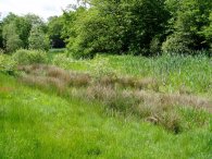
(7) Pond by Woodford New Road |
(8) View towards Central London |
(9) Rain clouds over North London |
The pond beside the Woodford New Road, photo 7, seemed almost completely full up with reeds although it was only a few years since it had been dredged. On Multimap it is rather optimistically described as "Children's boating pond". The path crosses a footbridge over the A503, close to the Waterworks Roundabout from where there were brief views across towards Central London, photo 8. The day had started bright and sunny but had now clouded over and a heavy downpour could also be seen coming in from the North West , photo 9. Fortunately I was under the trees by the time this reached me which provided a good amount of shelter. The rest of the day the weather remained quite bright, interspersed by the odd shower of rain although these soon passed over each time and were never quite heavy enough for me to need to put on my waterproofs. Although I had only walked just over four miles by this point I was starting to feel quite tired which was a bit odd.
 |
 |
 |
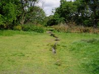
(10) Highams Park Boating Lake |
(11) Path nr Woodford Golf Course |
(12) A Squirrel |
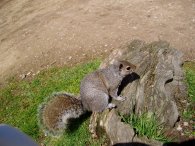
The path takes an underpass beneath the North Circular and continues in a generally northerly direction. Whilst in places the surviving remnants of the forest are quite narrow the path manages to avoid any road walking for its entire length. The path passes to the right of the Highams Park Boating Lake, photo 10, where I stopped for a little rest before crossing Chingford Lane to the Woodford Golf course which is hidden amongst the trees, photo 11. I passed through Hatch Forest and over Whitehall Road before turning left and heading up to Warren's pond where stooped on a handy log for lunch. While I was eating my lunch I was joined by a very friendly squirrel who was happy to share my food sitting beside me on the log, photo 12.
Despite having only walked seven miles, which was nothing, it felt more like seventeen miles and I felt exhausted and my legs were hurting. Warren Pond, which is close to Chingford Station was an obvious place to cut short the walk however I had already cut the previous days walk short and it seemed silly to do such a short walk, so near to home, in two stages so after a lengthy lunch break I eventually decided to press on, having drunk a bottle of lucozade sport, taken a few a paracetomols and also eaten an energy bar I had had in my rucksack since I been in the Peak District a couple of months before.
 |
 |
 |
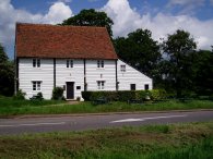
(13) Queen Elizabeths' Hunting Lodge |
(14) Butlers Retreat |
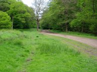
(15) Epping Forest |
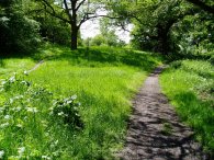
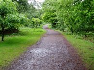
From Waren Pond I passed the Queen Elizabeth hunting lodge, photo 13, and the cafe at Butlers Retreat, photo 14, briefly joining the route of the London Loop as I crossed the road before heading through the forest towards the Epping Forest Conservation Centre at High Beach. The energy food helped a bit however did little to help my overall level of tiredness or the ache in my legs although it was easy walking along the broad paths that also serve as bridleways, photo 15.
 |
 |
 |
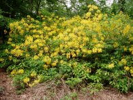
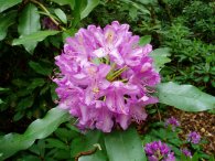
(16) Rhododendrons |
(17) Rhododendrons |
(18) Epping Forest |
Near to the conservation centre I spotted a couple of rhododendrons in bloom, photo's 16 and 17. I know they are not a native species and can become a nuisance however there were only a few bushes and they looked very colourful in the forest.
On the map the route of the Centenary walk is marked as turning to head South East at a point level with the conservation centre however this route is not particularly clear on the ground and I continued North East before taking a path that curves round to cross the Epping New Road and then heads along a ride, photo 18, that runs parallel, but a bit further north, to the route of the walk as marked on the map. Eventually both routes reach the Green Ride and turn left to resume the North Easterly course towards Epping. At this point I once again thought about cutting the walk short and heading down to Loughton tube station but after another rest decided to push on to Epping.
 |
 |
 |
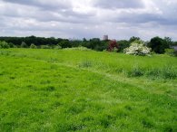
(19) Green Ride, Epping Forest |
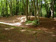
(20) Ambresbury Banks |
(21) Epping Tube Station |
The route of the path continues along the Green Ride, over Golding's hill and across Coppice Row, a pleasant walk through the trees of Epping Forest, photo 19. A little further on the path passes the earth embankments known as the Ambresbury Banks, photo 20. These are remains of an iron age rectangular, lowland plateau fort. The fort encircles an area of 4.5 hectares and is surrounded by a bank of 2 m (6 ft) in height, together with a ditch .The ditch was originally three metres deep and six metres wide, though nowadays is not quite as impressive and the fort is completely covered in woodland.
The final couple of miles of this walk past Ivy Chimneys and down into Epping really hurt but I was glad that I had persevered rather than wimp out and eventually made it to the station at Epping, photo 21 some six hours and twenty minutes after I had set off. I didn't have any obvious symptoms like a cough or a cold but there was definitely something up with me today.
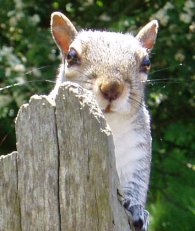 |
(22) Being watched by a squirrel |
The GPS made this walk 13.7 miles long.
![]() Back to:Walking index page
Back to:Walking index page
| ©2008 Bertuchi.co.uk. Please contact me if you have any questions or comments regarding the site. Additional information about places of interest on the walks is always welcomed. All rights reserved. Please contact me if you want to use any of the images or information from the site. Thank you. |
|